Andrews, Levy County, Florida

Last updated

Andrews, Florida
Levy County Florida Incorporated and Unincorporated areas Andrews Highlighted 1201353.svg
Location of Andrews in Levy County, Florida
Coordinates: 29°31′55″N82°53′7″W / 29.53194°N 82.88528°W / 29.53194; -82.88528
Country Flag of the United States.svg  United States
State Flag of Florida.svg  Florida
County   Levy
Area
[1]
  Total5.42 sq mi (14.03 km2)
  Land5.42 sq mi (14.03 km2)
  Water0.00 sq mi (0.00 km2)
Elevation
35 ft (11 m)
Population
 (2020)
  Total837
  Density154.46/sq mi (59.64/km2)
Time zone UTC-5 (Eastern (EST))
  Summer (DST) UTC-4 (EDT)
FIPS code 12-01353 [2]
GNIS feature ID1853235 [3]

Andrews is a census-designated place (CDP) in Levy County, Florida, United States. The population was 837 at the 2020 census, up from 798 at the 2010 census. [4] It is part of the Gainesville, Florida Metropolitan Statistical Area.

Contents

Geography

Andrews is located in northwestern Levy County at 29°31′55″N82°53′7″W / 29.53194°N 82.88528°W / 29.53194; -82.88528 (29.531873, -82.885215). [5] It is bordered to the south by Chiefland and to the northwest by Fanning Springs. U.S. Routes 19, 98 and 27 Alt pass through Andrews as a four-lane highway, connecting Chiefland and Fanning Springs. The Andrews Wildlife Management Area is located west of the community.

According to the United States Census Bureau, the Andrews CDP has a total area of 5.4 square miles (14.0 km2), all land. [6]

Demographics

Historical population
CensusPop.Note
2000 708
2010 79812.7%
2020 8374.9%
U.S. Decennial Census [7]

As of the census [2] of 2000, there were 708 people, 294 households, and 204 families residing in the CDP. The population density was 103.7 inhabitants per square mile (40.0/km2). There were 345 housing units at an average density of 50.5 per square mile (19.5/km2). The racial makeup of the CDP was 97.32% White, 1.27% African American, 0.71% Native American, 0.42% from other races, and 0.28% from two or more races. Hispanic or Latino of any race were 2.26% of the population.

There were 294 households, out of which 26.2% had children under the age of 18 living with them, 55.4% were married couples living together, 7.8% had a female householder with no husband present, and 30.3% were non-families. 24.1% of all households were made up of individuals, and 10.2% had someone living alone who was 65 years of age or older. The average household size was 2.41 and the average family size was 2.77.

In the CDP, the population was spread out, with 22.0% under the age of 18, 6.5% from 18 to 24, 28.2% from 25 to 44, 26.8% from 45 to 64, and 16.4% who were 65 years of age or older. The median age was 41 years. For every 100 females, there were 99.4 males. For every 100 females age 18 and over, there were 97.1 males.

The median income for a household in the CDP was $26,554, and the median income for a family was $29,279. Males had a median income of $28,281 versus $20,588 for females. The per capita income for the CDP was $12,186. About 13.7% of families and 18.2% of the population were below the poverty line, including 23.4% of those under age 18 and 23.6% of those age 65 or over.

Related Research Articles

<span class="mw-page-title-main">Lisbon, Florida</span> Census-designated place in Florida

Lisbon is an unincorporated community and census-designated place (CDP) in Lake County, Florida, United States. The population was 260 at the 2000 census. It is part of the Orlando–Kissimmee Metropolitan Statistical Area.

<span class="mw-page-title-main">Burnt Store Marina, Florida</span> Census-designated place in Florida, United States

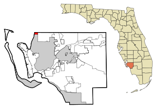
Burnt Store Marina is an unincorporated community and census-designated place (CDP) in Lee County, Florida, United States. The population was 1,890 at the 2020 census, up from 1,793 at the 2010 census. It is part of the Cape Coral-Fort Myers, Florida Metropolitan Statistical Area.

<span class="mw-page-title-main">Matlacha Isles-Matlacha Shores, Florida</span> Census-designated place in Florida, United States

Matlacha Isles-Matlacha Shores is an unincorporated community and census-designated place (CDP) in Lee County, Florida, United States. The population was 227 at the 2020 census, down from 229 at the 2010 census. It is part of the Cape Coral-Fort Myers, Florida Metropolitan Statistical Area.

<span class="mw-page-title-main">Chiefland, Florida</span> City in Florida, United States

Chiefland is a city in Levy County, Florida, United States. The population was 2,316 at the 2020 census, up from 2,245 at the 2010 census. It is part of the Gainesville, Florida Metropolitan Statistical Area. Chiefland calls itself "The Gem of the Suwannee Valley" and was incorporated in 1913.

<span class="mw-page-title-main">Manatee Road, Florida</span> Census-designated place in Florida, United States

Manatee Road is a census-designated place (CDP) in Levy County, Florida, United States. The population was 2,484 at the 2020 census, up from 2,244 at the 2010 census. At the 2000 census, the CDP was misspelled as "Manattee Road". It is part of the Gainesville, Florida Metropolitan Statistical Area.

<span class="mw-page-title-main">West Bradenton, Florida</span> Census-designated place in Florida, United States

West Bradenton is an unincorporated area and census-designated place (CDP) in Manatee County, Florida, United States. The population was 4,247 at the 2020 census, up from 4,192 at the 2010 census. It is part of the North Port–Bradenton–Sarasota, Florida Metropolitan Statistical Area.

<span class="mw-page-title-main">Goldenrod, Florida</span> CDP in Orange and Seminole counties, Florida, United States

Goldenrod is a census-designated place (CDP) in Orange and Seminole counties in the U.S. state of Florida. The population was 12,039 at the 2010 census. It is part of the Orlando–Kissimmee–Sanford, Florida Metropolitan Statistical Area.

<span class="mw-page-title-main">Lacoochee, Florida</span> CDP in Florida, United States

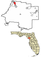
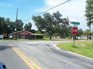
Lacoochee is a census-designated place (CDP) in Pasco County, Florida, United States. The population was 1,345 at the 2000 census.

<span class="mw-page-title-main">Bay Pines, Florida</span> Census-designated place in Florida, United States

Bay Pines is a census-designated place (CDP) in Pinellas County, Florida, United States. The population was 2,931 at the 2010 census. The community is home to Bay Pines Veterans Hospital and Bay Pines National Cemetery.

<span class="mw-page-title-main">Feather Sound, Florida</span> Census-designated place in Florida, United States

Feather Sound is a census-designated place (CDP) in Pinellas County, Florida, United States. The population was 3,420 at the 2010 census. It includes the St. Petersburg-Clearwater International Airport.

<span class="mw-page-title-main">Harbor Bluffs, Florida</span> Census-designated place in Florida, United States

Harbor Bluffs is a census-designated place (CDP) in Pinellas County, Florida, United States. The population was 2,860 at the 2010 census.

<span class="mw-page-title-main">South Highpoint, Florida</span> Census-designated place in Florida, United States

South Highpoint is a census-designated place (CDP) in Pinellas County, Florida, United States. The population was 5,195 at the 2010 census.

<span class="mw-page-title-main">Gulf Gate Estates, Florida</span> Census-designated place in Florida, United States

Gulf Gate Estates is a census-designated place (CDP) in Sarasota County, Florida, United States. The population was 11,118 at the 2020 census, up from 10,911 at the 2010 census. It is part of the North Port–Bradenton–Sarasota, Florida Metropolitan Statistical Area.

<span class="mw-page-title-main">North Sarasota, Florida</span> Census-designated place in Florida, United States

North Sarasota is a census-designated place (CDP) in Sarasota County, Florida, United States. The population was 2,418 at the 2020 census, down from 6,982 at the 2010 census. It is part of the North Port–Bradenton–Sarasota, Florida Metropolitan Statistical Area.

<span class="mw-page-title-main">Sarasota Springs, Florida</span> Census-designated place in Florida, United States

Sarasota Springs is a census-designated place (CDP) in Sarasota County, Florida, United States. The population was 12,521 at the 2020 census, down from 14,395 at the 2010 census. It is part of the North Port–Bradenton–Sarasota, Florida Metropolitan Statistical Area.

<span class="mw-page-title-main">Venice Gardens, Florida</span> Census-designated place in Florida, United States

Venice Gardens is a census-designated place (CDP) in Sarasota County, Florida, United States. The population was 3,402 at the 2020 census, down from 7,104 at the 2010 census. It is part of the North Port–Bradenton–Sarasota, Florida Metropolitan Statistical Area.

<span class="mw-page-title-main">Fallston, Maryland</span> Census-designated place in Maryland, United States

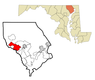
Fallston is a census-designated place (CDP) in Harford County, Maryland, United States. The population was 8,958 at the 2010 census, up from 8,427 in 2000. Fallston is a semi-rural community consisting mostly of farms and suburban-like developments.

<span class="mw-page-title-main">Belvedere, South Carolina</span> Census-designated place in South Carolina, United States of America

Belvedere is a census-designated place (CDP) and suburb of North Augusta in Aiken County, South Carolina, United States. It is part of the Augusta, Georgia metropolitan area. The population was 5,792 at the 2010 census.

<span class="mw-page-title-main">North Spearfish, South Dakota</span> Census-designated place in South Dakota, United States

North Spearfish is a census-designated place (CDP) in Lawrence County, South Dakota, United States. The population was 2,366 at the 2020 census.

<span class="mw-page-title-main">North Sultan, Washington</span> CDP in Washington, United States

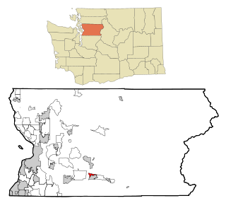
North Sultan is a census-designated place (CDP) in Snohomish County, Washington, United States. The population was 256 at the 2020 census.

References

  1. "2020 U.S. Gazetteer Files". United States Census Bureau. Retrieved October 31, 2021.
  2. 1 2 "U.S. Census website". United States Census Bureau . Retrieved January 31, 2008.
  3. "US Board on Geographic Names". United States Geological Survey. October 25, 2007. Retrieved January 31, 2008.
  4. "Geographic Identifiers: 2010 Demographic Profile Data (G001): Andrews CDP, Florida". U.S. Census Bureau, American Factfinder. Archived from the original on February 12, 2020. Retrieved December 5, 2012.
  5. "US Gazetteer files: 2010, 2000, and 1990". United States Census Bureau. February 12, 2011. Retrieved April 23, 2011.
  6. "U.S. Gazetteer Files: 2019: Places: Florida". U.S. Census Bureau Geography Division. Retrieved December 5, 2019.
  7. "Census of Population and Housing". Census.gov. Retrieved June 4, 2016.