
Marion County is located in the North Central region of the U.S. state of Florida. As of the 2020 census, the population was 375,908. Its county seat is Ocala.
Altoona is an unincorporated community and census-designated place (CDP) in Lake County, Florida, United States. The population was 89 at the 2010 census. It is part of the Orlando–Kissimmee–Sanford Metropolitan Statistical Area.

Astor is an unincorporated community and census-designated place (CDP) in Lake County, Florida, United States, located on the west side of the St. Johns River between Lake George and Lake Dexter. The community straddles State Road 40, with the community of Volusia in Volusia County across the St. Johns to the east and Astor Park to the west. The population was 1,556 at the 2010 census. It is part of the Orlando–Kissimmee–Sanford Metropolitan Statistical Area.

Lake Kathryn is a census-designated place (CDP) in Lake County, Florida, United States. The population was 920 at the 2010 census. The area is also known as Lake Kathryn Heights. It is part of the Orlando–Kissimmee Metropolitan Statistical Area.

Paisley is an unincorporated community and census-designated place (CDP) in Lake County, Florida, United States. The population was 818 at the 2010 census, up from 734 at the 2000 census. It is part of the Orlando–Kissimmee Metropolitan Statistical Area.

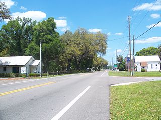
Pittman is an unincorporated community and census-designated place (CDP) in Lake County, Florida, United States. The population was 180 at the 2010 census. It is part of the Orlando–Kissimmee Metropolitan Statistical Area.

Dunnellon is a city in Marion County, Florida, United States. The population was 1,928 at the 2020 census, up from 1,733 in 2010. It is part of the Ocala Metropolitan Statistical Area.

Silver Springs Shores is a census-designated place (CDP) in Marion County, Florida, United States. The population was 24,846 at the 2020 census, up from 6,539 at the 2010 census. It is part of the Ocala, Florida Metropolitan Statistical Area.

The Villages is a census-designated place (CDP) in Sumter and Marion counties in the U.S. state of Florida. It shares its name with a broader master-planned, age-restricted community that spreads into portions of Lake County. The overall development lies in central Florida, approximately 20 miles (32 km) south of Ocala and approximately 45 miles (72 km) northwest of Orlando. As of the 2020 census, the population of the CDP was 79,077.
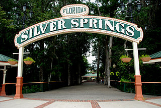
Silver Springs is an unincorporated community and census-designated place (CDP) in Marion County of northern Florida. It is the site of Silver Springs, a group of artesian springs and a historic tourist attraction that is now part of Silver Springs State Park. The community is part of the Ocala metropolitan area. It was first listed as a CDP for the 2020 census, at which time it had a population of 2,844.

Marion Oaks is an unincorporated community and census-designated place (CDP) in Marion County, Florida, United States. It is part of the Ocala Metropolitan Statistical Area. As of the 2020 census, the population was 19,034. The community is currently exploring becoming an incorporated city.

Ocklawaha is an unincorporated community and census-designated place (CDP) in Marion County, Florida, United States. As of the 2020 census, the population was 1,508. The community is part of the Ocala Metropolitan Statistical Area.
Rainbow Springs is an unincorporated community and census-designated place (CDP) in southwestern Marion County, Florida, United States. It is named for the first-magnitude artesian spring found in the community. U.S. Route 41 passes through the CDP, leading south 3.5 miles (5.6 km) to Dunnellon and north 20 miles (32 km) to Williston. Ocala, the Marion county seat, is 20 miles (32 km) to the northeast.
Morriston is a census-designated place (CDP) in Levy County, Florida, United States. The population was 165 at the 2020 census, up from 164 at the 2010 census. It is part of the Gainesville, Florida Metropolitan Statistical Area.
Lake Kerr is an unincorporated community and census-designated place (CDP) in northeastern Marion County, Florida, United States, surrounding the lake of the same name. It is 30 miles (48 km) northeast of Ocala, the Marion county seat, and 25 miles (40 km) southwest of Palatka.
Liberty Triangle is an unincorporated area and census-designated place (CDP) in southwestern Marion County, Florida, United States. It is bordered to the north by Ocala, the county seat, to the east by Interstate 75, and to the northwest by Florida State Road 200.
Ocala Estates is an unincorporated community and census-designated place (CDP) in western Marion County, Florida, United States. It is 11 miles (18 km) west of Ocala, the county seat.
On Top of the World is a census-designated place (CDP) in southwestern Marion County, Florida, United States. It is 11 miles (18 km) southwest of Ocala, the county seat.
Rainbow Park is an unincorporated community and census-designated place (CDP) in western Marion County, Florida, United States. It is on the northwest side of Florida State Road 40, 14 miles (23 km) west of Ocala, the county seat, and 10 miles (16 km) northeast of Dunnellon.
Silver Springs Shores East is a census-designated place (CDP) in southeastern Marion County, Florida, United States. It is bordered to the west by Ocklawaha and is 20 miles (32 km) southeast of Ocala, the Marion county seat.


