Fanning Springs, Florida

Last updated

Fanning Springs, Florida
City of Fanning Springs
Fanning Springs FL city hall04.jpg
Fanning Springs City Hall
Motto: 
"In God We Trust"
Levy County Florida Incorporated and Unincorporated areas Fanning Springs Highlighted.svg
Location in Levy County and the state of Florida
Coordinates: 29°35′3″N82°55′27″W / 29.58417°N 82.92417°W / 29.58417; -82.92417
Country Flag of the United States (23px).png  United States
State Flag of Florida.svg  Florida
Counties Levy, Gilchrist
Incorporated 1965 [1]
Government
  Type Mayor-Council
   Mayor Howell "Trip" Lancaster III
   Council Chair Thomas "Tommy" Darus
   Councilmembers Kayla Davis, Wendy Fore,
Jane Jones-Redd, and
Wanda Michaud
   City Clerk Sheila Watson
   City Attorney Stan Griffis
Area
[2]
  Total5.00 sq mi (12.96 km2)
  Land4.87 sq mi (12.61 km2)
  Water0.13 sq mi (0.35 km2)
Elevation
30 ft (9 m)
Population
 (2020)
  Total1,182
  Density242.76/sq mi (93.73/km2)
Time zone UTC-5 (Eastern (EST))
  Summer (DST) UTC-4 (EDT)
ZIP code
32693
Area code 352
FIPS code 12-21850 [3]
GNIS feature ID0291913 [4]
Website www.fanningsprings.org

Fanning Springs is a city in Gilchrist and Levy counties in the U.S. state of Florida. It is part of the Gainesville, Florida Metropolitan Statistical Area. The population was 1,182 at the 2020 census, up from 764 at the 2010 census.

Contents

Geography

The exact coordinates for the City of Fanning Springs is located at 29°35′03″N82°55′27″W / 29.584224°N 82.924160°W / 29.584224; -82.924160 . [5]

A pedestrian view of the city Fanning Springs, Florida.jpg
A pedestrian view of the city

According to the United States Census Bureau, the city has a total area of 3.9 square miles (10.2 km2), of which 3.8 square miles (9.8 km2) is land and 0.12 square miles (0.3 km2), or 3.40%, is water.

Climate

The climate in this area is characterized by hot, humid summers and generally mild winters. According to the Köppen climate classification, the City of Fanning Springs has a humid subtropical climate zone (Cfa).

Demographics

Historical population
CensusPop.Note
1970 115
1980 314173.0%
1990 49357.0%
2000 73749.5%
2010 7643.7%
2020 1,18254.7%
U.S. Decennial Census [6]

2010 and 2020 census

Fanning Springs racial composition
(Hispanics excluded from racial categories)
(NH = Non-Hispanic)
RacePop 2010 [7] Pop 2020 [8] % 2010% 2020
White (NH)67798888.61%83.59%
Black or African American (NH)5250.65%2.12%
Native American or Alaska Native (NH)11111.44%0.93%
Asian (NH)5140.65%1.18%
Pacific Islander or Native Hawaiian (NH)000.00%0.00%
Some other race (NH)010.00%0.08%
Two or more races/Multiracial (NH)7500.92%4.23%
Hispanic or Latino (any race)59937.72%7.87%
Total7641,182

As of the 2020 United States census, there were 1,182 people, 457 households, and 304 families residing in the city. [9]

As of the 2010 United States census, there were 764 people, 442 households, and 298 families residing in the city. [10]

2000 census

As of the census [3] of 2000, there were 737 people, 311 households, and 198 families residing in the city. The population density was 207.2 inhabitants per square mile (80.0/km2). There were 397 housing units at an average density of 111.6 per square mile (43.1/km2). The racial makeup of the city was 89.01% White, 4.34% African American, 0.68% Native American, 0.54% Asian, 3.66% from other races, and 1.76% from two or more races. Hispanic or Latino of any race were 8.96% of the population.

In 2000, there were 311 households, out of which 25.4% had children under the age of 18 living with them, 42.8% were married couples living together, 15.8% had a female householder with no husband present, and 36.3% were non-families. 29.3% of all households were made up of individuals, and 12.2% had someone living alone who was 65 years of age or older. The average household size was 2.37 and the average family size was 2.84.

In 2000, in the city, the population was spread out, with 24.7% under the age of 18, 9.5% from 18 to 24, 23.7% from 25 to 44, 25.0% from 45 to 64, and 17.1% who were 65 years of age or older. The median age was 38 years. For every 100 females, there were 100.3 males. For every 100 females age 18 and over, there were 91.4 males.

In 2000, the median income for a household in the city was $17,875, and the median income for a family was $24,167. Males had a median income of $25,139 versus $14,306 for females. The per capita income for the city was $11,389. About 26.1% of families and 30.5% of the population were below the poverty line, including 46.6% of those under age 18 and 19.9% of those age 65 or over.

Fort Fanning historical park Fanning Springs FL hist park02.jpg
Fort Fanning historical park

Attractions

The Nature Coast State Trail, which follows abandoned railway lines, has a junction at Fanning Springs. [11] Fanning Springs State Park is located just south of the center of town, along the Suwannee River. Fort Fanning Historic Park is the site of a fort that was built in 1838 to counter Native American attacks in North Florida during the Seminole Wars. [12]

Related Research Articles

<span class="mw-page-title-main">Callaway, Florida</span> City in Florida, United States

Callaway is a city in Bay County, Florida, United States, and is a suburb of Panama City. The population was 13,045 at the 2020 census, down from 14,405 at the 2010 census. It is part of the Panama City–Panama City Beach, Florida Metropolitan Statistical Area.

Parker is a city in Bay County, Florida, United States. It is part of the Panama City–Panama City Beach, Florida Metropolitan Statistical Area. As of the 2020 US census, it had a population of 4,010, down from 4,317 at the 2010 census.

<span class="mw-page-title-main">Penney Farms, Florida</span> Town in the state of Florida, United States

Penney Farms is a town in Clay County, Florida, United States. It is part of the Jacksonville metropolitan area. The population was 821 at the 2020 census.

<span class="mw-page-title-main">Zolfo Springs, Florida</span> Town in the state of Florida, United States

Zolfo Springs is a town in Hardee County, Florida, United States. It is part of the Florida Heartland region. The population was 1,737 at the 2020 census.

<span class="mw-page-title-main">Ponce de Leon, Florida</span> Town in the state of Florida, United States

Ponce de Leon is a town in Holmes County, Florida, United States. The Town of Ponce de Leon was named after Spanish explorer, Juan Ponce de León. It is part of the Florida Panhandle in North Florida. The population was 504 at the 2020 census, down from 598 at the 2010 census.

<span class="mw-page-title-main">Campbellton, Florida</span> Town in Florida, United States

Campbellton is a town in Jackson County, Florida, United States. The town is part of the Florida Panhandle in North Florida, and has a predominately African American majority. The population was 191 at the 2020 census.

<span class="mw-page-title-main">Cottondale, Florida</span> City in Florida, United States

Cottondale is a city in Jackson County, Florida, United States. It is part of the Florida Panhandle and North Florida. The population was 848 at the 2020 census, down from 933 at the 2010 census.

<span class="mw-page-title-main">Mascotte, Florida</span> City in Florida

Mascotte is a city in Lake County, Florida, United States. As of the 2020 census, the population was 6,609, up from 5,101 in 2010. It is part of the Orlando–Kissimmee–Sanford Metropolitan Statistical Area.

<span class="mw-page-title-main">Inglis, Florida</span> Town in Florida, United States

Inglis is a town in Levy County, Florida, United States. It is on U.S. Highway 19 near the Cross Florida Greenway. As of the 2020 census, the town had a population of 1,476, up from 1,325 at the 2010 census. It is part of the Gainesville, Florida Metropolitan Statistical Area.

<span class="mw-page-title-main">Williston, Florida</span> City in Florida, United States

Williston is a city in Levy County, Florida, United States. It is part of the Nature Coast. As of the 2020 census, it had a population of 2,976, up from 2,768 at the 2010 census. It is part of the Gainesville, Florida Metropolitan Statistical Area.

<span class="mw-page-title-main">Holmes Beach, Florida</span> City in Florida, United States

Holmes Beach is a city on Anna Maria Island in Manatee County, Florida, United States. As of the 2020 census, it had a population of 3,010, down from 3,836 at the 2010 census. It is part of the North Port-Bradenton-Sarasota, Florida Metropolitan Statistical Area. The city occupies the central part of Anna Maria Island and is one of three municipalities on the island. The others are Bradenton Beach in the south and Anna Maria in the north.

<span class="mw-page-title-main">Coral Terrace, Florida</span> Census-designated place in Florida

Coral Terrace is a suburban unincorporated community and census-designated place (CDP) in Miami-Dade County, Florida, United States. It is part of the Miami metropolitan area of South Florida. The population was 23,142 at the 2020 census, down from 24,376 in 2010.

<span class="mw-page-title-main">Homestead Base, Florida</span> Census-designated place in Florida

Homestead Base is a census-designated place (CDP) in Miami-Dade County, Florida, United States. The CDP comprises the extent of Homestead Air Reserve Base plus some surrounding land. It is part of the Miami metropolitan area of South Florida. The population was 999 at the 2020 census.

<span class="mw-page-title-main">Palm Springs North, Florida</span> Census-designated place in Florida

Palm Springs North is an unincorporated community and census-designated place (CDP) in Miami-Dade County, Florida, United States. It is part of the Miami metropolitan area of South Florida. The population was 5,030 at the 2020 census.

<span class="mw-page-title-main">Pinewood, Florida</span> Census-designated place in Florida

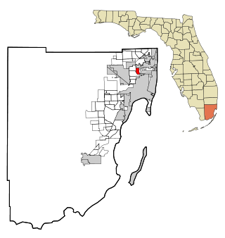
Pinewood is an unincorporated community and census-designated place (CDP) in Miami-Dade County, Florida, United States. It is part of the Miami metropolitan area of South Florida. The population was 17,246 at the 2020 census.

<span class="mw-page-title-main">Edgewood, Florida</span> City in Florida, United States

Edgewood is a city in Orange County, Florida, United States. It is part of the Orlando–Kissimmee–Sanford Metropolitan Statistical Area. The population was 2,685 at the 2020 census.

<span class="mw-page-title-main">Belleair Beach, Florida</span> City in Florida, United States

Belleair Beach is a city in Pinellas County, Florida, United States. It is part of Tampa–St. Petersburg–Clearwater Metropolitan Statistical Area, more commonly known as the Tampa Bay Area. The population was 1,633 at the 2020 census.

<span class="mw-page-title-main">Belleair Bluffs, Florida</span> City in Florida, United States

Belleair Bluffs is a city in Pinellas County, Florida, United States. It is part of the Tampa–St. Petersburg–Clearwater Metropolitan Statistical Area, more commonly known as the Tampa Bay Area. The population was 2,311 at the 2020 census.

<span class="mw-page-title-main">Highland Park, Florida</span> Village in Florida, United States

Highland Park is a village in Polk County, Florida, United States. Highland Park is part of the Lakeland–Winter Haven Metropolitan Statistical Area. Its population was 251 at the 2020 US census.

<span class="mw-page-title-main">Freeport, Florida</span> City in Florida, United States of America

Freeport is a city in Walton County, Florida, United States. It is part of the Crestview–Fort Walton Beach–Destin, Florida Metropolitan Statistical Area. As of the 2020, the population recorded by the U.S. Census Bureau was 5,861, up from 1,787 at the 2010 census. Freeport is one of the fastest growing cities in Florida. After the construction of the massive group of neighborhoods, Hammock Bay, the population exploded.

References

  1. "S1101 HOUSEHOLDS AND FAMILIES - 2020: Fanning Springs city, Florida" (PDF). Florida League of Cities.
  2. "2020 U.S. Gazetteer Files". United States Census Bureau. Retrieved October 31, 2021.
  3. 1 2 "U.S. Census website". United States Census Bureau . Retrieved January 31, 2008.
  4. "US Board on Geographic Names". United States Geological Survey. October 25, 2007. Retrieved January 31, 2008.
  5. "US Gazetteer files: 2010, 2000, and 1990". United States Census Bureau. February 12, 2011. Retrieved April 23, 2011.
  6. "Census of Population and Housing". Census.gov. Retrieved June 4, 2015.
  7. "P2 HISPANIC OR LATINO, AND NOT HISPANIC OR LATINO BY RACE - 2010: DEC Redistricting Data (PL 94-171) - Fanning Springs city, Florida". United States Census Bureau .
  8. "P2 HISPANIC OR LATINO, AND NOT HISPANIC OR LATINO BY RACE - 2020: DEC Redistricting Data (PL 94-171) - Fanning Springs city, Florida". United States Census Bureau .
  9. "S1101 HOUSEHOLDS AND FAMILIES - 2020: Fanning Springs city, Florida". United States Census Bureau .
  10. "S1101 HOUSEHOLDS AND FAMILIES - 2010: Fanning Springs city, Florida". United States Census Bureau .
  11. "Nature Coast State Trail". Cross Florida Region. Archived from the original on July 12, 2012. Retrieved June 16, 2012.
  12. "Fort Fanning Historic Park — Fanning Springs, Florida". Explore Southern History. Retrieved June 16, 2012.