Ardmore comes from the Irish: Ard Mór or the Scottish Gaelic: Àird Mhòr meaning "great height" and may refer to:

Indiana County is a county in the Commonwealth of Pennsylvania. It is located in the west central part of Pennsylvania. As of the 2020 census, the population was 83,246. Its county seat is Indiana. Indiana County comprises the Indiana, PA Micropolitan Statistical Area, which is also included in the Pittsburgh-New Castle-Weirton, PA-WV-OH Combined Statistical Area.

Ardmore is a town in Limestone County, Alabama, United States, and is included in the Huntsville-Decatur Metro Area. As of the 2010 census, the population of the town is 1,194. It borders its sister city Ardmore, Tennessee.

Ardmore is the county seat of Carter County, Oklahoma, United States. The population was 24,725 at the time of the 2020 census, a 1.8% increase over the 2010 census figure of 24,283. The Ardmore micropolitan statistical area had an estimated population of 48,491 in 2013. Ardmore is 90 miles (140 km) from both Oklahoma City and Dallas/Fort Worth, Texas, at the junction of Interstate 35 and U.S. Highway 70, and is generally considered the hub of the 13-county region of South Central Oklahoma, also known by state tourism pamphlets as "Chickasaw Country" and previously "Lake and Trail Country". It is also a part of the Texoma region. Ardmore is situated about 9 miles (14 km) south of the Arbuckle Mountains and is located at the eastern margin of the Healdton Basin, one of the most oil-rich regions of the United States.

Haverford Township is a home rule municipality township in Delaware County, Pennsylvania, United States. Haverford is named after the town of Haverfordwest in Wales, United Kingdom. It is a commuting suburb located due west of Philadelphia and is officially known as the Township of Haverford. Despite being under a home rule charter since 1977, it continues to operate under a Board of Commissioners divided into wards, as do "First Class" townships that are still under the Pennsylvania Township Code. Haverford Township was founded in 1682 and incorporated in 1911.

Indiana is a borough in and the county seat of Indiana County, Pennsylvania, United States. The population was 14,044 at the 2020 census. It is the principal city of the Indiana, Pennsylvania micropolitan area, about 46 miles (74 km) northeast of Pittsburgh. It is a part of the greater Pittsburgh–New Castle–Weirton combined statistical area, as well as the Johnstown and Pittsburgh media markets.

Ardmore is an unincorporated community and census-designated place (CDP) spanning the border between Delaware and Montgomery counties in the U.S. state of Pennsylvania. The population was 12,455 at the time of the 2010 census and had risen to 13,566 in the 2020 census.

Ardmore is a city in Giles and Lincoln counties, Tennessee. The population was 1,213 at the 2010 census. Ardmore is the site of a Tennessee Department of Tourist Development Welcome Center. It borders its sister city, Ardmore, Alabama.
The Philadelphia Main Line, known simply as the Main Line, is an informally delineated historical and social region of suburban Philadelphia, Pennsylvania. Lying along the former Pennsylvania Railroad's once prestigious Main Line, it runs northwest from Center City Philadelphia parallel to Lancaster Avenue, also known as U.S. Route 30.

Haverford is an unincorporated community located in both Haverford Township in Delaware County, Pennsylvania, United States, and Lower Merion Township in Montgomery County, approximately 3 miles (4.8 km) west of Philadelphia. The Pennsylvania Railroad (PRR) opened Haverford Station in 1880 on their Main Line west out of Broad Street Station in Philadelphia. Haverford sits at milepost 9.17.

Bala Cynwyd is a community in Lower Merion Township, Pennsylvania, United States. It is located on the Philadelphia Main Line in Southeastern Pennsylvania and borders the western edge of Philadelphia at U.S. Route 1. The present-day community was originally two separate towns, Bala and Cynwyd, but was united as a singular community largely because the U.S. Post Office, the Bala Cynwyd branch, served both towns using ZIP Code 19004. The community was long known as hyphenated Bala-Cynwyd. Bala and Cynwyd are currently served by separate stations on SEPTA's Cynwyd Line of Regional Rail.
Havertown is a residential suburban unincorporated community in Haverford Township, Pennsylvania, United States. It is located approximately 9 miles west of the center of Philadelphia. Havertown's ZIP Code is 19083 and "Havertown" is a postal address. The name "Havertown" was coined by the U.S. Post Office and came into use on January 1, 1946. Before then, each constituent community was known by its local name: Bon Air, Brookline, Penfield, Beechwood, Llanerch, Manoa, Oakmont, Coopertown, and Ardmore. Under William Penn's land divisions these communities were part of the Welsh Tract and comprised the area known as Harford, a Welsh contraction of Haverford.

Wynnewood is a suburban unincorporated community, located west of Philadelphia, straddling Lower Merion Township in Montgomery County, Pennsylvania and Haverford Township in Delaware County, Pennsylvania, United States.

Ardmore station is a train station in Ardmore, Pennsylvania, located on the Pennsylvania Main Line. The station serves several Amtrak Keystone Service trains daily, as well as all SEPTA Paoli/Thorndale Line local regional rail trains. The station is 8.5 miles (13.7 km) from Suburban Station in Center City Philadelphia, and travel time to Suburban Station is 22 minutes on SEPTA local trains.

Lower Merion High School is a public high school in Ardmore, Pennsylvania in the Main Line suburbs of Philadelphia. It is one of two high schools in the Lower Merion School District; the other one is Harriton High School. Lower Merion serves both Lower Merion Township and the Borough of Narberth.
Penn Valley is an unincorporated community located within Lower Merion Township, Pennsylvania, United States. Penn Valley residents share a zip code with Merion, Narberth, or Wynnewood because the community does not have its own post office. However, Penn Valley is a distinct community whose civic association demarcates its boundaries with iconic signs featuring William Penn and a farmhouse in blue or red on white, dating from 1930.
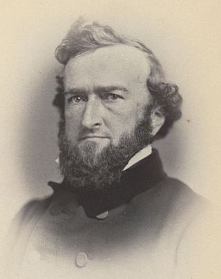
Owen Jones was an American politician from Pennsylvania who served as a Democratic member of the U.S. House of Representatives for Pennsylvania's 5th congressional district for one term from 1857 to 1859. During the American Civil War he raised a troop of cavalry that would become Company B of the 1st Pennsylvania Cavalry Regiment and served as colonel.

Portage Township is one of thirteen townships in St. Joseph County, in the U.S. state of Indiana. As of the 2020 census, its population was 94,571.
Airport Expressway, is a 7.9-mile (12.7 km) long expressway located in Allen County and the City of Fort Wayne, Indiana. The expressway, completed in 2001, provides access to the Fort Wayne International Airport. Airport Expressway begins as an extension of Lower Huntington Road in rural Allen County at an interchange with Interstate 69 (I–69) exit 299 and travels northeast, then east to end at Fairfield Avenue. None of the highway is listed on the National Highway System. Various sections are rural four-lane undivided highway and urbanized four-lane divided highway.


