Centenary is an unincorporated community in Clinton Township, Vermillion County, in the U.S. state of Indiana.
Klondyke is an unincorporated community in Clinton Township, Vermillion County, in the U.S. state of Indiana.
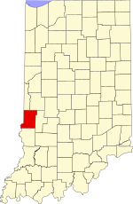
Toronto is an extinct town in Helt Township, Vermillion County, in the U.S. state of Indiana. The site is near the Illinois and Indiana border.

Reserve Township is one of thirteen townships in Parke County, Indiana, United States. As of the 2010 census, its population was 1,423 and it contained 675 housing units.

Saint Omer is an unincorporated community in Adams Township, Decatur County, Indiana.
Judson is an unincorporated community in Ervin Township, Howard County, Indiana, United States. It is part of the Kokomo, Indiana Metropolitan Statistical Area.

Blackhawk is an unincorporated community in Pierson Township, Vigo County, in the U.S. state of Indiana. The nearest official town is Riley. Blackhawk has one listing on the National Register of Historical Places in Vigo County, the Frank Senour Round Barn, built in 1905.

Markles is an unincorporated community in southern Otter Creek Township, Vigo County, in the U.S. state of Indiana. Within the boundaries of Terre Haute, it is also part of the Terre Haute metropolitan area.
Swalls is an unincorporated community in Lost Creek Township, Vigo County, in the U.S. state of Indiana. It is part of the Terre Haute metropolitan area.
Tabertown is an unincorporated community in Lost Creek Township, Vigo County, in the U.S. state of Indiana.
Terre Town is an unincorporated community in northern Harrison Township, Vigo County, in the U.S. state of Indiana. Now within the borders of the city of Terre Haute, it is part of the Terre Haute metropolitan area.

Smockville is an unincorporated community in Raccoon Township, Parke County, in the U.S. state of Indiana.
Denmark is an unincorporated community in the southwest portion of Marion Township, Owen County, in the U.S. state of Indiana. It lies near the intersection of County Road 1400 West and County Road 150 South, which is a community about fifteen miles west of the city of Spencer, the county seat of Owen County. Its elevation is 722 feet, and it is located at 39°16′11″N87°1′33″W.
Smithville is an unincorporated community in the northwest corner of Marion Township, Owen County, in the U.S. state of Indiana. It lies near the intersection of County Road 200 North and County Road 1400 West, which is a community about fifteen miles west of the city of Spencer, the county seat. Its elevation is 591 feet, and it is located at 39°19′15″N87°1′33″W.
New Discovery is an unincorporated community in Adams Township, Parke County, in the U.S. state of Indiana.
West Dana is an extinct town in Helt Township, Vermillion County, in the U.S. state of Indiana. The site is near the Illinois and Indiana border.
Early Station is an extinct town in Helt Township, Vermillion County, in the U.S. state of Indiana.
Montezuma Station is an extinct town in Helt Township, Vermillion County, in the U.S. state of Indiana.

Caledonia was a former town in Cass Township, Sullivan County, in the U.S. state of Indiana.
Farnsworth was a former town in Cass Township, Sullivan County, in the U.S. state of Indiana.