
Natchitoches Parish is a parish located in the U.S. state of Louisiana. As of the 2020 census, the population was 37,515. The parish seat and most populous municipality is Natchitoches, the largest by land area is Ashland, and the most density populated area is Campti. The parish was formed in 1805.

Bossier City is a city in Bossier Parish in the northwestern region of the state of Louisiana in the United States. It is the second-most populous city in the Shreveport–Bossier City metropolitan statistical area. In 2020, it had a total population of 62,701, up from 61,315 in 2010.
Natchez is a village in Natchitoches Parish, Louisiana, United States. The population was 597 at the 2010 census. It is part of the Natchitoches Micropolitan Statistical Area. The village and parish are part of the Cane River National Heritage Area and located on Isle Brevelle.

Natchitoches, officially the City of Natchitoches, is a small city and the parish seat of Natchitoches Parish, Louisiana, United States. At the 2020 United States Census, the city's population was 18,039. Established in 1714 by Louis Juchereau de St. Denis as part of French Louisiana, the community was named after the indigenous Natchitoches people.

Robeline is a village in western Natchitoches Parish, Louisiana, United States. The population was 183 at the 2000 census. It is part of the Natchitoches Micropolitan Statistical Area.
The Cane River National Heritage Area is a United States National Heritage Area in the state of Louisiana. The heritage area is known for plantations featuring Creole architecture, as well as numerous other sites that preserve the multi-cultural history of the area. The heritage area includes the town of Natchitoches, Louisiana and its national historic district. Founded in 1714, it is the oldest community in the territory covered by the Louisiana Purchase. Cane River Creole National Historical Park, including areas of Magnolia and Oakland plantations, also is within the heritage area.
Melrose is an unincorporated community in Natchitoches Parish, Louisiana, United States, including the Melrose Plantation and surrounding area, on Louisiana Highway 119. In addition to the historic plantation, the Cane River Creole National Historical Park and Heritage Area encompass the Melrose area.

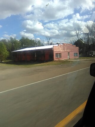
Cloutierville is an unincorporated community in Natchitoches Parish, Louisiana, United States. It lies approximately 20 miles (32 km) south of the city of Natchitoches on the Cane River. The community is part of the Natchitoches Micropolitan Statistical Area, off exit 119 of Interstate 49.

Derry is an unincorporated community in Natchitoches Parish, Louisiana, United States, located on Louisiana Highway 1 near Isle Brevelle. It is the closest town to Magnolia Plantation, a National Historic Landmark.

St. Augustine Catholic Church and Cemetery, or the Isle Brevelle Church, is a historic Catholic parish property founded in 1829 near Melrose, Natchitoches Parish, Louisiana. It is the cultural center of the Cane River area's historic French, Spanish, Native American and Black Creole community. It is also the oldest surviving Black Catholic church in the United States.
Flora is an unincorporated community in Natchitoches Parish, Louisiana, United States. It is located near the intersection of Louisiana highways 120 and 478, south of Natchitoches near Isle Brevelle and the El Camino Real de los Tejas National Historic Trail. Local waterways include Old River, Bayou Brevelle and Kisatchie Bayou.

The Basilica of the Immaculate Conception is a minor basilica located in Natchitoches, Louisiana, United States. It is also a parish church in the Diocese of Alexandria. The church building is the seventh structure to house the parish and was at one time the cathedral for the Roman Catholic Diocese of Natchitoches. As the Church of the Immaculate Conception it was listed as contributing property in the Natchitoches Historic District on the National Register of Historic Places.
The Rural African American Museum is a museum in Opelousas that focuses on the history of African Americans living in St. Landry Parish, Louisiana, United States, from the American Civil War to the present. It was inaugurated in late 2018 and is free to tour, although its operations rely primarily on donations. The museum's creator and president is Wilken Jones, a retired social studies school teacher who grew up in the nearby town of Plaisance. The permanent exposition showcases books, objects and press clippings that pertain to the economic, religious and political history of the region. The items on display include antique bedroom furniture, kitchen utensils and farm tools, among other things. The exposition illustrates the conditions of life of many Black sharecroppers in the late 19th and early 20th century.

Isle Brevelle is an ethnically and culturally diverse community, which began as a Native American and Louisiana Creole settlement and is located in Natchitoches Parish, Louisiana. For many years this area was known as Côte Joyeuse. It is considered the birthplace of Creole culture and remains the epicenter of Creole art and literature blending European, African, and Native American cultures. It is home to the Cane River Creole National Historical Park and part of the Louisiana African American Heritage Trail.
Bayou Brevelle is a series of interconnected, natural waterways totaling over 18 miles in length in Natchitoches Parish, Louisiana. Its main channel is at Old River and Kisatchie Bayou at Montrose to Natchez near the Cane River. During heavy rains or floods, Bayou Brevelle joins the Cane River. The bayou is flanked by Interstate 49 on the west and the Cane River on the east, and is one of the many waterways on Isle Brevelle.
St. Anne Chapel at Old River is a historic Catholic chapel founded in the 1800s along the banks of Old River near Cypress and Isle Brevelle in Natchitoches Parish, Louisiana, serving the Old River community. It is the cultural and religious center of the area's Louisiana Creole people, predominantly of French descent.
St. Charles Chapel at Bermuda is a historic Catholic chapel founded in the early 1900s along the banks of the Cane River on Isle Brevelle in Natchitoches Parish serving the unincorporated community of Bermuda, Louisiana. It is the cultural and religious center of the area's Louisiana Creole people, predominantly of French descent.
St. Joseph's Catholic Mission at Bayou Derbonne is a historic Catholic mission founded in the 1800s along the banks of Bayou Derbonne near Montrose and Isle Brevelle in Natchitoches Parish, Louisiana, serving the Montrose and Cloutierville Creole community. It was the cultural and religious center of the area's Louisiana Creole people, predominantly of French descent.
Bermuda is an unincorporated community in Natchitoches Parish, Louisiana, United States. It is located near the Cane River Creole National Historic Park on LA-112, south of Point Place near Isle Brevelle and the Oakland Plantation. Local waterways include the Cane River.
Old River (Natchitoches Parish) is a series of interconnected, natural waterways totaling over 25 miles in length in Natchitoches Parish, Louisiana. Its main channel runs along LA Highway 1 from South of Natchitoches, Louisiana, to Colfax, Louisiana. The river is flanked by Interstate 49 on the west and the Red River of the South on the east, and is one of the many waterways on Isle Brevelle.

