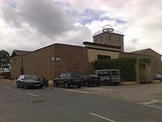
Galar is a town and municipality located in the province and autonomous community of Navarre, Northern Spain.

Jackson Township is a township in Lebanon County, Pennsylvania, United States. The population was 9,352 at the 2020 census.

The Plaza de Cibeles is a square with a neo-classical complex of marble sculptures with fountains that has become a symbol for the city of Madrid. It sits at the intersection of Calle de Alcalá, Paseo de Recoletos and Paseo del Prado. Plaza de Cibeles was originally named Plaza de Madrid, but in 1900, the City Council named it Plaza de Castelar, which was eventually replaced by its current name.

San Antonio de Flores is a municipality in the Honduran department of Choluteca.

Kilarrow Church is a Church of Scotland parish church, overlooking and serving Bowmore on the island of Islay.
Nicolum River Provincial Park, formerly Nicolum Provincial Park, is a provincial park in British Columbia, Canada, located at the confluence of the Nicolum and Coquihalla Rivers near the town of Hope. The park is a Class A, category 6 Provincial Park.
Pine River Breaks Provincial Park is a provincial park in British Columbia, Canada in the Peace River Lowland between the communities of East Pine and Chetwynd.

Woodruff Park, named for Robert W. Woodruff, is located in the heart of Downtown Atlanta, Georgia. The park's 6 acres (2.4 ha) are north of Edgewood Ave, between Peachtree Street NE and Park Place NE. The park includes a fountain, a performance pavilion, and several monuments.

A Coruña is a comarca in the Galician Province of A Coruña. The overall population of this local region is 403,386 (2019).
The Tŝideldel First Nation is the band government of the Tsi Del Del subgroup of the Tsilhqot'in people, located in the Chilcotin District in the western Central Interior region of the Canadian province of British Columbia. It is a member of the Tsilhqot'in National Government.

North Industry is an unincorporated community in southern Canton Township, Stark County, Ohio, United States, along the Nimishillen Creek. Its altitude is 1,001 feet (305 m). The community is part of the Canton–Massillon Metropolitan Statistical Area. North Industry is often referred to as "Canton South" by the local residents.
Lost Nation, Illinois is an unincorporated census-designated place in Ogle County, Illinois, United States, located south of the city of Oregon. As of the 2010 census, its population was 708. Lost Nation has an area of 2.552 square miles (6.61 km2); 2.441 square miles (6.32 km2) of this is land, and 0.111 square miles (0.29 km2) is water.

Calle de Alcalá is among the longest streets in Madrid. It starts at the Puerta del Sol and goes on for 11 kilometres (6.8 mi), to the northeastern outskirts of the city. Henry David Inglis described it in 1837 as "long, of superb width, and flanked by a splendid range of unequal buildings".
Lipina is a settlement in the administrative district of Gmina Bartoszyce, within Bartoszyce County, Warmian-Masurian Voivodeship, in northern Poland, close to the border with the Kaliningrad Oblast of Russia. It lies approximately 5 kilometres (3 mi) south-west of Bartoszyce and 51 km (32 mi) north of the regional capital Olsztyn.
Oleander is an unincorporated community in Fresno County, California. It is located 9 miles (14 km) south-southeast of downtown Fresno, at an elevation of 285 feet.
Marrs Center is an unincorporated community in Marrs Township, Posey County, in the U.S. state of Indiana.

Prosperidad is an administrative neighborhood of Madrid belonging to the district of Chamartín. Its boundaries are: to the west the street Príncipe de Vergara, south: the Calle de María de Molina and Avenida de América, east: the M-30 and north: the street Lopez de Hoyos Padre Claret street and avenue Ramon y Cajal.1

Ciudad Jardín is a neighborhood (barrio) of the Chamartín district, situated in the northeast part of the city of Madrid and adjacent to the Salamanca district. It is located between Calle Príncipe de Vergara, Avenida Ramón y Cajal and Calle López de Hoyos, the latter being one of the longest streets in the city and well known for its great commercial activity.
Banning Corner is an extinct town that was located in Warren Township in Warren County, Indiana, north of the town of Independence.

Black Rock is an extinct community located in Warren Township in Warren County, Indiana, near the border with Tippecanoe County. The site, which is still listed as a populated place by the USGS, is mostly forested and is part of the Black Rock Nature Preserve administered by NICHES Land Trust.

