Bukit Panjang

Last updated

Bukit Panjang
Other transcription(s)
   Malay Bukit Panjang(Rumi)
بوکيت ڤنجڠ(Jawi)
   Chinese 武吉班让(Simplified)
武吉班讓(Traditional)
Wǔjí Bānràng(Pinyin)
Bú-kit Pan-jiāng(Hokkien POJ)
   Tamil புக்கிட் பாஞ்சாங்
Pukkiṭ Pāñcāṅ(Transliteration)
Junction of Bukit Panjang Road and Bukit Panjang Ring Road near Bukit Panjang Plaza, Singapore - 20130223.jpg
Bukit Panjang Estate (8026633031).jpg
Bukit timah rock.jpg
Zhenghua Community Club.JPG
Clockwise: A busy intersection between Bukit Panjang Road and Bukit Panjang Ring Road, Senja-Cashew Community Club with HDB flats in the background, Zhenghua Community Club, Summit of Bukit Timah Hill
Bukit Panjang location.svg
Location of Bukit Panjang in Singapore
Singapore location map (main island).svg
Red pog.svg
Bukit Panjang
Location of Bukit Panjang within Singapore
Coordinates: 1°22′51.00″N103°45′45.00″E / 1.3808333°N 103.7625000°E / 1.3808333; 103.7625000
CountryFlag of Singapore.svg  Singapore
Region West Region
CDC
Town Council
  • Holland-Bukit Panjang Town Council
Constituencies
Government
  MayorNorth West CDC
  Members of ParliamentBukit Panjang SMC

Holland-Bukit Timah GRC

Area
  Total8.99 km2 (3.47 sq mi)
  Residential2.19 km2 (0.85 sq mi)
Population
 (2019) [1] [2] [3]
  Total138,270
  Density15,000/km2 (40,000/sq mi)
Demonym
  • Bukit Panjang resident
Ethnic groups
[3]
   Chinese 102,800
   Malays 21,690
   Indians 10,340
  Others3,450
Postal districts
21, 23
Dwelling units34,463
Projected ultimate44,000

Bukit Panjang is a planning area and residential town located in the West Region of Singapore. A portion of this town is situated on a low-lying elongated hill. The planning area is bounded by Bukit Batok to the west, Choa Chu Kang to the northwest, Sungei Kadut to the north, the Central Water Catchment to the east, and Bukit Timah to the south. Bukit Panjang New Town is located at the northern portion of the planning area. Bukit Panjang has an average elevation of 36m/118 ft. [4]

Contents

The town is categorised into seven subzones, namely Jelebu, Bangkit, Fajar, Saujana, Senja, Dairy Farm, and Nature Reserve.

Etymology

Bukit Panjang means "long hill" in Malay. It gets its name from the low hills which end south to Bukit Timah. [5] The roads in the town are named after old 60s kampung tracks (Lorong Petir, Lorong Pending, Jalan Fajar, Jalan Senja) which used to ply the area. [6]

History

Bukit Panjang is a suburban town in western Singapore. Before redevelopment, Kampong Bukit Panjang used to exist in the area. Initially, instead of using the original place name, Bukit Panjang, there were plans to open up the new town using the name, Zhenghua, [6] derived from Jalan Cheng Hwa that used to ply the area. However, Bukit Panjang was quickly reinstated following complaints. [7] Development of the town and advanced earthworks begun on 15 June 1981. HDB flats rose up by 20 May 1985, but only Blocks 1xx and 2xx were built so far. Neighbourhood 4 was up and running by 1989, and followed by Neighbourhood 5 and 6 which was the recent ones since 1995.

Administration

The Bukit Panjang area comes under the administrative lead of the Holland-Bukit Panjang Town Council, which oversees the management and maintenance of the many apartments (HDB flats) and commercial units in Bukit Panjang. Its chairman is Liang Eng Hwa.

Housing, amenities, and attractions

640A Senja Close, an HDB block in Senja, is the tallest building in Bukit Panjang with a total of 38 floors. Bukit Panjang (6).jpg
640A Senja Close, an HDB block in Senja, is the tallest building in Bukit Panjang with a total of 38 floors.

The town consists of a mixture of old and new blocks of flats, condominiums and private housing. To date, there are three community centres, namely Bukit Panjang Community Club, Zhenghua Community Club, [8] and Senja-Cashew Community Club, which serve the entertainment, recreational, and educational needs of residents.

Bukit Panjang Plaza, one of the popular malls in Bukit Panjang, before its second major renovation. Bukit Panjang Plaza.jpg
Bukit Panjang Plaza, one of the popular malls in Bukit Panjang, before its second major renovation.

Bukit Panjang Plaza is one of the well-known malls in Bukit Panjang. It is located in the heart of Bukit Panjang town and is near Bukit Panjang LRT station, Bukit Panjang MRT station, and Bukit Panjang Bus Interchange. Located on Jelebu Road, the mall has been expanded twice throughout its existence to include more shops in the building. The mall is owned by CapitaRetail which is another retail-based REIT by CapitaLand. The mall houses the Bukit Panjang Public Library as well as a NTUC FairPrice Finest supermarket.

Hillion Mall as viewed from Bukit Panjang MRT station Singapore - Hillion Mall.png
Hillion Mall as viewed from Bukit Panjang MRT station

Hillion Mall is another well-known mall in Bukit Panjang, located along Petir Road. It is one of the more recent commercial facilities, which completed construction and was opened to the public on 24 February 2017. It is part of the Bukit Panjang Integrated Transport Hub, which shares the building with the Bukit Panjang Bus Interchange, and directly links to the Bukit Panjang MRT/LRT station through an underpass and above-ground link way respectively.

The market at the Bukit Panjang Neighbourhood Centre in Bangkit Covered market at Bukit Panjang Neighbourhood Centre.jpg
The market at the Bukit Panjang Neighbourhood Centre in Bangkit

There are other smaller commercial buildings equipped with food courts, supermarkets, and other basic shops to meet the basic necessities of the residents. They are commonly located within HDB estates or small standalone buildings. Some of the more iconic buildings include Junction 10 located along Woodlands Road, Fajar Shopping Centre located along Fajar Road, Greenridge Shopping Centre located along Jelapang Road, and the Bukit Panjang Neighbourhood Centre located along Bangkit Road.

Within the neighbourhood consists of two hawker centres; the Bukit Panjang Hawker Centre and Market and the Senja Hawker Centre. [9] The former opened in 2015 [10] while the latter opened in 2022. [11]

A healthcare facility located along Senja Road was opened on 2 October 2021 to house the Bukit Panjang Polyclinic and the Senja Care Home. [12]

Pang Sua Pond, home to the second largest man-made floating wetland system in Singapore Bukit panjang neighbourhood park.png
Pang Sua Pond, home to the second largest man-made floating wetland system in Singapore

The town has two major parks, namely Bukit Panjang Park and Zhenghua Park. [6] Bukit Panjang Park is located adjacent to the Senja-Cashew Community Club and wraps around Pang Sua Pond, a man-made floating wetland. Zhenghua Park, located in the eastern part of Bukit Panjang, consists of a fitness area, gazebos, playgrounds, and a 2.5-kilometre cycling and jogging track that runs parallel to the Bukit Timah Expressway.

Education

Bukit Panjang has both primary and secondary schools within the neighbourhood, [13] as well as other private institutions.

Primary schools

Secondary schools

Private institutions

Transportation

Rail

Bukit Panjang is served by the following MRT Stations on the Downtown MRT Line which opened on 27 December 2015 and provide residents with direct train access to the Downtown Core:

It is also served by the following LRT Stations which connect it to nearby Choa Chu Kang for commuters to access the North South MRT Line:

The interior of Bukit Panjang MRT station. DT1 Bukit Panjang MRT Platforms 20220503 130818.jpg
The interior of Bukit Panjang MRT station.
Bukit Panjang LRT station with a condominium and HDB flats in the background. BP6 Bukit Panjang exterior 2020-08-08 17-27-13 671.jpg
Bukit Panjang LRT station with a condominium and HDB flats in the background.

The driverless and fully automated Bukit Panjang LRT line was completed on 11 June 1999 at a cost of S$285 million. [14] The rail line was intended to serve the growing town and act as a replacement to the many buses employed through the town, especially during rush hours. Originally opening with 14 stations, Ten Mile Junction station permanently closed in 2019 after sighting low ridership, bringing the number to 13. [15]

Several petitions were presented by the residents of Bukit Panjang protesting the decision by SMRT to replace the buses in Bukit Panjang with the LRT system. Some of the complaints were related to the fact that people preferred the previous bus system that covered most parts of the Bukit Panjang neighbourhoods such as bus service 190 and 972. The previous bus system was viewed as more efficient because it had many bus stops within walking distance; the LRT system has only 13 stations that are spaced hundreds of meters apart.

The LRT system is expected to go through a major upgrading programme that is due to be completed by 2026. The programme will bring about a new signalling system, better condition monitoring, new power rails system and 19 new light rail vehicles. [16] [17]

Bus

The public bus system is predominantly run by SMRT Buses. Of the SMRT buses based in Bukit Panjang, some are smaller feeder bus services that serve the various areas of the neighbourhood, while the rest are long-distance trunk services that serve as a mode of transport to other towns and to the city centre. Bus services start and end at Bukit Panjang Bus Interchange.

Road

The Senja/KJE road interchange Bukit Panjang (23).jpg
The Senja/KJE road interchange

Bukit Panjang is bounded by two of Singapore's expressways — the Bukit Timah Expressway (BKE) and Kranji Expressway (KJE). The BKE is accessible via Bukit Panjang Road and Dairy Farm Road, while the KJE is accessible via Woodlands Road and Senja Road. [18]

Bukit Panjang also has a ring road running through the various parts of Bukit Panjang, the Bukit Panjang Ring Road. It acts as a feeder to the main arterial roads in the town.

Cycling

Pang Sua Park Connector running along a canal Pang Sua Park Connector running adjacent to canal and Bukit Panjang Road near 123 Pending Road.jpg
Pang Sua Park Connector running along a canal

There is a total of 8.5 km-worth of cycling paths around Bukit Panjang to facilitate active mobility as part of the Land Transport Authority's Walk-Cycle-Ride initiative. [19] The first batch of cycling paths was constructed along Petir Road in 2018 by the Holland-Bukit Panjang Town Council. The network has since expanded to cover areas such as Fajar, Bangkit, Jelapang, and Senja. [20] Together with the Pang Sua Park Connector, Bukit Panjang Park Connector, and Bukit Panjang (Woodlands Road to KJE) Park Connector, the cycling paths form the backbone of the town's 16 km cycling network. [21]

Politics

Bukit Panjang is politically divided into two constituencies, namely the Bukit Panjang Single Member Constituency and the Cashew and Zhenghua wards of the Holland-Bukit Timah Group Representation Constituency.

Bukit Panjang SMC mainly consists of the Pending, Bangkit and Fajar areas. Its Member of Parliament is Liang Eng Hwa.

Senja, Segar, and Jelapang are located in Zhenghua ward of Holland-Bukit Timah GRC where its Member of Parliament is Edward Chia. Petir, Gangsa, and Chestnut areas belong to the Cashew division of Holland-Bukit Timah GRC with its Member of Parliament being Vivian Balakrishnan.

Related Research Articles

<span class="mw-page-title-main">Woodlands, Singapore</span> Planning Area and Regional Centre in North Region, Singapore

Woodlands is a planning area and residential town located in the North of Singapore. As of 2019, the town has a population of 254,733. Located approximately 25 km (16 mi) north of the central business district (CBD), it is the densest planning area and is the regional centre for the northern parts of the country.

<span class="mw-page-title-main">Clementi, Singapore</span> Planning Area and HDB Town in West Region, Singapore

Clementi is a planning area and residential town located at the easternmost fringe of the West Region of Singapore. The town borders Bukit Batok to the north, Bukit Timah to the northeast, Queenstown to the east and Jurong East to the west.

<span class="mw-page-title-main">Choa Chu Kang</span> Planning area and residential town in Singapore

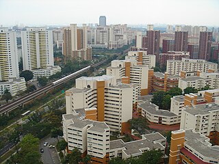
Choa Chu Kang, alternatively spelled Chua Chu Kang and often abbreviated as CCK, is a planning area and residential town located at the northwestern point of the West Region of Singapore. The town shares borders with Sungei Kadut to the north, Tengah to the southwest, Bukit Batok to the southeast, Bukit Panjang to the east and the Western Water Catchment to the west. Choa Chu Kang New Town is separated into two portions by the Kranji Expressway.

<span class="mw-page-title-main">Bukit Batok</span> Planning Area and HDB Town in West Region ----, Singapore

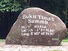
Bukit Batok, often abbreviated as Bt Batok, is a planning area and matured residential town located along the eastern boundary of the West Region of Singapore. Bukit Batok statistically ranks in as the 25th largest, the 12th most populous and the 11th most densely populated planning area in Singapore. It is bordered by six other planning areas - Choa Chu Kang to the North, Northeast and Northwest, Cashew to the northeast and East, Clementi to the South, Bukit Timah to the southeast, Jurong East to the southwest and Tengah to the west.

<span class="mw-page-title-main">Light Rail Transit (Singapore)</span> Automated guideway transit systems in Singapore

The Light Rail Transit (LRT) is a series of localised automated guideway transit systems acting as feeder services to the heavy rail Mass Rapid Transit, which together forms the core of Singapore's rail transport services. The first LRT line was opened in 1999 and the system has since expanded to three lines, each serving a new town, namely Bukit Panjang LRT line, Sengkang LRT line and Punggol LRT line. Trains on these lines have at least one station interchange link to the MRT.

<span class="mw-page-title-main">Yew Tee</span> Place in Singapore

Yew Tee is a residential area in the West Region of Singapore. Yew Tee is a cluster of Housing and Development Board flats and private condominiums, As a relatively new estate, a large proportion of its residents are young families and middle income earners.

<span class="mw-page-title-main">Rail transport in Singapore</span> Overview of rail transport in Singapore

Rail transport in Singapore mainly consists of a passenger urban rail transit system spanning the entire city-state: a rapid transit system collectively known as the Mass Rapid Transit (MRT) system operated by the two biggest public transport operators SMRT Trains and SBS Transit, as well as several Light Rail Transit (LRT) rubber-tyred automated guideway transit lines also operated by both companies. In addition, local specialised light rail lines are in operation in places such as the Singapore Changi Airport and Sentosa.

<span class="mw-page-title-main">Fernvale, Singapore</span> Place in Singapore

Fernvale is a neighbourhood of Sengkang New Town in Singapore. It is located between Sungei Punggol and the proposed Sengkang West Industrial Estate. The house numbers of the public apartment blocks in Fernvale begin with the number '4' (4xx). Fernvale is the newest neighbourhood in Sengkang Town to be completed by the Housing and Development Board (HDB). Seletar Mall, a new shopping amenity which houses Sengkang's first cineplex, is located within this neighbourhood. In 2017, a proposed community facility to be located next to Seletar Mall was announced, which houses a community club, childcare centre, hawker centre and wet market. The community facility which was slated to be ready by the second half of 2020, had stopped construction in April 2020 due to the COVID-19 measures set by the government. Construction of the facility has since continued in the second half of 2020 and was completed in 2022.

<span class="mw-page-title-main">Ten Mile Junction LRT station</span> Light rail station in Singapore

Ten Mile Junction LRT station was an elevated Light Rail Transit (LRT) station on the Bukit Panjang LRT line in Choa Chu Kang, Singapore that was in operation between 6 November 1999 and 13 January 2019. This LRT station was the only one that was air conditioned, inside a building, had full height platform screen doors, faregates on the same level as the platform, and only one track. The two-car configuration was not deployed for the service and it provided a 20-minute frequency, which was lower than the other LRT stations.

<span class="mw-page-title-main">Bukit Panjang Bus Interchange</span> Bus Interchange at Bukit Panjang New Town, Singapore

Bukit Panjang Bus Interchange is a bus interchange serving Bukit Panjang New Town, Singapore, located within Hillion Mall. It is diagonally opposite Bukit Panjang Plaza and adjacent to Bukit Panjang station on the Downtown MRT and Bukit Panjang LRT lines.

Taman Jurong is a residential precinct in Jurong West, Singapore. It is one of the oldest residential precincts in Singapore and a division of Jurong GRC, with the area's HDB flats under the management of Jurong-Clementi Town Council and Shawn Huang as the area's MP.

Teban Gardens is a residential precinct located in Jurong East, Singapore. Immediately north of Pandan Reservoir, it comprises exclusively public housing built by the JTC Corporation and Housing and Development Board.

<span class="mw-page-title-main">Hillview MRT station</span> Mass Rapid Transit station in Singapore

Hillview MRT station is an underground Mass Rapid Transit (MRT) station on the Downtown Line, situated on the boundaries of Hillview and Nature Reserve planning subzones of Bukit Batok and Bukit Panjang respectively, Singapore.

<span class="mw-page-title-main">Cashew MRT station</span> Mass Rapid Transit station in Singapore

Cashew MRT station is an underground Mass Rapid Transit (MRT) station on the Downtown line in Singapore, located between Upper Bukit Timah Road and Cashew Road. It is the nearest MRT station to the headquarters of the Ministry of Defence as well as the upcoming National Service (NS) Hub.

<span class="mw-page-title-main">Bukit Panjang MRT/LRT station</span> Mass Rapid Transit and light rail station in Singapore

Bukit Panjang MRT/LRT station is a Mass Rapid Transit (MRT) and Light Rail Transit (LRT) interchange station on the Downtown line (DTL) and the Bukit Panjang LRT line (BPLRT) in Singapore. Located in the namesake estate of Bukit Panjang, the station is at the junction of Upper Bukit Timah Road and Petir Road. The station serves the commercial buildings of Bukit Panjang Plaza, Hillion Mall and Junction 10. It forms a part of the Bukit Panjang Integrated Transport Hub (BPITH), which also contains a bus interchange.

<span class="mw-page-title-main">Hillview, Singapore</span> Place in Singapore

Hillview is located in Upper Bukit Timah, Northwest Singapore. The neighbourhood overlooks Bukit Timah Hill, hence its name.

<span class="mw-page-title-main">Choa Chu Kang MRT/LRT station</span> Mass Rapid Transit and light rail station in Singapore

Choa Chu Kang MRT/LRT station is an elevated Mass Rapid Transit (MRT) and Light Rail Transit (LRT) interchange station in Choa Chu Kang, Singapore. It is an interchange between the North South line and Bukit Panjang LRT, serving as the western terminus of the latter. The station is located between Choa Chu Kang Bus Interchange and Lot One in the Choa Chu Kang town centre.

Yuhua is a subzone region located in the town of Jurong East, Singapore. Yuhua comprises two subzones, Yuhua East and Yuhua West. The area's HDB flats are under the management of Jurong-Clementi Town Council and the people of this precinct are represented in parliament by either Grace Fu or Rahayu Mahzam, depending on where they stay.

Hong Kah is a residential precinct in Jurong West, Singapore. It is bounded by the PIE, Corporation Road, Jurong Canal Drive, Jurong East Avenue 1 and Jurong Town Hall Road. It is named after the former 'Hong Kah Village'.

Bukit Panjang may refer to:

References

Citations

  1. 1 2 "Bukit Panjang (Planning Area, Singapore) - Population Statistics, Charts, Map and Location". www.citypopulation.de. Retrieved 10 April 2018.
  2. 1 2 HDB Key Statistics FY 2014/2015 Archived 4 March 2016 at the Wayback Machine
  3. 1 2 "Statistics Singapore - Geographic Distribution - 2018 Latest Data" . Retrieved 11 February 2019.
  4. elevationmap.net. "Bukit Panjang New Town Singapore on the Elevation Map. Topographic Map of Bukit Panjang New Town Singapore". elevationmap.net. Retrieved 10 April 2018.
  5. Savage; Yeoh, p. 73
  6. 1 2 3 Loh Xiu, Ruth (3 July 2019). "Bukit Panjang, where the hills come alive". edgeprop.sg. Retrieved 7 September 2023.
  7. Savage; Yeoh, p. 74
  8. People's Association - Zhenghua Community Club
  9. "New Bukit Panjang hawker centre design unveiled; construction to begin this year: NEA". CNA. Retrieved 27 February 2020.
  10. "Bukit Panjang's first hawker centre sees sizeable crowds on opening day". TODAY. Retrieved 3 January 2023.
  11. cue (11 December 2022). "New Bukit Panjang hawker centre offers affordable fare, Michelin-rated stalls | The Straits Times". www.straitstimes.com. Retrieved 3 January 2023.
  12. "New Bukit Panjang Polyclinic has dental, women's and children's health services". The Straits Times. 2 October 2021. Retrieved 23 May 2022.
  13. "School Information Service (SIS)". sis.moe.gov.sg. Retrieved 11 September 2020.
  14. "Built at a cost of $285 million, Bukit Panjang LRT may be scrapped – The Independent News". 7 October 2016. Retrieved 27 February 2020.
  15. "Bt Panjang LRT's Ten Mile Junction station to close". The Straits Times. 8 March 2018. ISSN   0585-3923 . Retrieved 7 April 2024.
  16. "LTA | Upcoming Projects | System Renewal | Upgrading the Bukit Panjang LRT (BPLRT)". www.lta.gov.sg. Retrieved 11 September 2020.
  17. Lim, Adrian (7 March 2018). "Parliament: $344m overhaul of Bukit Panjang LRT; smoother rides expected from 2022". The Straits Times. ISSN   0585-3923 . Retrieved 7 September 2023.
  18. "LTA | Upcoming Projects | Road & Commuter Facilities | Senja/KJE Interchange". www.lta.gov.sg. Retrieved 27 February 2020.
  19. "LTA | Getting Around". www.lta.gov.sg. Retrieved 3 January 2023.
  20. "Bukit Panjang cycling paths to feed into Park Connector Network by 2021 | Video". CNA. Retrieved 3 January 2023.
  21. cue (18 February 2023). "Bukit Panjang gets 8.5km of new cycling paths along nearly every street | The Straits Times". www.straitstimes.com. Retrieved 19 February 2023.

Further reading