Ang Mo Kio is a planning area and residential town situated in the North-East region of Singapore. Located approximately 11 km (6.8 mi) north of the Downtown Core district, Ang Mo Kio is the 3rd most populated planning area in the North-East region and ranks 8th in terms of population in the country overall. The planning area is located at the south-western corner of the North-East region, bordered by the planning areas of Yishun to the north, Sengkang to the north-east, Serangoon to the east, Bishan to the south and the Central Water Catchment to the west.
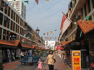
Katong is a residential neighbourhood in the eastern portion of the Central Region of Singapore, within the Marine Parade planning area. Katong district stretches from Fort Road area to Joo Chiat area. It used to be located by the sea, before land reclamation towards the south to East Coast Park was created for housing and recreational purposes beginning in the 1960s to 1970s.

Geylang is a planning area and township located on the eastern fringe of the Central Region of Singapore, bordering Hougang and Toa Payoh in the north, Marine Parade in the south, Bedok in the east, and Kallang in the west.

Punggol, historically Ponggol, is a planning area and new town situated on the Tanjong Punggol peninsula in the North-East Region of Singapore. The town directly borders Sengkang to the south and shares riverine boundaries with the planning area of Seletar to the west and Pasir Ris to the east. Bounding the town to the north and north-east is the Straits of Johor, with Coney Island included as a part of the Punggol planning area.
Clementi is a planning area and residential town located at the easternmost fringe of the West Region of Singapore. The town borders Bukit Batok to the north, Bukit Timah to the northeast, Queenstown to the east and Jurong East to the west.

Kallang is a planning area and residential zone located in the Central Region of Singapore.

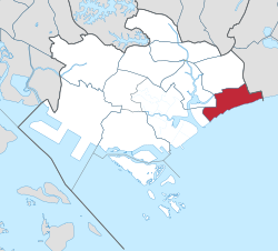
Tampines is the regional centre of the East Region of Singapore. With a population of 274,360 living across its five subzones, it is the second-most populous planning area in Singapore, according to the DOS Population Trends 2023. It is home to approximately 5% of Singapore's population. Tampines is bordered to the west by Bedok and Paya Lebar, to the north by Pasir Ris, to the east by Changi, and to the south by the Straits of Singapore. Situated in the historical region of Tanah Merah, its present-day terrain is particularly flat due to the large-scale sand quarrying in the 1960s.
Kembangan is a subzone and residential precinct located in the town of Bedok in the East Region of Singapore. It consists largely of private residential areas and a small public housing estate along Lengkong Tiga.
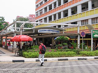
Hougang or Aukang is a planning area and mature residential town located in the North-East Region of Singapore. The town is the most populous in the region, being home to 247,528 residents as of 2018. Hougang planning area is bordered by Sengkang to the north, Geylang and Serangoon to the south, Bedok to the southeast, Toa Payoh to the southwest, Paya Lebar to the east, Ang Mo Kio to the west and Bishan to the southwest.

Queenstown is a planning area and satellite residential town situated on the south-westernmost fringe of the Central Region of Singapore. It borders Bukit Timah to the north, Tanglin to the northeast, Bukit Merah to the east and southeast, as well as Clementi to the northwest and west. Its southern and southwesternmost limits are bounded by the Pandan Strait.
Toa Payoh is a planning area and mature residential town located in the northern part of the Central Region of Singapore. Toa Payoh planning area borders Bishan and Serangoon to the north, the Central Water Catchment to the northwest, Kallang to the south, Geylang to the southeast, Novena to the west and Hougang to the east. Toa Payoh New Town is situated in the western portion of the Toa Payoh planning area. The latter occupies a much larger area, encompassing estates such as Potong Pasir and Bidadari.

Bedok is a planning area and residential town located in the geographical region of Tanah Merah along the south-eastern coast of the East Region of Singapore. Bedok is bounded by five other planning areas: Paya Lebar to the north, Hougang to the northwest, Tampines to the northeast and east, Geylang to the west and Marine Parade to the southwest. It also shares a maritime boundary with the Singapore Strait to the south and southeast.
Bukit Merah, also known as Redhill, is a planning area and new town situated in the southernmost part of the Central Region of Singapore. The planning area borders Tanglin to the north, Queenstown to the west and the Downtown Core, Outram and Singapore River planning areas of the Central Area to the east. It also shares a maritime boundary with the Southern Islands planning area to the south. Bukit Merah is linked to Sentosa Island via Sentosa Gateway, Sentosa Broadwalk, Sentosa Express and the Cable Car.

Siglap is a neighbourhood located south-west of Bedok in the East Region of Singapore. The area encompasses the Frankel and Opera Estates and their names have sometimes been used interchangeably to refer to the approximate same area. The planning subzone area of Siglap, as defined by the Urban Redevelopment Authority (URA), is confusingly and inaccurately referred to as the small strip of land between Victoria Junior College and Bedok South Avenue 1.

Tanjong Rhu, is a subzone within the planning area of Kallang, Singapore, as defined by the Urban Redevelopment Authority (URA). The perimeter of Tanjong Rhu is made up of Nicoll Highway in the north; Mountbatten Road and Fort Road in the east; East Coast Parkway (ECP) in the south; as well as Marina Channel and Kallang Basin in the west. Tanjong Rhu is the largest in terms of physical area among the nine subzones that make up Kallang.

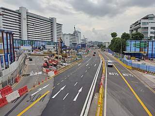
This article shows the notable future developments in Singapore. Most of them are currently under construction with most to be completed within the next five years.

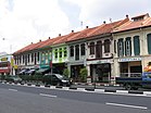
Joo Chiat Road is a road in Katong and a residential conservation area located in the east coast of Singapore.
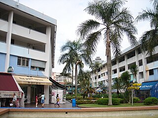
Teban Gardens is a residential precinct located in Jurong East, Singapore. Immediately north of Pandan Reservoir, it comprises exclusively public housing built by the JTC Corporation and Housing and Development Board.
Marine Terrace MRT station is a future underground Mass Rapid Transit station on the Thomson–East Coast line at the boundary of Marine Parade and Bedok planning areas, Singapore. Nearby residential areas such as Marine Terrace and Telok Kurau will be served.

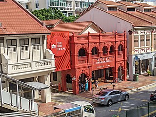
Tanjong Katong Complex is a shopping complex in Geylang Serai, Singapore. Constructed in 1982, the complex was the first air-conditioned shopping complex built by the Housing and Development Board and has since become known for servicing the Malay community in the area.