Washington County is a county in the U.S. state of Minnesota. As of the 2020 census, the population was 267,568, making it the fifth-most populous county in Minnesota. Its county seat is Stillwater. The largest city in the county is Woodbury, the eighth-largest city in Minnesota and the fourth-largest Twin Cities suburb.

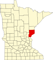
Pine County is a county in the U.S. state of Minnesota. As of the 2020 census, the population was 28,876. Its county seat is Pine City. The county was formed in 1856 and organized in 1872.

The St. Croix River is a tributary of the Mississippi River, approximately 169 miles (272 km) long, in the U.S. states of Wisconsin and Minnesota. The lower 125 miles (201 km) of the river form the border between Wisconsin and Minnesota. The river is a National Scenic Riverway under the protection of the National Park Service. A hydroelectric plant at the Saint Croix Falls Dam supplies power to the Minneapolis–St. Paul metropolitan area.
Mille Lacs Indian Reservation is the popular name for the land-base for the Mille Lacs Band of Ojibwe in Central Minnesota, about 100 miles (160 km) north of Minneapolis-St. Paul. The contemporary Mille Lacs Band reservation has significant land holdings in Mille Lacs, Pine, Aitkin and Crow Wing counties, as well as other land holdings in Kanabec, Morrison, and Otter Tail Counties. Mille Lacs Indian Reservation is also the name of a formal Indian reservation established in 1855. It is one of the two formal reservations on which the contemporary Mille Lacs Band retains land holdings. The contemporary Mille Lacs band includes several aboriginal Ojibwe bands and villages, whose members reside in communities throughout central Minnesota.

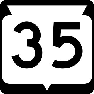
State Trunk Highway 35 is a Wisconsin state highway running north–south across western Wisconsin. It is 412.15 miles in length, and is the longest state highway in Wisconsin. Portions of WIS 35 are part of the Great River Road.

Minnesota State Highway 48 is a 23.527-mile-long (37.863 km) highway in east-central Minnesota, which runs from its interchange with Interstate Highway 35 in Hinckley and continues east to its eastern terminus at the Wisconsin state line, where it becomes Wisconsin Highway 77.
Lake Lena is an unincorporated community and Native American village in Ogema Township, Pine County, Minnesota, United States, located along the Lower Tamarack River. It currently is the administrative center for the Mille Lacs Indian Reservation, District III.
Markham is an unincorporated community in Colvin Township, Saint Louis County, Minnesota, United States.
Pengilly is an unincorporated community in eastern Itasca County, Minnesota, United States.
Crane Lake is an unincorporated community in Crane Lake Township, Saint Louis County, Minnesota, United States; located within the Kabetogama State Forest.
Margie is an unincorporated community in Koochiching County, Minnesota, United States; located near Big Falls.
Cloverton is an unincorporated community in New Dosey Township, Pine County, Minnesota, United States.
Wildwood is an unincorporated community in Koochiching County, Minnesota, United States; located within the Pine Island State Forest.
Pinetop is an unincorporated community in Koochiching County, Minnesota, United States; located within the Pine Island State Forest. The community is located east of Mizpah; and south of Gemmell; along Koochiching County Road 6.
Duxbury is an unincorporated community in Wilma Township, Pine County, Minnesota, United States.

Markville is an unincorporated community in Arna Township, Pine County, Minnesota, United States, located along the Saint Croix River.
Kingsdale is an unincorporated community in New Dosey Township, Pine County, Minnesota, United States.
Ellson is an unincorporated community in Bremen Township, Pine County, Minnesota, United States.
Greeley is an unincorporated community in Royalton Township, Pine County, Minnesota, United States.


