Colwell, Iowa

Last updated

Colwell, Iowa
Floyd County Iowa Incorporated and Unincorporated areas Colwell Highlighted.svg
Location of Colwell, Iowa.
Coordinates: 43°9′25″N92°35′35″W / 43.15694°N 92.59306°W / 43.15694; -92.59306
Country Flag of the United States.svg  United States
State Flag of Iowa.svg  Iowa
County Floyd
Area
[1]
  Total0.17 sq mi (0.43 km2)
  Land0.17 sq mi (0.43 km2)
  Water0.00 sq mi (0.00 km2)
Elevation
1,152 ft (351 m)
Population
 (2020)
  Total55
  Density333.33/sq mi (128.65/km2)
Time zone UTC-6 (Central (CST))
  Summer (DST) UTC-5 (CDT)
ZIP code
50620
Area code 641
FIPS code 19-15465
GNIS feature ID0455549

Colwell is a city in Floyd County, Iowa. The population was 55 at the time of the 2020 census. [2]

Contents

Geography

Colwell is located at 43°9′25″N92°35′35″W / 43.15694°N 92.59306°W / 43.15694; -92.59306 (43.157064, -92.593159). [3]

According to the United States Census Bureau, the city has a total area of 0.18 square miles (0.47 km2), all land. [4]

Demographics

Historical populations
YearPop.±%
1930 87    
1940 93+6.9%
1950 122+31.2%
1960 119−2.5%
1970 100−16.0%
1980 91−9.0%
1990 94+3.3%
2000 76−19.1%
2010 73−3.9%
2020 55−24.7%
Source: "U.S. Census website". United States Census Bureau . Retrieved March 29, 2020. and Iowa Data Center
Source:
U.S. Decennial Census [5] [2]
The population of Colwell, Iowa from US census data ColwellIowaPopPlot.png
The population of Colwell, Iowa from US census data

2010 census

As of the census [6] of 2010, there were 73 people, 30 households, and 22 families living in the city. The population density was 405.6 inhabitants per square mile (156.6/km2). There were 35 housing units at an average density of 194.4 per square mile (75.1/km2). The racial makeup of the city was 97.3% White and 2.7% from two or more races.

There were 30 households, of which 33.3% had children under the age of 18 living with them, 56.7% were married couples living together, 16.7% had a female householder with no husband present, and 26.7% were non-families. 20.0% of all households were made up of individuals, and 6.6% had someone living alone who was 65 years of age or older. The average household size was 2.43 and the average family size was 2.86.

The median age in the city was 42.8 years. 27.4% of residents were under the age of 18; 6.8% were between the ages of 18 and 24; 20.6% were from 25 to 44; 27.3% were from 45 to 64; and 17.8% were 65 years of age or older. The gender makeup of the city was 46.6% male and 53.4% female.

2000 census

As of the census [7] of 2000, there were 76 people, 31 households, and 20 families living in the city, a total population change of -19.1% (15 people) from the previous census. The population density was 413.8 inhabitants per square mile (159.8/km2). There were 33 housing units at an average density of 179.7 per square mile (69.4/km2). The racial makeup of the city was 100.00% White.

There were 31 households, out of which 35.5% had children under the age of 18 living with them, 64.5% were married couples living together, 3.2% had a female householder with no husband present, and 32.3% were non-families. 32.3% of all households were made up of individuals, and 19.4% had someone living alone who was 65 years of age or older. The average household size was 2.45 and the average family size was 3.14.

In the city, the population was spread out, with 30.3% under the age of 18, 9.2% from 18 to 24, 27.6% from 25 to 44, 23.7% from 45 to 64, and 9.2% who were 65 years of age or older. The median age was 31 years. For every 100 females, there were 100.0 males. For every 100 females age 18 and over, there were 89.3 males.

The median income for a household in the city was $27,813, and the median income for a family was $29,688. Males had a median income of $30,625 versus $17,500 for females. The per capita income for the city was $12,504. There were 4.3% of families and 10.7% of the population living below the poverty line, including 19.0% of under eighteens and none of those over 64.

Education

The Charles City Community School District operates area public schools. [8]

Related Research Articles

<span class="mw-page-title-main">Lincoln, Alabama</span> City in Alabama, United States

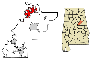
Lincoln is a city in Talladega County, Alabama, United States. It was incorporated in 1911. At the 2020 census, the population was 6,845. It was named for Major General Benjamin Lincoln, who served in the American army during the Revolutionary War.

<span class="mw-page-title-main">Ucon, Idaho</span> City in Idaho, United States

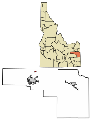
Ucon is a city in Bonneville County, Idaho, United States. It is part of the Idaho Falls, Idaho Metropolitan Statistical Area. The population was 1,108 at the 2010 census. Ucon was first settled in 1883.

<span class="mw-page-title-main">Stanley, Iowa</span> City in Iowa, United States

Stanley is a city in Buchanan and Fayette counties in the U.S. state of Iowa. The population was 81 at the time of the 2020 census.

<span class="mw-page-title-main">Truesdale, Iowa</span> City in Iowa, United States

Truesdale is a city in Buena Vista County, Iowa, United States. The population was 69 at the time of the 2020 census.

<span class="mw-page-title-main">Ventura, Iowa</span> City in Iowa, United States

Ventura is a city in Cerro Gordo County, Iowa, United States. The population was 711 at the time of the 2020 census. It is part of the Mason City Micropolitan Statistical Area. Ventura is located on the northeastern basin of Clear Lake, making it an area with many lakeside areas.

<span class="mw-page-title-main">North Washington, Iowa</span> City in Iowa, United States

North Washington is a city in Chickasaw County, Iowa, United States. The population was 112 at the time of the 2020 census.

<span class="mw-page-title-main">Waucoma, Iowa</span> City in Iowa, United States

Waucoma is a city in Fayette County, Iowa, United States. The population was 229 at the time of the 2020 census.

<span class="mw-page-title-main">Roosevelt Park, Michigan</span> City in Michigan, United States

Roosevelt Park is a city in Muskegon County in the U.S. state of Michigan. The population was 3,831 at the 2010 census.

<span class="mw-page-title-main">Hollandale, Minnesota</span> City in Minnesota, United States

Hollandale is a city on State Highway 251 in Freeborn County, Minnesota, United States. The population was 303 at the 2010 census.

<span class="mw-page-title-main">Manchester, Minnesota</span> City in Minnesota, United States

Manchester is a city in Freeborn County, Minnesota, United States. The population was 57 at the 2010 census.

<span class="mw-page-title-main">Maplewood, Minnesota</span> City in Minnesota, United States

Maplewood is a city in Ramsey County, Minnesota, United States. The population was 42,088 at the 2020 census. Maplewood is ten minutes' drive from downtown Saint Paul. It stretches along the northern and eastern borders of Saint Paul.

<span class="mw-page-title-main">St. Rosa, Minnesota</span> City in Minnesota, United States

Saint Rosa is a city in Stearns County, Minnesota, United States. The population was 68 at the 2010 census. It is part of the St. Cloud Metropolitan Statistical Area.

<span class="mw-page-title-main">Northwoods, Missouri</span> City in Missouri, United States

Northwoods is a city in St. Louis County, Missouri, United States. The population was 4,227 at the 2010 census.

<span class="mw-page-title-main">Velda City, Missouri</span> City in Missouri, United States

Velda City is a city in St. Louis County, Missouri, United States. The population was 1,420 at the 2010 census.

<span class="mw-page-title-main">Milledgeville, Ohio</span> Village in Ohio, United States

Milledgeville is a village in Jasper Township, Fayette County, Ohio, United States. The population was 98 at the 2020 census.

<span class="mw-page-title-main">Stewartstown, Pennsylvania</span> Borough in Pennsylvania, United States

Stewartstown is a borough that is located in York County, Pennsylvania, United States. The population was 2,125 at the time of the 2020 census.

<span class="mw-page-title-main">Lake Andes, South Dakota</span> City in South Dakota, United States

Lake Andes is a city in, and the county seat of, Charles Mix County, South Dakota, United States. The population was 710 at the 2020 census.

<span class="mw-page-title-main">Garretson, South Dakota</span> City in South Dakota, United States

Garretson is a city in Minnehaha County, South Dakota, United States. The city had a population of 1,228 at the 2020 census.

<span class="mw-page-title-main">Greenfield, Tennessee</span> City in Tennessee, United States

Greenfield is a city in southwestern Weakley County, Tennessee, United States. The population was 2,182 at the 2010 census and 2,078 in 2018.

<span class="mw-page-title-main">Walworth, Wisconsin</span> Village in Wisconsin, United States

Walworth is a village in Walworth County, Wisconsin, United States. The population was 2,759 at the 2020 census. The village is located within the Town of Walworth.

References

  1. "2020 U.S. Gazetteer Files". United States Census Bureau. Retrieved March 16, 2022.
  2. 1 2 "2020 Census State Redistricting Data". census.gov. United states Census Bureau. Retrieved August 12, 2021.
  3. "US Gazetteer files: 2010, 2000, and 1990". United States Census Bureau. February 12, 2011. Retrieved April 23, 2011.
  4. "US Gazetteer files 2010". United States Census Bureau. Archived from the original on July 2, 2012. Retrieved May 11, 2012.
  5. "Census of Population and Housing". Census.gov. Retrieved June 4, 2015.
  6. "U.S. Census website". United States Census Bureau . Retrieved May 11, 2012.
  7. "U.S. Census website". United States Census Bureau . Retrieved January 31, 2008.
  8. "Charles City" (PDF). Iowa Department of Education . Retrieved August 8, 2020.