Floyd, Iowa

Last updated
Floyd, Iowa
Floyd Iowa.jpg
Downtown Floyd
Floyd County Iowa Incorporated and Unincorporated areas Floyd Highlighted.svg
Location of Floyd, Iowa
Coordinates: 43°7′39″N92°44′23″W / 43.12750°N 92.73972°W / 43.12750; -92.73972 Coordinates: 43°7′39″N92°44′23″W / 43.12750°N 92.73972°W / 43.12750; -92.73972
Country Flag of the United States.svg  United States
State Flag of Iowa.svg  Iowa
County Floyd
Area
[1]
  Total0.55 sq mi (1.43 km2)
  Land0.55 sq mi (1.43 km2)
  Water0.00 sq mi (0.00 km2)
Elevation
1,066 ft (325 m)
Population
 (2020)
  Total313
  Density567.03/sq mi (218.84/km2)
Time zone UTC-6 (Central (CST))
  Summer (DST) UTC-5 (CDT)
ZIP code
50435
Area code(s) 641
FIPS code 19-28020
GNIS feature ID0456646

Floyd is a city in Floyd County, Iowa, United States. The population was 313 at the time of the 2020 census. [2]

Contents

History

Floyd is named for Charles Floyd of Lewis and Clark fame, as was Floyd County. [3]

Geography

Floyd is located at 43°7′39″N92°44′23″W / 43.12750°N 92.73972°W / 43.12750; -92.73972 (43.127494, -92.739628) [4] on the Cedar River.

According to the United States Census Bureau, the city has a total area of 0.60 square miles (1.55 km2), all land. [5]

Demographics

Water Tower in Floyd, Iowa FloydWaterTower.JPG
Water Tower in Floyd, Iowa
Historical populations
YearPop.±%
1880 279    
1900 353+26.5%
1910 332−5.9%
1920 308−7.2%
1930 350+13.6%
1940 352+0.6%
1950 440+25.0%
1960 401−8.9%
1970 380−5.2%
1980 408+7.4%
1990 359−12.0%
2000 361+0.6%
2010 335−7.2%
2020 313−6.6%
Source: "U.S. Census website". United States Census Bureau . Retrieved 2020-03-28. and Iowa Data Center
Source:
U.S. Decennial Census [6] [2]
The population of Floyd, Iowa from US census data FloydIowaPopPlot.png
The population of Floyd, Iowa from US census data

2010 census

As of the census [7] of 2010, there were 335 people, 140 households, and 98 families living in the city. The population density was 558.3 inhabitants per square mile (215.6/km2). There were 149 housing units at an average density of 248.3 per square mile (95.9/km2). The racial makeup of the city was 98.8% White, 0.6% from other races, and 0.6% from two or more races. Hispanic or Latino of any race were 0.3% of the population.

There were 140 households, of which 27.1% had children under the age of 18 living with them, 61.4% were married couples living together, 4.3% had a female householder with no husband present, 4.3% had a male householder with no wife present, and 30.0% were non-families. 24.3% of all households were made up of individuals, and 10.7% had someone living alone who was 65 years of age or older. The average household size was 2.39 and the average family size was 2.81.

The median age in the city was 46.4 years. 21.2% of residents were under the age of 18; 5.8% were between the ages of 18 and 24; 21.6% were from 25 to 44; 29.7% were from 45 to 64; and 22.1% were 65 years of age or older. The gender makeup of the city was 52.5% male and 47.5% female.

2000 census

As of the census [8] of 2000, there were 361 people, 142 households, and 102 families living in the city. The population density was 612.7 inhabitants per square mile (236.6/km2). There were 147 housing units at an average density of 249.5 per square mile (96.3/km2). The racial makeup of the city was 99.17% White, 0.55% Asian, and 0.28% from two or more races.

There were 142 households, out of which 33.1% had children under the age of 18 living with them, 62.0% were married couples living together, 4.2% had a female householder with no husband present, and 27.5% were non-families. 23.2% of all households were made up of individuals, and 11.3% had someone living alone who was 65 years of age or older. The average household size was 2.54 and the average family size was 2.99.

In the city, the population was spread out, with 24.4% under the age of 18, 9.4% from 18 to 24, 23.8% from 25 to 44, 29.4% from 45 to 64, and 13.0% who were 65 years of age or older. The median age was 40 years. For every 100 females, there were 108.7 males. For every 100 females age 18 and over, there were 99.3 males.

The median income for a household in the city was $35,096, and the median income for a family was $36,458. Males had a median income of $28,021 versus $18,438 for females. The per capita income for the city was $14,723. About 3.1% of families and 6.4% of the population were below the poverty line, including 10.6% of those under age 18 and 12.5% of those age 65 or over.

Education

The Charles City Community School District operates area public schools.. [9]

See also

Related Research Articles

Naknek, Alaska CDP/borough seat in Alaska, United States

Naknek is a census-designated place located in and the borough seat of Bristol Bay Borough in the U.S. state of Alaska. As of the 2020 census, the population of the CDP was 470, down from 544 in 2010.

<span class="mw-page-title-main">Keystone, Florida</span> Census-designated place in Florida, United States

Keystone is an unincorporated census-designated place in Hillsborough County, Florida, United States. The Keystone area was first settled in the middle 1800s by the W.M. Mobley Family who migrated from Savannah, Georgia. The region has evolved from citrus and farming into a rural retreat of many lake homes and ranches. The population was 24,039 at the 2010 census, up from 14,627 at the 2000 census. The ZIP Codes encompassing the CDP area are 33556 and 33558.

Junction City, Illinois Village in Illinois, United States

Junction City is a village in Marion County, Illinois, United States. The population was 482 at the 2010 census.

<span class="mw-page-title-main">Galena, Indiana</span> Census-designated place in Indiana, United States

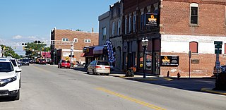
Galena is a census-designated place (CDP) in Floyd County, Indiana, United States. The population was 1,818 at the 2010 census. The CDP includes the town of Galena as well as the nearby town of Floyds Knobs and their immediate surroundings.

<span class="mw-page-title-main">Cicero, Indiana</span> Town in Indiana, United States

Cicero is a town in Jackson Township, Hamilton County, Indiana, United States, north of Indianapolis. The population was 4,812 at the 2010 census.

Rowley, Iowa City in Iowa, United States

Rowley is a city in Buchanan County, Iowa, United States. The population was 270 at the time of the 2020 census.

Marble Rock, Iowa City in Iowa, United States

Marble Rock is a city in Floyd County, Iowa, United States, along the Shell Rock River. The population was 271 at the time of the 2020 census. Marble Rock has a city park, historical museums, a powerhouse on the river, and a veterans' memorial. The Marble Rock Historical Society has a website with information about the museums.

<span class="mw-page-title-main">Merrill, Iowa</span> City in Iowa, United States

Merrill is a city in Plymouth County, Iowa, United States, along the Floyd River. The population was 717 at the time of the 2020 census.

<span class="mw-page-title-main">Alton, Iowa</span> City in Iowa, United States

Alton is a city in Sioux County, Iowa, United States, along the Floyd River. The population was 1,248 at the 2020 census.

Maurice, Iowa City in Iowa, United States

Maurice is a city in Sioux County, Iowa, United States, along the West Branch of the Floyd River. The population was 265 at the time of the 2020 census. It is home to the "Famous Maurice Fire Escape Slide" in the town park.

Martensdale, Iowa City in Iowa, United States

Martensdale is a city in Warren County, Iowa, United States. The population was 421 at the time of the 2020 census. It is part of the Des Moines–West Des Moines Metropolitan Statistical Area

<span class="mw-page-title-main">Middletown, Missouri</span> City in Missouri, United States

Middletown is a city in Montgomery County, Missouri, United States. The population was 171 at the 2020 census.

Kirtland, New Mexico Town in New Mexico, United States

Kirtland is a town, made up of part of the former census-designated place (CDP) of the same name in San Juan County, New Mexico, United States. The population of the former CDP was 6,190 at the 2000 census. It is part of the Farmington Metropolitan Statistical Area.

Rochester, Ohio Village in Ohio

Rochester is a village in Lorain County, Ohio, United States, along the West Branch of the Black River. The population was 182 at the 2010 census.

Callery, Pennsylvania Borough in Pennsylvania, United States

Callery is a borough in Butler County, Pennsylvania, United States. The population was 394 at the 2010 census.

Ashland Heights, South Dakota CDP in South Dakota, United States

Ashland Heights is a census-designated place (CDP) and unincorporated community in Pennington County, South Dakota, United States. The population was 678 at the 2020 census.

<span class="mw-page-title-main">Daniels, West Virginia</span> Census-designated place in West Virginia, United States

Daniels is a census-designated place (CDP) in Raleigh County, West Virginia, United States. The population was 1,881 at the 2010 census.

Hendricks, West Virginia Town in West Virginia, United States

Hendricks is a town in Tucker County, West Virginia, United States. The population was 226 at the 2020 census. The Blackwater River and the Dry Fork join at Hendricks to form the Black Fork, a principal tributary of the Cheat River.

Ludington, Wisconsin Town in Wisconsin, United States

Ludington is a town in Eau Claire County, Wisconsin, United States. The population was 998 at the 2000 census. The town's administration is located in the unincorporated community of Ludington.

Kingston is a town in Green Lake County, Wisconsin, United States. The population was 900 at the 2000 census. The Village of Kingston and the unincorporated community of Dalton are located within the town.

References

  1. "2020 U.S. Gazetteer Files". United States Census Bureau. Retrieved March 16, 2022.
  2. 1 2 "2020 Census State Redistricting Data". census.gov. United states Census Bureau. Retrieved 12 August 2021.
  3. Gannett, Henry (1905). The Origin of Certain Place Names in the United States. Govt. Print. Off. pp.  127.
  4. "US Gazetteer files: 2010, 2000, and 1990". United States Census Bureau. 2011-02-12. Retrieved 2011-04-23.
  5. "US Gazetteer files 2010". United States Census Bureau. Archived from the original on 2012-01-25. Retrieved 2012-05-11.
  6. "Census of Population and Housing". Census.gov. Retrieved June 4, 2015.
  7. "U.S. Census website". United States Census Bureau . Retrieved 2012-05-11.
  8. "U.S. Census website". United States Census Bureau . Retrieved 2008-01-31.
  9. "Charles City" (PDF). Iowa Department of Education . Retrieved 2020-08-08.