
Clay County is a county located in the U.S. state of Iowa. As of the 2020 census, the population was 16,384. Its county seat is Spencer. Its name is in honor of Henry Clay Jr., a colonel who died in action in the Mexican–American War, and son of Henry Clay, famous American statesman from Kentucky.

Montgomery County is a county located in the southwestern area of the U.S. state of Iowa. As of the 2020 census, the population was 10,330. Its population has declined since a peak in 1900, since urbanization and decline of family farms. The county seat is Red Oak. The county was founded by European-American migrants from eastern areas in 1851. It was named in honor of Richard Montgomery, an American Revolutionary War general killed in 1775 while trying to capture Quebec City, Canada.

Shelby County is a county located in the U.S. state of Iowa. As of the 2020 census, the population was 11,746. The county seat is Harlan. Its name is in honor of Isaac Shelby, the first Governor of Kentucky.

Webster County is a county in the U.S. state of Iowa. As of the 2020 census, the population was 36,999. The county seat is Fort Dodge. The county was established in January 1851, one of 43 counties established by a legislative package. This county was named after Daniel Webster, an American statesman noted for his moving oratory.

Van Buren County is a county located in the U.S. state of Iowa. As of the 2020 census the population was 7,203, making it the state's tenth-least populous county. The county seat is Keosauqua, which contains the oldest continuously operational courthouse in the state of Iowa, and second oldest in the United States.

O'Brien County is a county in the U.S. state of Iowa. As of the 2020 United States Census, the population was 14,182. The county seat is Primghar.

Humboldt County is a county in the U.S. state of Iowa. As of the 2020 census, the population was 9,597. The county seat is Dakota City. The county was created in 1857 and named in honor of Alexander von Humboldt.

Hancock County is a county in the U.S. state of Iowa. As of the 2020 census, the population was 10,795. The county seat is Garner. The county was founded on January 15, 1851, and named in honor of John Hancock, a leader of the Continental Congress during the American Revolution.

Guthrie County is a county located in the U.S. state of Iowa. As of the 2020 census, the population was 10,623. The county seat is Guthrie Center. The county was formed on January 15, 1851, and named after Captain Edwin B. Guthrie, who died in the Mexican–American War.

Grundy County is a county located in the U.S. state of Iowa. At the 2020 census, the population was 12,329. The county seat is Grundy Center. The county is named for Felix Grundy, former U.S. Attorney General.

Crawford County is a county located in the U.S. state of Iowa. As of the 2020 census, the population was 16,525. Its county seat is Denison. The county was named for William Harris Crawford, U.S. senator from Georgia and United States Secretary of the Treasury.

Cerro Gordo County is a county located in the U.S. state of Iowa. As of the 2020 census, the population was 43,127. Its county seat is Mason City. The county is named for the Battle of Cerro Gordo, which took place during the Mexican–American War.

Appanoose County is a county in the U.S. state of Iowa. As of the 2020 census, the population was 12,317. Its county seat is Centerville.

Boxholm is a city in Grant Township, Boone County, Iowa, United States. The population was 181 at the 2020 census. It is part of the Boone, Iowa Micropolitan Statistical Area, which is a part of the larger Ames-Boone, Iowa Combined Statistical Area.

Denison is a city in Crawford County, Iowa, United States, along the Boyer River, and located in both Denison Township and East Boyer Township. The population was 8,373 at the time of the 2020 census. It is the county seat of Crawford County.

Missouri Valley is a city in Harrison County, Iowa, United States. The population was 2,678 at the time of the 2020 census.

Dunleith Township is one of twenty-three townships in Jo Daviess County, Illinois, USA. As of the 2010 census, its population was 3,820 and it contained 1,713 housing units. It was formed from Menominee Township on March 2, 1865.
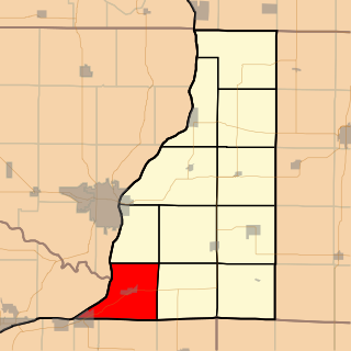
Lomax Township is one of eleven townships in Henderson County, Illinois, USA. As of the 2010 census, its population was 850 and it contained 399 housing units.

Ingham Township is one of sixteen townships in Franklin County, Iowa, United States. As of the 2010 census, its population was 311 and it contained 145 housing units.

Scott Township is one of sixteen townships in Franklin County, Iowa, United States. As of the 2010 census, its population was 382 and it contained 178 housing units.

