Conconully, Washington

Last updated

Conconully
Conconully, Washington
Conconully.jpg
Overview of Conconully
Okanogan County Washington Incorporated and Unincorporated areas Conconully Highlighted.svg
Location of Conconully, Washington
Coordinates: 48°33′32″N119°45′4″W / 48.55889°N 119.75111°W / 48.55889; -119.75111
CountryUnited States
State Washington
County Okanogan
Area
[1]
  Total0.21 sq mi (0.55 km2)
  Land0.21 sq mi (0.55 km2)
  Water0.00 sq mi (0.00 km2)
Elevation
2,303 ft (702 m)
Population
 (2020)
  Total193
  Density920/sq mi (350/km2)
Time zone UTC-8 (Pacific (PST))
  Summer (DST) UTC-7 (PDT)
ZIP code
98819
Area code 509
FIPS code 53-14310
GNIS feature ID1518000 [2]
Website townofconconully.com

Conconully is a town in Okanogan County, Washington, United States. The population was 193 at the 2020 census.

Contents

History

The name Conconully comes from the Okanogan name for Salmon Creek, /qʷúnqʷunɬp/, which flows from Conconully to the Okanogan River at Okanogan. [3] According to historian Harry M. Majors, the word means "cloudy". [4] Originally named Salmon City after the nearby Salmon Creek, Conconully began as a gold miners camp, and served as the county seat from 1888 to 1914. It was officially incorporated on November 11, 1908. [5]

On May 27, 1894, the town was devastated when an unusually heavy storm caused Salmon Creek to overflow. Debris-filled water more than 30 feet high rushed through canyons toward the town. One resident witnessed the oncoming flood and rode his horse through town warning the residents. More than 42 buildings were destroyed and one person was killed. [6]

Geography

Conconully is located at 48°33′32″N119°45′4″W / 48.55889°N 119.75111°W / 48.55889; -119.75111 (48.558820, -119.751054). [7]

According to the United States Census Bureau, the town has a total area of 0.31 square miles (0.80 km2), all of it land. [8] The city is flanked by two separate reservoirs of the United States Bureau of Reclamation, created by the 1911 Conconully Dam and the 1921 Salmon Lake Dam.

Climate

This climatic region is typified by large seasonal temperature differences, with warm to hot (and often humid) summers and cold (sometimes severely cold) winters. According to the Köppen Climate Classification system, Conconully has a humid continental climate, abbreviated "Dfb" on climate maps. [9]

Climate data for Conconully
MonthJanFebMarAprMayJunJulAugSepOctNovDecYear
Record high °F (°C)61
(16)
70
(21)
73
(23)
88
(31)
96
(36)
101
(38)
110
(43)
109
(43)
98
(37)
84
(29)
66
(19)
56
(13)
110
(43)
Mean daily maximum °F (°C)31.3
(−0.4)
39.1
(3.9)
51.4
(10.8)
63.5
(17.5)
71.6
(22.0)
77.9
(25.5)
87.2
(30.7)
85.6
(29.8)
75.7
(24.3)
60.5
(15.8)
42.5
(5.8)
33.6
(0.9)
60
(16)
Mean daily minimum °F (°C)17.8
(−7.9)
20.7
(−6.3)
27.9
(−2.3)
33.4
(0.8)
40.2
(4.6)
45.7
(7.6)
49.2
(9.6)
47.3
(8.5)
41.3
(5.2)
33.9
(1.1)
27.9
(−2.3)
22
(−6)
33.9
(1.1)
Record low °F (°C)−29
(−34)
−29
(−34)
−17
(−27)
10
(−12)
20
(−7)
29
(−2)
32
(0)
27
(−3)
20
(−7)
6
(−14)
−18
(−28)
−31
(−35)
−31
(−35)
Average precipitation inches (mm)1.42
(36)
1.26
(32)
1.16
(29)
1.04
(26)
1.46
(37)
1.58
(40)
0.81
(21)
0.82
(21)
0.72
(18)
1.02
(26)
1.63
(41)
1.68
(43)
14.6
(370)
Average snowfall inches (cm)13.8
(35)
6.7
(17)
2.5
(6.4)
0.5
(1.3)
0
(0)
0
(0)
0
(0)
0
(0)
0
(0)
0.3
(0.76)
5.8
(15)
12.6
(32)
42.2
(107)
Average precipitation days87667844458976
Source: [10]

Demographics

Historical population
CensusPop.Note
1890 232
1910 357
1920 270−24.4%
1930 102−62.2%
1940 18783.3%
1950 141−24.6%
1960 108−23.4%
1970 12213.0%
1980 15728.7%
1990 153−2.5%
2000 18520.9%
2010 21013.5%
2020 193−8.1%
U.S. Decennial Census [11]
2020 Census [12]

2010 census

As of the 2010 census, [13] there were 210 people, 103 households, and 63 families living in the town. The population density was 677.4 inhabitants per square mile (261.5/km2). There were 189 housing units at an average density of 609.7 per square mile (235.4/km2). The racial makeup of the town was 91.0% White, 0.5% African American, 2.4% Native American, 0.5% Asian, 3.3% from other races, and 2.4% from two or more races. Hispanic or Latino of any race were 5.7% of the population.

There were 103 households, of which 13.6% had children under the age of 18 living with them, 55.3% were married couples living together, 2.9% had a female householder with no husband present, 2.9% had a male householder with no wife present, and 38.8% were non-families. 31.1% of all households were made up of individuals, and 7.7% had someone living alone who was 65 years of age or older. The average household size was 2.04 and the average family size was 2.49.

The median age in the town was 55.1 years. 12.4% of residents were under the age of 18; 5.6% were between the ages of 18 and 24; 11.9% were from 25 to 44; 43.4% were from 45 to 64; and 26.7% were 65 years of age or older. The gender makeup of the town was 51.9% male and 48.1% female.

2000 census

As of the 2000 census, there were 185 people, 94 households, and 53 families living in the town. The population density was 834.3 people per square mile (324.7/km2). There were 192 housing units at an average density of 865.8 per square mile (337.0/km2). The racial makeup of the town was 96.22% White, 3.24% Native American, and 0.54% from two or more races.

There were 94 households, out of which 13.8% had children under the age of 18 living with them, 47.9% were married couples living together, 6.4% had a female householder with no husband present, and 42.6% were non-families. 31.9% of all households were made up of individuals, and 12.8% had someone living alone who was 65 years of age or older. The average household size was 1.97 and the average family size was 2.43.

In the town, the population was spread out, with 11.9% under the age of 18, 3.8% from 18 to 24, 21.6% from 25 to 44, 32.4% from 45 to 64, and 30.3% who were 65 years of age or older. The median age was 52 years. For every 100 females, there were 107.9 males. For every 100 females age 18 and over, there were 103.8 males.

The median income for a household in the town was $23,214, and the median income for a family was $24,750. Males had a median income of $29,167 versus $22,000 for females. The per capita income for the town was $16,168. About 17.5% of families and 18.7% of the population were below the poverty line, including 21.7% of those under the age of eighteen and none of those 65 or over.

Related Research Articles

<span class="mw-page-title-main">Okanogan County, Washington</span> County in Washington, United States

Okanogan County is a county located in the U.S. state of Washington along the Canada–U.S. border. As of the 2020 census, the population was 42,104. The county seat is Okanogan, while the largest city is Omak. Its area is the largest in the state.

<span class="mw-page-title-main">Douglas County, Washington</span> County in Washington, United States

Douglas County is a county located in the U.S. state of Washington. As of the 2020 census, its population was 42,938. The county seat is Waterville, while its largest settlement is East Wenatchee. The county was created out of Lincoln County on November 28, 1883 and is named for American statesman Stephen A. Douglas.

<span class="mw-page-title-main">Riggins, Idaho</span> City in Idaho, United States

Riggins is a city in the western United States in Idaho County, Idaho. Nestled deep in a canyon at the confluence of the Salmon and Little Salmon rivers in west central Idaho, it is approximately 150 highway miles (240 km) north of Boise, and 120 highway miles (190 km) south-southeast of Lewiston. The elevation is 1,821 feet (555 m) above sea level, and its population was 419 at the 2010 census.

Springfield is a town in Penobscot County, Maine, United States. The population was 293 at the 2020 census.

<span class="mw-page-title-main">Cadogan Township, Pennsylvania</span> Township in Pennsylvania, United States

Cadogan Township is a township in Armstrong County, Pennsylvania, United States. The population was 346 at the 2020 census, an increase over the figure of 344 tabulated in 2010.

<span class="mw-page-title-main">Starbuck, Washington</span> Town in Washington, United States

Starbuck is a town in Columbia County, Washington, United States. The population was 119 at the 2020 census.

<span class="mw-page-title-main">Bridgeport, Washington</span> City in Washington, United States

Bridgeport is a city in Douglas County, Washington. It is part of the Wenatchee−East Wenatchee Metropolitan Statistical Area. Bridgeport's population was 2,141 at the 2020 census. Bridgeport is located near the Chief Joseph Dam.

<span class="mw-page-title-main">Coulee City, Washington</span> Town in Washington, United States

Coulee City is a town in Grant County, Washington. The population was 549 at the 2020 census.

<span class="mw-page-title-main">Mattawa, Washington</span> City in Washington, United States

Mattawa is an incorporated city in Grant County, Washington, United States. The population was 3,335 at the 2020 census.

<span class="mw-page-title-main">Nespelem, Washington</span> Town in Washington, United States

Nespelem is a town in Okanogan County, Washington, United States. The population was 180 at the 2020 census. The town is located on the Colville Indian Reservation. The name Nespelem is derived from a local Native American term meaning "large flat meadow".

<span class="mw-page-title-main">Okanogan, Washington</span> City in Washington, United States

Okanogan is a city in Okanogan County, Washington, United States. The population was 2,379 at the 2020 census, down from 2,552 at the 2010 census, within the Greater Omak Area. It is the seat of Okanogan County.

<span class="mw-page-title-main">Oroville, Washington</span> City in Washington, United States

Oroville is a city located in the northern bulk of the Okanogan Highlands in north-central Washington, United States. Oroville is a member municipality of Okanogan County, Washington, situated between Omak and Penticton. The population was 1,795 at the 2020 census.

<span class="mw-page-title-main">Pateros, Washington</span> City in Washington, United States

Paterospə-TARR-əs is a city in Okanogan County, Washington, United States. The population at the 2020 census was 593.

<span class="mw-page-title-main">Riverside, Washington</span> Town in Washington, United States

Riverside is a town in Okanogan County, Washington, United States. The population was 280 at the 2010 census, and increased to 329 at the 2020 census.

<span class="mw-page-title-main">Tonasket, Washington</span> City in Washington, United States

Tonasket is a city in Okanogan County, Washington, United States. The population was 1,103 at the 2020 census.

<span class="mw-page-title-main">McMechen, West Virginia</span> City in West Virginia

McMechen is a city in Marshall County, West Virginia, United States, situated along the Ohio River. It is part of the Wheeling, West Virginia Metropolitan Statistical Area. The population was 1,714 at the 2020 census.

<span class="mw-page-title-main">Matoaka, West Virginia</span> Census-designated place in West Virginia, United States

Matoaka is a census-designated place in Mercer County, West Virginia, United States. The population was 173 at the 2020 census. It is part of the Bluefield, WV-VA micropolitan area which has a population of 100,093. This town is named for Chief Powhatan's daughter Matoaka who was better known by her nickname "Pocahontas". Matoaka became an unincorporated town when it voted to dissolve its charter in May 2018.

<span class="mw-page-title-main">Rowlesburg, West Virginia</span> Town in West Virginia, United States

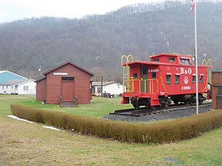
Rowlesburg is a town in southern Preston County, West Virginia, United States, along the Cheat River. The population was 438 at the 2020 census. It is part of the Morgantown metropolitan area. A former railroad town, it is home to the Downtown Rowlesburg Historic District, and was the site of action during the American Civil War.

<span class="mw-page-title-main">Auburn, West Virginia</span> Town in West Virginia, United States

Auburn is a town in Ritchie County, West Virginia, United States. The population was 80 at the 2020 census.

<span class="mw-page-title-main">Coulee Dam, Washington</span> Town in Washington, United States

Coulee Dam is a town in Douglas, Grant, and Okanogan counties in the state of Washington. The Douglas County portion of Coulee Dam is part of the Wenatchee–East Wenatchee Metropolitan Statistical Area. The population was 1,211 as of the 2020 census.

References

  1. "2019 U.S. Gazetteer Files". United States Census Bureau. Retrieved August 7, 2020.
  2. "Conconully". Geographic Names Information System . United States Geological Survey, United States Department of the Interior.
  3. Bright, William (2004). Native American Placenames of the United States. University of Oklahoma Press. p. 118. ISBN   978-0-8061-3598-4 . Retrieved February 1, 2023.
  4. Majors, Harry M. (1975). Exploring Washington. Van Winkle Publishing Co. p. 50. ISBN   978-0-918664-00-6.
  5. "First county seat of Okanogan County is established at Ruby City on March 7, 1888". www.historylink.org. Retrieved May 30, 2020.
  6. McNair-Huff, Rob & Natalie (2016). Washington Disasters. Rowman & Littlefield. pp. 41–45. ISBN   978-1-4930-1322-7.
  7. "US Gazetteer files: 2010, 2000, and 1990". United States Census Bureau. February 12, 2011. Retrieved April 23, 2011.
  8. "US Gazetteer files 2010". United States Census Bureau. Archived from the original on July 2, 2012. Retrieved December 19, 2012.
  9. Climate Summary for Conconully, Washington
  10. "CONCONULLY, WASHINGTON (451666)". Western Regional Climate Center. Retrieved November 16, 2015.
  11. United States Census Bureau. "Census of Population and Housing" . Retrieved September 25, 2014.
  12. "Census Bureau profile: Conconully, Washington". United States Census Bureau. May 2023. Retrieved May 12, 2024.
  13. "U.S. Census website". United States Census Bureau . Retrieved December 19, 2012.