Nespelem Community, Washington

Last updated

Nespelem Community, Washington
CDP
Okanogan County Washington Incorporated and Unincorporated areas Nespelem Community Highlighted.svg
Location of Nespelem Community, Washington
Coordinates: 48°9′45″N118°59′17″W / 48.16250°N 118.98806°W / 48.16250; -118.98806
Country United States
State Washington
County Okanogan
Area
  Total23.1 sq mi (59.9 km2)
  Land23.1 sq mi (59.8 km2)
  Water0.0 sq mi (0.0 km2)
Population
 (2010)
  Total253
  Density11.0/sq mi (4.2/km2)
Time zone UTC-8 (Pacific (PST))
  Summer (DST) UTC-7 (PDT)
ZIP code
99155 [1]
Area code 509
FIPS code 53-48550 [2]
GNIS feature ID2408915 [3]

Nespelem Community is a census-designated place (CDP) in Okanogan County, Washington, United States. The population was 253 at the 2010 census.

Contents

Geography

Nespelem Community is located at 48°9′45″N118°59′17″W / 48.16250°N 118.98806°W / 48.16250; -118.98806 (48.162518, -118.987920). [4]

According to the United States Census Bureau, the CDP has a total area of 23.1 square miles (59.9 km2), of which, 23.1 square miles (59.8 km2) of it is land and 0.04 square miles (0.1 km2) of it (0.09%) is water.

Demographics

Historical population
CensusPop.Note
1990 291
2000 290−0.3%
2010 253−12.8%

As of the census [2] of 2000, there were 290 people, 84 households, and 58 families residing in the CDP. The population density was 12.6 people per square mile (4.8/km2). There were 102 housing units at an average density of 4.4/sq mi (1.7/km2). The racial makeup of the CDP was 6.55% White, 92.07% Native American, 0.69% from other races, and 0.69% from two or more races. Hispanic or Latino of any race were 2.76% of the population.

There were 84 households, out of which 33.3% had children under the age of 18 living with them, 36.9% were married couples living together, 25.0% had a female householder with no husband present, and 29.8% were non-families. 27.4% of all households were made up of individuals, and 6.0% had someone living alone who was 65 years of age or older. The average household size was 3.45 and the average family size was 4.22.

In the CDP, the population was spread out, with 37.2% under the age of 18, 6.6% from 18 to 24, 29.3% from 25 to 44, 17.9% from 45 to 64, and 9.0% who were 65 years of age or older. The median age was 30 years. For every 100 females, there were 116.4 males. For every 100 females age 18 and over, there were 119.3 males.

The median income for a household in the CDP was $39,688, and the median income for a family was $48,438. Males had a median income of $23,750 versus $21,667 for females. The per capita income for the CDP was $12,507. About 9.8% of families and 11.9% of the population were below the poverty line, including 4.5% of those under the age of eighteen and 9.5% of those 65 or over.

Related Research Articles

<span class="mw-page-title-main">Shonto, Arizona</span> CDP in Navajo County, Arizona

Shonto is a census-designated place (CDP) in Navajo County, Arizona, United States, in the Navajo Nation. The population was 591 at the 2010 census.

<span class="mw-page-title-main">Dixon Lane-Meadow Creek, California</span> Census-designated place in California, United States

Dixon Lane-Meadow Creek is a census-designated place (CDP) in Inyo County, California, United States. The population was 2,645 at the 2010 census, down from 2,702 at the 2000 census.

<span class="mw-page-title-main">East Rancho Dominguez, California</span> Unincorporated community in California, United States

East Rancho Dominguez, also known as East Compton, is an unincorporated community and census-designated place (CDP) located in southern Los Angeles County, California. The population was 15,135 at the 2010 census, up from 9,286 at the 2000 census. East Rancho Dominguez is an accepted city name according to the USPS, and shares the 90221 ZIP Code with Compton.

<span class="mw-page-title-main">South San Gabriel, California</span> Census-designated place in California, United States

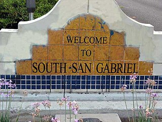
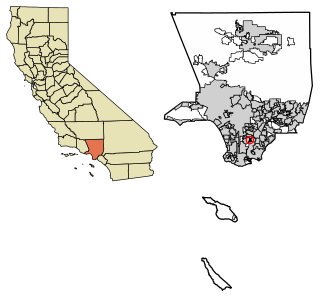
South San Gabriel is a census-designated place (CDP) in Los Angeles County, California, United States. The population was 8,070 at the 2010 census, up from 7,595 at the 2000 census.

<span class="mw-page-title-main">West Athens, California</span> Unincorporated community in California, United States

West Athens is a census-designated place (CDP) in Los Angeles County, California. The population was 9,393 at the 2020 census. It is an unincorporated community within the 2nd Supervisorial District of Los Angeles County. West Athens is served by the Los Angeles County Sheriff's Department, operating out of the South Los Angeles Station. The approximate boundaries for West Athens are: 87th Street to the north, Vermont Avenue to the east, El Segundo Boulevard to the south, and approximately Western Avenue to Van Ness Avenue to the west. West Athens is predominantly residential, with commercial uses along its main corridors. Los Angeles Southwest Community College lies within the West Athens neighborhood and city limits.

<span class="mw-page-title-main">Northwest Harwinton, Connecticut</span> Census-designated place in Connecticut, United States

Northwest Harwinton is a census-designated place (CDP) in the town of Harwinton in Litchfield County, Connecticut, United States. The population was 3,158 at the 2020 census, out of 5,484 in the entire town. The CDP contains the town center.

<span class="mw-page-title-main">Lake Asbury, Florida</span> Census-designated place in Florida, United States

Lake Asbury is an unincorporated community and census-designated place (CDP) in Clay County, Florida, United States. The population was 8,700 at the 2010 census, which calls it Asbury Lake.

<span class="mw-page-title-main">South Dennis, Massachusetts</span> Census-designated place in Massachusetts, United States

South Dennis is a census-designated place (CDP) in the town of Dennis in Barnstable County, Massachusetts, United States. The population was 3,643 at the 2010 census, the most of the 5 CDPs in Dennis.

<span class="mw-page-title-main">Herron, Montana</span> Census-designated place in Montana, United States

Herron is a census-designated place (CDP) in Hill County, Montana, United States. The population was 43 at the 2010 census.

<span class="mw-page-title-main">Montrose-Ghent, Ohio</span> CDP in Ohio, United States

Montrose-Ghent is a census-designated place (CDP) in Summit County, Ohio, United States, composed of the unincorporated communities of Montrose and Ghent. The population was 5,261 at the 2000 census. It is part of the Akron Metropolitan Statistical Area. Despite sharing a commercial district with Fairlawn, the regions are administratively separate.

<span class="mw-page-title-main">Skyline View, Pennsylvania</span> Census-designated place in Pennsylvania, United States

Skyline View is an unincorporated community and census-designated place (CDP) in West Hanover Township, Dauphin County, Pennsylvania, United States. The population was 4,003 at the 2010 census, up from 2,307 at the 2000 census. It is part of the Harrisburg–Carlisle Metropolitan Statistical Area.

<span class="mw-page-title-main">Lake Wynonah, Pennsylvania</span> CDP in Pennsylvania, United States

Lake Wynonah is a census-designated place (CDP) in Schuylkill County, Pennsylvania, United States. The population was 1,961 at the 2000 census, and 2,640 at the 2010 census. Lake Wynonah is a gated community with two lakes, Fawn Lake and Lake Wynonah, and as of July 2008, there are over 1200 homes and 1500 members. It is in South Manheim and Wayne Townships.

<span class="mw-page-title-main">Oakland, South Carolina</span> CDP in South Carolina, United States

Oakland is a census-designated place (CDP) in Sumter County, South Carolina, United States. The population was 1,272 at the 2000 census. It is included in the Sumter, South Carolina Metropolitan Statistical Area. Part of the area of the census-designated place is located within the Stateburg Historic District

<span class="mw-page-title-main">Redwood, Texas</span> Unincorporated community in Texas, United States

Redwood is an unincorporated community and census-designated place (CDP) in Guadalupe County, Texas, United States. The population was 4,003 at the 2020 census, down from 4,338 at the 2010 census. It is part of the San Antonio Metropolitan Statistical Area.

<span class="mw-page-title-main">Edroy, Texas</span> CDP in Texas, United States

Edroy is a census-designated place (CDP) in San Patricio County, Texas, United States. The population was 331 at the 2010 census.

<span class="mw-page-title-main">Sebastian, Texas</span> CDP in Texas, United States

Sebastian is a census-designated place (CDP) in Willacy County, Texas, United States. The population was 1,917 at the 2010 census.

<span class="mw-page-title-main">Nespelem, Washington</span> Town in Washington, United States

Nespelem is a town in Okanogan County, Washington, United States. The population was 236 at the 2010 census. The town is located on the Colville Indian Reservation. The name Nespelem is derived from a local Native American term meaning "large flat meadow".

<span class="mw-page-title-main">Switzer, West Virginia</span> Census-designated place in West Virginia, United States

Switzer is an unincorporated community and census-designated place (CDP) in Logan County, West Virginia, United States. The CDP includes the neighboring unincorporated community of Micco. The total CDP population was 595 at the 2010 census.

Slim Lake is an unorganized territory in Saint Louis County, Minnesota, United States, located north of Ely and Morse Township. The population was 75 at the 2000 census.

<span class="mw-page-title-main">Bedford (CDP), New York</span> Census-designated place in New York, United States

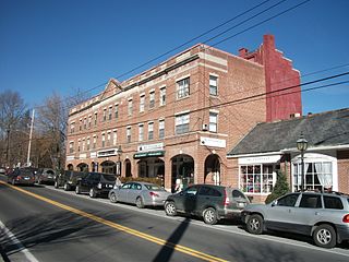
Bedford is a hamlet and census-designated place (CDP) located in the town of Bedford in Westchester County, New York, United States. The population was 1,834 at the 2010 census.

References

  1. "Nespelem Community WA ZIP Code". zipdatamaps.com. 2023. Retrieved June 16, 2023.
  2. 1 2 "U.S. Census website". United States Census Bureau . Retrieved January 31, 2008.
  3. "Nespelem Community Census Designated Place". Geographic Names Information System . United States Geological Survey, United States Department of the Interior.
  4. "US Gazetteer files: 2010, 2000, and 1990". United States Census Bureau. February 12, 2011. Retrieved April 23, 2011.