Related Research Articles

Spink County is a county in the U.S. state of South Dakota. As of the 2020 census, the population was 6,361. Its county seat is Redfield. The county was created in 1873, and was organized in 1879 within Dakota Territory.

Clark County is a county in the U.S. state of South Dakota. As of the 2020 census, the population was 3,837. Its county seat is Clark. The county was created in 1873 and organized in 1881. It was named for Newton Clark, a Dakota Territory legislator in 1873.

Limestone Township is a civil township of Alger County in the U.S. state of Michigan. The population was 392 in 2020.

Rockham is a town in Faulk County, South Dakota, United States, off U.S. Route 212, and was a stop on the old Chicago and North Western Railway. The population was 22 at the 2020 census.

Doland is a city in eastern Spink County, South Dakota, United States. The population was 199 at the 2020 census.

Northville is a town in Spink County, South Dakota, United States. The population was 139 at the 2020 census.

Redfield is a city in and the county seat of Spink County, South Dakota, United States. The population was 2,214 at the 2020 census. The city was named for J. B. Redfield, a railroad official.

The Northern Pacific Railway was a transcontinental railroad that operated across the northern tier of the western United States, from Minnesota to the Pacific Northwest. It was approved by Congress in 1864 and given nearly 40 million acres of land grants, which it used to raise money in Europe for construction.

The Dakota, Minnesota and Eastern Railroad is a wholly owned U.S. subsidiary of the Canadian Pacific Kansas City. Before its purchase, it was the largest Class II railroad in the United States, operating across South Dakota and southern Minnesota in the Northern Plains of the United States. Portions of the railroad also extended into Wyoming, Nebraska, Iowa, and Illinois. It interchanged with all seven U.S. Class I railroads.
Redfield College was an institution of higher learning located in Redfield, South Dakota. The college was sponsored by the "Northern Association of Congregational Churches," an alliance of Congregational groups in the north-central area of South Dakota. Redfield College opened in September 1887 and graduated its first class in 1894.
Zell is an unincorporated community in Faulk County, South Dakota, United States, astride U.S. Route 212. It was once a stop on the old Chicago and North Western Railway.

Minnesota Junction is an unincorporated community located, in the town of Oak Grove, in Dodge County, Wisconsin, United States. Minnesota Junction is located on Wisconsin Highway 26. It is located at latitude 43.452 and longitude -88.697 at 925 feet above mean sea level.
Athol is an unincorporated community in Spink County, South Dakota, United States. It is part of Athol Township.

Capa is an unincorporated community in Jones County, South Dakota, United States.
Hooker is an unincorporated community in Turner County, in the U.S. state of South Dakota.
Miranda is an unincorporated community in Faulk County, in the U.S. state of South Dakota.
Ordway is an unincorporated community in Brown County, in the U.S. state of South Dakota.
Rudolph is an unincorporated community in Brown County, in the U.S. state of South Dakota.
Terry is an unincorporated community in Lawrence County, South Dakota, United States.
Wendte is an unincorporated community in Stanley County, in the U.S. state of South Dakota.
References
- ↑ U.S. Geological Survey Geographic Names Information System: Crandon, South Dakota
- 1 2 Company, Chicago and North Western Railway (1908). A History of the Origin of the Place Names Connected with the Chicago & North Western and Chicago, St. Paul, Minneapolis & Omaha Railways. p. 60.
- ↑ Federal Writers' Project (1940). South Dakota place-names, v.1-3. University of South Dakota. p. 32.
- ↑ Lamberton, C.E. (February 1978). "Why South Dakota's Branchlines Face Abandonment". Agricultural Experiment Station– via South Dakota State University.
- ↑ Vanished South Dakota: Towns of Yesterday | PBS , retrieved September 4, 2023
- ↑ "Spink County". Jim Forte Postal History. Retrieved February 16, 2015.
Municipalities and communities of Spink County, South Dakota, United States | ||
|---|---|---|
| Cities | 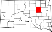 | |
| Towns | ||
| Townships |
| |
| CDPs | ||
| Other communities | ||
| Footnotes | ‡This populated place also has portions in an adjacent county or counties | |