Frankfort, South Dakota

Last updated

Frankfort, South Dakota
Spink County South Dakota Incorporated and Unincorporated areas Frankfort Highlighted.svg
Location in Spink County and the state of South Dakota
Coordinates: 44°52′40″N98°18′33″W / 44.87778°N 98.30917°W / 44.87778; -98.30917
Country United States
State South Dakota
County Spink
Area
[1]
  Total0.79 sq mi (2.04 km2)
  Land0.79 sq mi (2.04 km2)
  Water0.00 sq mi (0.00 km2)
Elevation
[2]
1,296 ft (395 m)
Population
 (2020) [3]
  Total134
  Density170.05/sq mi (65.69/km2)
Time zone UTC-6 (Central (CST))
  Summer (DST) UTC-5 (CDT)
ZIP code
57440
Area code 605
FIPS code 46-22580 [4]
GNIS feature ID1267394 [2]

Frankfort is a city in Spink County, South Dakota, United States. The population was 134 at the 2020 census. [5]

Contents

History

Frankfort was platted in 1882. [6] Some say it was named after Frankfurt, in Germany, [6] while others believe the town has the name of Frankfort I. Fisher, a pioneer settler. [7] A post office has been in operation in Frankfort since 1882. [8]

Geography

According to the United States Census Bureau, the city has a total area of 0.79 square miles (2.05 km2), all land. [9]

Demographics

Historical population
CensusPop.Note
1890 186
1900 1986.5%
1910 408106.1%
1920 4387.4%
1930 367−16.2%
1940 335−8.7%
1950 331−1.2%
1960 240−27.5%
1970 192−20.0%
1980 2098.9%
1990 192−8.1%
2000 166−13.5%
2010 149−10.2%
2020 134−10.1%
U.S. Decennial Census [10] [3]

2010 census

As of the census [11] of 2010, there were 149 people, 61 households, and 37 families residing in the city. The population density was 188.6 inhabitants per square mile (72.8/km2). There were 82 housing units at an average density of 103.8 per square mile (40.1/km2). The racial makeup of the city was 94.6% White, 3.4% Native American, and 2.0% from other races. Hispanic or Latino of any race were 2.0% of the population.

There were 61 households, of which 24.6% had children under the age of 18 living with them, 50.8% were married couples living together, 6.6% had a female householder with no husband present, 3.3% had a male householder with no wife present, and 39.3% were non-families. 32.8% of all households were made up of individuals, and 13.1% had someone living alone who was 65 years of age or older. The average household size was 2.44 and the average family size was 3.19.

The median age in the city was 42.6 years. 29.5% of residents were under the age of 18; 4.1% were between the ages of 18 and 24; 18.1% were from 25 to 44; 26.8% were from 45 to 64; and 21.5% were 65 years of age or older. The gender makeup of the city was 49.7% male and 50.3% female.

2000 census

As of the census [4] of 2000, there were 166 people, 81 households, and 43 families residing in the city. The population density was 214.4 inhabitants per square mile (82.8/km2). There were 99 housing units at an average density of 127.9 per square mile (49.4/km2). The racial makeup of the city was 98.80% White, 0.60% Native American, 0.60% from other races. Hispanic or Latino of any race were 0.60% of the population.

There were 81 households, out of which 18.5% had children under the age of 18 living with them, 48.1% were married couples living together, 4.9% had a female householder with no husband present, and 46.9% were non-families. 40.7% of all households were made up of individuals, and 14.8% had someone living alone who was 65 years of age or older. The average household size was 2.05 and the average family size was 2.84.

In the city, the population was spread out, with 20.5% under the age of 18, 6.6% from 18 to 24, 15.7% from 25 to 44, 31.9% from 45 to 64, and 25.3% who were 65 years of age or older. The median age was 49 years. For every 100 females, there were 115.6 males. For every 100 females age 18 and over, there were 109.5 males.

The median income for a household in the city was $30,357, and the median income for a family was $39,688. Males had a median income of $22,500 versus $17,000 for females. The per capita income for the city was $14,989. About 4.3% of families and 9.2% of the population were below the poverty line, including 18.8% of those under the age of eighteen and 12.2% of those 65 or over.

Notable people

Related Research Articles

<span class="mw-page-title-main">Frankfort Square, Illinois</span> Census-designated place in Illinois, United States

Frankfort Square is a census-designated place (CDP) in Will County, Illinois, United States. Per the 2020 census, the population was 8,968.

<span class="mw-page-title-main">Dazey, North Dakota</span> City in North Dakota, United States

Dazey is a city in Barnes County, North Dakota, United States. The population was 78 at the 2020 census. Dazey was founded in 1883 after a local farmer, Charles Dazey, donated land to start a townsite.

<span class="mw-page-title-main">Maxbass, North Dakota</span> City in North Dakota, United States

Maxbass is a city in Bottineau County, North Dakota, United States. The population was 89 at the 2020 census. Maxbass was founded in 1905.

<span class="mw-page-title-main">Lincoln, North Dakota</span> City in North Dakota, United States

Lincoln is a city in Burleigh County, North Dakota, United States. It is a suburb of adjacent Bismarck, and also a core city of the Bismarck-Mandan Metropolitan Statistical Area. The population was 4,257 at the 2020 census, making it the fourteenth largest city in North Dakota. Lincoln was founded in 1977.

<span class="mw-page-title-main">White, South Dakota</span> City in South Dakota, United States

White is a city in Brookings County, South Dakota, United States. The population was 537 at the 2020 census.

<span class="mw-page-title-main">Wagner, South Dakota</span> City in South Dakota, United States

Wagner is a city in Charles Mix County, South Dakota, United States. The population was 1,490 at the 2020 census. The city is served by Wagner Municipal Airport as well as YST Transit buses.

<span class="mw-page-title-main">Garden City, South Dakota</span> Town in South Dakota, United States

Garden City is a town in Clark County, South Dakota, United States. The population was 33 at the 2020 census.

<span class="mw-page-title-main">Ipswich, South Dakota</span> City in South Dakota, United States

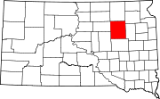
Ipswich is a city in and county seat of Edmunds County, South Dakota, United States. The population was 928 at the 2020 census.

<span class="mw-page-title-main">Gregory, South Dakota</span> City in South Dakota, United States

Gregory is a city in western Gregory County, South Dakota, United States. The population was 1,221 at the 2020 census.

<span class="mw-page-title-main">Tripp, South Dakota</span> City in South Dakota, United States

Tripp is a city in Hutchinson County, South Dakota, United States. The population was 575 in the 2020 census.

<span class="mw-page-title-main">Wentworth, South Dakota</span> Village in South Dakota, United States

Wentworth is an incorporated village in Lake County, South Dakota, United States. It is the only incorporated village in the state of South Dakota. The population was 181 at the 2020 census.

<span class="mw-page-title-main">Central City, South Dakota</span> City in South Dakota, United States

Central City is a city in Lawrence County, South Dakota, United States. The population was 93 at the 2020 census.

<span class="mw-page-title-main">Lennox, South Dakota</span> City in South Dakota, United States

Lennox is a city in Lincoln County, South Dakota, United States, located 20 miles (32 km) southwest of Sioux Falls. The population was 2,423 at the 2020 census.

<span class="mw-page-title-main">Crooks, South Dakota</span> City in South Dakota, United States

Crooks is a city in Minnehaha County, South Dakota, United States and is a suburb of Sioux Falls. The population was 1,362 at the 2020 census. Crooks was named New Hope until 1904. The town's present name honors W. A. Crooks, a local politician.

<span class="mw-page-title-main">Ashton, South Dakota</span> City in South Dakota, United States

Ashton is a city in eastern Spink County, South Dakota, United States. The population was 108 at the 2020 census.

<span class="mw-page-title-main">Doland, South Dakota</span> City in South Dakota, United States

Doland is a city in eastern Spink County, South Dakota, United States. The population was 199 at the 2020 census.

<span class="mw-page-title-main">Mellette, South Dakota</span> City in South Dakota, United States

Mellette is a city in Spink County, South Dakota, United States. The population was 199 at the 2020 census.

<span class="mw-page-title-main">Mission, South Dakota</span> City in South Dakota, United States

Mission is a city on the Rosebud Indian Reservation in northern Todd County, South Dakota, United States. The population was 1,156 at the 2020 census.

<span class="mw-page-title-main">Elk Point, South Dakota</span> City in South Dakota, United States

Elk Point is a city in and county seat of Union County, South Dakota, United States. The population was 2,149 as of the 2020 census.

<span class="mw-page-title-main">Frankfort, Marathon County, Wisconsin</span> Town in Wisconsin, United States

Frankfort is a town in Marathon County, Wisconsin, United States. It is part of the Wausau, Wisconsin Metropolitan Statistical Area. It is part of the Wausau, Wisconsin Metropolitan Statistical Area. The population was 670 at the 2010 census. The unincorporated community of Swan is located in the town.

References

  1. "ArcGIS REST Services Directory". United States Census Bureau. Retrieved October 15, 2022.
  2. 1 2 U.S. Geological Survey Geographic Names Information System: Frankfort, South Dakota
  3. 1 2 "Census Population API". United States Census Bureau. Retrieved October 15, 2022.
  4. 1 2 "U.S. Census website". United States Census Bureau . Retrieved January 31, 2008.
  5. "U.S. Census Bureau: Frankfort city, South Dakota". www.census.gov. United States Census Bureau. Retrieved February 12, 2022.
  6. 1 2 Chicago and North Western Railway Company (1908). A History of the Origin of the Place Names Connected with the Chicago & North Western and Chicago, St. Paul, Minneapolis & Omaha Railways. p. 73.
  7. Federal Writers' Project (1940). South Dakota place-names, v.1-3. University of South Dakota. p. 38.
  8. "Spink County". Jim Forte Postal History. Archived from the original on April 2, 2015. Retrieved March 18, 2015.
  9. "US Gazetteer files 2010". United States Census Bureau. Archived from the original on July 2, 2012. Retrieved June 21, 2012.
  10. "Census of Population and Housing". Census.gov. Retrieved June 4, 2015.
  11. "U.S. Census website". United States Census Bureau . Retrieved June 21, 2012.