Garwood is an unincorporated community in northern Kootenai County, Idaho, United States.
Washburn is an unincorporated town and census-designated place (CDP) in Black Hawk County, Iowa, United States. Washburn lies south of Waterloo on U.S. Route 218. Other towns near Washburn are Gilbertville and La Porte City. The community is part of the Waterloo–Cedar Falls Metropolitan Statistical Area.
Buckingham is an unincorporated community located near the intersections of Hwy D-65 and U.S. Highway 63 in Buckingham Township, Tama County, Iowa, United States. It lies 5.5 miles north of Traer and 11 miles south of Hudson. Buckingham is located at 42°15′45″N92°26′52″W.
Farrar is an unincorporated community in Polk County, Iowa, United States. An unused elementary school building and one church are located in Farrar and 13 houses. The mayor of Farrar is Zach Stiles.
Oran is an unincorporated community in southwestern Fayette County, Iowa, United States. It lies along local roads southwest of the city of West Union, the county seat of Fayette County, and west of the city of Oelwein, the largest city in Fayette County. Its elevation is 1,043 feet (318 m). Although Oran is unincorporated, it has a post office with the ZIP code of 50664.
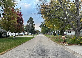
Montpelier is an unincorporated community and census-designated place (CDP) in Muscatine County, Iowa, United States. As of the 2020 census, the population was 186. The community is part of the Muscatine Micropolitan Statistical Area.
Ardon is a former townsite and unincorporated community in Muscatine County, Iowa, United States. It is located at the intersection of 250th Street and Jasper Avenue, four miles east of Cranston, at 41.366543N, -94.317809W.
Mederville is an unincorporated community in Clayton County, Iowa, United States.
Corley is an unincorporated community and census-designated place in Shelby County, Iowa, in the United States. As of the 2010 Census the population of Corley was 26.
Jacksonville is an unincorporated community and census-designated place in Jackson Township, Shelby County, Iowa, in the United States. As of the 2010 Census the population of Jacksonville was 30.
Germantown is an unincorporated community in O'Brien County, Iowa, United States.
Miller is an unincorporated community and census-designated place in Hancock County, Iowa, United States. As of the 2010 census, the population was 60.
May City is an unincorporated community in Osceola County, Iowa, United States.
Carnes is an unincorporated rural small hamlet in Sioux County, in the U.S. state of Iowa. Presently, the hamlet consists of a grain elevator and a pizza restaurant.
Cornelia is an unincorporated community in Grant Township, Wright County, Iowa, United States. Cornelia is located along County Highway C25, 4.8 miles (7.7 km) north-northeast of Clarion. Lake Cornelia State Park is in the community.
Holmes is an unincorporated community in Lake Township, Wright County, Iowa, United States. Holmes is located along County Highway R33, 5 miles (8.0 km) west of Clarion.
Ticonic is an unincorporated community in Grant Township, Monona County, Iowa, United States. Ticonic is located along County Highway E16, 8.2 miles (13.2 km) west of Mapleton.
Zook Spur is a former unincorporated community at the border of Dallas County and Polk County, in the U.S. state of Iowa. It was at the corner of what is now NW 158th Avenue and Iowa State Highway 17.
Vilmar, also known as Wilmar, is an unincorporated community in Butler County, Iowa, United States. It lies west of Iowa Highway 14 5.5 miles southwest of the community of Greene. Its elevation is 1,053 feet.


