Related Research Articles
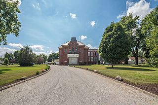
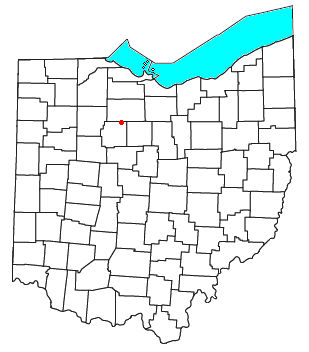
Wyandot County is a county located in the northwestern part of the U.S. state of Ohio. As of the 2020 census, the population was 21,900. Its county seat is Upper Sandusky. It was named for the Wyandot Indians, who lived here before and after European encounter. Their autonym is variously translated from their language as "around the plains" and "dwellers on the peninsula".

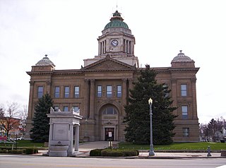
Upper Sandusky is a city in and the county seat of Wyandot County, Ohio, United States, along the upper Sandusky River. The city lies approximately 59 miles (95 km) south of Toledo and 62 miles (100 km) north of Columbus. The population was 6,698 at the 2020 census.

The Sandusky River is a tributary to Lake Erie in north-central Ohio in the United States. It is about 133 miles (214 km) long and flows into Lake Erie at the southwest side of Sandusky Bay.

Roundhead is an unincorporated community in southeastern Roundhead Township, Hardin County, Ohio, United States. It has a post office with the ZIP code 43346.

Oceola is a census-designated place (CDP) in central Tod Township, Crawford County, Ohio, United States. As of the 2020 census its population was 156. It has a post office with the ZIP code 44860. It is located along the road that was U.S. Route 30 until being upgraded to a freeway.

Brokensword is an unincorporated community on the border between the Holmes and Lykens townships of Crawford County, Ohio, United States. Located at the intersection of the concurrent State Routes 19 and 100 with Brokensword Road, it is six miles north and two miles west of the city of Bucyrus, the county seat. Broken Sword Creek flows a short distance to the south of the community.
Harlan is an unincorporated census-designated place (CDP) in Springfield Township, Allen County, in the U.S. state of Indiana. As of the 2010 census, Harlan had a population of 1,634.
Mexico is an unincorporated community in northeastern Tymochtee Township, Wyandot County, Ohio, United States. Located at 40°59′11″N83°11′36″W, it lies at an elevation of 810 feet.
Tymochtee is an unincorporated community in Wyandot County, in the U.S. state of Ohio.
Lykens is an unincorporated community in Lykens Township, Crawford County, Ohio, United States.
Benton is an unincorporated community in Texas Township, Crawford County, Ohio, United States.
Little Sandusky is an unincorporated community in Wyandot County, in the U.S. state of Ohio.
Belle Vernon is an unincorporated community in Wyandot County, in the U.S. state of Ohio.
Brownstown is an unincorporated community in Wyandot County in the U.S. state of Ohio.
Deunquat is an unincorporated community in Wyandot County, in the U.S. state of Ohio. The community is 3 miles from Sycamore and 2 miles from Benton, and is accessed by C-34 and OH-231.
Lovell is an unincorporated community in Wyandot County, in the U.S. state of Ohio.
Seal is an unincorporated community in Wyandot County, in the U.S. state of Ohio.
Wyandot is an unincorporated community in Wyandot County, in the U.S. state of Ohio.
DeCliff is an unincorporated community in Montgomery Township, Marion County, Ohio, United States. It is located northwest of New Bloomington at the intersection of DeCliff Road North and DeCliff-Big Island Road, at 40°36′27″N83°20′32″W.
Brush Ridge is an unincorporated community in Grand Prairie Township, Marion County, Ohio, United States. Brush Ridge is served by Ridgedale Local School District.
References
- ↑ "Wyandot County". Jim Forte Postal History. Retrieved December 7, 2015.
- ↑ U.S. Geological Survey Geographic Names Information System: Crawford, Ohio
Municipalities and communities of Wyandot County, Ohio, United States | ||
|---|---|---|
| City |  | |
| Villages | ||
| Townships | ||
| CDP | ||
| Unincorporated communities | ||
| Footnotes | ‡This populated place also has portions in an adjacent county or counties. | |
40°55′11″N83°20′32″W / 40.91972°N 83.34222°W
| | This Wyandot County, Ohio state location article is a stub. You can help Wikipedia by expanding it. |