Deer Lake, Pennsylvania

Last updated
Deer Lake, Pennsylvania
Borough
Deer Lake, Schuylkill Co PA 01.JPG
Deer Lake Pond in June 2015
Nickname: 
The Lake
Schuylkill County Pennsylvania Incorporated and Unincorporated areas Deer Lake Highlighted.svg
Location of Deer Lake in Schuylkill County, Pennsylvania
USA Pennsylvania location map.svg
Red pog.svg
Deer Lake
Location of Deer Park in Pennsylvania
Usa edcp location map.svg
Red pog.svg
Deer Lake
Deer Lake (the United States)
Coordinates: 40°37′19″N76°03′17″W / 40.62194°N 76.05472°W / 40.62194; -76.05472
Country United States
State Pennsylvania
County Schuylkill
Incorporated1936
Government
  TypeBorough Council
  MayorJim Bo
Area
[1]
  Total0.47 sq mi (1.22 km2)
  Land0.44 sq mi (1.14 km2)
  Water0.03 sq mi (0.08 km2)
Elevation
486 ft (148 m)
Population
 (2020) [2]
  Total670
  Density1,526.20/sq mi (589.57/km2)
Time zone UTC-5 (Eastern (EST))
  Summer (DST) UTC-4 (EDT)
Zip Code
17961
Area code 570
FIPS code 42-18576
Website deerlakeboro.com

Deer Lake is a borough in Schuylkill County, Pennsylvania. The population was 670 at the 2020 census. [3] The mayor of the borough is Larry Kozlowski.

Contents

History

Deer Lake Pond as seen from its eastern coast Deer Lake, Schuylkill Co PA 02.JPG
Deer Lake Pond as seen from its eastern coast

The community was founded as a resort community serving coal barons and other members of the wealthy elite of nearby Pottsville. A small summer stock theatre operated during the 1920s, in which actors such as John Kenley performed.

In 1972, Muhammad Ali set his training camp in Deer Lake, and it still stands today complete with an indoor boxing ring.

Geography

Deer Lake is located at 40°37′19″N76°3′17″W / 40.62194°N 76.05472°W / 40.62194; -76.05472 (40.621903, -76.054638). [4]

According to the U.S. Census Bureau, the borough has a total area of 0.4 square miles (1.0 km2), of which 0.4 square miles (1.0 km2) is land and 0.04 square miles (0.10 km2) (6.67%) is water.

Pennsylvania Route 61 is the principal highway passing through Deer Lake.

Demographics

Historical population
CensusPop.Note
1940 65
1950 174167.7%
1960 33492.0%
1970 3473.9%
1980 51548.4%
1990 5506.8%
2000 528−4.0%
2010 68730.1%
2020 673−2.0%
2021 (est.)673 [5] 0.0%
Sources: [6] [7] [8] [9] [2]

As of the census [7] of 2000, there were 528 people, 203 households, and 160 families living in the borough. The population density was 1,261.8 inhabitants per square mile (487.2/km2). There were 216 housing units at an average density of 516.2 per square mile (199.3/km2). The racial makeup of the borough was 98.30% White, 0.19% Native American, 1.33% Asian, and 0.19% from two or more races. Hispanic or Latino of any race were 0.19% of the population.

There were 203 households, out of which 34.0% had children under the age of 18 living with them, 66.5% were married couples living together, 8.9% had a female householder with no husband present, and 20.7% were non-families. 18.2% of all households were made up of individuals, and 6.9% had someone living alone who was 65 years of age or older. The average household size was 2.60 and the average family size was 2.94.

In the borough the population was spread out, with 23.1% under the age of 18, 7.0% from 18 to 24, 30.9% from 25 to 44, 27.7% from 45 to 64, and 11.4% who were 65 years of age or older. The median age was 39 years. For every 100 females there were 89.9 males. For every 100 females age 18 and over, there were 95.2 males.

The median income for a household in the borough was $52,386, and the median income for a family was $61,042. Males had a median income of $36,000 versus $28,611 for females. The per capita income for the borough was $25,577. About 1.3% of families and 4.0% of the population were below the poverty line, including none of those under age 18 and 13.3% of those age 65 or over.

Related Research Articles

Evening Shade is a census-designated place (CDP) in Sequoyah County, Oklahoma, United States. It is part of the Fort Smith, Arkansas-Oklahoma Metropolitan Statistical Area. The population was 359 at the 2010 census.

<span class="mw-page-title-main">Centerport, Pennsylvania</span> Borough in Pennsylvania, United States

Centerport is a borough in north central Berks County, Pennsylvania. The population was 387 at the 2010 census. The borough is in the Schuylkill Valley School District.

<span class="mw-page-title-main">Athens, Pennsylvania</span> Borough in Pennsylvania, United States

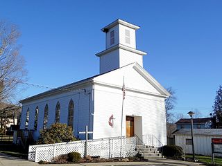
Athens is a borough in Bradford County, Pennsylvania, United States. It is part of Northeastern Pennsylvania and is located 2 miles (3 km) south of the New York state line on the Susquehanna and Chemung rivers. The population was 3,749 in 1900 and 3,796 in 1910. The population was 3,265 at the 2020 census. Athens is in a small area locally known as "The Valley", a group of four contiguous communities in Pennsylvania and New York: Waverly, New York; South Waverly, Pennsylvania; Sayre, Pennsylvania; and Athens. The Valley has a population near 30,000.

<span class="mw-page-title-main">Monroe, Pennsylvania</span> Borough in Pennsylvania, United States

Monroe is a borough in Bradford County, Pennsylvania, United States. It is part of Northeastern Pennsylvania. The population was 482 at the 2020 census.

<span class="mw-page-title-main">Rome, Pennsylvania</span> Borough in Pennsylvania, United States

Rome is a borough in Bradford County, Pennsylvania, United States. It is part of Northeastern Pennsylvania. The population was 385 at the 2020 census.

<span class="mw-page-title-main">Sylvania, Pennsylvania</span> Borough in Pennsylvania, United States

Sylvania is a borough in Bradford County, Pennsylvania, United States. It is part of Northeastern Pennsylvania. The population was 216 at the 2020 census. Children residing in the borough are assigned to attend the Troy Area School District.

<span class="mw-page-title-main">Lumber City, Pennsylvania</span> Former Borough in Pennsylvania, United States

Lumber City is a former borough in Clearfield County, Pennsylvania, United States. The population was 76 at the 2010 census.

<span class="mw-page-title-main">Briar Creek, Pennsylvania</span> Borough in Pennsylvania, United States

Briar Creek is a borough in Columbia County, Pennsylvania, United States. It is part of Northeastern Pennsylvania. The population was 597 at the 2020 census. It is part of the Bloomsburg-Berwick micropolitan area.

<span class="mw-page-title-main">Conneaut Lake, Pennsylvania</span> Borough in Pennsylvania, United States

Conneaut Lake is a borough in Crawford County, Pennsylvania, located at the southern end of the lake of the same name. The population was 626 at the 2020 census, down from 653 at the 2010 census.

<span class="mw-page-title-main">New Cumberland, Pennsylvania</span> Borough in Pennsylvania, United States

New Cumberland is a borough in easternmost Cumberland County, Pennsylvania, United States. New Cumberland was incorporated on March 21, 1831. The population was 7,277 at the 2010 census. The borough is noted for its historic downtown which includes landmarks like the historic West Shore Theater, Borough park, the yearly Apple Festival, which gathers hundreds of vendors and thousands of visitors.

<span class="mw-page-title-main">Berrysburg, Pennsylvania</span> Borough in Pennsylvania, United States

Berrysburg is a borough in Dauphin County, Pennsylvania, United States. The population was 324 at the 2020 census. It is part of the Harrisburg–Carlisle Metropolitan Statistical Area.

<span class="mw-page-title-main">Elizabethville, Pennsylvania</span> Borough in Pennsylvania, United States

Elizabethville is a borough in Dauphin County, Pennsylvania, United States. As of the 2020 census, the borough's population was 1,352. It is part of the Harrisburg metropolitan area.

<span class="mw-page-title-main">Harveys Lake, Pennsylvania</span> Borough in Pennsylvania, United States

Harveys Lake is a borough in Luzerne County, Pennsylvania, United States. It is part of the Back Mountain, a one hundred and eighteen-square mile region in northern Luzerne County.

<span class="mw-page-title-main">Penn Lake Park, Pennsylvania</span> Borough in Pennsylvania, United States

Penn Lake Park is a borough in Luzerne County, Pennsylvania, United States. The population was 359 at the 2020 census.

<span class="mw-page-title-main">Gordon, Pennsylvania</span> Borough in Pennsylvania, United States

Gordon is a borough in Schuylkill County, Pennsylvania, United States. The population was 765 at the 2020 census.

<span class="mw-page-title-main">Elk Lick Township, Somerset County, Pennsylvania</span> Township in Pennsylvania, United States

Elk Lick Township is a township in Somerset County, Pennsylvania, United States. The population was 2,257 at the 2020 census. Mount Davis, the highest point in Pennsylvania, is located within the township.

<span class="mw-page-title-main">Indian Lake, Pennsylvania</span> Borough in Pennsylvania, United States

Indian Lake is a borough in Somerset County, Pennsylvania, United States. It is part of the Johnstown, Pennsylvania Metropolitan Statistical Area. The population was 391 at the 2020 census, down from 394 in 2010. Indian Lake is home to Indian Lake Golf Club, which opened in 1974, and was the first to be designed by Arnold Palmer, Northwinds Golf Course (public), Indian Lake Resort, Indian Lake Marina, and the James W. McIntyre Hiking and Biking Trail.

<span class="mw-page-title-main">Friendsville, Pennsylvania</span> Borough in Pennsylvania, United States

Friendsville is a borough in Susquehanna County, Pennsylvania, United States. The population was 100 at the 2020 census.

<span class="mw-page-title-main">East Prospect, Pennsylvania</span> Borough in Pennsylvania, United States

East Prospect is a borough in York County, Pennsylvania, United States. The population was 932 at the 2020 census.

<span class="mw-page-title-main">Fawn Grove, Pennsylvania</span> Borough in Pennsylvania, United States

Fawn Grove is a borough in York County, Pennsylvania, United States. The population was 476 at the 2020 census. It is served by the South Eastern School District, which provides public education.

References

  1. "ArcGIS REST Services Directory". United States Census Bureau. Retrieved October 12, 2022.
  2. 1 2 "Census Population API". United States Census Bureau. Retrieved Oct 12, 2022.
  3. "Deer Lake, Pennsylvania (PA 17961) profile: Population, maps, real estate, averages, homes, statistics, relocation, travel, jobs, hospitals, schools, crime, moving, houses, news, sex offenders".
  4. "US Gazetteer files: 2010, 2000, and 1990". United States Census Bureau. 2011-02-12. Retrieved 2011-04-23.
  5. Bureau, US Census. "City and Town Population Totals: 2020—2021". Census.gov. US Census Bureau. Retrieved August 1, 2022.
  6. "Census of Population and Housing". U.S. Census Bureau. Retrieved 11 December 2013.
  7. 1 2 "U.S. Census website". United States Census Bureau . Retrieved 2008-01-31.
  8. "Incorporated Places and Minor Civil Divisions Datasets: Subcounty Resident Population Estimates: April 1, 2010 to July 1, 2012". Population Estimates. U.S. Census Bureau. Archived from the original on 11 June 2013. Retrieved 11 December 2013.
  9. "Census of Population and Housing". Census.gov. Retrieved June 4, 2016.