Dennis Acres, Missouri

Last updated

Dennis Acres, Missouri
Newton County Missouri Incorporated and Unincorporated areas Dennis Acres Highlighted.svg
Location of Dennis Acres, Missouri
Coordinates: 37°02′47″N94°30′16″W / 37.04639°N 94.50444°W / 37.04639; -94.50444
Country United States
State Missouri
County Newton
Area
[1]
  Total0.04 sq mi (0.11 km2)
  Land0.04 sq mi (0.11 km2)
  Water0.00 sq mi (0.00 km2)
Elevation
[2]
1,056 ft (322 m)
Population
 (2020)
  Total47
  Density1,119.05/sq mi (427.67/km2)
Time zone UTC-6 (Central (CST))
  Summer (DST) UTC-5 (CDT)
FIPS code 29-19090 [3]
GNIS feature ID2398711 [2]

Dennis Acres is a village in Newton County, Missouri, United States. The population was 76 at the 2010 census.

Contents

Geography

According to the United States Census Bureau, the village has a total area of 0.05 square miles (0.13 km2), all land. [4]

Demographics

Historical population
CensusPop.Note
1960 99
1970 64−35.4%
1980 56−12.5%
1990 157180.4%
2000 68−56.7%
2010 7611.8%
2020 47−38.2%
U.S. Decennial Census

2010 census

As of the census [5] of 2010, there were 76 people, 27 households, and 18 families living in the village. The population density was 1,520.0 inhabitants per square mile (586.9/km2). There were 31 housing units at an average density of 620.0 per square mile (239.4/km2). The racial makeup of the village was 76.3% White, 1.3% Native American, 1.3% Pacific Islander, 14.5% from other races, and 6.6% from two or more races. Hispanic or Latino of any race were 18.4% of the population.

There were 27 households, of which 44.4% had children under the age of 18 living with them, 48.1% were married couples living together, 11.1% had a female householder with no husband present, 7.4% had a male householder with no wife present, and 33.3% were non-families. 22.2% of all households were made up of individuals, and 7.4% had someone living alone who was 65 years of age or older. The average household size was 2.81 and the average family size was 3.44.

The median age in the village was 26.3 years. 26.3% of residents were under the age of 18; 21.1% were between the ages of 18 and 24; 23.7% were from 25 to 44; 18.3% were from 45 to 64; and 10.5% were 65 years of age or older. The gender makeup of the village was 48.7% male and 51.3% female.

2000 census

As of the census [3] of 2000, there were 68 people, 27 households, and 12 families living in the village. The population density was 1,455.7 inhabitants per square mile (562.0/km2). There were 29 housing units at an average density of 620.8 per square mile (239.7/km2). The racial makeup of the village was 70.59% White, 11.76% Native American, 10.29% from other races, and 7.35% from two or more races. Hispanic or Latino of any race were 16.18% of the population.

There were 27 households, out of which 29.6% had children under the age of 18 living with them, 33.3% were married couples living together, 11.1% had a female householder with no husband present, and 51.9% were non-families. 33.3% of all households were made up of individuals, and 7.4% had someone living alone who was 65 years of age or older. The average household size was 2.52 and the average family size was 3.54.

In the village, the population was spread out, with 30.9% under the age of 18, 10.3% from 18 to 24, 33.8% from 25 to 44, 11.8% from 45 to 64, and 13.2% who were 65 years of age or older. The median age was 30 years. For every 100 females, there were 106.1 males. For every 100 females age 18 and over, there were 95.8 males.

The median income for a household in the village was $28,125, and the median income for a family was $28,750. Males had a median income of $28,333 versus $13,750 for females. The per capita income for the village was $8,709. There were 11.1% of families and 17.1% of the population living below the poverty line, including no under eighteens and none of those over 64.

Related Research Articles

<span class="mw-page-title-main">Burlington, Michigan</span> Village in Michigan, United States

Burlington is a village in Calhoun County in the U.S. state of Michigan. The population was 281 at the 2020 census. It is part of the Battle Creek, Michigan Metropolitan Statistical Area. The village is located within Burlington Township on M-60.

<span class="mw-page-title-main">Muir, Michigan</span> Village in Michigan, United States

Muir is a village in Lyons Township, Ionia County in the U.S. state of Michigan. The population was 604 at the 2010 census.

<span class="mw-page-title-main">Emerald Beach, Missouri</span> Village in Missouri, United States

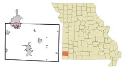
Emerald Beach is a village in White River Township, Barry County, Missouri, United States. The community is located on a bend in the White River now Table Rock Lake. Cassville is approximately 13 miles to the northwest and Rogers, Arkansas is 32 mile to the southwest.

<span class="mw-page-title-main">Hanley Hills, Missouri</span> Village in Missouri, United States

Hanley Hills is a village in St. Louis County, Missouri, United States. The population was 2,101 at the 2010 census.

<span class="mw-page-title-main">Walton Hills, Ohio</span> Village in Ohio, United States

Walton Hills is a village in Cuyahoga County, Ohio, United States. The population was 2,033 at the 2020 census. A suburb of Cleveland, it is a part of the Cleveland metropolitan area.

<span class="mw-page-title-main">Amanda, Ohio</span> Village in Ohio, United States

Amanda is a village in Fairfield County, Ohio, United States. The population was 637 at the 2020 census.

<span class="mw-page-title-main">Spring Valley, Ohio</span> Village in Ohio, United States

Spring Valley is a village in Greene County, Ohio, United States. The population was 415 at the 2020 census. It is part of the Dayton Metropolitan Statistical Area.

<span class="mw-page-title-main">Martinsburg, Ohio</span> Village in Ohio, United States

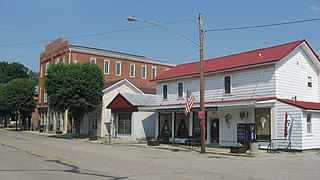
Martinsburg is a village in Knox County, Ohio, United States. The population was 222 at the 2020 census.

<span class="mw-page-title-main">Graysville, Ohio</span> Village in Ohio, United States

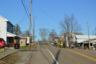
Graysville is a village in Monroe County, Ohio, United States. The population was 70 at the 2020 census.

<span class="mw-page-title-main">Melrose, Ohio</span> Village in Ohio, United States

Melrose is a village in Paulding County, Ohio, United States. The population was 233 at the 2020 census.

<span class="mw-page-title-main">West Elkton, Ohio</span> Village in Ohio, United States

West Elkton is a village in Preble County, Ohio, United States. The population was 164 at the 2020 census. It is part of the Dayton Metropolitan Statistical Area.

<span class="mw-page-title-main">Orangeville, Ohio</span> Village in Ohio, United States

Orangeville is a village in eastern Trumbull County, Ohio, United States, along the state line with Pennsylvania. The population was 174 at the 2020 census. It is part of the Youngstown–Warren metropolitan area.

<span class="mw-page-title-main">Burbank, Ohio</span> Village in Ohio, United States

Burbank is a village in Wayne County, Ohio, United States, along Killbuck Creek. The population was 296 at the 2020 census.

<span class="mw-page-title-main">Colley Township, Sullivan County, Pennsylvania</span> Township in Pennsylvania, United States

Colley Township is a township in Sullivan County, Pennsylvania, United States. The population was 626 at the 2020 census. The village of Lopez is located in the township.

<span class="mw-page-title-main">Beech Bottom, West Virginia</span> Village in West Virginia, United States

Beech Bottom is a village in Brooke County, West Virginia, United States, situated along the Ohio River. The population was 523 at the 2010 census. It is part of the Weirton–Steubenville metropolitan area.

<span class="mw-page-title-main">Hubbardston, Michigan</span> Village in Michigan, United States

Hubbardston is a village in the U.S. state of Michigan. It is mostly in North Plains Township in Ionia County, and partially in Lebanon Township in Clinton County. Its population was 395 at the 2010 census.

<span class="mw-page-title-main">Excelsior Estates, Missouri</span> 4th Class City in Missouri in the United States

Excelsior Estates is a village in Clay and Ray counties in the U.S. state of Missouri and part of the Kansas City metropolitan area. The population was 209 at the 2020 census.

<span class="mw-page-title-main">Dallas, Wisconsin</span> Village in Wisconsin, United States

Dallas is a village in Barron County in the U.S. state of Wisconsin. The population was 409 at the 2010 census. The village is located within the Town of Dallas.

<span class="mw-page-title-main">Melrose, Wisconsin</span> Village in Wisconsin, United States

Melrose is a village in Jackson County, Wisconsin, United States. The population was 503 at the 2010 census. The village is located within the Town of Melrose.

<span class="mw-page-title-main">Milltown, Wisconsin</span> Village in Wisconsin, United States

Milltown is a village in Polk County, Wisconsin, United States. The population was 917 at the 2010 census. The village is located within the Town of Milltown.

References

  1. "ArcGIS REST Services Directory". United States Census Bureau. Retrieved August 28, 2022.
  2. 1 2 U.S. Geological Survey Geographic Names Information System: Dennis Acres, Missouri
  3. 1 2 "U.S. Census website". United States Census Bureau . Retrieved January 31, 2008.
  4. "US Gazetteer files 2010". United States Census Bureau. Archived from the original on January 25, 2012. Retrieved July 8, 2012.
  5. "U.S. Census website". United States Census Bureau . Retrieved July 8, 2012.