Ritchey, Missouri

Last updated

Ritchey, Missouri
Newton County Missouri Incorporated and Unincorporated areas Ritchey Highlighted.svg
Location of Ritchey, Missouri
Coordinates: 36°56′39″N94°11′9″W / 36.94417°N 94.18583°W / 36.94417; -94.18583
Country United States
State Missouri
County Newton
Area
[1]
  Total0.05 sq mi (0.13 km2)
  Land0.05 sq mi (0.13 km2)
  Water0.00 sq mi (0.00 km2)
Elevation
[2]
1,079 ft (329 m)
Population
 (2020)
  Total66
  Density1,346.94/sq mi (519.92/km2)
Time zone UTC-6 (Central (CST))
  Summer (DST) UTC-5 (CDT)
FIPS code 29-62030 [3]
GNIS feature ID2396880 [2]

Ritchey is a village in Newton County, Missouri, United States. The population was 82 at the 2010 census. It is part of the Joplin, Missouri Metropolitan Statistical Area.

Contents

History

Ritchey was originally called Richville, and under the latter name was platted in 1870. [4] The community was named for its founder, Matthew H. Ritchey, who had settled there in 1832. [5] A post office called Ritchey was established in 1871, and remained in operation until 1974. [6]

Geography

Ritchey is located at 36°56′38″N94°11′9″W / 36.94389°N 94.18583°W / 36.94389; -94.18583 (36.943808, -94.185889). [7]

According to the United States Census Bureau, the village has a total area of 0.05 square miles (0.13 km2), all land. [8]

Demographics

Historical population
CensusPop.Note
1920 356
1930 168−52.8%
1940 152−9.5%
1950 137−9.9%
1960 128−6.6%
1970 101−21.1%
1980 12624.8%
1990 62−50.8%
2000 7622.6%
2010 827.9%
2020 66−19.5%
U.S. Decennial Census

2010 census

As of the census [9] of 2010, there were 82 people, 32 households, and 22 families living in the village. The population density was 1,640.0 inhabitants per square mile (633.2/km2). There were 38 housing units at an average density of 760.0 per square mile (293.4/km2). The racial makeup of the village was 96.3% White, 2.4% Native American, and 1.2% from two or more races.

There were 32 households, of which 34.4% had children under the age of 18 living with them, 46.9% were married couples living together, 15.6% had a female householder with no husband present, 6.3% had a male householder with no wife present, and 31.3% were non-families. 15.6% of all households were made up of individuals, and 6.2% had someone living alone who was 65 years of age or older. The average household size was 2.56 and the average family size was 3.00.

The median age in the village was 45.5 years. 25.6% of residents were under the age of 18; 2.4% were between the ages of 18 and 24; 22% were from 25 to 44; 24.3% were from 45 to 64; and 25.6% were 65 years of age or older. The gender makeup of the village was 50.0% male and 50.0% female.

2000 census

As of the census [3] of 2000, there were 76 people, 35 households, and 22 families living in the town. The population density was 1,487.7 inhabitants per square mile (574.4/km2). There were 36 housing units at an average density of 704.7 per square mile (272.1/km2). The racial makeup of the town was 96.05% White and 3.95% Native American.

There were 35 households, out of which 28.6% had children under the age of 18 living with them, 40.0% were married couples living together, 8.6% had a female householder with no husband present, and 37.1% were non-families. 34.3% of all households were made up of individuals, and 14.3% had someone living alone who was 65 years of age or older. The average household size was 2.17 and the average family size was 2.82.

In the town the population was spread out, with 23.7% under the age of 18, 9.2% from 18 to 24, 19.7% from 25 to 44, 30.3% from 45 to 64, and 17.1% who were 65 years of age or older. The median age was 43 years. For every 100 females, there were 85.4 males. For every 100 females age 18 and over, there were 93.3 males.

The median income for a household in the town was $17,500, and the median income for a family was $26,250. Males had a median income of $16,250 versus $18,750 for females. The per capita income for the town was $13,048. There were no families and 10.1% of the population living below the poverty line, including no under eighteens and 50.0% of those over 64.

Related Research Articles

<span class="mw-page-title-main">Kingston, Michigan</span> Village in Michigan, United States

Kingston is a village in Tuscola County in the U.S. state of Michigan. The population was 440 at the 2010 census. The village is located at the southern edge of Kingston Township and is partially within Koylton Township.

<span class="mw-page-title-main">Rushville, Missouri</span> Village in Missouri, United States

Rushville is a village in western Buchanan County, Missouri, United States. The population was 225 at the 2020 census. It is part of the St. Joseph, MO–KS Metropolitan Statistical Area.

<span class="mw-page-title-main">Jerico Springs, Missouri</span> Village in Missouri, United States

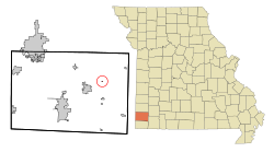
Jerico Springs is a village in Cedar County, Missouri, United States. The population was 160 at the 2020 census.

<span class="mw-page-title-main">Jameson, Missouri</span> Village in Missouri, United States

Jameson is a village in Daviess County, Missouri, United States. The population was 73 at the 2020 census.

<span class="mw-page-title-main">Rives, Missouri</span> Village in Missouri, United States

Rives is a town in Dunklin County, Missouri, United States. The population was 63 at the 2010 census.

<span class="mw-page-title-main">Brooklyn Heights, Missouri</span> Village in Missouri, United States

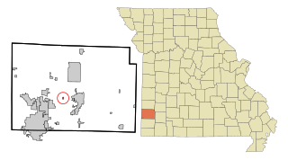
Brooklyn Heights is a village in Jasper County, Missouri, United States. The population was 101 at the 2020 census. It is part of the Joplin, Missouri Metropolitan Statistical Area.

<span class="mw-page-title-main">Brumley, Missouri</span> Town in Missouri, United States

Brumley is a town in Miller County, Missouri, United States. The population was 69 at the 2020 census, down from 91 in 2010.

<span class="mw-page-title-main">Tuscumbia, Missouri</span> Town in Missouri, United States

Tuscumbia is a village in and the county seat of Miller County, Missouri, United States. The population was 188 at the 2020 census.

<span class="mw-page-title-main">Jamestown, Missouri</span> Town in Missouri, United States

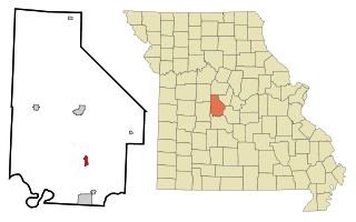
Jamestown is a village in northeastern Moniteau County, Missouri, United States. The population was 330 at the 2020 census, down from 386 in 2010. It is part of the Jefferson City metropolitan area.

<span class="mw-page-title-main">Gravois Mills, Missouri</span> Town in Missouri, United States

Gravois Mills is a town in Morgan County, Missouri, United States. The population was 129 at the 2020 census.

<span class="mw-page-title-main">Newtonia, Missouri</span> Village in Missouri, United States

Newtonia is a village in Newton County, Missouri, United States. The population was 199 at the 2010 census. It is part of the Joplin, Missouri Metropolitan Statistical Area. Newtonia was the site of the Battles of Newtonia during the American Civil War. The village contains some Antebellum houses, such as the Mathew H. Ritchey House, as well as a cemetery for Civil War dead. It is a farming community and is immediately adjacent to Stark City, Missouri.

<span class="mw-page-title-main">Guilford, Missouri</span> Village in Missouri, United States

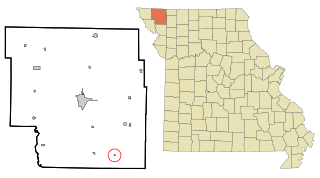
Guilford is a village in Nodaway County, Missouri, United States, near the Platte River. The population was 85 at the 2010 census.

<span class="mw-page-title-main">Halfway, Missouri</span> Village in Missouri, United States

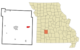
Halfway is a village in Polk County, Missouri, United States. According to the 2010 census, the population of Halfway is 173. It is part of the Springfield, Missouri Metropolitan Statistical Area.

<span class="mw-page-title-main">Arbela, Missouri</span> Village in Missouri, United States

Arbela is a village in Scotland County, Missouri, United States. As of the 2020 census, its population was 24.

<span class="mw-page-title-main">Blodgett, Missouri</span> Village in Missouri, United States

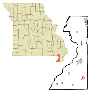
Blodgett is a village in Scott County, Missouri, United States. The population was 213 at the 2010 census.

<span class="mw-page-title-main">Harwood, Missouri</span> Village in Missouri, United States

Harwood is a village in northeast Vernon County, Missouri, United States. The population was 47 at the 2010 census. It was estimated to be 45 by the City of Harwood as of July 1, 2019.

<span class="mw-page-title-main">Richards, Missouri</span> Village in Missouri, United States

Richards is a village in northwest Vernon County, Missouri, United States. The population was 96 at the 2010 census.

<span class="mw-page-title-main">Wyalusing, Wisconsin</span> Town in Wisconsin, United States

Wyalusing is a town in Grant County, Wisconsin, United States. The population was 370 at the 2000 census. The unincorporated communities of Brodtville and Wyalusing are located in the town. Pioneer Robert Glenn, Sr. is credited with naming the village "Wyalusing" after Wyalusing, Pennsylvania, because of a perceived resemblance.

<span class="mw-page-title-main">Ionia, Missouri</span> Village in Missouri, United States

Ionia is a village in northern Benton and southern Pettis counties in the U.S. state of Missouri. The population was 88 at the 2010 census.

<span class="mw-page-title-main">Argyle, Missouri</span> Town in Missouri, United States

Argyle is a town in Osage and Maries counties in the U.S. state of Missouri. The population was 144 at the 2020 census.

References

  1. "ArcGIS REST Services Directory". United States Census Bureau. Retrieved August 28, 2022.
  2. 1 2 U.S. Geological Survey Geographic Names Information System: Ritchey, Missouri
  3. 1 2 "U.S. Census website". United States Census Bureau . Retrieved January 31, 2008.
  4. "Newton County Place Names, 1928–1945". The State Historical Society of Missouri. Archived from the original on June 24, 2016. Retrieved November 22, 2016.
  5. Eaton, David Wolfe (1917). How Missouri Counties, Towns and Streams Were Named. The State Historical Society of Missouri. p. 335.
  6. "Post Offices". Jim Forte Postal History. Retrieved November 22, 2016.
  7. "US Gazetteer files: 2010, 2000, and 1990". United States Census Bureau. February 12, 2011. Retrieved April 23, 2011.
  8. "US Gazetteer files 2010". United States Census Bureau. Archived from the original on January 25, 2012. Retrieved July 8, 2012.
  9. "U.S. Census website". United States Census Bureau . Retrieved July 8, 2012.