Redings Mill, Missouri

Last updated

Redings Mill, Missouri
Newton County Missouri Incorporated and Unincorporated areas Redings Mill Highlighted.svg
Location of Redings Mill, Missouri
Coordinates: 37°01′10″N94°31′01″W / 37.01944°N 94.51694°W / 37.01944; -94.51694
Country United States
State Missouri
County Newton
Area
[1]
  Total0.21 sq mi (0.54 km2)
  Land0.20 sq mi (0.52 km2)
  Water0.01 sq mi (0.02 km2)
Elevation
[2]
951 ft (290 m)
Population
 (2020)
  Total164
  Density815.92/sq mi (315.33/km2)
Time zone UTC-6 (Central (CST))
  Summer (DST) UTC-5 (CDT)
FIPS code 29-60986 [3]
GNIS feature ID2399053 [2]

Redings Mill is a village in Newton County, Missouri, United States. The population was 151 at the 2010 census. It is part of the Joplin, Missouri Metropolitan Statistical Area.

Contents

History

Photo of the Redings Mill Inn, built in the 19th century Redings Mill Inn.jpg
Photo of the Redings Mill Inn, built in the 19th century

Redings Mill was named for millwright John S. Reding (1816–1892). He built the first mill in Newton County prior to the American Civil War. [4] A variant name was "Shoalsburgh". [5] A post office called Shoalsburg was established in 1867, and remained in operation until 1883. [6]

Geography

According to the United States Census Bureau, the village has a total area of 0.21 square miles (0.54 km2), of which 0.20 square miles (0.52 km2) is land and 0.01 square miles (0.03 km2) is water. [7]

Demographics

Historical population
CensusPop.Note
1960 202
1970 179−11.4%
1980 22224.0%
1990 204−8.1%
2000 159−22.1%
2010 151−5.0%
2020 1648.6%
U.S. Decennial Census

2010 census

As of the census [8] of 2010, there were 151 people, 64 households, and 42 families living in the village. The population density was 755.0 inhabitants per square mile (291.5/km2). There were 74 housing units at an average density of 370.0 per square mile (142.9/km2). The racial makeup of the village was 98.0% White, 0.7% African American, and 1.3% from two or more races. Hispanic or Latino of any race were 2.0% of the population.

There were 64 households, of which 31.3% had children under the age of 18 living with them, 57.8% were married couples living together, 7.8% had a female householder with no husband present, and 34.4% were non-families. 29.7% of all households were made up of individuals, and 9.4% had someone living alone who was 65 years of age or older. The average household size was 2.36 and the average family size was 2.95.

The median age in the village was 48.5 years. 22.5% of residents were under the age of 18; 3.9% were between the ages of 18 and 24; 20.5% were from 25 to 44; 32.4% were from 45 to 64; and 20.5% were 65 years of age or older. The gender makeup of the village was 49.0% male and 51.0% female.

2000 census

As of the census [3] of 2000, there were 159 people, 69 households, and 44 families living in the village. The population density was 773.1 inhabitants per square mile (298.5/km2). There were 76 housing units at an average density of 369.5 per square mile (142.7/km2). The racial makeup of the village was 91.19% White, 5.03% Native American, 0.63% Pacific Islander, and 3.14% from two or more races. Hispanic or Latino of any race were 1.89% of the population.

There were 69 households, out of which 31.9% had children under the age of 18 living with them, 52.2% were married couples living together, 13.0% had a female householder with no husband present, and 34.8% were non-families. 29.0% of all households were made up of individuals, and 8.7% had someone living alone who was 65 years of age or older. The average household size was 2.30 and the average family size was 2.91.

In the village, the population was spread out, with 23.3% under the age of 18, 6.9% from 18 to 24, 27.0% from 25 to 44, 32.1% from 45 to 64, and 10.7% who were 65 years of age or older. The median age was 41 years. For every 100 females, there were 87.1 males. For every 100 females age 18 and over, there were 82.1 males.

The median income for a household in the village was $35,938, and the median income for a family was $45,313. Males had a median income of $30,417 versus $27,500 for females. The per capita income for the village was $18,629. None of the families and 4.6% of the population were living below the poverty line.

Related Research Articles

<span class="mw-page-title-main">Wheaton, Missouri</span> City in Missouri, United States

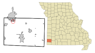
Wheaton is a city in Wheaton Township, Barry County, Missouri, United States. The population was 696 at the 2010 census.

<span class="mw-page-title-main">Gordonville, Missouri</span> Village in Missouri, United States

Gordonville is a village in Cape Giradeau County, Missouri, United States. The population was 625 at the 2020 census. It is part of the Cape Girardeau–Jackson, MO-IL Metropolitan Statistical Area.

<span class="mw-page-title-main">Prathersville, Missouri</span> Village in Missouri, United States

Prathersville is a village in Clay County, Missouri, United States. The population was 121 at the 2020 census. It is part of the Kansas City metropolitan area.

<span class="mw-page-title-main">Smithville, Missouri</span> City in Missouri, United States

Smithville is a city in Clay and Platte counties in the U.S. state of Missouri and is part of the Kansas City metropolitan area, along the Little Platte River. The population was 10,406 at the 2020 United States Census.

<span class="mw-page-title-main">Stoutsville, Missouri</span> Village in Missouri, United States

Stoutsville is a village in Monroe County, Missouri, United States. The population was 37 at the 2020 census.

<span class="mw-page-title-main">Gravois Mills, Missouri</span> Town in Missouri, United States

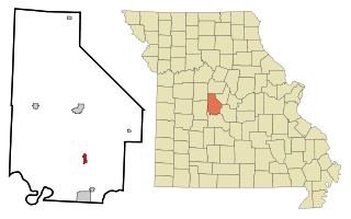
Gravois Mills is a town in Morgan County, Missouri, United States. The population was 129 at the 2020 census.

<span class="mw-page-title-main">Cliff Village, Missouri</span> Village in Missouri, United States

Cliff Village is a village in Newton County, Missouri, United States. The population was 40 at the 2010 census. It is part of the Joplin, Missouri Metropolitan Statistical Area.

<span class="mw-page-title-main">Grand Falls Plaza, Missouri</span> Village in Missouri, United States

Grand Falls Plaza is a village in Newton County, Missouri, United States. The population was 114 at the 2010 census, at which time it was a town. It is part of the Joplin, Missouri Metropolitan Statistical Area.

<span class="mw-page-title-main">Leawood, Missouri</span> Village in Missouri, United States

Leawood is a village in Newton County, Missouri, United States. The population was 682 at the 2010 census. It is part of the Joplin, Missouri Metropolitan Statistical Area.

<span class="mw-page-title-main">Newtonia, Missouri</span> Village in Missouri, United States

Newtonia is a village in Newton County, Missouri, United States. The population was 199 at the 2010 census. It is part of the Joplin, Missouri Metropolitan Statistical Area. Newtonia was the site of the Battles of Newtonia during the American Civil War. The village contains some Antebellum houses, such as the Mathew H. Ritchey House, as well as a cemetery for Civil War dead. It is a farming community and is immediately adjacent to Stark City, Missouri.

<span class="mw-page-title-main">Shoal Creek Drive, Missouri</span> Village in Missouri, United States

Shoal Creek Drive is a village in Newton County, Missouri, United States. The population was 337 at the 2010 census. It is part of the Joplin, Missouri Metropolitan Statistical Area.

<span class="mw-page-title-main">Shoal Creek Estates, Missouri</span> Village in Missouri, United States

Shoal Creek Estates is a village in Newton County, Missouri, United States. The population was 76 at the 2010 census. It is part of the Joplin, Missouri Metropolitan Statistical Area.

<span class="mw-page-title-main">Stark City, Missouri</span> Town in Missouri, United States

Stark City is a town in Newton County, Missouri, United States. The population was 139 at the 2010 census, at which time it was a town. It is part of the Joplin, Missouri Metropolitan Statistical Area. It is adjacent to the battlefield of the Second Battle of Newtonia.

<span class="mw-page-title-main">Wentworth, Missouri</span> Village in Missouri, United States

Wentworth is a village in northeastern Newton County, Missouri, United States. The population was 151 at the 2010 census. It is part of the Joplin, Missouri Metropolitan Statistical Area.

<span class="mw-page-title-main">Leonard, Missouri</span> Village in Missouri, United States

Leonard is a village in northwestern Shelby County, Missouri, United States. The population was 57 at the 2020 census.

<span class="mw-page-title-main">Mill Spring, Missouri</span> Village in Missouri, United States

Mill Spring is a village in Wayne County, Missouri, United States, along the Black River. The population was 159 at the 2020 census.

<span class="mw-page-title-main">Dennis Acres, Missouri</span> Village in Missouri, United States

Dennis Acres is a village in Newton County, Missouri, United States. The population was 76 at the 2010 census.

<span class="mw-page-title-main">Saginaw, Missouri</span> Village in Missouri, United States

Saginaw is a village in Newton County, Missouri, United States. The population was 297 at the 2010 census. It is part of the Joplin, Missouri Metropolitan Statistical Area.

<span class="mw-page-title-main">Silver Creek, Missouri</span> Neighborhood in Newton, Missouri, United States

Silver Creek was a village in Newton County, Missouri, United States. The population was 623 at the 2010 census. It is part of the Joplin, Missouri Metropolitan Statistical Area. On August 7, 2012, residents of the Village of Silver Creek and the City of Joplin voted to consolidate and become part of the city of Joplin.

<span class="mw-page-title-main">Uplands Park, Missouri</span> Village in Missouri, United States

Uplands Park is a village in St. Louis County, Missouri, United States. The population was 445 at the 2010 census. The village is one of many small majority black communities located in the Natural Bridge corridor of mid-St. Louis County, characterized by small homes on small lots.

References

  1. "ArcGIS REST Services Directory". United States Census Bureau. Retrieved August 28, 2022.
  2. 1 2 U.S. Geological Survey Geographic Names Information System: Redings Mill, Missouri
  3. 1 2 "U.S. Census website". United States Census Bureau . Retrieved January 31, 2008.
  4. Moser, Arthur Paul. "A Directory of Towns, Villages, and Hamlets Past and Present of Newton County, Missouri". TheLibrary.org. Retrieved September 3, 2007.
  5. "Newton County Place Names, 1928–1945". The State Historical Society of Missouri. Archived from the original on June 24, 2016. Retrieved November 22, 2016.
  6. "Post Offices". Jim Forte Postal History. Retrieved November 22, 2016.
  7. "US Gazetteer files 2010". United States Census Bureau. Archived from the original on January 25, 2012. Retrieved July 8, 2012.
  8. "U.S. Census website". United States Census Bureau . Retrieved July 8, 2012.