Dupont, Pennsylvania

Last updated
Dupont, Pennsylvania
Borough
Dupont Pano.jpg
Dupont from Pittston Township
Luzerne County Pennsylvania Incorporated and Unincorporated areas Dupont Highlighted.svg
Location of Dupont in Luzerne County, Pennsylvania.
USA Pennsylvania location map.svg
Red pog.svg
Dupont
Usa edcp location map.svg
Red pog.svg
Dupont
Coordinates: 41°19′18″N75°44′47″W / 41.32167°N 75.74639°W / 41.32167; -75.74639
Country United States
State Pennsylvania
County Luzerne
Region Greater Pittston
Incorporated1917
Government
  TypeBorough Council
   Mayor Daniel Lello (D)
Area
[1]
  Total1.56 sq mi (4.05 km2)
  Land1.56 sq mi (4.05 km2)
  Water0.00 sq mi (0.00 km2)
Elevation
720 ft (220 m)
Population
 (2020) [2]
  Total2,539
  Density1,623.40/sq mi (626.68/km2)
Time zone UTC-5 (Eastern (EST))
  Summer (DST) UTC-4 (EDT)
Zip code
18641
Area code 570
FIPS code 42-20424
Website dupontpa.us

Dupont is a borough in the Greater Pittston area of Luzerne County, Pennsylvania, United States. The population was 2,536 as of the 2020 census. [3]

Contents

History

The community was incorporated as a borough in 1917; it was originally called "Smithville," in honor of its first group of settlers. The community was later renamed Dupont after Dupont Explosives, a company which made explosives for mining. These explosives were used throughout Northeastern Pennsylvania in the 19th and 20th centuries. Dupont Explosives eventually closed after the advancement of technology in gathering coal.

Geography

Dupont is located at 41°19′18″N75°44′47″W / 41.32167°N 75.74639°W / 41.32167; -75.74639 (41.321680, -75.746285). [4]

According to the United States Census Bureau, the borough has a total area of 1.5 square miles (3.9 km2), all land.

Transportation

PA 315 northbound (Chestnut Street) through Dupont PA 315 nb in Dupont, Sept. 2023.jpg
PA 315 northbound (Chestnut Street) through Dupont
Major highways
I-81.svg I-81
I-476.svgPennsylvania Turnpike logo.svg I-476  / Penna Turnpike NE Extension
US 11.svg US 11
PA-315.svg PA 315

Demographics

Historical population
CensusPop.Note
1920 4,576
1930 5,16112.8%
1940 5,2782.3%
1950 4,107−22.2%
1960 3,669−10.7%
1970 3,431−6.5%
1980 3,4600.8%
1990 2,984−13.8%
2000 2,719−8.9%
2010 2,711−0.3%
2020 2,536−6.5%
2021 (est.)2,541 [3] 0.2%
Sources: [5] [6] [7] [2]

As of the census of 2000, [6] there were 2,719 people, 1,228 households, and 789 families living in the borough. The population density was 1,790.9 inhabitants per square mile (691.5/km2). There were 1,354 housing units at an average density of 891.8 per square mile (344.3/km2). The racial makeup of the borough was 99.23% White, 0.44% African American, 0.07% Asian, and 0.26% from two or more races. Hispanic or Latino of any race were 0.11% of the population.

There were 1,228 households, 18.9% had children under the age of 18 living with them, 46.7% were married couples living together, 13.4% had a female householder with no husband present, and 35.7% were non-families. 32.6% of households were made up of individuals, and 17.8% were one person aged 65 or older. The average household size was 2.21 and the average family size was 2.79.

The age distribution was 15.9% under the age of 18, 6.3% from 18 to 24, 26.9% from 25 to 44, 24.5% from 45 to 64, and 26.4% 65 or older. The median age was 46 years. For every 100 females there were 88.8 males. For every 100 females age 18 and over, there were 84.3 males.

The median household income was $32,317 and the median family income was $39,250. Males had a median income of $28,431 versus $26,250 for females. The per capita income for the borough was $17,042. About 4.0% of families and 6.2% of the population were below the poverty line, including 10.3% of those under age 18 and 7.8% of those age 65 or over.

Notable people

Related Research Articles

<span class="mw-page-title-main">Emsworth, Pennsylvania</span> Borough in Allegheny County, Pennsylvania, United States

Emsworth is a borough in Allegheny County, Pennsylvania, United States, along the Ohio River. The population was 2,525 at the 2020 census.

<span class="mw-page-title-main">Burlington Township, Bradford County, Pennsylvania</span> Township in Pennsylvania, United States

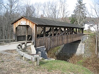
Burlington Township is a township in Bradford County, Pennsylvania, United States. It is part of Northeastern Pennsylvania. The population was 791 at the 2010 census. Children residing in the township are assigned to attend the Troy Area School District.

<span class="mw-page-title-main">South Waverly, Pennsylvania</span> Borough in Pennsylvania, United States

South Waverly is a borough in Bradford County, Pennsylvania, United States. It is part of Northeastern Pennsylvania. The population was 1,070 at the 2020 census. South Waverly is part of the Penn-York Valley, a group of four contiguous communities in New York and Pennsylvania: Waverly, New York, South Waverly, Sayre, and Athens, with a combined population near 30,000.

<span class="mw-page-title-main">West Liberty, Pennsylvania</span> Borough in Pennsylvania, United States

West Liberty is a borough in Butler County, Pennsylvania, United States. The population was 343 at the 2010 census.

<span class="mw-page-title-main">Spring City, Pennsylvania</span> Borough in Pennsylvania, United States

Spring City is a borough in Chester County, Pennsylvania, United States. The population was 3,494 at the 2020 census. Spring City is a member of the Spring-Ford Area School District.

<span class="mw-page-title-main">Clarks Green, Pennsylvania</span> Borough in Pennsylvania, United States

Clarks Green is a borough in Lackawanna County, Pennsylvania, United States. It is part of Northeastern Pennsylvania. The population was 1,529 at the 2020 census.

<span class="mw-page-title-main">Clarks Summit, Pennsylvania</span> Borough in Pennsylvania, United States

Clarks Summit is a borough in Lackawanna County, northwest of Scranton in Northeastern Pennsylvania. The population was 5,108 at the 2020 census. It is also the northern control city of the Pennsylvania Turnpike Northeast Extension, I-476, though the official terminus is in adjacent South Abington Township.

<span class="mw-page-title-main">Jessup, Pennsylvania</span> Borough in Pennsylvania, United States

Jessup is a borough in Lackawanna County, Pennsylvania, United States. The population was 4,532 at the 2020 census.

<span class="mw-page-title-main">Mayfield, Pennsylvania</span> Borough in Pennsylvania, United States

Mayfield is a borough in Lackawanna County, Pennsylvania, United States, approximately 14 miles (23 km) northeast of Scranton. In the past, it contained a silk mill and a coal mining industry. The population was 1,763 at the 2020 census.

<span class="mw-page-title-main">Avoca, Pennsylvania</span> Borough in Pennsylvania, United States

Avoca is a borough within the Greater Pittston area of Luzerne County, Pennsylvania, United States. It is located 7.5 miles (12.1 km) northeast of Wilkes Barre and 3.4 miles (5.5 km) southwest of Scranton. The population was 2,501 at the time of the 2020 census. The Wilkes-Barre/Scranton International Airport (AVP) is located near Avoca.

<span class="mw-page-title-main">Bear Creek Village, Pennsylvania</span> Borough in Pennsylvania, United States

Bear Creek Village is a borough in Luzerne County, Pennsylvania, United States. The population was 290 at the 2020 census.

<span class="mw-page-title-main">Dallas, Pennsylvania</span> Borough in Pennsylvania, United States

Dallas is a borough in Luzerne County, Pennsylvania, United States. The population was 2,692 at the 2020 census. The local government describes the borough as the "Pride" of the Back Mountain. The area includes the townships of Dallas, Franklin, Jackson, Kingston, Lake, and Lehman. The region also includes the boroughs of Dallas and Harveys Lake. Dallas is in the vicinity of Misericordia University and Dallas State Correctional Institution.

<span class="mw-page-title-main">Edwardsville, Pennsylvania</span> Borough in Pennsylvania, United States

Edwardsville is a borough in Luzerne County, Pennsylvania, United States. The population was 4,918 at the 2020 census.

<span class="mw-page-title-main">Larksville, Pennsylvania</span> Borough in Pennsylvania, United States

Larksville is a borough in Luzerne County, Pennsylvania, United States. It is 2 miles (3 km) west of Wilkes Barre on the Susquehanna River. The population was 4,216 as of the 2020 census.

<span class="mw-page-title-main">Penn Lake Park, Pennsylvania</span> Borough in Pennsylvania, United States

Penn Lake Park is a borough in Luzerne County, Pennsylvania, United States. The population was 359 at the 2020 census.

<span class="mw-page-title-main">Yatesville, Pennsylvania</span> Borough in Pennsylvania, United States

Yatesville is a borough in the Greater Pittston area of Luzerne County, Pennsylvania. The population was 638 as of the 2020 census.

<span class="mw-page-title-main">Lanesboro, Pennsylvania</span> Borough in Pennsylvania, United States

Lanesboro is a borough in Susquehanna County, Pennsylvania, United States. The population was 485 at the 2020 census.

<span class="mw-page-title-main">New Milford, Pennsylvania</span> Borough in Pennsylvania, United States

New Milford is a borough in Susquehanna County, Pennsylvania, United States. The population was 817 at the 2020 census. Children living in New Milford are served by the schools in the Blue Ridge School District, including Blue Ridge High School.

<span class="mw-page-title-main">Union Dale, Pennsylvania</span> Borough in Pennsylvania, United States

Union Dale is a borough in Susquehanna County, Pennsylvania, United States. The borough was incorporated in 1885. Union Dale's population was 267 at the 2010 census.

<span class="mw-page-title-main">Waymart, Pennsylvania</span> Borough in Pennsylvania, United States

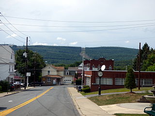
Waymart is a borough in Wayne County, Pennsylvania, United States. The borough's population was 1,341 at the time of the 2010 United States Census.

References

  1. "ArcGIS REST Services Directory". United States Census Bureau. Retrieved October 12, 2022.
  2. 1 2 "Census Population API". United States Census Bureau. Retrieved Oct 12, 2022.
  3. 1 2 Bureau, US Census. "City and Town Population Totals: 2020—2021". Census.gov. US Census Bureau. Retrieved August 4, 2022.
  4. "US Gazetteer files: 2010, 2000, and 1990". United States Census Bureau. 2011-02-12. Retrieved 2011-04-23.
  5. "Census of Population and Housing". U.S. Census Bureau. Retrieved 11 December 2013.
  6. 1 2 "U.S. Census website". United States Census Bureau . Retrieved 2008-01-31.
  7. "Incorporated Places and Minor Civil Divisions Datasets: Subcounty Resident Population Estimates: April 1, 2010 to July 1, 2012". Population Estimates. U.S. Census Bureau. Archived from the original on 11 June 2013. Retrieved 11 December 2013.