
Tresckow, formerly known as Dutchtown, is an unincorporated community and census-designated place (CDP) in Carbon County, Pennsylvania, United States. It is part of Northeastern Pennsylvania and is located west of Junedale and Beaver Meadows, which share the same road network. The community has deep roots in the anthracite coal mining and transportation industries.
Kenilworth is a census-designated place (CDP) in North Coventry Township, Chester County, Pennsylvania, United States. The population was 2,148 at the 2020 census.

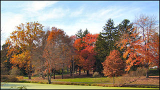
Lionville is a census-designated place (CDP) in Uwchlan Township, Chester County, Pennsylvania, United States. The population was 6,189 at the 2010 census. Prior to 2010 the CDP was recorded as Lionville-Marchwood. "Marchwood", however, refers only to the housing development begun in the early 1960s that is located south of the 100-113 intersection.

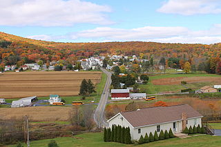
Mainville is a census-designated place in Columbia County, Pennsylvania, United States. It is part of Northeastern Pennsylvania. The population was 132 at the 2010 census. It is part of the Bloomsburg-Berwick micropolitan area.
Hazle Township is a township in Luzerne County, Pennsylvania, United States. The population was 10,150 at the time of the 2020 census. The township surrounds the city of Hazleton and the borough of West Hazleton.

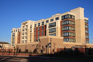
Hazleton is a city in Luzerne County, Pennsylvania, United States. The population was 29,963 at the 2020 census. Hazleton is the second largest city in Luzerne County. It was incorporated as a borough on January 5, 1857, and as a city on December 4, 1891.

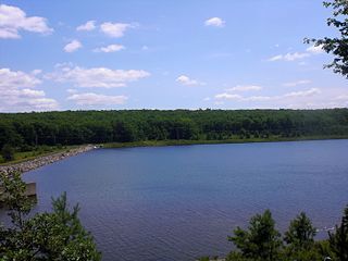
Mountain Top is an unincorporated area and census-designated place (CDP) in Luzerne County, Pennsylvania, United States. As of the 2010 census, the CDP population was 10,982.

West Hazleton is a borough in Luzerne County, Pennsylvania, United States. The borough is 31 miles (50 km) south of Wilkes Barre and had a population of 5,167 as of the 2020 census.

Eagleville is a census-designated place (CDP) in Montgomery County, Pennsylvania, United States. The population was 4,800 at the 2010 census. It is within Lower Providence Township.
Kulpsville is a census-designated place (CDP) in Montgomery County, Pennsylvania. The population was 8,194 at the 2010 census. It is located in Towamencin Township, which is part of the North Penn Valley region that is centered around the borough of Lansdale. The name is derived from the Kulp family.

Hometown is a village in Rush Township, Schuylkill County, Pennsylvania, United States that sits astride a crossing point between important transportation corridors. The population was 1,399 at the 2000 census, and excepting for the area near the east–west PA 54 running mostly parallel to the tracks of the Reading, Blue Mountain, and Northern Railroad — once the important east-west shortline Nesquehoning & Mahanoy Railroad — and the PA 54 junction with PA 309.
Nuremberg is a census-designated place (CDP) that is located in Schuylkill and Luzerne counties, Pennsylvania, United States. The population was 434 at the time of the 2010 census.

Devon is a census-designated place (CDP) located in Easttown township in Chester County, Pennsylvania, United States. The population was 1,515 at the 2010 census. The area is part of the Philadelphia Main Line suburbs.
Pardeesville is a census-designated place (CDP) in Hazle Township, Luzerne County, Pennsylvania, United States. The population was 572 at the 2010 census.

Cochranville is a census-designated place (CDP) in West Fallowfield Township, Chester County, Pennsylvania, United States. The population was 668 at the 2010 census. It is the hometown of Olympic swimmer Cierra Runge.

Chase is a census-designated place (CDP) in Jackson Township, Luzerne County, Pennsylvania, United States. The CDP population was 978 at the 2010 census.
Hickory Hills is a census-designated place (CDP) in Foster Township, Luzerne County, Pennsylvania, southwest of the borough of White Haven. The CDP population was 562 at the 2010 census.

Lattimer is a village and census-designated place (CDP) in Hazle Township, Luzerne County, Pennsylvania, United States. The population was 554 at the 2010 census.

Weston is a census-designated place (CDP) in Black Creek Township, Luzerne County, Pennsylvania, United States. The population was 321 at the 2010 census.

Caln is a census-designated place (CDP) in Caln Township, Chester County, Pennsylvania, United States. The population was 1,519 at the 2010 census. It is located east of the city of Coatesville and lies west of Philadelphia.


