Nuangola, Pennsylvania

Last updated
Nuangola, Pennsylvania
Borough
Nuangola Municipal Building.JPG
Nuangola Municipal Building
Luzerne County Pennsylvania Incorporated and Unincorporated areas Nuangola Highlighted.svg
Location of Nuangola in Luzerne County, Pennsylvania.
USA Pennsylvania location map.svg
Red pog.svg
Nuangola
Usa edcp location map.svg
Red pog.svg
Nuangola
Coordinates: 41°09′26″N75°58′37″W / 41.15722°N 75.97694°W / 41.15722; -75.97694
Country United States
State Pennsylvania
County Luzerne
Incorporated1908
Government
  TypeBorough Council
Area
[1]
  Total1.34 sq mi (3.47 km2)
  Land1.18 sq mi (3.07 km2)
  Water0.16 sq mi (0.41 km2)
Population
 (2020) [2]
  Total666
  Density562.50/sq mi (217.25/km2)
Time zone UTC-5 (Eastern (EST))
  Summer (DST) UTC-4 (EDT)
Area code 570
FIPS code 42-55752

Nuangola is a borough in Luzerne County, Pennsylvania. The population was 663 as of the 2020 census. [3] Developed as a summer resort in the early 20th century, the borough is built around a heart-shaped lake called Nuangola Lake.

Contents

History

Lake Nuangola Red Rocks, Lake Nuangola, Pennsylvania (75222).jpg
Lake Nuangola

Origin of name

The name Nuangola probably derives from an Algonquian language, which was spoken by the indigenous Native Americans of the area (most likely the Delaware (Lenape), the region's largest tribe. Some Nanticoke and Shawnee also lived there at the time). According to legend, a Native American maiden named Nuangola is believed to have drowned in the lake. Another account says that Nuangola is a Native American word (probably from an Algonquian language) for "Three-Cornered Lake" or "Triangular Lake." Early settlers named its this, but the name was changed to Nuangola to avoid confusion with other towns in Pennsylvania. It has also been suggested that Nuangola means "people of the north." [4]

Incorporation

Nuangola was incorporated as a borough in 1908. Two years later, in 1910, the population of the new town was just over one hundred people. In the following decades, the population grew. The county became a center of mining and attracted many European immigrants.

But in the 20th century, this area was developed as a summer resort around the lake. Today, over six hundred people reside in Nuangola. Some are retirees; others have second homes here. The population increases in the summer.

Grove Theatre

Nuangola is home of the Grove Theatre. From the 1930s through the 1950s, it was a popular summer stock playhouse. Kirk Douglas, Joseph Cotten, Jean Kerr, and many other notable actors had early roles there.

After having been closed for decades, the theatre was reopened in 2006 as a Non-Equity stock theatre. Since then, the theatre has produced the following: Godspell , On Golden Pond , Plaza Suite , Prisoner of Second Avenue , Ring of Fire , A Christmas Carol , and many others.

East side, Lake Nuangola, Pennsylvania (75223).jpg
East side of Lake Nuangola
Bathing at Lake Nuangola, Pennsylvania (75224).jpg
Lake Nuangola
Grove Theatre at Lake Nuangola, Pennsylvania (65420).jpg
Grove Theatre at Lake Nuangola

Geography

Lake Nuangola Lake Nuangola, Pennsylvania (65421).jpg
Lake Nuangola

Nuangola is located at 41°09′26″N75°58′37″W / 41.157132°N 75.977081°W / 41.157132; -75.977081 . [5]

According to the United States Census Bureau, the borough has a total area of 1.2 square miles (3.1 km2), of which 1.0 square mile (2.7 km2) is land and 0.15 square miles (0.4 km2), or 13.04%, is water. [6] The town is situated around Nuangola Lake. It is part of the Crestwood School District.

Nuangola borders Hanover Township (to the northeast), Newport Township (to the northwest), Rice Township (to the east and south), Dorrance Township (to the south), and Slocum Township (to the west).

Transportation

Interstate 81 is the only major highway within proximity to Nuangola. The interstate is east of the borough. It links Nuangola to the county seat of Wilkes-Barre (in the north) and the city of Hazleton (in the south).

Public safety

Demographics

Historical population
CensusPop.Note
1910 124
1920 87−29.8%
1930 241177.0%
1940 30928.2%
1950 295−4.5%
1960 34617.3%
1970 46434.1%
1980 72656.5%
1990 701−3.4%
2000 671−4.3%
2010 6791.2%
2020 663−2.4%
2021 (est.)667 [3] 0.6%
Sources: [7] [8] [9] [2]

As of the census [8] of 2000, there were 671 people, 259 households, and 193 families residing in the borough. The population density was 594.7 inhabitants per square mile (229.6/km2). There were 370 housing units at an average density of 327.9 per square mile (126.6/km2). The racial makeup of the borough was 99.70% White and 0.30% Asian. Hispanic or Latino of any race were 0.30% of the population.

There were 259 households, out of which 30.5% had children under the age of 18 living with them, 62.5% were married couples living together, 8.5% had a female householder with no husband present, and 25.1% were non-families. 20.5% of all households were made up of individuals, and 5.0% had someone living alone who was 65 years of age or older. The average household size was 2.57 and the average family size was 2.95.

In the borough the population was spread out, with 21.3% under the age of 18, 6.9% from 18 to 24, 30.6% from 25 to 44, 28.6% from 45 to 64, and 12.7% who were 65 years of age or older. The median age was 40 years. For every 100 females there were 108.4 males. For every 100 females age 18 and over, there were 104.7 males.

The median income for a household in the borough was $41,964, and the median income for a family was $45,833. Males had a median income of $33,000 versus $27,500 for females. The per capita income for the borough was $16,851. About 7.9% of families and 11.8% of the population were below the poverty line, including 21.1% of those under age 18 and none of those age 65 or over.

Related Research Articles

<span class="mw-page-title-main">Towanda, Pennsylvania</span> Borough in Pennsylvania, United States

Towanda is a borough and the county seat of Bradford County in the U.S. state of Pennsylvania. It is part of Northeastern Pennsylvania and is located 66 miles (106 km) northwest of Wilkes-Barre, on the Susquehanna River. The name means "burial ground" in the Algonquian language. As of the 2020 census, the population of Towanda was 2,833.

<span class="mw-page-title-main">Conneaut Lake, Pennsylvania</span> Borough in Pennsylvania, United States

Conneaut Lake is a borough in Crawford County, Pennsylvania, located at the southern end of the lake of the same name. The population was 626 at the 2020 census, down from 653 at the 2010 census.

<span class="mw-page-title-main">Sadsbury Township, Crawford County, Pennsylvania</span> Township in Pennsylvania, United States

Sadsbury Township is a township in Crawford County, Pennsylvania, United States. The population was 2,762 at the 2020 census, down from 2,933 at the 2010 census.

<span class="mw-page-title-main">Spring Township, Crawford County, Pennsylvania</span> Township in Pennsylvania, United States

Spring Township is a township in Crawford County, Pennsylvania, United States. The population was 1,412 at the 2020 census, down from 1,548 at the 2010 census.

<span class="mw-page-title-main">Springboro, Pennsylvania</span> Borough in Pennsylvania, United States

Springboro is a borough in Crawford County, Pennsylvania, United States, located 35 miles southwest of Erie. The population was 377 at the 2020 census, down from 477 at the 2010 census.

<span class="mw-page-title-main">Summerhill Township, Crawford County, Pennsylvania</span> Township in Pennsylvania, United States

Summerhill Township is a township in Crawford County, Pennsylvania, United States. The population was 1,188 at the 2020 census, down from 1,236 at the 2010 census.

<span class="mw-page-title-main">Woodcock, Pennsylvania</span> Borough in Pennsylvania, United States

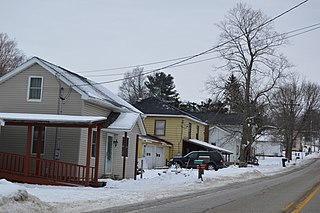
Woodcock is a borough in Crawford County, Pennsylvania, United States. The population was 139 at the 2020 census, down from 157 at the 2010 census.

<span class="mw-page-title-main">Woodcock Township, Crawford County, Pennsylvania</span> Township in Pennsylvania, United States

Woodcock Township is a township in Crawford County, Pennsylvania, United States. The population was 2,754 at the 2020 census, down from 2,856 at the 2010 census.

<span class="mw-page-title-main">Girard Township, Erie County, Pennsylvania</span> Township in Pennsylvania, United States

Girard Township is a township in Erie County, Pennsylvania, United States. The population was 4,872 at the 2020 census, down from the population of 5,102 at the 2010 census.

<span class="mw-page-title-main">McKean Township, Erie County, Pennsylvania</span> Township in Pennsylvania, United States

McKean Township is a township in Erie County, Pennsylvania, United States. The population was 4,435 at the 2020 census, up from 4,409 at the 2010 census, down from 4,619 in 2000.

<span class="mw-page-title-main">Tionesta Township, Forest County, Pennsylvania</span> Township in Pennsylvania, United States

Tionesta Township is a township in Forest County, Pennsylvania, United States. The population was 739 at the time of the 2020 census, up from the total of 729 that was documented by the 2010, up from 610 at the 2000 census.

<span class="mw-page-title-main">Conyngham Township, Luzerne County, Pennsylvania</span> Township in Pennsylvania

Conyngham Township is a township in Luzerne County, Pennsylvania, United States. The population was 1,309 at the 2020 census.

<span class="mw-page-title-main">Dallas, Pennsylvania</span> Borough in Pennsylvania, United States

Dallas is a borough in Luzerne County, Pennsylvania, United States. The population was 2,692 at the 2020 census. The local government describes the borough as the "Pride" of the Back Mountain. The area includes the townships of Dallas, Franklin, Jackson, Kingston, Lake, and Lehman. The region also includes the boroughs of Dallas and Harveys Lake. Dallas is in the vicinity of Misericordia University and Dallas State Correctional Institution.

<span class="mw-page-title-main">Hanover Township, Luzerne County, Pennsylvania</span> Township in Pennsylvania, United States

Hanover Township is a township in Luzerne County, Pennsylvania. As of the 2020 census, the population was 11,424, making it the most populous township in the county.

<span class="mw-page-title-main">Harveys Lake, Pennsylvania</span> Borough in Pennsylvania, United States

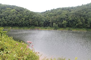
Harveys Lake is a borough in Luzerne County, Pennsylvania, United States. It is part of the Back Mountain, a one hundred and eighteen-square mile region in northern Luzerne County.

<span class="mw-page-title-main">Mountain Top, Pennsylvania</span> Census-designated place in Pennsylvania, United States

Mountain Top is an unincorporated area and census-designated place (CDP) in Luzerne County, Pennsylvania, United States. As of the 2010 census, the CDP population was 10,982.

<span class="mw-page-title-main">Rice Township, Luzerne County, Pennsylvania</span> Township in Pennsylvania, United States

Rice Township is a township in Luzerne County, Pennsylvania, United States. The population was 3,626 at the 2020 census.

<span class="mw-page-title-main">Delmar Township, Tioga County, Pennsylvania</span> Township in Pennsylvania, United States

Delmar Township is a township in Tioga County, Pennsylvania, United States. The population was 2,796 at the 2020 census.

<span class="mw-page-title-main">Tioga Township, Tioga County, Pennsylvania</span> Township in Pennsylvania, United States

Tioga Township is a township in Tioga County, Pennsylvania, United States. The population was 941 at the 2020 census.

<span class="mw-page-title-main">Waymart, Pennsylvania</span> Borough in Pennsylvania, United States

Waymart is a borough in Wayne County, Pennsylvania, United States. The borough's population was 1,341 at the time of the 2010 United States Census.

References

  1. "ArcGIS REST Services Directory". United States Census Bureau. Retrieved October 12, 2022.
  2. 1 2 "Census Population API". United States Census Bureau. Retrieved Oct 12, 2022.
  3. 1 2 Bureau, US Census. "City and Town Population Totals: 2020—2021". Census.gov. US Census Bureau. Retrieved August 5, 2022.
  4. "Origins of town names of Northeast PA".
  5. "US Gazetteer files: 2010, 2000, and 1990". United States Census Bureau. 2011-02-12. Retrieved 2011-04-23.
  6. "Geographic Identifiers: 2010 Demographic Profile Data (G001): Nuangola borough, Pennsylvania". United States Census Bureau . Retrieved April 12, 2012.
  7. "Census of Population and Housing". U.S. Census Bureau. Retrieved 11 December 2013.
  8. 1 2 "U.S. Census website". United States Census Bureau . Retrieved 2008-01-31.
  9. "Incorporated Places and Minor Civil Divisions Datasets: Subcounty Resident Population Estimates: April 1, 2010 to July 1, 2012". Population Estimates. U.S. Census Bureau. Archived from the original on 11 June 2013. Retrieved 11 December 2013.