Dutch commonly refers to:
A shire is a traditional term for a division of land, found in Great Britain, Australia and some other English-speaking countries. It was first used in Wessex from the beginning of Anglo-Saxon settlement, and spread to most of the rest of England in the tenth century. In some rural parts of Australia, a shire is a local government area; however, in Australia it is not synonymous with a "county", which is a lands administrative division.

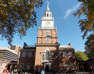
The Thirteen Colonies, also known as the Thirteen British Colonies or the Thirteen American Colonies, were a group of British colonies on the Atlantic coast of North America founded in the 17th and 18th centuries. They declared independence in 1776 and formed the United States of America. The Thirteen Colonies had very similar political, constitutional, and legal systems and were dominated by Protestant English-speakers. They were part of Britain's possessions in the New World, which also included colonies in Canada, the Caribbean, and the Floridas.

The Delmarva Peninsula, or simply Delmarva, is a large peninsula on the East Coast of the United States, occupied by Delaware and parts of the Eastern Shores of Maryland and Virginia. The peninsula is 170 miles (274 km) long. In width, it ranges from 70 miles (113 km) near its center, to 12 miles (19 km) at the isthmus on its northern edge, to less near its southern tip of Cape Charles. It is bordered by the Chesapeake Bay on the west, the Delaware River, Delaware Bay, and the Atlantic Ocean on the east, and the Elk River and its isthmus on the north.

Pocahontas County is a county located in the U.S. state of West Virginia. As of the 2010 census, the population was 8,719. Its county seat is Marlinton. The county was established in 1821. It is named after the daughter of the Powhatan Native American chief from Jamestown, Virginia. She married an English settler and their mixed-race children became ancestors of many of the First Families of Virginia.

Bluefield is a town in Tazewell County, Virginia, United States, located along the Bluestone River. The population was 5,444 at the 2010 census. It is part of the Bluefield WV-VA micropolitan area which has a population of 107,342. The micropolitan area is the 350th largest statistical population area in the United States.
The Mid-Atlantic, also called Middle Atlantic states or the Mid-Atlantic states, form a region of the United States generally located between New England and the South Atlantic States. Its exact definition differs upon source, but the region usually includes New York, New Jersey, Pennsylvania, Delaware, Maryland, Washington, D.C., Virginia, and West Virginia. When discussing climate, Connecticut is sometimes included in the region, since its climate is closer to the Middle Atlantic than the New England states. The Mid-Atlantic has played an important role in the development of American culture, commerce, trade, and industry.

"Take Me Home, Country Roads", also known as "Take Me Home" or "Country Roads", is a song written by Bill Danoff, Taffy Nivert, and John Denver about the state of West Virginia. It was released as a single performed by Denver on April 12, 1971, peaking at number 2 on Billboard's US Hot 100 singles for the week ending August 28, 1971. The song was a success on its initial release and was certified Gold by the RIAA on August 18, 1971, and Platinum on April 10, 2017. The song became one of John Denver's most popular and beloved songs. It has continued to sell, with over 1.5 million digital copies sold in the United States. It is considered to be Denver's signature song.

The Eastern Panhandle is the eastern of the two panhandles in the U.S. state of West Virginia. It is a small stretch of territory in the northeast of the state, bordering Maryland and Virginia. Some sources and regional associations only identify the Eastern Panhandle as being composed of Morgan, Berkeley, and Jefferson Counties. Berkeley and Jefferson Counties are geographically located in the Shenandoah Valley. West Virginia is unusual in having two panhandles, the Eastern Panhandle and the Northern Panhandle.

Susquehannock people, also called the Conestoga by the English, were Iroquoian-speaking Native Americans who lived in areas adjacent to the Susquehanna River and its tributaries ranging from its upper reaches in the southern part of what is now New York, through eastern and central Pennsylvania West of the Poconos and the upper Delaware River, with lands extending beyond the mouth of the Susquehanna in Maryland along the west bank of the Potomac at the north end of the Chesapeake Bay. Evidence of their habitation has also been found in northern West Virginia and portions of southwestern Pennsylvania, which could be reached via the gaps of the Allegheny or several counties to the south, via the Cumberland Narrows pass which held the Nemacolin Trail. Both passes abutted their range and could be reached through connecting valleys from the West Branch Susquehanna and their large settlement at Conestoga, Pennsylvania.

Michael Terrence Holland is an American college athletics administrator and former basketball player and coach. He is currently the Emeritus Director of Athletics and special assistant to Chancellor Steve Ballard at East Carolina University. Holland served as the head men's basketball coach at Davidson College from 1969 to 1974 and at the University of Virginia from 1974 to 1990, compiling a career college basketball coaching record of 418–216. While coaching at Virginia, he was responsible for signing the nation's top-ranked high school basketball player, seven-foot-four-inch Ralph Sampson, who went on to become a three-time consensus collegiate national player-of-the-year as a Cavalier. Following his retirement from coaching, Holland was the athletic director at Davidson from 1990 to 1994, at Virginia from 1994 to 2001, and at East Carolina from 2004 to 2013.
Burgess originally meant a freeman of a borough or burgh (Scotland). It later came to mean an elected or unelected official of a municipality, or the representative of a borough in the English House of Commons.
The following is a list of lists of the cities, towns and villages of the United States separated by state, territory or district name.

The English overseas possessions, also known as the English colonial empire, comprised a variety of overseas territories that were colonised, conquered, or otherwise acquired by the former Kingdom of England during the centuries before the Acts of Union of 1707 between the Kingdom of England and the Kingdom of Scotland created the Kingdom of Great Britain. The many English possessions then became the foundation of the British Empire and its fast-growing naval and mercantile power, which until then had yet to overtake those of the Dutch Republic, the Kingdom of Portugal, and the Kingdom of Spain.
Eighteen special routes of U.S. Route 58 currently exist in Virginia. In order from west to east they are as follows:


