Related Research Articles

Devils Elbow is an unincorporated community in Pulaski County, Missouri, United States on historic U.S. Highway 66. It is situated on the Big Piney River and is named for a tight incised meander in the river known as a "devil of an elbow". The community is approximately five miles (8 km) east of St. Robert. The floods of May 2017 destroyed much of the historic area, including the post office, but it is in the process of being rebuilt.
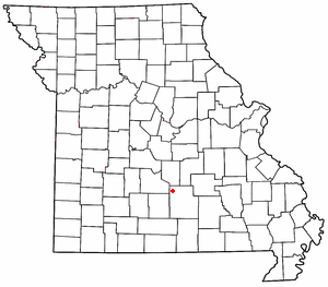
Plato is an incorporated village in northwestern Texas County, Missouri, United States. It is located approximately 20 miles northwest of Houston and 10 miles south of Fort Leonard Wood on Route 32. The population was 109 at the 2010 census.
Duke is an unincorporated community in southwest Phelps County, Missouri, United States. It is located approximately thirteen miles northwest of Licking and five miles east of Fort Leonard Wood. The community is on Missouri Route K and two miles east of a meander in the Big Piney River in the Mark Twain National Forest.
Big Piney is an unincorporated community in Pulaski County, Missouri, United States on the southeastern edge of Fort Leonard Wood and one mile west of a bend in the Big Piney River. The community is on Missouri Route TT four miles northeast of Palace. Licking is seventeen miles to the southeast. Its former K-8 school has closed; students attend the Plato R-V School District.
Clara is an unincorporated community in central Texas County, Missouri, United States. The community is located on a hilltop, approximately one-half mile northwest of the Big Piney River. It is about three miles southwest of Houston on Missouri Route Z.
Hazleton is an extinct town in Texas County, in the U.S. state of Missouri. The GNIS classifies it as a populated place. The village is on the bank of the Big Piney River within the Mark Twain National Forest.
Bloodland is a former community in southern Pulaski County, Missouri, United States. The community lies within Ft. Leonard Wood. The location is about 3.5 miles west-northwest of the community of Big Piney which sits adjacent to the east boundary of the Fort Leonard Wood and 4.5 miles north of the community of Palace, which is just outside the southern boundary of Fort Leonard Wood.
Simmons is an unincorporated community in Texas County, in the U.S. state of Missouri. The community is located at the intersection of US Route 63 and Missouri Route Z, approximately seven miles south of Houston. The Big Piney River flows past the east side of the community.
Spring Creek is an extinct town in Phelps County, in the U.S. state of Missouri. The GNIS classifies it as a populated place. The community is on the southwest side of the confluence of Spring Creek and the Big Piney River. The site is on the Phelps-Pulaski county line. The Wayman/Pillman cemetery is west of the county line in Pulaski County. The boundary of Fort Leonard Wood is two miles to the west, along Missouri Route J, which passes through the community.
Piney Township is an inactive township in Pulaski County, in the U.S. state of Missouri.
Alice is an unincorporated community in southwest Texas County, in the U.S. state of Missouri.
Bado is an unincorporated community in southwest Texas County, in the U.S. state of Missouri. Bado is located on Missouri Route M, along the banks of Big Piney Creek. The community is approximately nine miles west-southwest of Houston and nine miles north of Cabool. The store, post office, a rock house and White House are still standing.
Boone Creek is a stream in Texas County in the U.S. state of Missouri. It is a tributary of the Big Piney River.
Gravel Point is an extinct town in southwestern Texas County, in the U.S. state of Missouri. The community and Gravel Point School is on Gravel Point Road and adjacent to a small tributary of West Piney Creek. It was approximately eight miles north-northwest of Cabool.
Ladd is an unincorporated community in northwestern Texas County, in the U.S. state of Missouri.
Prescott is an unincorporated community in northern Texas County, in the U.S. state of Missouri. The community lies approximately 4.5 miles southwest of Licking and the Big Piney River flows about 1.5 miles to the west of the location. The Prescott Church and cemetery lie one-half mile south.
Raftville is an extinct town in Texas County, in the U.S. state of Missouri. The community was located on the west side of the Big Piney River, south of Boiling Spring.
Venable is an unincorporated community in northwest Texas County, in the U.S. state of Missouri.
Piney Township is a township in Texas County, in the U.S. state of Missouri.
West Piney Creek also known as the Little Piney River is a stream in Texas County in the Ozarks of south central Missouri. It is a tributary to the Big Piney River.
References
- ↑ U.S. Geological Survey Geographic Names Information System: Edanville
- ↑ Big Piney, MO, 15 Minute Topographic Quadrangle, USGS, 1943
- ↑ "Post Offices". Jim Forte Postal History. Retrieved 28 December 2016.
- ↑ "Texas County Place Names, 1928–1945". The State Historical Society of Missouri. Archived from the original on June 24, 2016. Retrieved December 28, 2016.
Municipalities and communities of Texas County, Missouri, United States | ||
|---|---|---|
| Cities |  | |
| Villages | ||
| Townships | ||
| Unincorporated communities |
| |
| Ghost towns | ||
| Footnotes | ‡This populated place also has portions in an adjacent county or counties | |
Coordinates: 37°35′36″N92°02′55″W / 37.59333°N 92.04861°W
| | This Texas County, Missouri state location article is a stub. You can help Wikipedia by expanding it. |