Raymondville, Missouri

Last updated

Raymondville, Missouri
Texas County Missouri Incorporated and Unincorporated areas Raymondville Highlighted.svg
Location of Raymondville, Missouri
Coordinates: 37°20′23″N91°50′03″W / 37.33972°N 91.83417°W / 37.33972; -91.83417 [1]
Country United States
State Missouri
County Texas
Area
[2]
  Total2.95 sq mi (7.65 km2)
  Land2.95 sq mi (7.65 km2)
  Water0.00 sq mi (0.00 km2)
Elevation
[1]
1,312 ft (400 m)
Population
 (2020)
  Total345
  Density116.79/sq mi (45.10/km2)
Time zone UTC-6 (Central (CST))
  Summer (DST) UTC-5 (CDT)
ZIP code
65555
Area code 417
FIPS code 29-60734 [3]
GNIS feature ID2396870 [1]
Website www.gotrain.org/raymondville

Raymondville is a town in Texas County, Missouri, United States. The population was 345 at the 2020 census. [4]

Contents

History

A post office called Raymondville has been in operation since 1871. [5] The community was named after Raymond, Maine, the native home of a first settler. [6]

Geography

Raymondville is located in the Ozarks of southern Missouri. The town is in central Texas County on Missouri routes 137 and B, approximately six miles east of Houston. Yukon is about five miles south and Licking is about ten miles north on route 137. [7]

According to the United States Census Bureau, the village has a total area of 2.95 square miles (7.64 km2), all land. [8]

Demographics

Historical population
CensusPop.Note
1950 175
1960 20215.4%
1970 28440.6%
1980 38836.6%
1990 4259.5%
2000 4424.0%
2010 363−17.9%
2020 345−5.0%
U.S. Decennial Census [9]

2010 census

As of the census [10] of 2010, there were 363 people, 157 households, and 96 families living in the village. The population density was 123.1 inhabitants per square mile (47.5/km2). There were 189 housing units at an average density of 64.1 per square mile (24.7/km2). The racial makeup of the village was 96.7% White, 0.3% African American, 0.3% Asian, 0.3% from other races, and 2.5% from two or more races. Hispanic or Latino of any race were 0.8% of the population.

There were 157 households, of which 28.7% had children under the age of 18 living with them, 45.9% were married couples living together, 12.1% had a female householder with no husband present, 3.2% had a male householder with no wife present, and 38.9% were non-families. 33.1% of all households were made up of individuals, and 15.3% had someone living alone who was 65 years of age or older. The average household size was 2.31 and the average family size was 2.95.

The median age in the village was 41.7 years. 24% of residents were under the age of 18; 7.1% were between the ages of 18 and 24; 21% were from 25 to 44; 30.3% were from 45 to 64; and 17.6% were 65 years of age or older. The gender makeup of the village was 49.0% male and 51.0% female.

2000 census

As of the census [3] of 2000, there were 442 people, 173 households, and 115 families living in the town. The population density was 150.0 inhabitants per square mile (57.9/km2). There were 189 housing units at an average density of 64.1 per square mile (24.7/km2). The racial makeup of the town was 96.61% White, 0.45% African American, 0.45% Native American, 0.68% Asian, and 1.81% from two or more races. Hispanic or Latino of any race were 0.45% of the population.

There were 173 households, out of which 34.7% had children under the age of 18 living with them, 46.8% were married couples living together, 10.4% had a female householder with no husband present, and 33.5% were non-families. 30.6% of all households were made up of individuals, and 16.2% had someone living alone who was 65 years of age or older. The average household size was 2.49 and the average family size was 3.06.

In the town the population was spread out, with 27.8% under the age of 18, 7.0% from 18 to 24, 24.4% from 25 to 44, 24.4% from 45 to 64, and 16.3% who were 65 years of age or older. The median age was 39 years. For every 100 females, there were 97.3 males. For every 100 females age 18 and over, there were 87.6 males.

The median income for a household in the town was $16,806, and the median income for a family was $21,667. Males had a median income of $22,500 versus $14,063 for females. The per capita income for the town was $10,500. About 30.0% of families and 30.2% of the population were below the poverty line, including 40.0% of those under age 18 and 27.3% of those age 65 or over.

Related Research Articles

<span class="mw-page-title-main">Burgess, Missouri</span> Unincorporated community in the American state of Missouri

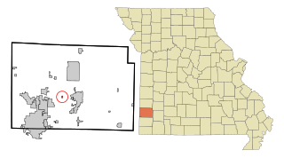
Burgess is a census-designated place and former village in Barton County, Missouri, United States. The population was 54 at the 2020 census.

<span class="mw-page-title-main">Hartsburg, Missouri</span> Village in Missouri, United States

Hartsburg is a village in southern Boone County, Missouri, United States. It is part of the Columbia, Missouri Metropolitan Statistical Area. The population was 133 per the 2020 census.

<span class="mw-page-title-main">Lewis and Clark Village, Missouri</span> Village in Missouri, United States

Lewis and Clark Village is a village in Buchanan County, Missouri, United States. The population was 96 at the 2020 census. It is part of the St. Joseph, MO–KS Metropolitan Statistical Area.

<span class="mw-page-title-main">Gunn City, Missouri</span> Village in Missouri, United States

Gunn City is a village in Cass County, Missouri, United States. The population was 118 at the 2010 census. It is part of the Kansas City metropolitan area.

<span class="mw-page-title-main">Amity, Missouri</span> Village in Missouri, United States

Amity is a village in DeKalb County, Missouri, United States. The population was 26 at the 2020 census. It is part of the St. Joseph, MO–KS Metropolitan Statistical Area.

<span class="mw-page-title-main">Eagleville, Missouri</span> Village in Missouri, United States

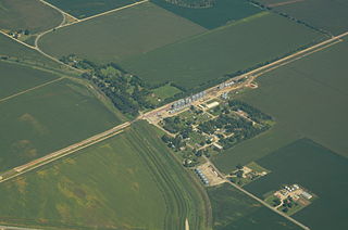
Eagleville is a village in northern Harrison County, Missouri, United States. The population was 275 at the 2020 census.

<span class="mw-page-title-main">Fortescue, Missouri</span> Village in Missouri, United States

Fortescue is a village in Holt County, Missouri, United States. The population was 21 at the 2020 census.

<span class="mw-page-title-main">Brooklyn Heights, Missouri</span> Village in Missouri, United States

Brooklyn Heights is a village in Jasper County, Missouri, United States. The population was 101 at the 2020 census. It is part of the Joplin, Missouri Metropolitan Statistical Area.

<span class="mw-page-title-main">Scotsdale, Missouri</span> Village in Missouri, United States

Scotsdale is a village in Jefferson County, Missouri, United States. The population was 222 at the 2010 census.

<span class="mw-page-title-main">Cave, Missouri</span> City in Missouri, United States

Cave is a City in Lincoln County, Missouri, United States. The population was 5 at the 2010 census. However, As of the 2020 census, the population is 0, making it the smallest incorporated community in the U.S state of Missouri. It is the 939th largest city in Missouri and the 19481st largest city in the United States. Cave is currently declining at a rate of 0.00% annually and its population has decreased by 0.00% since the most recent census, which recorded a population of 5 in 2010.

<span class="mw-page-title-main">Ludlow, Missouri</span> Village in Missouri, United States

Ludlow is a village in southwest Livingston County, Missouri, United States. The population was 111 at the 2020 census. The median income in Ludlow is $30,833 and the median home value is $33,500.

<span class="mw-page-title-main">Clyde, Missouri</span> Village in Missouri, United States

Clyde is a village in eastern Nodaway County, Missouri, United States. The population was 82 at the 2010 census.

<span class="mw-page-title-main">Bakersfield, Missouri</span> Village in Missouri, United States

Bakersfield is a village in southeastern Ozark County in the Ozarks of southern Missouri, United States. The population was 186 at the 2020 census.

<span class="mw-page-title-main">Rutledge, Missouri</span> Village in Missouri, United States

Rutledge is a village in Scotland County, Missouri, United States. As of the 2020 census, its population was 86.

<span class="mw-page-title-main">Norwood Court, Missouri</span> Village in Missouri, United States

Norwood Court is a village in St. Louis County, Missouri, United States. The population was 959 at the 2010 census.

<span class="mw-page-title-main">Richards, Missouri</span> Village in Missouri, United States

Richards is a village in northwest Vernon County, Missouri, United States. The population was 96 at the 2010 census.

<span class="mw-page-title-main">Mount Moriah, Missouri</span> Village in Missouri, United States

Mount Moriah is a village in eastern Harrison County, Missouri, United States. The population at the 2020 census was 75.

<span class="mw-page-title-main">Redings Mill, Missouri</span> Village in Missouri, United States

Redings Mill is a village in Newton County, Missouri, United States. The population was 151 at the 2010 census. It is part of the Joplin, Missouri Metropolitan Statistical Area.

<span class="mw-page-title-main">Ionia, Missouri</span> Village in Missouri, United States

Ionia is a village in northern Benton and southern Pettis counties in the U.S. state of Missouri. The population was 88 at the 2010 census.

<span class="mw-page-title-main">Argyle, Missouri</span> Town in Missouri, United States

Argyle is a town in Osage and Maries counties in the U.S. state of Missouri. The population was 144 at the 2020 census.

References

  1. 1 2 3 U.S. Geological Survey Geographic Names Information System: Raymondville, Missouri
  2. "ArcGIS REST Services Directory". United States Census Bureau. Retrieved August 28, 2022.
  3. 1 2 "U.S. Census website". United States Census Bureau . Retrieved January 31, 2008.
  4. "Explore Census Data". data.census.gov. Retrieved December 24, 2021.
  5. "Post Offices". Jim Forte Postal History. Retrieved December 28, 2016.
  6. "Texas County Place Names, 1928–1945". The State Historical Society of Missouri. Archived from the original on June 24, 2016. Retrieved December 28, 2016.
  7. Missouri Atlas & Gazetteer, DeLorme, 1998, First edition, p. 54, ISBN   0-89933-224-2
  8. "US Gazetteer files 2010". United States Census Bureau. Archived from the original on January 25, 2012. Retrieved July 8, 2012.
  9. "Census of Population and Housing". Census.gov. Retrieved June 4, 2015.
  10. "U.S. Census website". United States Census Bureau . Retrieved July 8, 2012.