Licking, Missouri

Last updated

Licking, Missouri
Texas County Missouri Incorporated and Unincorporated areas Licking Highlighted.svg
Location in Texas County and the state of Missouri.
Coordinates: 37°29′57″N91°51′42″W / 37.49917°N 91.86167°W / 37.49917; -91.86167 [1]
Country United States
State Missouri
County Texas
Area
[2]
  Total2.14 sq mi (5.55 km2)
  Land2.13 sq mi (5.52 km2)
  Water0.01 sq mi (0.03 km2)
Elevation
[1]
1,257 ft (383 m)
Population
 (2020)
  Total2,851
  Density1,337.87/sq mi (516.59/km2)
Time zone UTC-6 (Central (CST))
  Summer (DST) UTC-5 (CDT)
ZIP code
65542
Area code 573
FIPS code 29-42464 [3]
GNIS feature ID2395703 [1]
Website www.lickingmo.org

Licking is a city located in Texas County, Missouri, United States. The population was 3,124 at the 2010 census, making it the most populous city in Texas County.

Contents

Geography

Licking is located in north central Texas County in the Ozarks of southern Missouri. The city is located at the intersection of U.S. Route 63 and Missouri Route 32. [4]

According to the United States Census Bureau, the city has a total area of 2.14 square miles (5.54 km2), of which 2.13 square miles (5.52 km2) is land and 0.01 square miles (0.03 km2) is water. [5]

Climate

Climate data for Licking 4N, Missouri (1991–2020 normals, extremes 1936–present)
MonthJanFebMarAprMayJunJulAugSepOctNovDecYear
Record high °F (°C)78
(26)
83
(28)
89
(32)
92
(33)
96
(36)
106
(41)
114
(46)
106
(41)
104
(40)
93
(34)
84
(29)
76
(24)
114
(46)
Mean daily maximum °F (°C)41.9
(5.5)
47.0
(8.3)
56.4
(13.6)
67.4
(19.7)
75.5
(24.2)
83.4
(28.6)
88.0
(31.1)
87.3
(30.7)
79.7
(26.5)
68.6
(20.3)
55.6
(13.1)
45.2
(7.3)
66.3
(19.1)
Daily mean °F (°C)31.7
(−0.2)
36.1
(2.3)
45.0
(7.2)
55.3
(12.9)
64.5
(18.1)
72.9
(22.7)
77.3
(25.2)
76.0
(24.4)
68.0
(20.0)
56.5
(13.6)
45.0
(7.2)
35.5
(1.9)
55.3
(12.9)
Mean daily minimum °F (°C)21.4
(−5.9)
25.2
(−3.8)
33.7
(0.9)
43.3
(6.3)
53.4
(11.9)
62.4
(16.9)
66.6
(19.2)
64.7
(18.2)
56.2
(13.4)
44.4
(6.9)
34.3
(1.3)
25.7
(−3.5)
44.3
(6.8)
Record low °F (°C)−24
(−31)
−19
(−28)
−17
(−27)
16
(−9)
25
(−4)
36
(2)
41
(5)
38
(3)
28
(−2)
11
(−12)
−1
(−18)
−19
(−28)
−24
(−31)
Average precipitation inches (mm)2.81
(71)
2.71
(69)
4.12
(105)
4.80
(122)
5.54
(141)
4.54
(115)
3.48
(88)
4.04
(103)
4.20
(107)
3.34
(85)
4.09
(104)
2.87
(73)
46.54
(1,182)
Average snowfall inches (cm)3.5
(8.9)
1.7
(4.3)
2.0
(5.1)
0.0
(0.0)
0.0
(0.0)
0.0
(0.0)
0.0
(0.0)
0.0
(0.0)
0.0
(0.0)
0.0
(0.0)
0.2
(0.51)
3.6
(9.1)
11.0
(28)
Average precipitation days (≥ 0.01 in)7.87.310.310.712.59.58.28.37.78.39.28.0107.8
Average snowy days (≥ 0.1 in)1.81.20.50.10.00.00.00.00.00.00.31.55.4
Source: NOAA [6] [7]

History

The community was named for a mineral lick near the original town site. [8] An early variant name was "Buffalo Lick". [9] Licking experienced growth after the South Central Correctional Center opened in June 2000, which doubled the population from the 2000 Census to the 2010 Census. Also, a small Amish community moved from Berne, Indiana to Licking starting in 2009. [10]

Demographics

Historical population
CensusPop.Note
1880 163
1900 193
1910 35181.9%
1920 41117.1%
1930 4355.8%
1940 59837.5%
1950 73322.6%
1960 95430.2%
1970 1,0025.0%
1980 1,27226.9%
1990 1,3284.4%
2000 1,47110.8%
2010 3,124112.4%
2020 2,851−8.7%
U.S. Decennial Census [11]

2010 census

As of the census [12] of 2010, there were 3,124 people, 634 households, and 397 families living in the city. The population density was 1,466.7 inhabitants per square mile (566.3/km2). There were 742 housing units at an average density of 348.4 per square mile (134.5/km2). The racial makeup of the city was 73.1% White, 25.6% African American, 0.6% Native American, 0.2% Asian, 0.1% from other races, and 0.4% from two or more races. Hispanic or Latino of any race were 2.2% of the population.

There were 634 households, of which 31.2% had children under the age of 18 living with them, 45.1% were married couples living together, 13.4% had a female householder with no husband present, 4.1% had a male householder with no wife present, and 37.4% were non-families. 34.2% of all households were made up of individuals, and 18% had someone living alone who was 65 years of age or older. The average household size was 2.33 and the average family size was 2.97.

The median age in the city was 35 years. 12.9% of residents were under the age of 18; 16.2% were between the ages of 18 and 24; 36.8% were from 25 to 44; 23.2% were from 45 to 64; and 10.8% were 65 years of age or older. The gender makeup of the city was 73.3% male and 26.7% female.

2000 census

The 2000 census [3] found that there were 1,471 people, 647 households, and 390 families living in the city. The population density was 847.8 inhabitants per square mile (327.3/km2). There were 744 housing units at an average density of 428.8 per square mile (165.6/km2). The demographics of the city were 97.35% White, 1.70% Hispanic, 1.09% Native American, 0.07% Asian, and 0.34% from other races as stated by census.

There were 647 households within the city. 26.6% had children under the age of 18 living with them, 42.8% were married couples living together, single-mother households account for 13.6%, and 39.7% were non-families. Single-person households make up 37.1%. Citizens over the age of 65 years make up 23.5% of households. The average household size was 2.19, and the average family size was 2.85.

Census found that 22.7% of the city population were children. Adult population represented: 8.8% from 18 to 24, 22.4% from 25 to 44, 20.1% from 45 to 64, and 26.0% who were 65 years of age or older. The average median age was 41 years.

At the time of the 2000 census, Texas County was one of the poorer counties in the state. The median income for a household in the city was $17,576, and the median income for a family was $25,625. Males had a median income of $24,643 versus $17,153 for females. The per capita income for the city was $12,802. About 20.1% of families and 25.5% of the population were below the poverty line, including 33.4% of those under age 18 and 23.4% of those age 65 or over.

Education

Licking R-VIII School District operates one elementary school and Licking High School. [13]

Licking has a public library, a branch of the Texas County Library. [14]

Notable natives and residents

Related Research Articles

<span class="mw-page-title-main">Belton, Missouri</span> City in Missouri, United States

Belton is a city in northwestern Cass County, Missouri, United States. The population was 23,953 at the 2020 census.

<span class="mw-page-title-main">East Lynne, Missouri</span> City in Missouri, United States

East Lynne is a city in eastern Cass County, Missouri The population was 303 at the 2010 census. It is part of the Kansas City metropolitan area within the United States.

<span class="mw-page-title-main">Gunn City, Missouri</span> Village in Missouri, United States

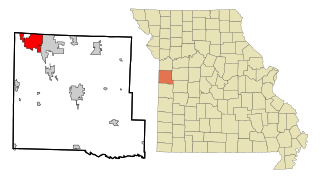
Gunn City is a village in Cass County, Missouri, United States. The population was 118 at the 2010 census. It is part of the Kansas City metropolitan area.

<span class="mw-page-title-main">Waco, Missouri</span> City in Missouri, United States

Waco is a city in Jasper County, Missouri, United States. The population was 72 at the 2020 census. It is part of the Joplin, Missouri Metropolitan Statistical Area.

<span class="mw-page-title-main">Lebanon, Missouri</span> City in Missouri, United States

Lebanon is a city in and the county seat of Laclede County in Missouri. The population was 14,474 at the time of the 2010 census. It is the county seat of Laclede County. The Lebanon Micropolitan Statistical Area consists of Laclede County.

<span class="mw-page-title-main">Linneus, Missouri</span> City in Missouri, United States

Linneus is a small city in Linn County, Missouri, United States. The population was 281 at the 2020 census. It is the county seat of Linn County.

<span class="mw-page-title-main">Edgar Springs, Missouri</span> City in Missouri, United States

Edgar Springs is a city in Phelps County, Missouri, United States. The population was 208 at the 2010 census.

<span class="mw-page-title-main">Shelbyville, Missouri</span> City in Missouri, United States

Shelbyville is a city in Shelby County, Missouri, United States. The population was 518 at the 2020 census. It is the county seat of Shelby County.

<span class="mw-page-title-main">Cabool, Missouri</span> City in Missouri, United States

Cabool is a city in Texas County, Missouri, United States. The population was 1,946 at the 2020 census.

<span class="mw-page-title-main">Houston, Missouri</span> City in Missouri, United States

Houston is a city in Texas County, Missouri, United States. The population was 2,079 at the 2020 census. It is the county seat of Texas County.

<span class="mw-page-title-main">Moline Acres, Missouri</span> City in Missouri, United States

Moline Acres is a city in St. Louis County, Missouri, United States. The population was 2,442 at the 2010 census.

<span class="mw-page-title-main">Raymondville, Missouri</span> Town in Missouri, United States

Raymondville is a town in Texas County, Missouri, United States. The population was 345 at the 2020 census.

<span class="mw-page-title-main">Beechwood Trails, Ohio</span> Census-designated place in Ohio, United States

Beechwood Trails is a census-designated place (CDP) in Harrison Township, Licking County, Ohio, United States. The population was 3,276 at the 2020 census.

<span class="mw-page-title-main">Hanover, Ohio</span> Village in Ohio, United States

Hanover is a village in Licking County, Ohio, United States. The population was 1,270 at the 2020 census. The village lies along Ohio State Route 16.

<span class="mw-page-title-main">Hebron, Ohio</span> Village in Ohio, USA

Hebron is a village in Licking County, Ohio, United States. The population was 2,326 at the 2020 census.

<span class="mw-page-title-main">Johnstown, Ohio</span> City in Ohio, United States

Johnstown is a city in Licking County, Ohio, United States. The population was 5,278 at the 2022 census. The city is most notable for the Johnnies-Vikings rivalry and the finding of a nearly complete mastodon skeleton under the city.

<span class="mw-page-title-main">Pataskala, Ohio</span> City in Ohio, United States

Pataskala is a city in Licking County, Ohio, United States, approximately 19 miles (31 km) east of Columbus. The population was 17,886 at the 2020 census. Pataskala was a small community until 1996, when what was then the village of Pataskala merged with Lima Township, vastly increasing its population and geographic area.

<span class="mw-page-title-main">Summersville, Missouri</span> City in Missouri, United States

Summersville is a city in Shannon and Texas counties in the U.S. state of Missouri. The population was 453 at the 2020 census.

<span class="mw-page-title-main">Buckeye Lake, Ohio</span> Village in Ohio, United States

Buckeye Lake is a village in Fairfield and Licking counties in the U.S. state of Ohio. The population was 2,520 at the 2020 census. It is named for Buckeye Lake, a large lake along which the village is built.

<span class="mw-page-title-main">Utica, Ohio</span> Village in Ohio, United States

Utica is a village in Knox and Licking counties in the U.S. state of Ohio, along the North Fork of the Licking River. The population was 2,064 at the 2020 census.

References

  1. 1 2 3 U.S. Geological Survey Geographic Names Information System: Licking, Missouri
  2. "ArcGIS REST Services Directory". United States Census Bureau. Retrieved August 28, 2022.
  3. 1 2 "U.S. Census website". United States Census Bureau . Retrieved January 31, 2008.
  4. Missouri Atlas & Gazetteer, DeLorme, 1998, First edition, p. 54, ISBN   0-89933-224-2
  5. "US Gazetteer files 2010". United States Census Bureau. Archived from the original on January 12, 2012. Retrieved July 8, 2012.
  6. "NowData – NOAA Online Weather Data". National Oceanic and Atmospheric Administration. Retrieved August 2, 2021.
  7. "Station: Licking 4N, MO". U.S. Climate Normals 2020: U.S. Monthly Climate Normals (1991-2020). National Oceanic and Atmospheric Administration. Retrieved August 2, 2021.
  8. Moyer, Armond; Moyer, Winifred (1958). The origins of unusual place-names. Keystone Pub. Associates. p. 74.
  9. Eaton, David Wolfe (1918). How Missouri Counties, Towns and Streams Were Named. The State Historical Society of Missouri. p. 368.
  10. "Exponential growth pushes the Amish into new places like Licking, Mo". St. Louis Post-Dispatch. October 8, 2017.
  11. "Census of Population and Housing". Census.gov. Retrieved June 4, 2015.
  12. "U.S. Census website". United States Census Bureau . Retrieved July 8, 2012.
  13. "Licking R-Viii School District". Greatschools. Retrieved March 18, 2018.
  14. "Branches". Texas County Library. Retrieved March 18, 2018.