Maples is an unincorporated community in northeastern Texas County, Missouri, United States. It is located approximately seven miles northeast of Licking on Missouri Route C.
Success is an unincorporated community in Texas County, Missouri, United States. It is located approximately twelve miles northwest of Houston at the southern intersection of Routes 17 and 32.
Ellis Prairie is an unincorporated community in Texas County, Missouri, United States. It is located on Missouri Route AA, 7.5 miles northwest of Houston and 2.5 miles east of Mitchells Corner and Missouri Route 17.
Bucyrus is an unincorporated community in central Texas County, Missouri, United States. It is located on Route 17, approximately three miles northwest of Houston. The ZIP Code for Bucyrus is 65444.

Upton is an unincorporated community in western Texas County, Missouri, United States. The community is located on a ridge top approximately one mile east of the West Fork Roubidoux Creek. It is located about ten miles west of Houston on Missouri Route FF.
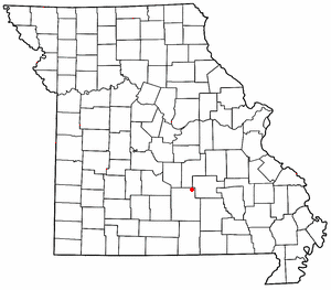
Clara is an unincorporated community in central Texas County, Missouri, United States. The community is located on a hilltop, approximately one-half mile northwest of the Big Piney River. It is about three miles southwest of Houston on Missouri Route Z.
Simmons is a community in Texas County, in the U.S. state of Missouri. The community is located at the intersection of US Route 63 and Missouri Route Z, approximately seven miles south of Houston. The Big Piney River flows past the east side of the community.
Bado is an unincorporated community in southwest Texas County, in the U.S. state of Missouri. Bado is located on Missouri Route M, along the banks of Little Piney Creek. The community is approximately nine miles west-southwest of Houston and nine miles north of Cabool. The store, post office, a rock house and White House are still standing.
Big Creek is an unincorporated community in Texas County, in the U.S. state of Missouri. The community was located along Big Creek, approximately 2.5 miles south of Yukon and one-half mile east of Missouri Route 137. The Big Creek school was south of the creek and the Big Creek church was about one-half mile north along a county road.
Clear Springs is an unincorporated community in southern Texas County, in the U.S. state of Missouri. The community is located on Missouri Route Y, one mile east of Missouri Route 137. The spring is on the South Prong Jacks Fork, 1.5 miles south of the community site.
Dykes is an unincorporated community in southwest Texas County, in the U.S. state of Missouri. Dykes is located on Missouri Route 38, seven miles west of Houston.
Evening Shade is an unincorporated community in northwest Texas County, in the U.S. state of Missouri.
Hattie is an extinct town in southeast Texas County, in the U.S. state of Missouri. The GNIS classifies it as a populated place. The community is on the South Prong Jacks Fork, south of Missouri Route Y, and two miles north of the county line.
Kinderpost is an unincorporated community in northern Texas County, in the U.S. state of Missouri. The community is located on Missouri Route AT approximately 6.5 miles northwest of Licking. Spring Creek flows past to the east of the community.
Mahan is an unincorporated community in Texas County, in the U.S. state of Missouri. The community was located on Missouri Route 137 and Missouri Route V, approximately one mile south of Oscar and four miles north of Raymondville. It is at an elevation of 1,309 ft (399 m). The Mahan Cemetery lies about one mile east on Route V.
Oscar is an unincorporated community within Jackson Township in Texas County, in the U.S. state of Missouri. The community is located on Missouri Route 137, approximately 5.5 miles south of Licking.
Samoa is an unincorporated community in Texas County, in the U.S. state of Missouri.
Vada is an unincorporated community in northern Texas County, in the U.S. state of Missouri. The community is located on Missouri Route 32, approximately three miles northeast of Success.
Varvol is an unincorporated community in southern Texas County, in the U.S. state of Missouri. The community is on the South Prong of Jacks Fork at the intersection of Missouri Route HH and Varvel Road. The community of Sargent is approximately 3.5 miles to the west on Varvel Road and Willow Springs in adjacent Howell County is about seven miles south on route HH and Missouri Route 137. Varvel School was about three miles east along the north bank of the river.
Venable is an unincorporated community in northwest Texas County, in the U.S. state of Missouri.

