U.S. Route 63 in Missouri

Last updated

US 63.svg

U.S. Route 63

U.S. Route 63 in Missouri
US 63 highlighted in red
Route information
Maintained by MoDOT
Length337.748 mi [1]  (543.553 km)
Existed1926–present
Major junctions
South endUS 63 (AR).svg US 63 at the Arkansas state line
Major intersections
North endUS 63.svg US 63 at the Iowa state line
Location
Country United States
State Missouri
Counties Oregon, Howell, Texas, Phelps, Maries, Osage, Cole, Callaway, Boone, Randolph, Macon, Adair, Schuyler
Highway system
US 62.svg US 62 I-64.svg I-64

U.S. Route 63 (US 63) is the portion of a north-south highway that runs through the U.S. state of Missouri from the Arkansas state line near Thayer to the Iowa state line near Lancaster.

Contents

Route description

Senator Roy Blunt Bridge Jefferson-city-bridge.jpg
Senator Roy Blunt Bridge

The highway passes south-to-north through Missouri, from Arkansas to Iowa, serving cities such as Rolla, Jefferson City, Columbia, Moberly, Macon, and Kirksville. Notable routes that are intersected include U.S. Route 160 and U.S. Route 60 in Howell County, Interstate 44 at Rolla, U.S. Route 50 (which it shares a concurrency with into Jefferson City south of the Missouri River until it reaches the junction with U.S. 54), US Route 54 (which it overlaps in Jefferson City from the junction with U.S. Route 50 and crosses the Missouri River with on the Senator Roy Blunt Bridge), Interstate 70 at Columbia, U.S. Route 24 at Moberly, U.S. Route 36 at Macon, and U.S. Route 136 at Lancaster.

Stonehenge next to U.S. Route 63 Umr stonehenge.jpg
Stonehenge next to U.S. Route 63

The road enters the state (passing the Oregon County line) at Thayer. Immediately after leaving Thayer, U.S. 63 intersects Route 19, then continues into Howell County on a two-lane highway with alternating passing lanes, then the highway enters West Plains. The highway then widens to a four-lane divided highway, bypassing West Plains to the south and west, intersecting U.S. Route 160 then continues on a divided highway to Willow Springs. The route then joins US Route 60, and the two highways run concurrently northwest to Cabool.

US 63 south of Vienna US 63 North.jpg
US 63 south of Vienna

North of Cabool, the highway returns to two-lane status (with alternating passing lanes), passing through Houston and intersecting Route 32 in Licking. The highway then enters Phelps County and passes through Rolla, the home of Missouri University of Science and Technology, and becomes locally known as Bishop Avenue. In Rolla, Route 63 intersects Route 72, and later, Business Loop 44. The Business Loop runs concurrently with Route 63 past the University's campus to Interstate 44, where the Business Loop ends. As it leaves Rolla, the highway quickly narrows to two lanes. US 63 between Rolla and US 50 is being studied for improvements. [2] It crosses into Maries County toward Vienna, intersecting Highway 42. After entering Osage County, Route 63 passes through Freeburg and Westphalia. A few miles north of Westphalia, Highway 63 widens to a four-lane divided highway, and almost immediately intersects US Route 50, and the two highways' head west toward Jefferson City, the state capital. After passing through downtown on the Whitton Expressway, the route leaves Route 50, joining the eastbound direction of US Route 54 to cross the Missouri River into Callaway County.

After crossing the river, Route 63 exits Route 54, and heads north on a four-lane divided highway. About five miles north of US 54, the highway enters Boone County, then after five miles more, leaves the Ozark Plateau and enters the Columbia metropolitan area. Highway 63 passes through the eastern edge of Ashland then passes along the eastern edge of Columbia, but gains freeway status for about 10 miles (16 km) through town. In the north part of town, Route 63 intersects Interstate 70. There is no direct connection between Route 63 and I-70; access to and from the Interstate is via an at-grade connector road, which intersects I-70 at a simple Diamond interchange. The route then leaves Columbia, returning to expressway status, and intersects Route 22 near Clark, right on the Boone-Randolph county line. After passing by Clark proper, U.S. 63 gains a Business Route, which passes through the otherwise-bypassed town of Renick, then passes through the city of Moberly. Mainline Route 63, meanwhile, upgrades to a freeway for about four miles as it passes through Moberly, intersecting US Route 24 at an interchange on the northern end of town.

Heading north, U.S. 63 leaves the Columbia metropolitan area and enters Macon County just north of Jacksonville, and heads toward the city of Macon. Through town, the highway narrows to a two-lane city street, with a center left-turn lane. Near the northern edge of town, US 63 intersects US Route 36, which is part of the Chicago-Kansas City Expressway. Leaving Macon, the highway re-gains expressway status, and passes by La Plata before crossing into Adair County. South of Kirksville, the route interchanges with a Business Route, which passes through the city proper, while mainline Route 63 narrows to two lanes and enters a newly-constructed bypass to the east of town. While on the bypass, the highway intersects Route 6 and Missouri Route 11, and the two east-west state routes form a three-mile long Wrong-way concurrency with each other following US 63. Leaving the Kirksville bypass, US 63 returns to a two-lane surface highway, and enters Schuyler County. Near Lancaster, the highway intersects US Route 136, which briefly overlaps with Route 63 into Lancaster itself. There, Route 136 turns east, while Route 63 continues north into Iowa, exiting Missouri about five miles north of Lancaster.

History

U.S. 63 in Missouri was Route 7 from 1922 to 1926.

Junction list

All exits are unnumbered.

CountyLocationmi [1] kmDestinationsNotes
Oregon 0.0000.000South plate.svg
US 63 (AR).svg
US 63 south Mammoth Spring
Continuation into Arkansas
Thayer 1.2021.934MO-142.svgBusiness plate.svg
US 63.svg
Route 142  / US 63 Bus.  Lanton
Southern terminus of Route 142 concurrency. Access to Grand Gulf State Park.
1.8232.934East plate.svg
MO-142.svg
Route 142 east Doniphan
Northern terminus of Route 142 concurrency
3.2295.197MO-19.svgBusiness plate.svg
US 63.svg
Route 19  / US 63 Bus.  Alton, Thayer
Access to Grand Gulf State Park and Business District.
4.5147.265MO-supp-OO.svg Route OO
Koshkonong 10.30116.578MO-supp-F.svg Route FAccess to Cover Prairie Conservation Area
11.06417.806MO-supp-Z.svg Route ZAccess to Warm Fork Conservation Area
11.58618.646MO-supp-M.svg Route M Rover
Howell 22.17335.684MO-supp-PP.svg Route PPAccess to Cover Prairie Conservation Area
West Plains 24.43239.319MO-supp-ZZ.svg Route ZZ
24.91040.089Business plate.svg
US 63.svg
US 63 Bus. (Bill Virdon Blvd.) West Plains
25.99441.833MO-17.svg Route 17  Lanton Southern terminus of Route 17 concurrency
27.21943.805West plate.svg
US 160.svg
US 160 west Gainesville
Southern terminus of US 160 concurrency. Access to Bull Shoals Lake and Norfork Lake.
27.88044.869MO-supp-K.svg Route K Pottersville
29.04846.748US 160.svgMO-17.svgMO-supp-CC.svgHospital sign.svg US 160  / Route 17  / Route CC Hammond Camp Northern terminus of US 160 / Route 17 concurrency. Access to Ozarks Medical Center.
29.85048.039Business plate.svg
US 63.svg
US 63 Bus.  West Plains
Interchange
33.15453.356MO-14.svg Route 14  Ava
Pomona 38.36061.734MO-supp-N.svgMO-supp-P.svgAirport Sign.svg Route N / Route PAccess to West Plains Regional Airport
42.38068.204MO-supp-UU.svg Route UU Burnham
Willow Springs 45.51473.248East plate.svg
US 60.svg
US 60 east Mountain View, Poplar Bluff
Interchange; southern end of freeway; southern terminus of US 60 concurrency
46.43374.727Business plate.svg
US 60.svg
Business plate.svg
US 63.svg
US 60 Bus.  / US 63 Bus.  Willow Springs
48.50878.066West plate.svg
MO-76.svg
North plate.svg
MO-137.svg
Route 76 west / Route 137 north Willow Springs
50.73981.657Business plate.svg
US 60.svg
Business plate.svg
US 63.svg
US 60 Bus.  / US 63 Bus.  Willow Springs
Interchange; northern end of freeway. Access to Missouri State Highway Patrol Troop G Headquarters.
Texas Cabool 59.41095.611West plate.svg
US 60.svg
US 60 west Mountain Grove, Springfield
Northern terminus of US 60 concurrency; southern terminus of US 60 Bus. concurrency
60.95398.094Business plate.svg
US 60.svg
US 60 Bus.
Northern terminus of US 60 Bus. concurrency. Access to Business District.
62.10799.952MO-supp-PP.svg Route PP
66.078106.342MO-supp-H.svg Route H Elk Creek
Simmons 69.933112.546MO-supp-Z.svg Route Z
71.152114.508MO-supp-UU.svg Route UU Solo
Houston 76.940123.823MO-17.svgHospital sign.svg Route 17  Summersville Southern terminus of Route 17 concurrency; access to Texas County Memorial Hospital and Ozark National Scenic Riverways.
77.141124.146MO-17.svg Route 17  Success, Fort Leonard Wood Northern terminus of Route 17 concurrency
77.888125.349MO-supp-B.svgMO-supp-F.svg Route B / Route F Raymondville
80.557129.644MO-supp-E.svg Route E
88.093141.772MO-supp-P.svgTo plate.svg
MO-137.svg
To plate.svg
MO-supp-BB.svg
Route P to Route 137  / Route BB
Licking 91.392147.081MO-32.svgTo plate.svg
MO-137.svg
Route 32 to Route 137  Success, Salem
Access to South Central Correctional Center
Sherrill 97.289156.571MO-supp-CC.svg Route CC Sherrill, Maples Access to White River Trace Conservation Area
Phelps 100.465161.683MO-supp-K.svg Route K Beulah
Edgar Springs 105.142169.210MO-supp-H.svg Route H Lenox, Salem
105.969170.541MO-supp-M.svgMO-supp-FF.svg Route M / Route FF Flat, Edgar Springs
117.948189.819MO-supp-W.svg Route W
Rolla 124.465200.307MO-72.svg Route 72 (Ridgeway Road) Salem
124.860200.943Business Loop 44.svg I-44 BL (Kingshighway)Southern terminus of BL I-44 concurrency
125.093201.318MO-supp-BB.svg Route BB (10th Street) Saint James
125.345201.723MO-supp-E.svgTo plate blue.svg
I-44.svg
Route E (University Drive) to I-44  Gasconade River
Access to Missouri University of Science and Technology
126.161203.036I-44.svg I-44  Springfield, Saint Louis I-44 exit 186; Eastern terminus of BL I-44
Maries 134.218216.003MO-supp-P.svgTo plate.svg
MO-68.svg
Route P to Route 68
Vichy 137.315220.987MO-68.svg Route 68  Saint James
138.081222.220MO-supp-FF.svg Route FF
138.587223.034MO-28.svgAirport Sign.svg Route 28  Belle Southern terminus of Route 28 concurrency. Access to Rolla National Airport
142.879229.941MO-supp-A.svg Route A
147.596237.533MO-28.svg Route 28  Dixon, Fort Leonard Wood Northern terminus of Route 28 concurrency
147.975238.143Spur plate.svg
MO-28.svg
To plate.svg
West plate.svg
MO-28.svg
Route 28 Spur to Route 28 west Dixon, Fort Leonard Wood
Vienna 150.246241.797MO-42.svg Route 42  Iberia, Belle, Lake of the Ozarks
151.122243.207MO-supp-AA.svg Route AA Argyle
Osage Freeburg 160.516258.325MO-supp-P.svg Route P Koeltztown
166.109267.327MO-supp-E.svg Route E Rich Fountain
168.790271.641MO-supp-T.svg Route T Koeltztown
Westphalia 172.454277.538MO-133.svg Route 133  Meta
175.420–
175.625
282.311–
282.641
East plate.svg
US 50.svg
US 50 east Saint Louis
Southern terminus of US 50 concurrency
Cole Schubert 178.755287.678MO-supp-M.svgMO-supp-J.svg Route M / Route J Taos, Osage City Access to Clark's Hill/Norton State Historic Site
Jefferson City 180.576290.609Militia DriveAccess to the Missouri National Guard Armory and the Missouri Military Museum
183.088294.652McCarty Street
184.721297.280Eastland Drive
185.875299.137Clark AvenueAccess to Missouri State Highway Patrol General Headquarters
186.367299.929Lafayette StreetAccess to Lincoln University
187.388301.572West plate.svg
Business plate.svg
US 50.svg
To plate.svg
West plate.svg
US 54.svg
US 50 Bus. west (Missouri Boulevard) to US 54 west Lake of the Ozarks
At-grade intersection; eastern end of freeway; eastern terminus of US 50 Bus.
187.476–
187.749
301.713–
302.153
West plate.svg
US 54.svg
West plate.svg
US 50.svg
US 54 west / US 50 west Eldon, Lake of the Ozarks, Sedalia
Northern terminus of US 50 concurrency; southern terminus of US 54 concurrency
Missouri River 187.952–
188.081
302.479–
302.687
Senator Roy Blunt Bridge
Callaway Jefferson City 188.713303.704MO-supp-W.svgAirport Sign.svg Route WAccess to Jefferson City Memorial Airport
189.176–
189.493
304.449–
304.959
East plate.svg
US 54.svg
MO-94.svg US 54 east / Route 94  Fulton, Mokane, Jefferson City
Northern terminus of US 54 concurrency
Boone 200.701322.997MO-supp-A.svg Route A Hartsburg
Ashland 203.706327.833MO-supp-M.svgMO-supp-Y.svg Route M / Route Y Ashland, Guthrie Interchange
Elkhurst 207.716334.286MO-163.svgMO-supp-H.svgAirport Sign.svg Route 163  / Route HInterchange; access to Columbia Regional Airport and Rock Bridge Memorial State Park
Columbia 212.874342.587Discovery ParkwayInterchange; southern end of freeway; access to Missouri Department of Conservation Central Regional Office and Resource Science Center
214.168344.670MO-supp-AC.svg Route AC (Grindstone Parkway) / East New Haven Road
215.486346.791Hospital sign.svgMO-740.svg Route 740 (Stadium Boulevard)Access to the University of Missouri, University Hospital, and Harry S. Truman Memorial Veterans' Hospital
216.486348.400MO-supp-WW.svgHospital sign.svg Route WW / Broadway StreetAccess to Downtown Columbia, Boone Hospital Center, University of Missouri Women's and Children's Hospital, and Little Dixie Lake Conservation Area
217.022–
218.352
349.263–
351.403
I-70.svgUS 40.svgMO-supp-PP.svg I-70  / US 40  / Route PP Kansas City, Saint Louis I-70 exit 128
218.836352.182Vandiver Drive / Bass Pro Drive
219.745353.645MO-supp-B.svg Route B Hallsville, Centralia
220.214354.400Brown School Road / Oakland Gravel Road
221.958357.207Prathersville Road
Prathersville 223.245359.278South plate.svg
MO-763.svg
Route 763 south Columbia
Interchange; northern end of freeway; southbound exit and northbound entrance
229.814369.850East plate.svg
MO-124.svg
Route 124 east Hallsville
Southern terminus of Route 124 concurrency
230.645371.187West plate.svg
MO-124.svg
Route 124 west Harrisburg
Northern terminus of Route 124 concurrency
235.038378.257MO-supp-NN.svg Route NN
237.090381.559MO-supp-CC.svg Route CC Sturgeon
BooneRandolph
county line
Sturgeon 238.559383.923MO-22.svgMO-supp-F.svg Route 22  / Route F Centralia, Sturgeon Interchange
Randolph Clark 241.224388.212MO-supp-B.svgMO-supp-P.svg Route B / Route P Higbee, Clark
246.386396.520Business plate.svg
US 63.svg
MO-supp-NN.svg US 63 Bus.  / Route NN Renick, Moberly
Moberly 250.225402.698MO-supp-M.svg Route M Moberly, Middle Grove Interchange
251.825405.273MO-supp-EE.svgHospital sign.svg Route EE (Rollins Street)Interchange; access to Moberly Regional Medical Center, Downtown Moberly, and Moberly Area Community College
253.861408.550US 24.svgHospital sign.svg US 24  Moberly Interchange; access to Moberly Regional Medical Center
254.863410.162Business plate.svg
US 63.svg
Airport Sign.svg US 63 Bus. (Morley Street)
Interchange; access to Omar N Bradley Airport - MBY
Cairo 258.674416.295MO-supp-K.svgMO-supp-Z.svg Route K / Route Z
Jacksonville 264.109425.042MO-supp-J.svg Route J Duncans Bridge
Macon Excello 267.828431.027MO-supp-T.svgMO-supp-Y.svg Route T / Route Y College Mound
Macon 273.817440.666MO-supp-PP.svgAirport Sign.svg Route PPAccess to Macon-Fowler International Airport
275.902444.021Business plate.svg
US 36.svg
Hospital sign.svg US 36 Bus.
Access to Samaritan Hospital
276.045–
276.057
444.251–
444.271
I-72 (Future).svgUS 36.svgChicago-Kansas City Expressway plate.svg
MO-110.svg
Future I-72  / US 36  / Route 110 (CKC)  Saint Joseph, Hannibal
Interchange
279.643450.042MO-supp-DD.svg Route DD Ten Mile
Atlanta 285.319459.176MO-supp-M.svg Route M Economy
287.842463.237MO-supp-J.svg Route J Elmer
292.375470.532MO-supp-NN.svg Route NN
La Plata 295.028474.802MO-156.svg Route 156  South Gifford, Novelty
Adair 298.319480.098MO-supp-E.svg Route E Wilson
Millard 302.056486.112MO-supp-KK.svgAirport Sign.svg Route KKAccess to Kirksville Regional Airport
Kirksville 304.438–
304.933
489.945–
490.742
North plate.svg
Business plate.svg
US 63.svg
US 63 Bus. north (South Baltimore Street)
Interchange; northbound exit and southbound entrance
307.140494.294MO-6.svgMO-11.svg Route 6  / Route 11  Edina, Brookfield Southern terminus of Route 6 / Route 11 concurrency
309.136497.506MO-6.svgMO-11.svg Route 6  / Route 11  Milan, Baring Northern terminus of Route 6 / Route 11 concurrency
312.432502.811South plate.svg
Business plate.svg
US 63.svg
US 63 Bus. south (North Baltimore Street)
Interchange
314.788506.602MO-supp-T.svg Route T Sperry
318.981513.350MO-supp-A.svg Route A Downing
Schuyler Greentop 320.179515.278MO-supp-K.svg Route K
Queen City 324.035521.484MO-supp-E.svgMO-supp-W.svg Route E / Route W Worthington
325.112523.217MO-supp-O.svg Route O
327.583527.194MO-supp-P.svgMO-supp-U.svg Route P / Route U Lancaster
330.468531.837US 136.svg US 136  Unionville Southern terminus of US 136 concurrency
Lancaster 332.587535.247US 136.svgMO-202.svg US 136  / Route 202  Glenwood, Keokuk Northern terminus of US 136 concurrency
337.748543.553North plate.svg
US 63.svg
US 63 north Bloomfield
Continuation into Iowa
1.000 mi = 1.609 km; 1.000 km = 0.621 mi

Related Research Articles

<span class="mw-page-title-main">Interstate 44</span> Interstate Highway mostly in Oklahoma and Missouri

Interstate 44 (I-44) is a major Interstate Highway in the central United States. Although it is nominally an east–west road as it is even-numbered, it follows a more southwest–northeast alignment. Its western terminus is in Wichita Falls, Texas, at a concurrency with U.S. Route 277 (US 277), US 281, and US 287; its eastern terminus is at I-70 in St. Louis, Missouri. I-44 is one of five Interstates built to bypass US 66; this highway covers the section between Oklahoma City and St. Louis. Virtually the entire length of I-44 east of Springfield, Missouri, was once US 66, which was upgraded from two to four lanes from 1949 to 1955. The section of I-44 west of Springfield was built farther south than US 66 in order to connect Missouri's section with the already completed Will Rogers Turnpike, which Oklahoma wished to carry their part of I-44.

<span class="mw-page-title-main">U.S. Route 412</span> Highway in the United States

U.S. Route 412 is an east–west United States highway, first commissioned in 1982. U.S. 412 overlaps expressway-grade Cimarron Turnpike from Tulsa west to Interstate 35 and the Cherokee Turnpike from 5 miles (8.0 km) east of Chouteau, Oklahoma, to 8 miles (13 km) west of the Arkansas state line. It runs the entire length of the Oklahoma Panhandle and traverses the Missouri Bootheel. Despite its numbering it is not associated with U.S. Route 12.

<span class="mw-page-title-main">U.S. Route 281</span> Highway in the United States

U.S. Route 281 (US 281) is a north–south United States Numbered Highway. At 1,875 miles (3,018 km) it is the longest continuous three-digit U.S. Route.

<span class="mw-page-title-main">U.S. Route 41</span> Highway in the United States

U.S. Route 41, also U.S. Highway 41 (US 41), is a major north–south United States Numbered Highway that runs from Miami, Florida, to the Upper Peninsula of Michigan. Until 1949, the part in southern Florida, from Naples to Miami, was US 94. The highway's southern terminus is in the Brickell neighborhood of Downtown Miami at an intersection with Brickell Avenue (US 1), and its northern terminus is east of Copper Harbor, Michigan, at a modest cul-de-sac near Fort Wilkins Historic State Park at the tip of the Keweenaw Peninsula. US 41 closely parallels Interstate 75 (I-75) from Naples, Florida, all the way through Georgia to Chattanooga, Tennessee.

<span class="mw-page-title-main">U.S. Route 71</span> US highway that goes from Ontario, Canada to Louisiana, United States

U.S. Route 71 or U.S. Highway 71 is a major north–south United States highway that extends for over 1500 miles (2500 km) in the central United States. This original 1926 route has remained largely unchanged by encroaching Interstate highways. Currently, the highway's northern terminus is in International Falls, Minnesota at the Canada–US border, at the southern end of the Fort Frances-International Falls International Bridge to Fort Frances, Ontario. U.S. Route 53 also ends here. On the other side of the bridge, Trans-Canada Highway is an east–west route while Ontario Highway 71 is a north–south route. US 71's southern terminus is between Port Barre and Krotz Springs, Louisiana at an intersection with U.S. Route 190. For the entirety south of Kansas City, Missouri, US 71 runs parallel and concurrent with the existing and future Interstate 49. North of Kansas City, US 71 runs halfway between Interstate 29 and Interstate 35, which they split in the city at an interchange with Interstate 70.

<span class="mw-page-title-main">U.S. Route 23</span> Highway in the United States

U.S. Route 23 or U.S. Highway 23 (US 23) is a major north–south United States Numbered Highway between Jacksonville, Florida, and Mackinaw City, Michigan. It is an original 1926 route which originally reached only as far south as Portsmouth, Ohio, and has since been extended. It was formerly part of the major highway known as the Dixie Highway. The highway's southern terminus is in Jacksonville, Florida, at US 1/US 17. The northern terminus is at Interstate 75 (I-75) in Mackinaw City, Michigan.

<span class="mw-page-title-main">U.S. Route 34</span> Highway in the United States

U.S. Route 34 (US 34) is an east–west United States highway that runs for 1,122 miles (1,806 km) from north-central Colorado to the western suburbs of Chicago. Through Rocky Mountain National Park it is known as the Trail Ridge Road where it reaches elevation 12,183 feet (3,713 m), making it the third highest paved through highway in the United States. The highway's western terminus is Granby, Colorado at US 40. Its eastern terminus is in Berwyn, Illinois at Illinois Route 43 and Historic US 66.

<span class="mw-page-title-main">U.S. Route 54</span> Highway in the United States

U.S. Route 54 is an east–west United States Highway that runs northeast–southwest for 1,197 miles (1,926 km) from El Paso, Texas, to Griggsville, Illinois. The Union Pacific Railroad's Tucumcari Line runs parallel to US 54 from El Paso to Pratt, Kansas, which comprises about two-thirds of the route.

<span class="mw-page-title-main">U.S. Route 63</span> Highway in the United States

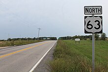
U.S. Route 63 (US 63) is a 1,286-mile (2,070 km), north–south United States Highway primarily in the Midwestern and Southern United States. The southern terminus of the route is at Interstate 20 (I-20) in Ruston, Louisiana; the northern terminus is at US 2 eight miles (13 km) west of Ashland, Wisconsin.

<span class="mw-page-title-main">Missouri Route 5</span> State highway in Missouri

Missouri Route 5 is the longest state highway in Missouri and the only Missouri state highway to traverse the entire state. It is part of a three state, 650 mile highway 5. To the north, it continues into Iowa as Iowa Highway 5 and to the south it enters Arkansas as Arkansas Highway 5. With only a few exceptions, it is two-lane for its entire length. Business Route 5 serves Milan and Ava. There is Business Route 5 in Camdenton.

<span class="mw-page-title-main">Kentucky Route 55</span> Highway in Kentucky

Kentucky Route 55 is a 140.858-mile-long (226.689 km) state highway in the U.S. Commonwealth of Kentucky.

<span class="mw-page-title-main">U.S. Route 60 in Kentucky</span> Highway in Kentucky

U.S. Route 60 (US 60) is a major U.S. Highway in the American state of Kentucky. In the early days of the U.S. Highway System, US 60 was originally to be numbered as US 62. Following extensive lobbying and complaints filed by Kentucky governor William J. Fields to the American Association of State Highway Officials, the route was re-designated as US 60 before the system was finalized. In Kentucky, US 60 parallels the Ohio River. US 60 enters Kentucky from Cairo, Illinois, traveling northeast to Louisville, then takes a direct eastward route to rejoin the Ohio River in downtown Ashland, Kentucky. Both US 60 and US 23 run concurrently from Ashland to Catlettsburg where US 60 turns east and enters Kenova, West Virginia. US 60 is the longest route in Kentucky, running 495 miles (797 km) across the width of the state, passing through 22 of Kentucky's counties and through the cities of Paducah, Henderson, Owensboro, Louisville, the state capital of Frankfort, and Lexington.

<span class="mw-page-title-main">Pennsylvania Route 51</span> State highway in Pennsylvania

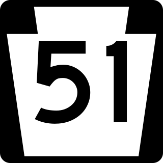
Pennsylvania Route 51 is a major state highway that is located in Western Pennsylvania in the United States. It runs for 89 miles (143 km) from Uniontown to the Ohio state line near Darlington, where it connects with Ohio State Route 14.

<span class="mw-page-title-main">Georgia State Route 49</span> State highway in Georgia, United States

State Route 49 (SR 49) is a 122.8-mile-long (197.6 km) state highway that travels southwest-to-northeast through portions of Terrell, Sumter, Macon, Peach, Houston, Bibb, Jones, and Baldwin counties, mainly in the central part of the U.S. state of Georgia. The highway connects SR 45 north of Dawson to SR 22/SR 24 in Milledgeville.

<span class="mw-page-title-main">U.S. Route 50 in Colorado</span> Section of U.S. Highway in Colorado, United States

U.S. Route 50 (US 50) is a part of the U.S. Highway System that travels from West Sacramento, California, to Ocean City, Maryland. In the U.S. state of Colorado, US 50 is a major highway crossing through the lower midsection of the state. It connects the Western Slope with the lower Front Range and the Arkansas Valley. The highway serves the areas of Pueblo and Grand Junction as well as many other smaller areas along its corridor. The long-term project to widen the highway from two lanes to a four lane expressway between Grand Junction and Montrose was completed in January 2005. Only about 25% of the remainder of highway 50 in Colorado is four lane expressway.

<span class="mw-page-title-main">U.S. Route 50 in Missouri</span>

U.S. Route 50 (US 50) is a major east–west route in the state of Missouri. It is also known as the Rex M. Whitton Expressway in the capital of Missouri, Jefferson City.

<span class="mw-page-title-main">Interstate 44 in Missouri</span> Highway in Missouri

Interstate 44 (I-44) in the US state of Missouri runs northeast from the Oklahoma state line near Joplin to I-70 in Downtown St. Louis. It runs for about 293 miles (472 km) in the state, and is the longest Interstate Highway in the state.

<span class="mw-page-title-main">Mid-Missouri</span> Central area of the U.S. state of Missouri

Mid-Missouri is a loosely-defined region comprising the central area of the U.S. state of Missouri. The region's largest city is Columbia ; the Missouri state capital, Jefferson City, and the University of Missouri are also located here. The region also includes portions of the Lake of the Ozarks, the Ozark Mountains, and the Missouri Rhineland. Mid-Missouri is centered on two contiguous metropolitan areas: the Columbia Metropolitan Area and the Jefferson City Metropolitan Area, which together have a population of over 400,000.

<span class="mw-page-title-main">U.S. Route 65 in Arkansas</span> US Highway section within the state of Arkansas

U.S. Highway 65 (US 65) runs north–south through southeastern and north central Arkansas for 309.52 miles (498.12 km). US 65 enters the state from Louisiana south of Eudora, running concurrently with the Great River Road. The route exits into Missouri northwest of Omaha. US 65 runs through the major cities of Pine Bluff and Little Rock.

<span class="mw-page-title-main">U.S. Route 60 in Missouri</span>

U.S. Route 60 (US 60) is a part of the United States Numbered Highway System that runs from Brenda, Arizona, east to Virginia Beach, Virginia. In the state of Missouri, US 60 is a main east–west highway that runs through the southern part of the state, from the Oklahoma border to the Illinois border.

References

  1. 1 2 Missouri Department of Transportation (August 16, 2017). MoDOT HPMAPS (Map). Missouri Department of Transportation. Retrieved August 16, 2017.
  2. "Route 63 Corridor Study - Osage, Maries, & Phelps Counties | Missouri Department of Transportation". www.modot.org. Retrieved 2022-11-30.
Template:Attached KML/U.S. Route 63 in Missouri
KML is not from Wikidata
US 63.svg U.S. Route 63
Previous state:
Arkansas
Missouri Next state:
Iowa