Elizabethtown, New York

Last updated

Elizabethtown, New York
Hand House, Elizabethtown, New York.jpg
Hand House, on the National Register of Historic Places
Motto: 
"Eastern Gateway to the Adirondack Mountains"
Essex County New York incorporated and unincorporated areas Elizabethtown highlighted.svg
Location in Essex County and the state of New York
Coordinates: 44°11′30″N73°35′38″W / 44.19167°N 73.59389°W / 44.19167; -73.59389
Country United States
State New York
County Essex
Government
  Type Town Council
   Town Supervisor Noel Merrihew (R)
   Town Council
Members' List
Area
[1]
  Total83.11 sq mi (215.25 km2)
  Land81.63 sq mi (211.43 km2)
  Water1.48 sq mi (3.82 km2)
Elevation
607 ft (185 m)
Population
 (2010)
  Total1,163
  Estimate 
(2016) [2]
1,127
  Density13.81/sq mi (5.33/km2)
Time zone UTC-5 (Eastern (EST))
  Summer (DST) UTC-4 (EDT)
ZIP code
12932
Area code 518
FIPS code 36-031-23833
GNIS feature ID0978930
Website etownny.com

Elizabethtown is a town in Essex County, New York, United States. The population was 1,163 at the 2010 census. [3] The county seat of Essex County [4] is the hamlet of Elizabethtown, located in the northern part of the town. The name is derived from Elizabeth Gilliland, the wife of an early settler.

Contents

Elizabethtown is in the east-central part of Essex County. It is 39 miles (63 km) southwest of Burlington, Vermont, 104 miles (167 km) south of Montreal, Quebec, and 117 miles (188 km) north of Albany. [5] The town calls itself the "Pleasant Valley".

History

Hubbard Hall, built in 1839, served as the town's hospital until 1966. It was destroyed by fire in 2011. Hubbard Hall, Elizabethtown, NY.jpg
Hubbard Hall, built in 1839, served as the town's hospital until 1966. It was destroyed by fire in 2011.

William Gilliland, an investor, bought up large tracts of land in Essex County. The town was first settled around 1792 near New Russia.

The town of Elizabethtown was established in 1798 from the town of Crown Point. The community of Elizabethtown in this town became the county seat, succeeding a location in the town of Essex. Parts of the town were used to form the towns of Moriah (1808), Keene (1898), and Westport (1815).

The lumber industry and processing iron ore were important in the beginning, but tourism became prominent by the end of the 19th century.

The Hand-Hale Historic District and Hubbard Hall are listed on the National Register of Historic Places. [6]

Geography

According to the United States Census Bureau, the town has a total area of 83.1 square miles (215.3 km2), of which 81.6 square miles (211.4 km2) is land and 1.5 square miles (3.8 km2), or 1.78%, is water. [3]

The Black River, a northward-flowing tributary of the Boquet River, marks part of the eastern town line.

Interstate 87, the Northway, is a major divided highway passing through the southeastern part of Elizabethtown. There are no exits within the town limits; the closest access is from Exit 32 (Stowersville Rd), just to the north in Lewis and from Exit 31 (NY 9N) just to the east in Westport. U.S. Route 9 is a north-south highway. New York State Route 9N is an east-west highway, which intersects U.S. Route 9 in downtown Elizabethtown. The town is also in the Adirondack High Peaks region, and is 18 miles (29 km) from Mount Marcy, the highest point in the state.

Demographics

Historical population
CensusPop.Note
1820 889
1830 1,01514.2%
1840 1,0614.5%
1850 1,63554.1%
1860 1,343−17.9%
1870 1,48810.8%
1880 1,363−8.4%
1890 1,3992.6%
1900 1,131−19.2%
1910 1,108−2.0%
1920 1,042−6.0%
1930 1,1136.8%
1940 1,1816.1%
1950 1,2082.3%
1960 1,3289.9%
1970 1,284−3.3%
1980 1,267−1.3%
1990 1,3143.7%
2000 1,3150.1%
2010 1,163−11.6%
2016 (est.)1,127 [2] −3.1%
U.S. Decennial Census [7]

As of the census [8] of 2000, there were 1,315 people, 497 households, and 318 families residing in the town. The population density was 16.1 people per square mile (6.2/km2). There were 794 housing units at an average density of 9.7 per square mile (3.8/km2). The racial makeup of the town was 97.49% White, 0.68% African American, 0.61% Asian, 0.08% Pacific Islander, 0.23% from other races, and 0.91% from two or more races. Hispanic or Latino of any race were 0.38% of the population.

There were 497 households, out of which 30.8% had children under the age of 18 living with them, 51.7% were married couples living together, 8.5% had a female householder with no husband present, and 36.0% were non-families. 31.4% of all households were made up of individuals, and 16.7% had someone living alone who was 65 years of age or older. The average household size was 2.32 and the average family size was 2.92.

In the town, the population was spread out, with 23.1% under the age of 18, 4.5% from 18 to 24, 22.1% from 25 to 44, 26.3% from 45 to 64, and 24.0% who were 65 years of age or older. The median age was 45 years. For every 100 females, there were 94.0 males. For every 100 females age 18 and over, there were 87.6 males.

The median income for a household in the town was $32,244, and the median income for a family was $44,531. Males had a median income of $28,295 versus $23,594 for females. The per capita income for the town was $17,059. About 9.1% of families and 15.7% of the population were below the poverty line, including 20.8% of those under age 18 and 10.4% of those age 65 or over.

Communities and locations in Elizabethtown

Notable people

United Church of Christ United Church of Christ, Elizabethtown, NY.jpg
United Church of Christ

Related Research Articles

<span class="mw-page-title-main">Essex County, New York</span> County in New York, United States

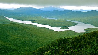
Essex County is a county in the U.S. state of New York. As of the 2020 census, the population was 37,381. Its county seat is the hamlet of Elizabethtown. Its name is from the English county of Essex. Essex is one of only 2 counties that are entirely within the Adirondack Park, the other being Hamilton County. The county is part of the North Country region of the state.

<span class="mw-page-title-main">AuSable, New York</span> Town in New York, United States

Au Sable, or Ausable, is a town in Clinton County, New York, United States. The population was 3,146 at the 2010 census. The name is from the Ausable River that flows through the town and means "of sand".

<span class="mw-page-title-main">Au Sable Forks, New York</span> Hamlet and census-designated place in New York, United States

Au Sable Forks is a hamlet in Clinton County and Essex County, New York, United States. The northern half of the community, within Clinton County, is listed as the Au Sable Forks census-designated place (CDP) and had a population of 559 at the 2010 census.

<span class="mw-page-title-main">Black Brook, New York</span> Town in New York, United States

Black Brook is a town in Clinton County, New York, United States. The population was 1,497 at the 2010 census. It is named after a stream that flows through the town.

<span class="mw-page-title-main">Chesterfield, New York</span> Town in New York, United States

Chesterfield is a town in Essex County, New York, United States. The population was 2,445 at the 2010 census. The name possibly is from a location in New England.

<span class="mw-page-title-main">Crown Point, New York</span> Town in New York, United States

Crown Point is a town in Essex County, New York, United States, located on the west shore of Lake Champlain. The population was 2,024 at the 2010 census. The name of the town is a direct translation of the original French name, Pointe à la Chevelure.

<span class="mw-page-title-main">Essex, New York</span> Town in New York, United States

Essex is a town in Essex County, New York, United States overlooking Lake Champlain. The population was 621 at the 2020 census. The town is named after locations in England.

<span class="mw-page-title-main">Jay, New York</span> Town in New York, United States

Jay is a town in Essex County, New York, United States. The population was 2,506 at the 2010 census. The town is named after John Jay, governor of New York when the town was formed.

<span class="mw-page-title-main">Keene, New York</span> Town in New York, United States

Keene is a town in central Essex County, New York, United States. It includes the hamlets of Keene, Keene Valley, and St. Huberts, with a total population of 1,144 as of the 2020 census

<span class="mw-page-title-main">Lewis, Essex County, New York</span> Town in Essex County, New York, US

Lewis is a town in Essex County, New York, United States. The population was 1,382 at the 2010 census. The town is named after Morgan Lewis, the governor of New York at the time the town was established.

<span class="mw-page-title-main">Moriah, New York</span> Town in New York, United States

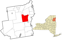
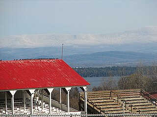
Moriah is a town in Essex County, New York, United States. Lying within the Adirondack Park, it is situated in the eastern part of the county, 47 miles (76 km) by road south-southwest of Burlington, Vermont, 55 miles (89 km) south of Plattsburgh, 115 miles (185 km) north of Albany, and 116 miles (187 km) south of Montreal, Quebec. The population was 4,798 at the 2010 census.

<span class="mw-page-title-main">North Hudson, New York</span> Town in New York, United States

North Hudson is a town in Essex County, New York, United States. The population was 240 at the 2010 census. The town derives its name by being near the northern end of the Hudson River.

<span class="mw-page-title-main">Port Henry, New York</span> Hamlet and CDP in New York, United States

Port Henry is a hamlet in Essex County, New York, United States. The population was 1,194 at the 2010 census.

<span class="mw-page-title-main">Ticonderoga, New York</span> Town in New York, United States

Ticonderoga is a town in Essex County, New York, United States. The population was 5,042 at the 2010 census. The name comes from the Mohawk tekontaró:ken, meaning "it is at the junction of two waterways".

<span class="mw-page-title-main">Westport, New York</span> Town in New York, United States

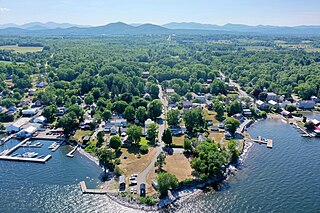
Westport is a town in Essex County, New York, United States overlooking Lake Champlain. The population was 1,312 at the 2010 census.

<span class="mw-page-title-main">Willsboro, New York</span> Town in New York, United States

Willsboro is a town in Essex County, New York, United States, and lies 30 miles (48 km) south of the city of Plattsburgh. As of the 2020 census, the town's population was 1,905. The town is named after early landowner William Gilliland.

<span class="mw-page-title-main">Lake Luzerne, New York</span> Town in New York, United States

Lake Luzerne, formerly the Town of Fairfield and then Luzerne, is a town in southern Warren County, New York, United States. The town is located within the Adirondack Park. The town is part of the Glens Falls Metropolitan Statistical Area. Lake Luzerne is west of the city of Glens Falls. The town population was 3,079 at the 2020 census.

<span class="mw-page-title-main">Keeseville, New York</span> Hamlet and CDP in New York, United States

Keeseville is a hamlet in Clinton and Essex counties, New York, United States. The population was 1,815 at the 2010 census. The hamlet was named after the Keese family, early settlers from Vermont. It developed along the Ausable River, which provided water power for mills and industrial development.

<span class="mw-page-title-main">Ticonderoga (CDP), New York</span> Census-designated place in New York, United States

Ticonderoga is a hamlet in the southeast part of the town of Ticonderoga, in Essex County, New York, United States. The name is derived from the Haudenosaunee term for "between the two waters", the two waters being Lake George and Lake Champlain. The hamlet became a census-designated place (CDP) in 2008. As of the 2010 census, the population was 3,382, out of a total 5,042 residents in the town of Ticonderoga.

<span class="mw-page-title-main">Elizabethtown (CDP), New York</span> Census-designated place in New York, United States

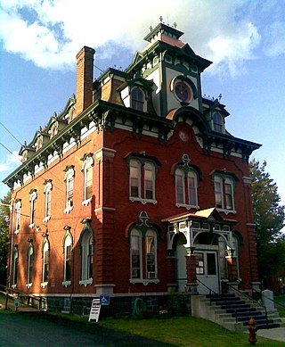
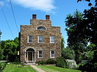
Elizabethtown is a hamlet and census-designated place (CDP) in the town of Elizabethtown in Essex County, New York, United States. The population of the CDP was 754 at the 2010 census, out of a total town population of 1,163.

References

  1. "2016 U.S. Gazetteer Files". United States Census Bureau. Archived from the original on August 24, 2017. Retrieved July 4, 2017.
  2. 1 2 "Population and Housing Unit Estimates". Archived from the original on June 13, 2018. Retrieved June 9, 2017.
  3. 1 2 "Geographic Identifiers: 2010 Demographic Profile Data (G001): Elizabethtown town, Essex County, New York". U.S. Census Bureau, American Factfinder. Retrieved March 2, 2016.[ dead link ]
  4. "Find a County". National Association of Counties. Archived from the original on May 31, 2011. Retrieved June 7, 2011.
  5. Google Maps
  6. "National Register Information System". National Register of Historic Places . National Park Service. July 9, 2010.
  7. "Census of Population and Housing". Census.gov. Archived from the original on April 26, 2015. Retrieved June 4, 2015.
  8. "U.S. Census website". United States Census Bureau. Archived from the original on December 27, 1996. Retrieved January 31, 2008.
  9. "Adirondack History Center Museum/Essex County Historical Society/Homepage". Archived from the original on February 5, 2007. Retrieved February 9, 2007.