Fort Berthold Indian Reservation

Last updated

Fort Berthold Indian Reservation
Mandan Hidatsa Arikara Nation seal.png
1160R Fort Berthold Reservation Locator Map.svg
Location in North Dakota
Coordinates: 47°44′35″N102°16′39″W / 47.74306°N 102.27750°W / 47.74306; -102.27750
Tribe Mandan, Hidatsa, and Arikara Nation
Country United States
State North Dakota
Counties Dunn
McKenzie
McLean
Mercer
Mountrail
Ward
Headquarters New Town
Government
[1]
  BodyThree Affiliated Tribes Business Council
  ChairmanMark N. Fox
  Vice-ChairmanRandy Phelan
Population
 (2017) [2]
  Total7,304
Website mhanation.com

The Fort Berthold Indian Reservation is a U.S. Indian reservation in western North Dakota that is home for the federally recognized Mandan, Hidatsa, and Arikara Nation, also known as the Three Affiliated Tribes. The reservation includes lands on both sides of the Missouri River. The tribal headquarters is in New Town, the 18th largest city in North Dakota.

Contents

Created in 1870, the reservation is a small part of the lands originally reserved to the tribes by the Fort Laramie Treaty of 1851, which allocated nearly 12 million acres (49,000 km2) in North Dakota, South Dakota, Montana, Nebraska and Wyoming. [3] [4]

Description

The reservation is located on the Missouri River in (in descending order of reservation land) McLean, Mountrail, Dunn, McKenzie, Mercer and Ward counties. The reservation consists of 988,000 acres (4,000 km2), of which 457,837 acres (1,853 km2) are owned by Native Americans, either as individual allotments or communally by the tribe. [4] The McLean National Wildlife Refuge lies within its boundaries.

The Four Bears Bridge, which opened in 2005 replacing the original 1955 Four Bears Bridge, provides access across Lake Sakakawea. [5]

History

Arikara, Hidatsa and Mandan 1851 treaty territory. (Area 529, 620 and 621 south of the Missouri). Arikara, Hidatsa and Mandan 1851 treaty territory. (Area 529, 620 and 621 south of the Missouri).png
Arikara, Hidatsa and Mandan 1851 treaty territory. (Area 529, 620 and 621 south of the Missouri).

A part of the Fort Berthold Indian Reservation is Indian territory of the Three Tribes recognized in the Treaty of Fort Laramie (1851). [6]

Created in 1870 by the U.S. government, the reservation was named after Fort Berthold, a United States Army fort located on the northern bank of the Missouri River some twenty miles downstream (southeast) from the mouth of the Little Missouri River. [7]

The green area (529) on the map turned U.S. territory on April 12, 1870, by executive order. Area 620 and the part of area 621 south of the Missouri remained in possession of the Indians. At the same time, the narrow area north of the Missouri (up to the greenish line) became territory of the Three Tribes. Thus, the United States recognized the Indians' right to the area with their only permanent homes in Like-a-Fishhook Village. By executive order, the tribes' holdings were reduced to the light pink area (621) on July 13, 1880 (although they gained some extra land straight north of the Missouri). On December 14, 1886, the tribes agreed to cede the land outside the nearly rectangular area on both sides of the Missouri indicated with black dots and strokes. [8]

In the late nineteenth and early twentieth centuries under the Dawes Act and related laws, the US government redistributed communal holdings of tribes, assigning lots to heads of households. [9] The government was trying to encourage the tribal members to take up subsistence farming in the European-American style. The tribe retained some communal holdings and, since its reorganization in the 1930s, has resisted distribution of individual allotments.

The population of the reservation was 6,341 as of the 2010 census. The Tribe reported a total enrollment of 15,013 registered tribe members in March 2016. [10] [11] Many members live in cities because there are more job opportunities. Unemployment on the reservation was at 42%. The 2000 census reported a reservation population of 5,915 persons living on a land area of 1,318.895 sq mi (3,415.923 km²).

The creation of Garrison Dam between 1947–53 and Lake Sakakawea as water reservoir for irrigation, for flood control, and hydroelectric power generation in 1956, increased the proportion of water area on the reservation. It totals 263.778 sq mi (683.182 km2) or one-sixth of the reservation's surface area. [12] [13] Creation of the lake resulted in flooding of large areas of tribal lands that were devoted to farming and ranching, destroying much of the Three Affiliated Tribes’ economy. [14]

Communities

The largest communities of the reservation are the towns of New Town and Parshall. The tribe operates 4 Bears Casino and Lodge in New Town, which was built in 1993. [15]

Communities are:

Related Research Articles

<span class="mw-page-title-main">Garrison Dam</span> Dam in McLean/Mercer Counties, North Dakota

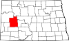
Garrison Dam is an earth-fill embankment dam on the Missouri River in central North Dakota, U.S. Constructed by the U.S. Army Corps of Engineers from 1947 to 1953, at over 2 miles (3.2 km) in length, the dam is the fifth-largest earthen dam in the world. The reservoir impounded by the dam is Lake Sakakawea, which extends to Williston and the confluence with the Yellowstone River, near the Montana border. The dam and resulting reservoir inundated approximately one-sixth (16.6%) to one-fourth (25%) of Fort Berthold Indian Reservation's land, resulting in the loss of homes, farmland, and community infrastructure for the Three Affiliated Tribes.

The Mandan, Hidatsa, and Arikara Nation, also known as the Three Affiliated Tribes, is a Native American Nation resulting from the alliance of the Mandan, Hidatsa, and Arikara peoples, whose native lands ranged across the Missouri River basin extending from present day North Dakota through western Montana and Wyoming.

<span class="mw-page-title-main">Treaty of Fort Laramie (1868)</span> US-Sioux treaty ending Red Clouds War

The Treaty of Fort Laramie is an agreement between the United States and the Oglala, Miniconjou, and Brulé bands of Lakota people, Yanktonai Dakota, and Arapaho Nation, following the failure of the first Fort Laramie treaty, signed in 1851.

<span class="mw-page-title-main">Hidatsa</span> Native American ethnic group

The Hidatsa are a Siouan people. They are enrolled in the federally recognized Three Affiliated Tribes of the Fort Berthold Reservation in North Dakota. Their language is related to that of the Crow, and they are sometimes considered a parent tribe to the modern Crow in Montana.

<span class="mw-page-title-main">Arikara</span> Ethnic group

Arikara, also known as Sahnish, Arikaree, Ree, or Hundi, are a tribe of Native Americans in North Dakota. Today, they are enrolled with the Mandan and the Hidatsa as the federally recognized tribe known as the Mandan, Hidatsa, and Arikara Nation.

<span class="mw-page-title-main">Mandan</span> Native American tribe of the Great Plains

The Mandan are a Native American tribe of the Great Plains who have lived for centuries primarily in what is now North Dakota. They are enrolled in the Three Affiliated Tribes of the Fort Berthold Reservation. About half of the Mandan still reside in the area of the reservation; the rest reside around the United States and in Canada.

<span class="mw-page-title-main">Treaty of Fort Laramie (1851)</span> Treaty on territorial claims of Native Americans

The Fort Laramie Treaty of 1851 was signed on September 17, 1851 between United States treaty commissioners and representatives of the Cheyenne, Sioux, Arapaho, Crow, Assiniboine, Mandan, Hidatsa, and Arikara Nations. Also known as Horse Creek Treaty, the treaty set forth traditional territorial claims of the tribes.

<span class="mw-page-title-main">Great Sioux Reservation</span> Former Indian reservation in the United States

The Great Sioux Reservation initially set aside land west of the Missouri River in South Dakota and Nebraska for the use of the Sioux, who had dominated this territory. The reservation was established in the Fort Laramie Treaty of 1868. It included all of present-day western South Dakota and modern Boyd County, Nebraska. This area was established by the United States as a reservation for the Teton Sioux, also known as the Lakota: the seven western bands of the "Seven Council Fires".

<span class="mw-page-title-main">Crow Creek Indian Reservation</span> Indian reservation in South Dakota, United States

The Crow Creek Indian Reservation, home to Crow Creek Sioux Tribe is located in parts of Buffalo, Hughes, and Hyde counties on the east bank of the Missouri River in central South Dakota in the United States. It has a land area of 421.658 square miles (1,092.09 km2) and a 2000 census population of 2,225 persons. The major town and capital of the federally recognized Crow Creek Sioux Tribe is Fort Thompson.

<span class="mw-page-title-main">Four Bears Bridge</span> Bridge

Four Bears Bridge is one of two bridges built over the Missouri River on the Fort Berthold Reservation in the U.S. state of North Dakota. It carries North Dakota Highway 23. The current bridge which opened in 2005 is the second largest bridge in the state and replaced an earlier bridge built in 1934. The 1934 bridge was moved in 1955 following the construction of the Garrison Dam and the creation of Lake Sakakawea.

<span class="mw-page-title-main">Like-a-Fishhook Village</span> Former settlement in North Dakota, United States

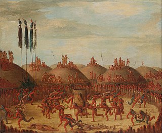
Like-a-Fishhook Village was a Native American settlement next to Fort Berthold in North Dakota, United States, established by dissident bands of the Three Affiliated Tribes, the Mandan, Arikara and Hidatsa. Formed in 1845, it was also eventually inhabited by non-Indian traders, and became important in the trade between Natives and non-Natives in the region.

Edward Lone Fight served as Chairman of the Mandan, Hidatsa and Arikara Nation from 1986 to 1990. In 1988 Lone Fight met with President Ronald Reagan, a meeting which was the catalyst for the Just Compensation Bill, introduced based on the findings of the Joint Tribal Advisory Committee, which provided the tribes partial compensation for the flooding of reservation due to the construction of the Garrison Dam under the Pick-Sloan Legislation.

<span class="mw-page-title-main">Fort Belknap Indian Reservation</span> Indian reservation in the United States

The Fort Belknap Indian Reservation is shared by two Native American tribes, the A'aninin and the Nakoda (Assiniboine). The reservation covers 1,014 sq mi (2,630 km2), and is located in north-central Montana. The total area includes the main portion of their homeland and off-reservation trust land. The tribes reported 2,851 enrolled members in 2010. The capital and largest community is Fort Belknap Agency, at the reservation's north end, just south of the city of Harlem, Montana, across the Milk River.

Fort Berthold was the name of two successive forts on the upper Missouri River in present-day central-northwest North Dakota. Both were initially established as fur trading posts. The second was adapted as a post for the U.S. Army. After the Army left the area, having subdued Native Americans, the fort was used by the US as the Indian Agency for the regional Arikara, Hidatsa, and Mandan Affiliated Tribes and their reservation.

Twin Buttes is an unincorporated community in Dunn County, North Dakota, United States. It is a community on the Fort Berthold Indian Reservation, which is home of the Mandan, Hidatsa, and Arikara Three Affiliated Tribes. Twin Buttes is 2 miles (3.2 km) south of Lake Sakakawea, and 12 miles (19 km) north-northeast of Halliday.

Alyce Spotted Bear was a Native American educator and politician and an enrolled member of the Mandan, Hidatsa, and Arikara Nation.

<span class="mw-page-title-main">Early Indian treaty territories in Montana</span>

A number of different Native Americans living in present-day Montana entered into treaties with the United States during the 19th Century. Most of the treaties included an article that established the territory of the tribe entering into it. More and more of this Indian land turned into public or U.S. territory with the signing of new treaties..

<span class="mw-page-title-main">Early Indian treaty territories in North Dakota</span>

Native Americans from various tribes lived in North Dakota before the arrival of settlers. With time, a number of treaties and agreements were signed between the Indians and the newcomers. Many of the treaties defined the domain of a specific group of Indians. The three maps below show the treaty territories of different Indians living in North Dakota and how the territories changed and diminished over time in the 19th century.

Raymond "Ray" Cross was an American attorney and law professor from the U.S. state of North Dakota. He was a member of the Mandan, Hidatsa, and Arikara Nation, also known as the Three Affiliated Tribes, and a former professor of American Indian Law at the University of Montana. As an attorney, Cross represented Native Americans in multiple landmark trials, including two U.S. Supreme Court cases, and successfully won a compensation claim against the U.S. government for the flooding of 156,000 acres of tribal land in North Dakota due to the construction of the Garrison Dam.

Elbowoods is a ghost town that was located in McLean County, North Dakota, United States, on the Fort Berthold Indian Reservation. It was founded in 1889 along the Missouri River as the agency seat for the reservation of the Mandan, Hidatsa, and Arikara Nation. After the creation of the Garrison Dam and Lake Sakakawea, rising water levels threatened the town, slowly engulfing its buildings until the entire town was submerged in 1954.

References

  1. "Tribal Business Council" . Retrieved July 24, 2019.
  2. 2013-2017 American Community Survey 5-Year Estimates. "My Tribal Area". United States Census Bureau.{{cite web}}: CS1 maint: numeric names: authors list (link)
  3. "Tribal Historical Overview - The 1851 Fort Laramie Treaty". www.ndstudies.org. Archived from the original on July 25, 2016. Retrieved August 1, 2016.
  4. 1 2 "Three Affiliated - Demographics - Land Base and Land Status". www.ndstudies.org. Retrieved August 1, 2016.
  5. "Four Bears Steadily Crosses Sakakawea in ND". www.constructionequipmentguide.com. Retrieved August 1, 2016.
  6. Kappler, Charles J.: Indian Affairs. Laws and Treaties. Vol. 2. Washington, 1904. p. 594.
  7. South Dakota State Historical Society, South Dakota. Dept. of History (1908). South Dakota Historical Collections. South Dakota State Historical Society. p. 235.
  8. Meyer, Roy w.: The Village Indians of the Upper Missouri. The Mandans, Hidatsas and Arikaas. Lincoln and London, 1977, map facing p. 112.
  9. Pub. L. Tooltip Public Law (United States)  61–197: An Act to Authorize the Survey and Allotment of Lands Embraced within the Limits of the Fort Berthold Indian Reservation, in the State of North Dakota, and the Sale and Disposition of a Portion of the Surplus Lands after Allotment, and Making Appropriations and Provisions to Carry the Same into Effect - Via University of North Dakota
  10. "Demographics | North Dakota Studies". ndstudies.gov. Archived from the original on November 3, 2014. Retrieved August 1, 2016.
  11. Sevant, Taft (March 30, 2016). "Three Affiliated Tribes Mandan, Hidatsa, and Arikara Nation Office of Tribal Enrollment" (PDF). mhanation.com. Archived from the original (PDF) on August 4, 2016. Retrieved August 1, 2016.
  12. Lake Sakakawea History Archived May 15, 2013, at the Wayback Machine McLean County
  13. VanDevelder, Paul (November 1, 2005). Coyote Warrior: One Man, Three Tribes, and the Trial That Forged a Nation. U of Nebraska Press. ISBN   978-0-8032-9631-2.
  14. "North Dakota: Fort Berthold Reservation - American Indian Relief Council is now Northern Plains Reservation Aid". www.nativepartnership.org. Retrieved April 2, 2020.
  15. "4 Bears Casino & Lodge". www.worldcasinodirectory.com. Retrieved August 1, 2016.