Wayne County is the westernmost county in the U.S. state of West Virginia. As of the 2020 census, the population was 38,982. Its county seat is Wayne. The county was founded in 1842 and named for General "Mad" Anthony Wayne.
Wayne County is a county in the U.S. state of Kentucky along the southern border with Tennessee. As of the 2020 census, the population was 19,555. Its county seat is Monticello. The county, on the south-central border with Tennessee, was named for Gen. Anthony Wayne, a Revolutionary War hero. As of November 3, 2020, Wayne County is a wet county—a measure allowing the sales and consumption of alcoholic drinks passed by a margin of 4,901 for and 3,966 against.

Russell County is a county located in the U.S. Commonwealth of Kentucky. As of the 2020 census, the population was 17,991. Its county seat is Jamestown and its largest city is Russell Springs. The county was formed on December 14, 1825, from portions of Adair, Cumberland and Wayne Counties and is named for William Russell.
Monticello is a city in Wayne County, Kentucky, in the United States. It is the seat of its county. The population was 6,188 at the time of the 2010 U.S. census.

The Big Sandy River, called Sandy Creek as early as 1756, is a tributary of the Ohio River, approximately 29 miles (47 km) long, in western West Virginia and northeastern Kentucky in the United States. The river forms part of the boundary between the two states along its entire course. Via the Ohio River, it is part of the Mississippi River watershed.

This is a list of properties and historic districts in Kentucky that are listed on the National Register of Historic Places. There are listings in all of Kentucky's 120 counties.

William Williams was an American lawyer and politician who served four terms as a U.S. Representative from Indiana from 1867 to 1875.
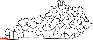
The Huntington–Ashland metropolitan area is a metropolitan area in the Appalachian Plateau region of the United States. Referred to locally as the "Tri-State area," and colloquially as "Kyova", the region spans seven counties in the three states of Kentucky, Ohio, and West Virginia. With a population of 361,580, the Tri-State area is nestled along the banks of the Ohio River. The region offers a diverse range of outdoor activities.
This is a list of the National Register of Historic Places listings in Clark County, Kentucky.

This is a list of the National Register of Historic Places listings in Powell County, Kentucky.

This is a list of the National Register of Historic Places listings in Nelson County, Kentucky.
This is a list of the National Register of Historic Places listings in Fulton County, Kentucky.

This is a list of the National Register of Historic Places listings in Ballard County, Kentucky.

This is a list of the National Register of Historic Places listings in Bath County, Kentucky.

This is a list of the National Register of Historic Places listings in McCreary County, Kentucky.

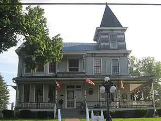
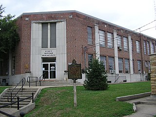
This is a list of the National Register of Historic Places listings in Wayne County, Kentucky.
Murl is an unincorporated community in Wayne County, Kentucky, United States.
Kidds Crossing is an unincorporated community in Wayne County, Kentucky, United States. The community is on Kentucky Route 92 near the McCreary County border, 10.7 miles (17.2 km) east-southeast of Monticello.
Cooper is an unincorporated community in Wayne County, Kentucky, United States.
This page is based on this
Wikipedia article Text is available under the
CC BY-SA 4.0 license; additional terms may apply.
Images, videos and audio are available under their respective licenses.