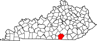
The Barren River is a 135-mile-long (217 km) river in Southcentral Kentucky, United States, and a tributary of the Green River. The watershed of the Green River is the largest of the twelve major river watersheds in Kentucky. The Barren River rises near the Tennessee border in Monroe County and flows into the Green in northeast Warren County. The drainage basin consists of Southcentral Kentucky and north-central Tennessee.
Chavies is a residential hamlet with a U.S. Post Office located in Perry County, Kentucky, United States.

Leatherwood is an unincorporated community within Perry County, Kentucky, United States. At one point, it was called Toner. The post office has been closed.
Verda is an unincorporated community in Harlan County, Kentucky, United States. The Verda Post Office is closed.
Kentenia is an unincorporated community and coal town in Harlan County, Kentucky, United States. Kentenia was served by a post office from 1917 to 1930.
Fusonia is an unincorporated community and coal town in Perry County, Kentucky, United States.
Lamont is an unincorporated community and coal town in Perry County, Kentucky, United States. Their post office has been closed.
Esco is an unincorporated community and coal town in Pike County, Kentucky, United States. Its post office is closed.
Pauley is an unincorporated community and coal town in Pike County, Kentucky, United States. Their post office is closed. It was also known as Panley.
Dunleary is an unincorporated community and coal town in Pike County, Kentucky, United States. The Dunleary post office is closed.
Big Shoal is an unincorporated community and coal town in Pike County, Kentucky, United States. Its post office has been closed.
Sharondale is an unincorporated community and coal town in Pike County, Kentucky, United States. Its post office has been closed.
Draper is an unincorporated community in Harlan County, Kentucky, United States. Their post office is closed.
Harveyton is an unincorporated community located in Perry County, Kentucky, United States.
Farler is an unincorporated community located in Perry County, Kentucky, United States.
Dow is an unincorporated community located in Perry County, Kentucky, United States. Its post office is closed.
Dunraven is an unincorporated community located in Perry County, Kentucky, United States. Its post office is closed.
Tilford is an unincorporated community located in Perry County, Kentucky, United States. Its post office is closed.
Wentz is an unincorporated community located in Perry County, Kentucky, United States. Its post office is closed.
Hilton is an unincorporated community located in Perry County, Kentucky, United States. Its post office is closed.