Funk, Ohio

Last updated

Location of Funk, Ohio OHMap-doton-Funk.png
Location of Funk, Ohio

Funk is an unincorporated community in southwestern Plain Township, Wayne County, Ohio, United States. [1] Because it is not tracked by the U.S. Census, a census population estimate is not available.

Funk is a hamlet and was platted under the name Austen in 1894. Before that, it was called Kauffman Corners. The names Kaufman, Funk, and Austen all referred to local families who had owned land in and around Funk for generations. [2]

Funk's growth started in the late 1890s when a portion of the A&W Railroad was built from Big Prairie to Ashland. This was completed in 1899. At this point, there was another village called Austin, Ohio, so the name was changed to Funk after a local family that lived and farmed in the area. [2]

Before World War I, a Grain elevator was built. It is assumed it was built by a man named Craig, who may be the man who donated his farmland to form Craigton, another unincorporated community and railroad depot from the early 1900s located a few miles from Funk. This grain elevator passed through several hands before becoming known as the Funk Equity Union Co. It was later owned by William "D" Funk, who also owned the successful general store and was an agent for the railroad in the village. D Funk inherited the general store from his father Zenas between 1895 and 1910. The store went through several more owners until it was finally closed in 1986. The grain elevator was operated until 1957. [2]

Funk had two blacksmiths, a scrap dealer, a butcher, several barbers, a makeshift automobile jack factory called The Black Jack Factory, an ice house, gravel pit, and in the 1980s was home to the Austin Disposal headquarters. [3]

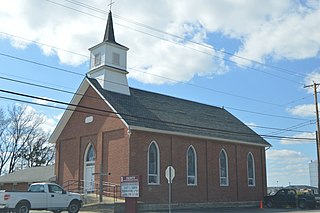
The only church in Funk was a Methodist church located across the Ashland County line, the building later moved to Funk and remodeled into a home. They were destroyed in a fire in 1940. The locals transferred to Maple Grove Methodist Church. [3]

There is some confusion for outsiders about the origins of Funk's name because they were never explicitly recorded in public records. [4]

Funk is located at the intersection of South Funk Road and State Route 95, southwest of the county seat of Wooster.

Related Research Articles

<span class="mw-page-title-main">Bidwell, Ohio</span> Unincorporated community in Ohio, U.S.

Bidwell is a small unincorporated community in northwestern Springfield Township, Gallia County, Ohio, United States, Although unincorporated, it has its own ZIP Code of 45614. Bidwell is located eleven miles from the county seat, Gallipolis. It is at an elevation of 735 feet.

<span class="mw-page-title-main">Houston, Ohio</span> Unincorporated community in Ohio, U.S.

Houston is an unincorporated community in northern Loramie Township, Shelby County, Ohio, United States. It has a post office, a dollar general, and a grain elevator.

<span class="mw-page-title-main">Olivesburg, Ohio</span> Unincorporated community in Ohio, United States

Olivesburg is an unincorporated community in northeastern Weller Township, Richland County, Ohio, United States. It is part of the Mansfield Metropolitan Statistical Area. The town is on the bank of the Whetstone Creek, about two miles north of its junction with the Blackfork of the Mohican River. The community is served by the Ashland (44805) post office.

<span class="mw-page-title-main">Raub, Indiana</span> Unincorporated community in Indiana, United States

Raub is an unincorporated community in York Township, Benton County, in the U.S. state of Indiana. It is part of the Lafayette, Indiana Metropolitan Statistical Area.

<span class="mw-page-title-main">Talbot, Indiana</span> Unincorporated community in Indiana, United States

Talbot is an unincorporated community in Hickory Grove Township, Benton County, in the U.S. state of Indiana. It is part of the Lafayette, Indiana Metropolitan Statistical Area.

Africa is an unincorporated community located in Orange Township of southern Delaware County, Ohio, United States, by Alum Creek.

<span class="mw-page-title-main">Boyd County, Kentucky</span> County in Kentucky, United States

Boyd County is a county located in the U.S. state of Kentucky. As of the 2020 census, its population was 48,261. The county seat is Catlettsburg, and its largest city is Ashland. The county was formed in 1860. The county spans 160 square miles (410 km2), and is found at the northeastern edge of the state, near the Ohio River and Big Sandy River and situated in mountainous Appalachia. Boyd County is in the Huntington-Ashland, WV-KY-OH metropolitan statistical area.

Ellery is an unincorporated community on the border of Edwards and Wayne counties in the U.S. state of Illinois. The eastern side lies in Edwards and the west side in Wayne; the county line runs down the main street.

<span class="mw-page-title-main">Marchand, Ohio</span> Unincorporated community in Ohio, U.S.

Marchand is an unincorporated community in northeastern Jackson Township, Stark County, Ohio, United States, a short distance west of North Canton. Marchand is a historical locality that contains very few businesses, surrounded by the B.& O. Railroad tracks.

Swiss is an unincorporated community in western Nicholas County, West Virginia, United States. Its elevation is 735 ft (224 m).

<span class="mw-page-title-main">Meadows, Illinois</span> Unincorporated community in Illinois, United States

Meadows, Illinois is a small unincorporated community located in McLean County. Meadows is located on US Route 24, midway between Chenoa and Gridley, with easy access from Interstate 55. Meadows at one time had a bank, general store, auto garage, a washing machine factory, and a school. All that remains in town is a nursing home, church, and a grain elevator. One railway line passes through the center of the town.

<span class="mw-page-title-main">Heidenheimer, Texas</span> Unincorporated community in Texas, US

Heidenheimer is an unincorporated community in Bell County, Texas, United States. According to the Handbook of Texas, the community had an estimated population of 144 in 2000. The community is part of the Killeen–Temple–Fort Hood Metropolitan Statistical Area.

<span class="mw-page-title-main">Lilly Chapel, Ohio</span> Unincorporated community in Ohio, United States

Lilly Chapel is an unincorporated community in Fairfield Township, Madison County, Ohio, United States. It is located at the intersection of W. Jefferson Kiousville Road and Lilly Chapel Georgesville Road, approximately three miles west of Georgesville.

Blackstone is an unincorporated village in section 7 of Sunbury Township, Livingston County, Illinois, United States. Blackstone is 10 miles (16 km) southeast of Streator and 13 miles (21 km) west of Dwight, Illinois. Blackstone has a post office with ZIP code 61313, a grainery complex, and a small rubber-products plant

Florence is an unincorporated community in Paint Township, Madison County, Ohio, United States. It is located along U.S. Route 42 between London and South Charleston.

Weavers is an unincorporated community in Darke County, in the U.S. state of Ohio.

Atlanta is an unincorporated community in Pickaway County, in the U.S. state of Ohio.

Jefferson is an unincorporated community in Wayne County, in the U.S. state of Ohio.

Ocoya is an unincorporated community in Central Illinois, located in southern Livingston County.

McDowell is an unincorporated community in Eppards Point Township in Livingston County, Illinois, surrounding the intersection of 1800 East and 1400 North.

References

  1. U.S. Geological Survey Geographic Names Information System: Funk, Ohio
  2. 1 2 3 Wayne County History Book Committee (1987). A History of Wayne County, Ohio. Dallas: Taylor Publishing Company. pp. 33–34.
  3. 1 2 Wayne County History Book Committee (1987). A History of Wayne County, Ohio. Dallas: Taylor Publishing Company. p. 34.
  4. Peacefull, Leonard (1996). A Geography of Ohio. Kent State University Press. p. 220. ISBN   9780873385251 . Retrieved December 8, 2013.

40°45′11″N82°06′59″W / 40.753056°N 82.11638°W / 40.753056; -82.11638