Smithville, Ohio

Last updated

Smithville, Ohio
GREEN TOWNSHIP HIGH SCHOOL, WAYNE COUNTY, OHIO.jpg
Former middle school, demolished in 2014
OHMap-doton-Smithville.png
Location of Smithville, Ohio
Map of Wayne County Ohio Highlighting Smithville Village.png
Location of Smithville in Wayne County
Coordinates: 40°51′45″N81°51′37″W / 40.86250°N 81.86028°W / 40.86250; -81.86028
Country United States
State Ohio
County Wayne
Area
[1]
  Total1.24 sq mi (3.22 km2)
  Land1.24 sq mi (3.20 km2)
  Water0.01 sq mi (0.01 km2)
Elevation
[2]
1,073 ft (327 m)
Population
 (2020)
  Total1,338
  Density1,082.52/sq mi (417.98/km2)
Time zone UTC-5 (Eastern (EST))
  Summer (DST) UTC-4 (EDT)
ZIP code
44677
Area code 330
FIPS code 39-72788 [3]
GNIS feature ID2399834 [2]
Website www.thevillageofsmithville.com

Smithville is a village in Wayne County, Ohio, United States. The population was 1,338 at the time of the 2020 census. The village derives its name from Thomas Smith, a pioneer settler. [4]

Contents

Geography

Kirtland I. Perky Kirtlandperky.jpg
Kirtland I. Perky

Smithville is located along Sugar Creek. [5]

According to the United States Census Bureau, the village has a total area of 1.25 square miles (3.24 km2), of which, 1.24 square miles (3.21 km2) is land and 0.01 square miles (0.03 km2) is water. [6]

Demographics

Historical population
CensusPop.Note
1880 546
1890 482−11.7%
1900 474−1.7%
1910 447−5.7%
1920 4827.8%
1930 58220.7%
1940 6176.0%
1950 75522.4%
1960 1,02435.6%
1970 1,27824.8%
1980 1,46714.8%
1990 1,354−7.7%
2000 1,333−1.6%
2010 1,252−6.1%
2020 1,3386.9%
U.S. Decennial Census [7]

2010 census

As of the census [8] of 2010, there were 1,252 people, 541 households, and 371 families living in the village. The population density was 1,009.7 inhabitants per square mile (389.8/km2). There were 573 housing units at an average density of 462.1 per square mile (178.4/km2). The racial makeup of the village was 97.8% White, 0.9% African American, 0.4% Native American, 0.6% Asian, and 0.3% from two or more races. Hispanic or Latino of any race were 1.3% of the population.

There were 541 households, of which 28.5% had children under the age of 18 living with them, 52.1% were married couples living together, 12.9% had a female householder with no husband present, 3.5% had a male householder with no wife present, and 31.4% were non-families. 28.1% of all households were made up of individuals, and 9.6% had someone living alone who was 65 years of age or older. The average household size was 2.31 and the average family size was 2.81.

The median age in the village was 44.2 years. 21.8% of residents were under the age of 18; 8.6% were between the ages of 18 and 24; 20.4% were from 25 to 44; 32.7% were from 45 to 64; and 16.6% were 65 years of age or older. The gender makeup of the village was 47.1% male and 52.9% female.

2000 census

As of the census [3] of 2000, there were 1,333 people, 545 households, and 395 families living in the village. The population density was 1,079.5 inhabitants per square mile (416.8/km2). There were 562 housing units at an average density of 455.1 per square mile (175.7/km2). The racial makeup of the village was 98.65% White, 0.15% African American, 0.23% Native American, 0.53% Asian, and 0.45% from two or more races. Hispanic or Latino of any race were 0.45% of the population.

There were 545 households, out of which 31.7% had children under the age of 18 living with them, 59.1% were married couples living together, 10.6% had a female head of household with no husband present, and 27.5% were non-families. 26.8% of all households were made up of individuals, and 11.6% had someone living alone who was 65 years of age or older. The average household size was 2.45 and the average family size was 2.93.

In the village, the population was spread out, with 25.0% under the age of 18, 8.3% from 18 to 24, 27.8% from 25 to 44, 22.1% from 45 to 64, and 16.7% who were 65 years of age or older. The median age was 38 years. For every 100 females there were 90.4 males. For every 100 females age 18 and over, there were 86.2 males.

The median income for a household in the village was $39,662, and the median income for a family was $47,109. Males had a median income of $32,500 versus $22,847 for females. The per capita income for the village was $18,329. About 5.2% of families and 5.9% of the population were below the poverty line, including 6.3% of those under age 18 and 7.1% of those age 65 or over.

Education

Smithville is home to the Wayne County Schools Career Center. It is also home to the campus of the Green Local School District, which also includes nearby Marshallville.

Notable residents

Related Research Articles

<span class="mw-page-title-main">Smithville, Missouri</span> City in Missouri, United States

Smithville is a city in Clay and Platte counties in the U.S. state of Missouri and is part of the Kansas City metropolitan area, along the Little Platte River. The population was 10,406 at the 2020 United States Census.

<span class="mw-page-title-main">Fort Shawnee, Ohio</span> CDP in Ohio, United States

Fort Shawnee is census-designated place (CDP) in Allen County, Ohio, United States. The population was 6,263 at the 2020 census. It is included in the Lima, Ohio Metropolitan Statistical Area. Fort Shawnee is adjacent to the city of Lima and the village of Cridersville in Auglaize County. In 2012, village residents voted to disincorporate the village. According to the United States Census Bureau, the village had a total area of 7.25 square miles (18.78 km2), of which 7.21 square miles (18.67 km2) is land and 0.04 square miles (0.10 km2) is water.

<span class="mw-page-title-main">Aberdeen, Ohio</span> Village in Ohio, United States

Aberdeen is a village in Huntington Township, Brown County, Ohio, United States, along the Ohio River 50 miles (80 km) southeast of Cincinnati. The population was 1,515 at the 2020 census.

<span class="mw-page-title-main">Warsaw, Ohio</span> Village in Ohio, United States

Warsaw is a village in Coshocton County, Ohio, United States, along the Walhonding River. The population was 624 at the 2020 census.

<span class="mw-page-title-main">Castine, Ohio</span> Village in Ohio, United States

Castine is a village in Darke County, Ohio, United States. The population was 110 at the 2020 census.

<span class="mw-page-title-main">Gordon, Ohio</span> Village in Ohio, United States

Gordon is a village in Darke County, Ohio, United States. The population was 245 at the 2020 census.

<span class="mw-page-title-main">Brice, Ohio</span> Village in Ohio, United States

Brice is a village in Franklin County, Ohio, United States, on the southeast side of the Columbus metropolitan area. The population was 93 at the 2020 census.

<span class="mw-page-title-main">Salesville, Ohio</span> Census-designated place in Ohio, United States

Salesville is a census-designated place and former village in Guernsey County, Ohio, United States. As of the 2020 census, the population was 123, down from 129 at the 2010 census. Its residents voted for dissolution in 2016.

<span class="mw-page-title-main">Addyston, Ohio</span> Village in Ohio, United States

Addyston is a village in Miami Township, Hamilton County, Ohio, United States. Located along the Ohio River, it is a western suburb of the neighboring city of Cincinnati. The population was 927 at the 2020 census.

<span class="mw-page-title-main">Cleves, Ohio</span> City in Ohio, United States

Cleves is a village in Miami Township, Hamilton County, Ohio, United States. Located along the Ohio River, it is a western suburb of Cincinnati. The population was 3,414 at the 2020 census.

<span class="mw-page-title-main">Sheffield, Ohio</span> Village in Ohio, United States

Sheffield is a village in Lorain County, Ohio, United States, along the Black River. The population was 4,135 at the 2020 census. It is part of the Cleveland metropolitan area.

<span class="mw-page-title-main">Montezuma, Ohio</span> Village in Ohio, United States

Montezuma is a village in Mercer County, Ohio, United States. The population was 152 at the 2020 census.

<span class="mw-page-title-main">Cloverdale, Ohio</span> Village in Ohio, United States

Cloverdale is a village in Perry Township, Putnam County, Ohio, United States. The population was 170 at the 2020 census.

<span class="mw-page-title-main">Port Jefferson, Ohio</span> Village in Ohio, United States

Port Jefferson is a village in Salem Township, Shelby County, Ohio, United States. The population was 308 at the 2020 census.

<span class="mw-page-title-main">Limaville, Ohio</span> Census-designated place in Ohio, United States

Limaville is a census-designated place (CDP) and former village in Stark County, Ohio, United States. The population was 151 at the 2020 census. It is part of the Canton–Massillon Metropolitan Statistical Area.

<span class="mw-page-title-main">Clinton, Ohio</span> Village in Ohio, United States

Clinton is a village in southwestern Summit County, Ohio, United States. The population was 1,197 at the 2020 Census. It is part of the Akron metropolitan area.

<span class="mw-page-title-main">Port Washington, Ohio</span> Village in Ohio, United States

Port Washington is a village in Tuscarawas County, Ohio, United States. The population was 548 at the 2020 census.

<span class="mw-page-title-main">Marshallville, Ohio</span> Village in Ohio, United States

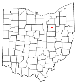
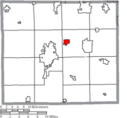
Marshallville is a village in Wayne County, Ohio. The population was 789 at the time of the 2020 census. Marshallville was originally called Bristol, and under the latter name was laid out in 1817.

<span class="mw-page-title-main">Wilson, Ohio</span> Village in Ohio, United States

Wilson is a village in Belmont and Monroe counties in the U.S. state of Ohio. The population was 129 at the 2020 census. It is part of the Wheeling metropolitan area.

<span class="mw-page-title-main">Gratiot, Ohio</span> Village in Ohio, United States

Gratiot is a village in Licking and Muskingum counties in the U.S. state of Ohio. The population was 215 at the 2020 census.

References

  1. "ArcGIS REST Services Directory". United States Census Bureau. Retrieved September 20, 2022.
  2. 1 2 U.S. Geological Survey Geographic Names Information System: Smithville, Ohio
  3. 1 2 "U.S. Census website". United States Census Bureau . Retrieved January 31, 2008.
  4. Overman, William Daniel (1958). Ohio Town Names. Akron, OH: Atlantic Press. p. 127.
  5. DeLorme (1991). Ohio Atlas & Gazetteer. Yarmouth, Maine: DeLorme. p. 50. ISBN   0-89933-233-1.
  6. "US Gazetteer files 2010". United States Census Bureau. Archived from the original on January 25, 2012. Retrieved January 6, 2013.
  7. "Census of Population and Housing". Census.gov. Retrieved June 4, 2015.
  8. "U.S. Census website". United States Census Bureau . Retrieved January 6, 2013.