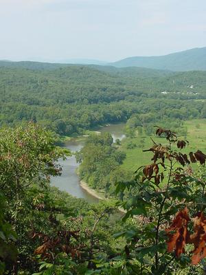
The Tug Fork is a tributary of the Big Sandy River, 159 miles (256 km) long, in southwestern West Virginia, southwestern Virginia, and eastern Kentucky in the United States. Via the Big Sandy and Ohio rivers, it is part of the watershed of the Mississippi River.

The Shenandoah River is the principal tributary of the Potomac River, 55.6 miles (89.5 km) long with two forks approximately 100 miles (160 km) long each, in the U.S. states of Virginia and West Virginia. The river and its tributaries drain the central and lower Shenandoah Valley and the Page Valley in the Appalachians on the west side of the Blue Ridge Mountains, in northwestern Virginia and the Eastern Panhandle of West Virginia. There is a hydroelectric plant along the Shenandoah river constructed in 2014 by Dominion.

The Holston River is a 136-mile (219 km) river that flows from Kingsport, Tennessee, to Knoxville, Tennessee. Along with its three major forks, it comprises a major river system that drains much of northeastern Tennessee, southwestern Virginia, and northwestern North Carolina. The Holston's confluence with the French Broad River at Knoxville marks the beginning of the Tennessee River.

The South Branch Potomac River has its headwaters in northwestern Highland County, Virginia near Hightown along the eastern edge of the Allegheny Front. After a river distance of 139 miles (224 km), the mouth of the South Branch lies east of Green Spring in Hampshire County, West Virginia where it meets the North Branch Potomac River to form the Potomac.
Sleepy Creek is a 44.0-mile-long (70.8 km) tributary of the Potomac River in the United States, belonging to the Chesapeake Bay's watershed. The stream rises in Frederick County, Virginia, and flows through Morgan County, West Virginia before joining the Potomac near the community of Sleepy Creek.

Beech Fork State Park is a state park located in Cabell County and Wayne County, West Virginia. The park is located on the tailwater shores of Beech Fork Lake, a flood control impoundment of the U.S. Army Corps of Engineers on the Beech Fork of Twelvepole Creek. Since its development in the mid-1970s, Beech Fork State Park has proven to be a popular recreation spot for the residents of nearby Barboursville and Huntington, West Virginia, as well as those living in the surrounding region. The park is located about 10 miles (16 km) south of the Hal Greer Exit of Interstate 64.
Catoctin Creek is a 14.1-mile-long (22.7 km) tributary of the Potomac River in Loudoun County, Virginia, with a watershed of 59,000 acres (240 km2). Agricultural lands make up 67 percent and forests 30 percent of Catoctin Creek's watershed. It is the main drainage system for the northern Loudoun Valley, including all of the Catoctin Valley.

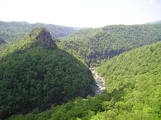
Breaks Interstate Park is a bi-state state park located partly in southeastern Kentucky and mostly in southwestern Virginia, in the Jefferson National Forest, at the northeastern terminus of Pine Mountain. Rather than their respective state park systems, it is instead administered by an interstate compact between the states of Virginia and Kentucky. It is one of several interstate parks in the United States, but only one of two operated jointly under a compact rather than as two separate state park units. The Virginia Department of Conservation and Recreation and the Kentucky Department of Parks are still major partner organizations.

State Route 14 is a primary state highway in the U.S. state of Virginia. The state highway runs 71.10 miles (114.42 km) from U.S. Route 360 in St. Stephens Church east to a cul-de-sac in Bayside. SR 14 is the primary highway of King and Queen and Mathews counties and the main east–west highway of Gloucester County; the highway connects the namesake county seats of all three counties.

Stonewall Jackson Lake State Park is a state park along the shores of Stonewall Jackson Lake, an impoundment on the West Fork River in the U.S. state of West Virginia. The lake is a project of the United States Army Corps of Engineers. The original park was completed in 1990 and consisted of a campground, marina, multi-purpose building, and park offices. The revenues generated from park activities were not able to support the debt from construction activities. Senator Robert C. Byrd developed a legislation that meant the State would not have to pay the Corps the $28 million debt if improvements to the State Park exceeded $28 million.

Henley Field is a historic site in Lakeland, Florida. Built in 1922, it is located at 1125 North Florida Avenue. Clare Henley, for whom the park was named in 1942, encouraged its construction in an effort to persuade a professional baseball team to train there. On May 23, 1997, it was added to the U.S. National Register of Historic Places. Henley Field is located adjacent to Bryant Stadium, a football stadium.

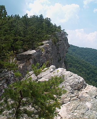
North Fork Mountain is a quartzite-capped mountain ridge in the Ridge and Valley physiographic province of the Allegheny Mountains, also known as the High Alleghenies or Potomac Highlands, of eastern West Virginia. Kile Knob, at 4,588 feet, is the mountain's highest point, and Panther Knob and Pike Knob are nearly as high.

Slab Fork is an unincorporated community in Raleigh County, West Virginia, United States with a population of 202. Slab Fork is located along a stream of the same name and West Virginia Route 54. The ZIP code for Slab Fork is 25920.
Beards Fork is a census-designated place (CDP) and coal town in Fayette County, West Virginia, United States that was founded as a coal town. As of the 2010 census, its population was 199.
Wyatt Allen is an American rower.

Tug Fork Wildlife Management Area (WMA) is located about 10 miles northwest of Welch, West Virginia in McDowell County. Tug Fork WMA is located on 2,165 acres (876 ha) of steep terrain along hills above the Tug Fork River. The WMA is heavily forested, primarily with mixed hardwoods and yellow poplar/black cherry forests in the coves. The WMA is accessed from U.S. Route 52 at Premier. Several tracks and jeep trails provide walking access into the Tug Fork WMA from U.S. Route 52.

Western View is a historic home located near Fork Union, Fluvanna County, Virginia. The original frame section was built about 1790, and expanded with a brick addition in 1824. The original section is a 1+1⁄2-story, two bay, rectangular frame structure with a slate covered gable roof. The brick addition is a one-over-one wing with Greek Revival attributes. Also on the property are the contributing site of the outdoor kitchen with extant chimney, and the Henley/Johnson family cemetery.

The Laurel Fork is a 15.7-mile-long (25.3 km) stream in Virginia and West Virginia, United States. The stream flows north from Highland County, Virginia, where its source and the majority of its length is located, to its mouth in Pendleton County, West Virginia. Laurel Fork is a tributary to the North Fork South Branch Potomac River, making it a part of the Potomac River watershed. The area surrounding Laurel Fork is home to several plant and animal species found nowhere else in Virginia, and is a prime example of a northern boreal forest in the state.


