
Chincoteague is a town in Accomack County, Virginia, U.S. The town includes the whole of Chincoteague Island and an area of adjacent water. The population was 2,941 at the 2010 census. The town is a tourist gateway to the Chincoteague National Wildlife Refuge on adjacent Assateague Island, the location of a popular recreational beach and home of the Virginia herd of Chincoteague Ponies. These ponies and the annual Pony Swim are the subject of Marguerite Henry's 1947 children's book Misty of Chincoteague, which was made into the 1961 family film Misty, filmed on location.

Painter is a town in Accomack County, Virginia, United States. The population was recorded at 229 at the 2010 census.

Appomattox is a town in Appomattox County, Virginia, United States. The population was 1,733 at the 2010 census. It is the county seat of Appomattox County.
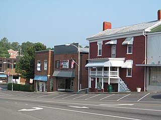
Brookneal is an incorporated town in Campbell County, Virginia, United States. The population was 1,112 as of the 2010 census. It is part of the Lynchburg Metropolitan Statistical Area.

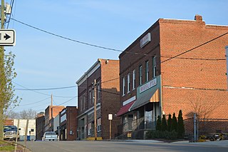
Chatham is a town in Pittsylvania County, Virginia, United States. It is the county seat of Pittsylvania County. Chatham's population was 1,232 at the 2020 census. It is included in the Danville, Virginia Metropolitan Statistical Area. The town was originally called Competition, but the name was changed to Chatham by the Virginia General Assembly on May 1, 1852.
Lebanon is a town in Russell County, Virginia, United States. The population was 3,424 at the 2010 census. It is the county seat of Russell County.

Stony Creek is a town in Sussex County, Virginia, United States. The population was 198 at the 2010 census.

Richlands is a town in Tazewell County, Virginia, United States. The population was 5,261 at the 2020 census. It is part of the Bluefield, WV-VA micropolitan area which has a population of 107,578.
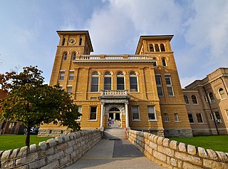
Wise is a town in Wise County, Virginia. The population was 3,286 at the 2010 census. It is the county seat of Wise County. It was originally incorporated as the town of Gladeville in 1874. The town's name was changed to Wise in 1924, after Henry A. Wise, the last Virginia governor before the American Civil War and the first governor to hail from the Eastern Shore of Virginia.

Terra Alta is a town in eastern Preston County, West Virginia, United States. The population was 1,415 at the 2020 census. It is part of the Morgantown metropolitan area.
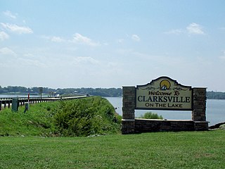
Clarksville is a town in Mecklenburg county in the U.S. state of Virginia, near the southern border of the commonwealth. The population was 1,139 at the 2010 census. Since the town has numerous buildings of the 18th-, 19th-, and early 20th-century architecture, the downtown area of Clarksville has been designated a Historic District on the National Register of Historic Places and Virginia's Historic Register. Clarksville claims the title of Virginia's only Lakeside town. Nearby the town of Clarksville is Occoneechee State Park.

Missouri generally has a variety of seasonal humid subtropical climate, with cool winters and long, hot summers. In the southern part of the state, particularly in the Bootheel, the climate borders on a more mild-type humid subtropical climate, and in the northern third, the state transitions into a humid continental climate. Because of its location in the interior United States, Missouri often experiences extremes in temperatures. Lacking either large mountains or oceans nearby to moderate its temperature, its climate is alternately influenced by air from the cold Arctic and the hot and humid Gulf of Mexico.

The climate of Virginia, a state on the east coast of the United States, is considered mild compared to more northern areas of the United States such as New England and the Midwest. Most of Virginia east of the Blue Ridge mountains, the southern part of the Shenandoah Valley, and the Roanoke Valley, has a humid subtropical climate. In the mountainous areas west of the Blue Ridge, the climate is warm-summer humid continental or oceanic climate. Severe weather, in the form of tornadoes, tropical cyclones, and winter storms, impacts the state on a regular basis. Central Virginia received significant snowfall of 20 inches in December 2009.

Hot Springs is a census-designated place (CDP) in Bath County, Virginia, United States. The population as of the 2010 Census was 738. It is located about 5 miles southwest of Warm Springs on U.S. Route 220.

Amelia Court House is the county seat of Amelia County in the U.S. state of Virginia and a census-designated place (CDP). The population as of the 2010 census was 1,099. The town was named for Princess Amelia of Great Britain, the second daughter of Great Britain's King George II, in 1735.
Columbus, Ohio has a humid continental climate, characterized by humid, hot summers and cold winters, with no dry season. The Dfa climate has average temperatures above 22 °C during the warmest months, with at least four months averaging above 10 °C, and below 0 °C during the coldest. The climate is transitional with the Cfa humid subtropical climate to the south, characterized by humid, hot summers and cool winters.

The Archbold Biological Station (ABS) is a research institute with a surrounding 5,192.63-acre (21 km2) estate near Lake Placid, Florida, USA. It includes an extensive area of Florida scrub, a scientifically interesting and highly threatened ecosystem. It was established in 1941 by Richard Archbold when his sponsorship of zoological research in New Guinea was curtailed by the outbreak of the Second World War in the Pacific region. The Station supports 19 federally listed threatened species, including the Sand Skink and 13 endemic plant species. It is a venue for field research and education, as well as ranching.

The climate of Pennsylvania is diverse due to the multitude of geographic features found within the state. Straddling two major climate zones, the southeastern corner of Pennsylvania has the warmest climate. A portion of Greater Philadelphia lies at the southernmost tip of the humid continental climate zone, with the city proper being in the humid subtropical climate zone. Still, Philadelphia features colder, snowier winters than most locations with a humid subtropical climate. Moving west toward the mountainous interior of the state, the climate becomes markedly colder, the number of cloudy days increases, and winter snowfall amounts are greater.
McLeod is a census designated place in eastern Ransom County, North Dakota, United States. An unincorporated community, it was designated as part of the U.S. Census Bureau's Participant Statistical Areas Program on March 31, 2010. It was not counted separately during the 2000 Census, but was included in the 2010 Census, where its population was reported to be 27.

The climate of New England varies greatly across its 500-mile (800 km) span from northern Maine to southern Connecticut.


