Horsepasture, Virginia

Last updated

Horsepasture, Virginia
CDP
Horsepasture Store exterior1 Horsepasture Virginia.jpg
Horsepasture Store, Horespasture
VAMap-doton-HorsePasture.PNG
Location of Horsepasture, Virginia
Coordinates: 36°37′35″N79°56′27″W / 36.62639°N 79.94083°W / 36.62639; -79.94083
CountryUnited States
State Virginia
County Henry
Area
  Total9.7 sq mi (25.0 km2)
  Land9.6 sq mi (24.9 km2)
  Water0.0 sq mi (0.1 km2)
Elevation
1,119 ft (341 m)
Population
 (2010)
  Total2,227
  Density230/sq mi (89/km2)
Time zone UTC−5 (Eastern (EST))
  Summer (DST) UTC−4 (EDT)
FIPS code 51-38552 [1]
GNIS feature ID1495717 [2]

Horsepasture is a census-designated place (CDP) in Henry County, Virginia, United States. The population was 2,227 at the 2010 census. It is part of the Martinsville Micropolitan Statistical Area.

Contents

Geography

Horsepasture is located at 36°37′35″N79°56′27″W / 36.62639°N 79.94083°W / 36.62639; -79.94083 (36.626394, 79.940695). [3]

According to the United States Census Bureau, the CDP has a total area of 9.6 square miles (25.0 km2), of which, 9.6 square miles (24.9 km2) of it is land and 0.04 square miles (0.1 km2) of it (0.31%) is water.

Demographics

As of the census [1] of 2000, there were 2,255 people, 957 households, and 673 families residing in the CDP. The population density was 234.3 people per square mile (90.5/km2). There were 1,021 housing units at an average density of 106.1/sq mi (41.0/km2). The racial makeup of the CDP was 70.16% White, 27.98% African American, 0.31% Native American, 0.18% Asian, and 1.37% from two or more races. Hispanic or Latino of any race were 0.35% of the population.

There were 957 households, out of which 24.1% had children under the age of 18 living with them, 54.6% were married couples living together, 11.1% had a female householder with no husband present, and 29.6% were non-families. 27.5% of all households were made up of individuals, and 11.9% had someone living alone who was 65 years of age or older. The average household size was 2.36 and the average family size was 2.83.

In the CDP, the population was spread out, with 20.9% under the age of 18, 6.6% from 18 to 24, 27.6% from 25 to 44, 27.5% from 45 to 64, and 17.5% who were 65 years of age or older. The median age was 42 years. For every 100 females, there were 92.1 males. For every 100 females age 18 and over, there were 91.6 males.

The median income for a household in the CDP was $38,036, and the median income for a family was $43,333. Males had a median income of $25,080 versus $22,230 for females. The per capita income for the CDP was $17,368. About 6.4% of families and 8.7% of the population were below the poverty line, including 10.4% of those under age 18 and 8.7% of those age 65 or over.

People from Horsepasture, Virginia

Related Research Articles

<span class="mw-page-title-main">Edgemoor, Delaware</span> CDP in Delaware, United States

Edgemoor is a census-designated place in New Castle County, Delaware, United States. The population was 5,677 at the 2010 census.

Supreme is a census-designated place (CDP) in Assumption Parish, Louisiana, United States. The population was 1,052 at the 2010 census.

Eastwood is a census-designated place (CDP) in Bossier Parish, Louisiana, United States. The population was 4,093 at the 2010 census. It is part of the Shreveport–Bossier City Metropolitan Statistical Area.

<span class="mw-page-title-main">Golden Triangle, New Jersey</span> Populated place in Camden County, New Jersey, US

Golden Triangle is an unincorporated community and census-designated place (CDP) located within Cherry Hill, in Camden County, in the U.S. state of New Jersey. As of the 2010 United States Census, the CDP's population was 4,145.

<span class="mw-page-title-main">Nenahnezad, New Mexico</span> CDP in New Mexico, United States

Nenahnezad is a census-designated place (CDP) in San Juan County, New Mexico, United States. The population was 726 at the 2000 census. Nenahnezad is a Chapter community just to the south of Fruitland, between the towns of Farmington and Shiprock. It is part of the Farmington Metropolitan Statistical Area.

<span class="mw-page-title-main">Curtisville, Pennsylvania</span> Census-designated place in Pennsylvania, United States

Curtisville is a census-designated place (CDP) in Allegheny County, Pennsylvania, United States. The population was 1,097 at the 2020 census.

<span class="mw-page-title-main">Orchard Hills, Pennsylvania</span> Census-designated place in Pennsylvania, United States

Orchard Hills is a census-designated place (CDP) in Armstrong County, Pennsylvania, United States. The population was 1,949 at the 2020 census.

<span class="mw-page-title-main">Republic, Pennsylvania</span> Census-designated place in Pennsylvania, United States

Republic is an unincorporated community and census-designated place (CDP) in Fayette County, Pennsylvania, United States. The population was 1,096 at the 2010 census, down from 1,396 at the 2000 census. The community is in Redstone Township.

<span class="mw-page-title-main">East Berwick, Pennsylvania</span> Census-designated place in Pennsylvania, United States

East Berwick is a census-designated place (CDP) in Salem Township, Luzerne County, Pennsylvania, United States. The population was 2,007 at the 2010 census.

<span class="mw-page-title-main">Sheffield, Pennsylvania</span> Census-designated place in Pennsylvania, United States

Sheffield is a census-designated place (CDP) within Sheffield Township in southeastern Warren County, Pennsylvania, United States. It is named after Sheffield, England. The population was 1,123 at the 2010 census.

Grapeville is a census-designated place (CDP) in Hempfield Township, Westmoreland County, Pennsylvania, United States. The population was 676 at the time of the 2000 census.

<span class="mw-page-title-main">Socastee, South Carolina</span> CDP in South Carolina, United States

Socastee is a census-designated place (CDP) in Horry County, South Carolina, United States. The population was 19,952 at the 2010 census.

<span class="mw-page-title-main">Rosebud, South Dakota</span> CDP in South Dakota, United States

Rosebud also Sicanġu is a census-designated place (CDP) in Todd County, South Dakota, United States. The population was 1,455 at the 2020 census.

<span class="mw-page-title-main">Leisuretowne, New Jersey</span> Populated place in Burlington County, New Jersey, US

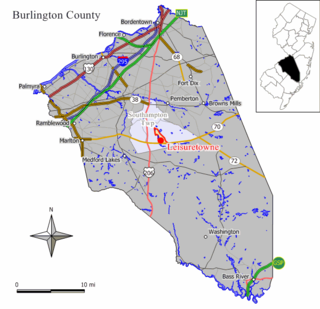
Leisuretowne is an unincorporated community and census-designated place (CDP) located within Southampton Township, in Burlington County, in the U.S. state of New Jersey. As of the 2010 United States Census, the CDP's population was 3,582.

Sandy Level is a census-designated place (CDP) in Henry County, Virginia, United States. The population was 484 at the 2010 census, which was a significant decrease from the 689 reported in 2000. It is part of the Martinsville Micropolitan Statistical Area.

Villa Heights is a census-designated place (CDP) in Henry County, Virginia, United States. The population was 717 at the 2010 census. It is part of the Martinsville Micropolitan Statistical Area.

<span class="mw-page-title-main">Verlot, Washington</span> CDP in Washington, United States

Verlot is a census-designated place (CDP) in Snohomish County, Washington, United States. The population was 285 at the 2010 census.

Washam is a census-designated place (CDP) in Sweetwater County, Wyoming, United States. The population was 51 at the 2010 census.

<span class="mw-page-title-main">Van Buren (CDP), Maine</span> Census-designated place in Maine, United States

Van Buren is a census-designated place (CDP) comprising the main village within the town of Van Buren in Aroostook County, Maine, United States. The population of the CDP was 1,937 at the 2010 census, out of a population of 2,171 for the entire town.

Norridgewock is a census-designated place (CDP) in the town of Norridgewock in Somerset County, Maine, United States. The population was 1,351 at the 2020 census.

References

  1. 1 2 "U.S. Census website". United States Census Bureau . Retrieved January 31, 2008.
  2. "US Board on Geographic Names". United States Geological Survey. October 25, 2007. Retrieved January 31, 2008.
  3. "US Gazetteer files: 2010, 2000, and 1990". United States Census Bureau. February 12, 2011. Retrieved April 23, 2011.