Howard, Kansas

Last updated

Howard, Kansas
Elk County Kansas Incorporated and Unincorporated areas Howard Highlighted.svg
Location within Elk County and Kansas
Map of Elk Co, Ks, USA.png
Coordinates: 37°28′10″N96°15′47″W / 37.46944°N 96.26306°W / 37.46944; -96.26306 [1]
Country United States
State Kansas
County Elk
Founded1870
Incorporated 1877
Named for Oliver O. Howard
Government
[2]
  Type Mayor–Council
   Mayor Richard Clark [ citation needed ]
Area
[3]
  Total0.69 sq mi (1.80 km2)
  Land0.69 sq mi (1.80 km2)
  Water0.00 sq mi (0.00 km2)
Elevation
[1]
1,040 ft (320 m)
Population
 (2020) [4]
  Total570
  Density830/sq mi (320/km2)
Time zone UTC-6 (CST)
  Summer (DST) UTC-5 (CDT)
ZIP code
67349
Area code 620
FIPS code 20-33250
GNIS ID 2394429 [1]
Website cityofhoward.org

Howard is a city in and the county seat of Elk County, Kansas, United States. [1] As of the 2020 census, the population of the city was 570. [4]

Contents

History

Howard was founded in 1870, and it was incorporated as a city in 1877. [5] Howard was named after Oliver O. Howard, a Union Army general during the Civil War and founder of Howard University. [6] [7] The first post office in Howard was established in February, 1870. [8] As of 1901, Howard was a sundown town where African Americans were not allowed to live. [9]

Geography

According to the United States Census Bureau, the city has a total area of 0.70 square miles (1.81 km2), all of it land. [10]

Climate

The climate in this area is characterized by hot, humid summers and generally mild to cool winters. According to the Köppen Climate Classification system, Howard has a humid subtropical climate, abbreviated "Cfa" on climate maps. [11]

Climate data for Howard, Kansas, 1991–2020 normals, extremes 1907–present
MonthJanFebMarAprMayJunJulAugSepOctNovDecYear
Record high °F (°C)79
(26)
88
(31)
94
(34)
97
(36)
99
(37)
108
(42)
115
(46)
111
(44)
109
(43)
98
(37)
90
(32)
80
(27)
115
(46)
Mean maximum °F (°C)67.1
(19.5)
71.9
(22.2)
79.7
(26.5)
85.8
(29.9)
89.3
(31.8)
93.7
(34.3)
99.8
(37.7)
100.3
(37.9)
95.9
(35.5)
87.1
(30.6)
76.2
(24.6)
67.4
(19.7)
101.9
(38.8)
Mean daily maximum °F (°C)43.5
(6.4)
48.5
(9.2)
58.6
(14.8)
68.2
(20.1)
76.2
(24.6)
85.0
(29.4)
90.4
(32.4)
90.0
(32.2)
82.4
(28.0)
70.7
(21.5)
57.3
(14.1)
46.0
(7.8)
68.1
(20.0)
Daily mean °F (°C)31.7
(−0.2)
35.9
(2.2)
45.4
(7.4)
55.4
(13.0)
64.9
(18.3)
74.1
(23.4)
78.9
(26.1)
77.7
(25.4)
69.4
(20.8)
57.4
(14.1)
44.7
(7.1)
34.6
(1.4)
55.8
(13.3)
Mean daily minimum °F (°C)19.9
(−6.7)
23.3
(−4.8)
32.3
(0.2)
42.5
(5.8)
53.5
(11.9)
63.1
(17.3)
67.5
(19.7)
65.4
(18.6)
56.5
(13.6)
44.1
(6.7)
32.1
(0.1)
23.3
(−4.8)
43.6
(6.5)
Mean minimum °F (°C)2.4
(−16.4)
8.0
(−13.3)
14.9
(−9.5)
27.8
(−2.3)
38.9
(3.8)
52.1
(11.2)
58.7
(14.8)
55.6
(13.1)
41.6
(5.3)
27.8
(−2.3)
16.1
(−8.8)
6.7
(−14.1)
−1.1
(−18.4)
Record low °F (°C)−17
(−27)
−18
(−28)
−2
(−19)
15
(−9)
27
(−3)
42
(6)
47
(8)
43
(6)
27
(−3)
12
(−11)
−3
(−19)
−17
(−27)
−18
(−28)
Average precipitation inches (mm)1.03
(26)
1.73
(44)
2.75
(70)
3.63
(92)
5.09
(129)
5.69
(145)
4.01
(102)
3.59
(91)
3.54
(90)
3.52
(89)
2.23
(57)
1.77
(45)
38.58
(980)
Average snowfall inches (cm)2.2
(5.6)
0.8
(2.0)
0.9
(2.3)
0.1
(0.25)
0.0
(0.0)
0.0
(0.0)
0.0
(0.0)
0.0
(0.0)
0.0
(0.0)
0.0
(0.0)
0.9
(2.3)
1.5
(3.8)
6.4
(16.25)
Average precipitation days (≥ 0.01 in)4.14.86.87.99.68.67.66.46.76.35.14.978.8
Average snowy days (≥ 0.1 in)1.61.20.60.10.00.00.00.00.00.00.31.45.2
Source 1: NOAA [12]
Source 2: National Weather Service [13]

Demographics

Historical population
CensusPop.Note
1880 683
1890 1,01548.6%
1900 1,20718.9%
1910 1,163−3.6%
1920 1,060−8.9%
1930 1,0690.8%
1940 1,1709.4%
1950 1,149−1.8%
1960 1,017−11.5%
1970 918−9.7%
1980 9655.1%
1990 815−15.5%
2000 808−0.9%
2010 687−15.0%
2020 570−17.0%
U.S. Decennial Census

2020 census

The 2020 United States census counted 570 people, 268 households, and 148 families in Howard. [14] [15] The population density was 808.5 per square mile (312.2/km2). There were 347 housing units at an average density of 492.2 per square mile (190.0/km2). [15] [16] The racial makeup was 90.88% (518) white or European American (89.12% non-Hispanic white), 0.35% (2) black or African-American, 1.23% (7) Native American or Alaska Native, 0.18% (1) Asian, 0.0% (0) Pacific Islander or Native Hawaiian, 1.05% (6) from other races, and 6.32% (36) from two or more races. [17] Hispanic or Latino of any race was 4.56% (26) of the population. [18]

Of the 268 households, 20.1% had children under the age of 18; 44.8% were married couples living together; 35.8% had a female householder with no spouse or partner present. 39.9% of households consisted of individuals and 28.0% had someone living alone who was 65 years of age or older. [15] The average household size was 2.1 and the average family size was 2.8. [19] The percent of those with a bachelor’s degree or higher was estimated to be 21.2% of the population. [20]

23.7% of the population was under the age of 18, 3.3% from 18 to 24, 17.7% from 25 to 44, 25.6% from 45 to 64, and 29.6% who were 65 years of age or older. The median age was 51.5 years. For every 100 females, there were 112.7 males. [15] For every 100 females ages 18 and older, there were 123.1 males. [15]

The 2016-2020 5-year American Community Survey estimates show that the median household income was $39,750 (with a margin of error of +/- $14,890) and the median family income was $61,167 (+/- $6,692). [21] Males had a median income of $38,750 (+/- $13,936) versus $13,500 (+/- $9,870) for females. The median income for those above 16 years old was $26,944 (+/- $7,633). [22] Approximately, 11.4% of families and 23.7% of the population were below the poverty line, including 26.8% of those under the age of 18 and 14.4% of those ages 65 or over. [23] [24]

2010 census

As of the census [25] of 2010, there were 687 people, 318 households, and 176 families residing in the city. The population density was 981.4 inhabitants per square mile (378.9/km2). There were 415 housing units at an average density of 592.9 per square mile (228.9/km2). The racial makeup of the city was 95.1% White, 1.6% Native American, 0.4% Asian, 0.6% from other races, and 2.3% from two or more races. Hispanic or Latino of any race were 4.1% of the population.

There were 318 households, of which 22.3% had children under the age of 18 living with them, 43.1% were married couples living together, 8.8% had a female householder with no husband present, 3.5% had a male householder with no wife present, and 44.7% were non-families. 41.2% of all households were made up of individuals, and 22.7% had someone living alone who was 65 years of age or older. The average household size was 2.03 and the average family size was 2.74.

The median age in the city was 49.6 years. 19.9% of residents were under the age of 18; 6.7% were between the ages of 18 and 24; 17.6% were from 25 to 44; 27.3% were from 45 to 64; and 28.5% were 65 years of age or older. The gender makeup of the city was 47.3% male and 52.7% female.

2000 census

As of the census [26] of 2000, there were 808 people, 350 households, and 215 families residing in the city. The population density was 1,154.6 inhabitants per square mile (445.8/km2). There were 452 housing units at an average density of 645.9 per square mile (249.4/km2). The racial makeup of the city was 94.93% White, 0.25% African American, 1.24% Native American, 0.62% Asian, 0.62% from other races, and 2.35% from two or more races. Hispanic or Latino of any race were 1.98% of the population.

There were 350 households, out of which 24.0% had children under the age of 18 living with them, 51.7% were married couples living together, 6.3% had a female householder with no husband present, and 38.3% were non-families. 37.4% of all households were made up of individuals, and 23.7% had someone living alone who was 65 years of age or older. The average household size was 2.16 and the average family size was 2.83.

In the city, the population was spread out, with 22.4% under the age of 18, 5.4% from 18 to 24, 19.2% from 25 to 44, 22.8% from 45 to 64, and 30.2% who were 65 years of age or older. The median age was 47 years. For every 100 females, there were 81.6 males. For every 100 females age 18 and over, there were 78.6 males.

The median income for a household in the city was $25,822, and the median income for a family was $28,365. Males had a median income of $24,886 versus $16,354 for females. The per capita income for the city was $15,441. About 11.9% of families and 14.5% of the population were below the poverty line, including 17.2% of those under age 18 and 14.6% of those age 65 or over.

Education

The community is served by West Elk USD 282 public school district. School unification consolidated Moline, Howard and Severy schools forming USD 282. West Elk High School is located in Howard. The West Elk High School mascot is Patriots. [27]

Prior to school unification, the Howard High School mascot was Pirates. [28]

See also

Related Research Articles

<span class="mw-page-title-main">Garnett, Kansas</span> City in Anderson County, Kansas

Garnett is a city in and the county seat of Anderson County, Kansas, United States. As of the 2020 census, the population of the city was 3,242.

<span class="mw-page-title-main">Isabel, Kansas</span> City in Kiowa County, Kansas

Isabel is a city in Barber County, Kansas, United States. As of the 2020 census, the population of the city was 68.

<span class="mw-page-title-main">Kiowa, Kansas</span> City in Kiowa County, Kansas

Kiowa is a city in Barber County, Kansas, United States. As of the 2020 census, the population of the city was 902. It is located 1 mile north of the Kansas / Oklahoma state border.

<span class="mw-page-title-main">Reserve, Kansas</span> City in Brown County, Kansas

Reserve is a city in Brown County, Kansas, United States. As of the 2020 census, the population of the city was 67. It is located approximately 1.5 miles south of the Nebraska-Kansas border.

<span class="mw-page-title-main">Denton, Kansas</span> City in Doniphan County, Kansas

Denton is a city in Doniphan County, Kansas, United States. As of the 2020 census, the population of the city was 130.

<span class="mw-page-title-main">Elk Falls, Kansas</span> City in Elk County, Kansas

Elk Falls is a city in Elk County, Kansas, United States, along the Elk River. As of the 2020 census, the population of the city was 113.

<span class="mw-page-title-main">Longton, Kansas</span> City in Elk County, Kansas

Longton is a city in Elk County, Kansas, United States, along the Elk River. As of the 2020 census, the population of the city was 288.

<span class="mw-page-title-main">Moline, Kansas</span> City in Elk County, Kansas

Moline is a city in Elk County, Kansas, United States. As of the 2020 census, the population of the city was 345. Moline is located in south central Elk County at the intersection of U.S. Highway 160 and K-99.

<span class="mw-page-title-main">Madison, Kansas</span> City in Greenwood County, Kansas

Madison is a city in Greenwood County, Kansas, United States, along the Verdigris River. As of the 2020 census, the population of the city was 689.

<span class="mw-page-title-main">North Newton, Kansas</span> City in Harvey County, Kansas

North Newton is a city in Harvey County, Kansas, United States. As of the 2020 census, the population of the city was 1,814. It is located between the north side of the city of Newton and the south side of Interstate I-135. North Newton is home of Bethel College.

<span class="mw-page-title-main">Hanston, Kansas</span> City in Hodgeman County, Kansas

Hanston is a city in Hodgeman County, Kansas, United States. As of the 2020 census, the population of the city was 259.

<span class="mw-page-title-main">Holton, Kansas</span> City in Jackson County, Kansas

Holton is a city in and the county seat of Jackson County, Kansas, United States. As of the 2020 census, the population of the city was 3,401.

<span class="mw-page-title-main">Randall, Kansas</span> City in Jewell County, Kansas

Randall is a city in Jewell County, Kansas, United States. As of the 2020 census, the population of the city was 79.

<span class="mw-page-title-main">Elk City, Kansas</span> City in Montgomery County, Kansas

Elk City is a city in Montgomery County, Kansas, United States, along the Elk River. As of the 2020 census, the population of the city was 260.

<span class="mw-page-title-main">Ness City, Kansas</span> City in Ness County, Kansas

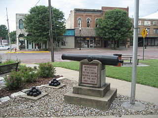
Ness City is a city in and the county seat of Ness County, Kansas, United States. As of the 2020 census, the population of the city was 1,329. Ness City is famous for its four-story Old Ness County Bank Building located downtown, and nicknamed Skyscraper of the Plains.

<span class="mw-page-title-main">Ransom, Kansas</span> City in Ness County, Kansas, United States

Ransom is a city in Ness County, Kansas, United States. As of the 2020 census, the population of the city was 260.

<span class="mw-page-title-main">Larned, Kansas</span> City in Pawnee County, Kansas

Larned is a city in and the county seat of Pawnee County, Kansas, United States. As of the 2020 census, the population of the city was 3,769.

<span class="mw-page-title-main">Belvue, Kansas</span> City in Pottawatomie County, Kansas

Belvue is a city in Pottawatomie County, Kansas, United States. As of the 2020 census, the population of the city was 177.

<span class="mw-page-title-main">Plevna, Kansas</span> City in Reno County, Kansas

Plevna is a city in Reno County, Kansas, United States. As of the 2020 census, the population of the city was 85.

<span class="mw-page-title-main">Gaylord, Kansas</span> City in Smith County, Kansas

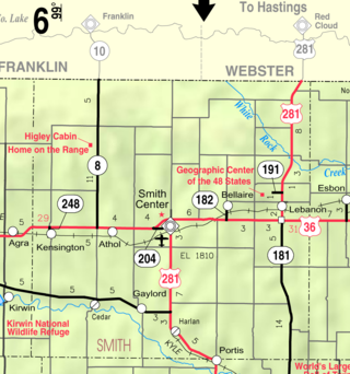
Gaylord is a city in Smith County, Kansas, United States. As of the 2020 census, the population of the city was 87.

References

  1. 1 2 3 4 U.S. Geological Survey Geographic Names Information System: Howard, Kansas
  2. "City of Howard". The League of Kansas Municipalities. May 29, 2019.
  3. "2019 U.S. Gazetteer Files". United States Census Bureau. Retrieved July 24, 2020.
  4. 1 2 "Profile of Howard, Kansas in 2020". United States Census Bureau. Archived from the original on May 4, 2022. Retrieved May 4, 2022.
  5. Blackmar, Frank Wilson (1912). Kansas: A Cyclopedia of State History, Embracing Events, Institutions, Industries, Counties, Cities, Towns, Prominent Persons, Etc. Standard Publishing Company. p. 876. ISBN   9780722249055.
  6. Rydjord, John (1972). Kansas Place-Names. Norman: University of Oklahoma Press. p. 202. ISBN   0-8061-0994-7.
  7. "Profile for Howard, Kansas". ePodunk. Archived from the original on July 14, 2014. Retrieved June 9, 2014.
  8. "Kansas Post Offices, 1828-1961 (archived)". Kansas Historical Society. Archived from the original on October 9, 2013. Retrieved June 8, 2014.
  9. "Kansas Items". Fairview Enterprise . Fairview, Kansas. February 9, 1901. p. 3 via Newspapers.com. Nortonville and Howard are two Kansas towns where negroes are not allowed to live.
  10. "US Gazetteer files 2010". United States Census Bureau. Archived from the original on January 25, 2012. Retrieved July 6, 2012.
  11. Climate Summary for Howard, Kansas
  12. "U.S. Climate Normals Quick Access – Station: Howard, KS". National Oceanic and Atmospheric Administration. Retrieved November 21, 2023.
  13. "NOAA Online Weather Data – NWS Wichita". National Weather Service. Retrieved November 21, 2023.
  14. "US Census Bureau, Table P16: HOUSEHOLD TYPE". data.census.gov. Retrieved January 3, 2024.
  15. 1 2 3 4 5 "US Census Bureau, Table DP1: PROFILE OF GENERAL POPULATION AND HOUSING CHARACTERISTICS". data.census.gov. Retrieved January 3, 2024.
  16. Bureau, US Census. "Gazetteer Files". Census.gov. Retrieved December 30, 2023.
  17. "US Census Bureau, Table P1: RACE". data.census.gov. Retrieved January 3, 2024.
  18. "US Census Bureau, Table P2: HISPANIC OR LATINO, AND NOT HISPANIC OR LATINO BY RACE". data.census.gov. Retrieved January 3, 2024.
  19. "US Census Bureau, Table S1101: HOUSEHOLDS AND FAMILIES". data.census.gov. Retrieved January 3, 2024.
  20. "US Census Bureau, Table S1501: EDUCATIONAL ATTAINMENT". data.census.gov. Retrieved January 3, 2024.
  21. "US Census Bureau, Table S1903: MEDIAN INCOME IN THE PAST 12 MONTHS (IN 2020 INFLATION-ADJUSTED DOLLARS)". data.census.gov. Retrieved January 3, 2024.
  22. "US Census Bureau, Table S2001: EARNINGS IN THE PAST 12 MONTHS (IN 2020 INFLATION-ADJUSTED DOLLARS)". data.census.gov. Retrieved January 3, 2024.
  23. "US Census Bureau, Table S1701: POVERTY STATUS IN THE PAST 12 MONTHS". data.census.gov. Retrieved January 3, 2024.
  24. "US Census Bureau, Table S1702: POVERTY STATUS IN THE PAST 12 MONTHS OF FAMILIES". data.census.gov. Retrieved January 3, 2024.
  25. "U.S. Census website". United States Census Bureau . Retrieved July 6, 2012.
  26. "U.S. Census website". United States Census Bureau . Retrieved January 31, 2008.
  27. "West Elk Schools". USD 282. Retrieved January 4, 2017.
  28. "Howard High School - Scraps Yearbook (Howard, KS) - Class of 1959". E-YEARBOOK.COM. Retrieved January 7, 2017.

Further reading