Related Research Articles
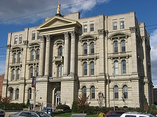
Jefferson County is a county located in the U.S. state of Ohio. As of the 2020 census, the population was 65,249. Its county seat is Steubenville. The county is named for Thomas Jefferson, who was vice president at the time of its creation.
New Somerset is an unincorporated community in northern Knox Township, Jefferson County, Ohio, United States. It lies south of Hammondsville along State Route 213, at 40°30′57″N80°42′21″W.
Rush Run is an unincorporated community in Warren Township, Jefferson County, Ohio, United States. It is mainly around the area of Rush Run Road also known as County Road 17. It is named for David Rush who settled in that area in 1798.

Clarkson is an unincorporated community in southwestern Middleton Township, Columbiana County, Ohio, United States, clustered around the intersection of Clarkson and Sprucevale roads. For most of the 19th century, until the founding of Negley and Rogers, Clarkson was the most prominent settlement in Middleton Township.
Monday is an unincorporated community in Hocking County, in the U.S. state of Ohio.
Annapolis is an unincorporated community in Salem Township, Jefferson County, in the U.S. state of Ohio.
Calumet is an unincorporated community in Knox Township, Jefferson County, Ohio, United States. It is located just north of Toronto between Ohio State Route 7 and the Ohio River, at 40°28′55″N80°36′24″W. North 4th Street and North River Avenue both run continuously from Toronto to Calumet.
Emerson is an unincorporated community in Jefferson County, in the U.S. state of Ohio. Emerson is usually considered to be the area that runs from the border of Mount Pleasant, Ohio to the junction between Route 250 and Route 150, and then when both Jefferson and Belmont 5 run into Pleasant Grove, Ohio on Route 250, and then finally when Township Road 128 splits into both the latter and Pinewood Drive, which then runs into Harrisville, Ohio.
Gould is an unincorporated community in Jefferson County, in the U.S. state of Ohio.

Monroeville is an unincorporated community in Jefferson County, in the U.S. state of Ohio.
Port Homer is an unincorporated community in Jefferson County, in the U.S. state of Ohio.
Reeds Mill is an unincorporated community in Jefferson County, in the U.S. state of Ohio.
Warrenton is an unincorporated community in Jefferson County, in the U.S. state of Ohio.
York is an unincorporated community in Jefferson County, in the U.S. state of Ohio.
Captina is an unincorporated community in Belmont County, in the U.S. state of Ohio.
Broadacre is an unincorporated community in Wayne Township, Jefferson County, Ohio, United States. It is located about 2.5 miles (4.0 km) northeast of Bloomingdale at the intersection of Ohio State Route 152 and Township Route 166, at 40°21′58″N80°46′59″W.
Chandler is an unincorporated community in Wayne Township, Jefferson County, Ohio, United States. It is located south of Bloomingdale at the intersection of Bloomingdale-Smithfield-Chandler Road and County Road 24, at 40°18′28″N80°48′15″W.
Holt is an unincorporated community in Knox Township, Jefferson County, Ohio, United States. It is located about 3 miles (4.8 km) west of New Somerset at the intersection of County Highway 53 and Township Road 218, at 40°30′44″N80°45′06″W.
Panhandle is an unincorporated community in Wayne Township, Jefferson County, Ohio, United States. It is located northwest of Bloomingdale and just west of Unionport at the intersection of Carman Road and Township Road 201, at 40°21′31″N80°52′07″W.
Yellow Creek is an unincorporated community in Saline Township, Jefferson County, Ohio, United States. It is located northwest of Hammondsville at the intersection of Ohio State Route 7 and Ohio State Route 213 where the Yellow Creek empties into the Ohio River, at 40°34′28″N80°40′03″W.
References
- ↑ U.S. Geological Survey Geographic Names Information System: Knoxville, Ohio
- ↑ Caldwell, John Alexander (1880). History of Belmont and Jefferson Counties, Ohio: And Incidentally Historical Collections Pertaining to Border Warfare and the Early Settlement of the Adjacent Portion of the Ohio Valley. Historical Publishing Company. p. 584.
- ↑ "Jefferson County". Jim Forte Postal History. Retrieved January 2, 2016.
Municipalities and communities of Jefferson County, Ohio, United States | ||
|---|---|---|
| Cities |  | |
| Villages | ||
| Townships | ||
| CDPs | ||
| Other communities |
| |
| Footnotes | ‡This populated place also has portions in an adjacent county or counties | |
40°29′32″N80°40′50″W / 40.49222°N 80.68056°W
| | This Jefferson County, Ohio state location article is a stub. You can help Wikipedia by expanding it. |