Companies based in Idaho
A

B
C
D
E

F
G
H

I
J
K
L
M
N
O
P

- Pacific Press Publishing Association
- Pita Pit (American Headquarters)
- Preco
Q
R
S

This is a list of companies based in Idaho. Idaho is a state in the northwestern region of the United States. It is the 14th largest, the 39th most populous, and the 7th least densely populated of the 50 United States. The United States Census Bureau estimates that the population of Idaho was 1,654,930 as of July 1, 2015, [1] up from 1,595,728 on July 1, 2012, a 1.8% increase since 2010. [2] The state's largest city and capital is Boise. Today, the largest industry in Idaho is the science and technology sector. It accounts for over 25% of the state's total revenue and over 70% of the state's exports. Idaho's industrial economy is growing, with high-tech products leading the way.[ citation needed ] Idaho is an important agricultural state, producing nearly one-third of the potatoes grown in the United States.


Idaho is a landlocked state in the Mountain West subregion of the United States. It shares a small portion of the Canada–United States border to the north, with the province of British Columbia. It borders Montana and Wyoming to the east, Nevada and Utah to the south, and Washington and Oregon to the west. The state's capital and largest city is Boise. With an area of 83,569 square miles (216,440 km2), Idaho is the 14th largest state by land area. With a population of approximately 1.8 million, it ranks as the 13th least populous and the 7th least densely populated of the 50 U.S. states.

Boise is the capital and most populous city in the U.S. state of Idaho and is the county seat of Ada County. As of the 2020 census, there were 235,684 people residing in the city. On the Boise River in southwestern Idaho, it is 41 miles (66 km) east of the Oregon border and 110 miles (177 km) north of the Nevada border. The downtown area's elevation is 2,704 feet (824 m) above sea level.

Valley County is a rural county located in the U.S. state of Idaho. As of the 2020 census, the population was 11,746. The county seat is Cascade, and the largest city is McCall. Established in 1917, it was named after the Long Valley of the North Fork of the Payette River, which extends over 30 miles (50 km) from Payette Lake at McCall south to Cascade to Round Valley. The valley was formerly a summer pasture for livestock from the Boise Valley. Since the completion of the Cascade Dam in 1948, much of the northern valley has been covered by the Cascade Reservoir.
Shoshone County is a county in the U.S. state of Idaho. As of the 2020 census, the population was 13,169. The county seat is Wallace and the largest city is Kellogg. The county was established in 1864, named for the Native American Shoshone tribe.
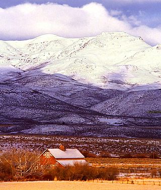
Owyhee County is a county in the southwestern corner of the U.S. state of Idaho. As of the 2020 census, the population was 11,913. The county seat is Murphy, and its largest city is Homedale. In area it is the second-largest county in Idaho, behind Idaho County.

Elmore County is a county in the U.S. state of Idaho. As of the 2020 census, the population was 28,666. The largest city and county seat is Mountain Home.

Boise County is a rural mountain county in the U.S. state of Idaho. As of the 2020 United States Census, the population was 7,610. The county seat is historic Idaho City, which is connected through a series of paved and unpaved roads to Lowman, Centerville, Placerville, Pioneerville, Star Ranch, Crouch, Garden Valley, and Horseshoe Bend.

Ada County is located in the southwestern part of Idaho, United States. As of the 2020 census, the county had a population of 494,967, which by 2022 was estimated to have risen to 518,907. Ada County is by far the state's most populous county; it is home to 26.8% of the state's population. The county seat and largest city is Boise, which is also the state capital. Ada County is included in the Boise metropolitan area. The Ada County Highway District has jurisdiction over all the local county and city streets, except for private roads and state roads. In the interior Pacific Northwest east of the Cascade Range, Ada County ranks second in population, behind Spokane County, Washington.

Pocatello is the county seat and largest city of Bannock County, with a small portion on the Fort Hall Indian Reservation in neighboring Power County, in the southeastern part of the U.S. state of Idaho. It is the principal city of the Pocatello metropolitan area, which encompasses all of Bannock County.

Horseshoe Bend is the largest city in rural Boise County, in the southwestern part of the U.S. state of Idaho. Its population of 707 at the 2010 census was the largest in the county, though down from 770 in 2000.

Idaho City is a town in, and the county seat of, Boise County, Idaho, United States, located about 36 miles (58 km) northeast of Boise. The population was 485 at the 2010 census, up from 458 in 2000.

Elko is a city in the U.S. state of Nevada and the county seat of Elko County. As of the official 2020 U.S. Census, the city has a population of 20,564. Elko serves as the center of the Ruby Valley, a region with a population of over 55,000. Elko is 21 miles (34 km) from Lamoille Canyon and the Ruby Mountains, providing year-round access to recreation, including hiking, skiing, hunting, and more than 20 alpine lakes. The city straddles the Humboldt River. Spring Creek, Nevada, serves as a bedroom community 6 miles (10 km) from the city with a population of 13,805.
The Boise, Idaho Metropolitan Statistical Area (MSA) is an area that encompasses Ada, Boise, Canyon, Gem, and Owyhee counties in southwestern Idaho, anchored by the cities of Boise and Nampa. It is the main component of the wider Boise–Mountain Home–Ontario, ID–OR Combined Statistical Area, which adds Elmore and Payette counties in Idaho and Malheur County, Oregon. It is the state's largest officially designated metropolitan area and includes Idaho's three largest cities: Boise, Nampa, and Meridian. Nearly 40 percent of Idaho's total population lives in the area.

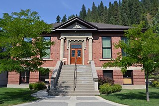
Murphy is a census-designated place in, and the county seat of, Owyhee County, Idaho, United States. It is among the smallest of county seats nationwide, with a population as of the 2020 census of 96. Murphy is part of the Boise City–Nampa, Idaho Metropolitan Statistical Area. Murphy is also located within the census-designated place bearing its name. Murphy is home to the Owyhee County Historical Museum and Library.
The history of Idaho is an examination of the human history and social activity within the state of Idaho, one of the United States of America located in the Pacific Northwest area near the west coast of the United States and Canada. Other associated areas include southern Alaska, all of British Columbia, Washington, Oregon, western Montana and northern California and Nevada.

Central Idaho is a geographical term for the region located northeast of Boise and southeast of Lewiston in the U.S. state of Idaho. It is dominated by federal lands administered by the United States Forest Service and the Bureau of Land Management. Idaho's tallest mountain, Borah Peak, is located in this region. A large part of the Sawtooth National Recreation Area is within Central Idaho.

Southwestern Idaho is a geographical term for the area along the U.S. state of Idaho's borders with Oregon and Nevada. It includes the populous areas of the Boise metropolitan area and the Treasure Valley.

The economy of the Spokane Metropolitan Area plays a vital role as the hub for the commercial, manufacturing, and transportation center as well as the medical, shopping, and entertainment hub of the 80,000 square miles (210,000 km2) Inland Northwest region. Although the two have opted not to merge into a single Metropolitan Statistical Area (MSA) yet, the Coeur d'Alene MSA has been combined by the Census Bureau into the Spokane–Coeur d'Alene combined statistical area (CSA). The CSA comprises the Spokane metropolitan area and the Coeur d'Alene metropolitan area anchored by Coeur d'Alene, Idaho. According to the U.S. Bureau of Labor Statistics, the Spokane metropolitan area has a workforce of about 287,000 people and an unemployment rate of 5.3 percent as of February 2020; the largest sectors for non–farm employment are education and health services, trade, transportation, and utilities, and government. The Coeur d'Alene metropolitan area has a workforce of 80,000 people and an unemployment rate of 6.8% as of June 2020; the largest sectors for non-farm employment are trade, transportation, and utilities, government, and education and health services as well as leisure and hospitality. In 2017, the Spokane–Spokane Valley metropolitan area had a gross metropolitan product of $25.5 billion while the Coeur d'Alene metropolitan area was $5.93 billion.

Gross state product for the state of Idaho in 2022 was $84 billion, and the per capita income based on 2015 GDP and 2015 population estimates was $39,100.
The following outline is provided as an overview of and topical guide to the U.S. state of Idaho: