List
| Country | No. of islands | No. of inhabited islands | Notes | List link | Source(s) |
|---|---|---|---|---|---|
| Algeria | 240 | 32 islands and 208 islets; coastal islands/islets only. | List | [2] | |
| Antigua and Barbuda | 54 | 2 | Three main islands (Antigua, Barbuda and Redonda) and 51 offshore islands | List | [3] [4] |
| Australia | 8,222 | List | [5] | ||
| Azerbaijan | 16 | 1 | List | [6] | |
| Bangladesh | 23 | ||||
| Barbados | 4 | 1 | There are currently two islands and two banks in Barbados. An additional historical island (Pelican Island) no longer exists. | List | [7] |
| Canada | 52,455 | Canada has several large inhabited islands, including Prince Edward Island, a founding province, Vancouver Island, with British Columbia's capital of Victoria, Montreal, and Manitoulin Island. | List | [1] | |
| Cape Verde | 15 | 9 | 10 islands and 5 islets | List | [8] |
| Chile | 43,471 | 2,324 | 3,739 islands (above 9,000 m2 (97,000 sq ft)) and 2180 islets (above 3,000 m2 (32,000 sq ft)) | List | [9] [10] |
| China | 6,961 | 433 | 500 m2 (5,400 sq ft) only. Excludes Taiwan, Hong Kong and Macao. | List | [11] |
| Croatia | 1,246 | 48 | List | [12] | |
| Cuba | 4,195 | List | [13] | ||
| Denmark | 406 | 70 | List | [14] | |
| Dominica | 3 | 1 | The island nation of Dominica with a total area of 750 km2 (290 sq mi) includes two small, off-shore islands and one disputed island: | List | [15] [16] |
| Estonia | 2,355 | 22 | List | [17] [18] | |
| Fiji | 330 | 110 | List | ||
| Finland | 178,947 | 780 | List | [19] | |
| France | 1,900+ | 109 | List | [20] | |
| Greece | 6,000 | 227 | Depending on inclusion criteria counts vary from 1,200 [21] to 6,000. [22] The number inhabited is variously cited as between 166 [23] and 227. [22] | List | [22] |
| Hong Kong | 263 | >500 m2 (5,400 sq ft) only. "Many" or "most" are inhabited. | List | [24] | |
| Iceland | 31 | 4 | 1 large and "about 30 smaller islands, and thousands of rocks and skerries." | List | [25] |
| India | 1,382 | 47 | "Off-shore identified islands". The Andaman and Nicobar Islands comprise 572 islands, 37 of which are inhabited. [26] Lakshadweep has 32 islands, 10 of which are inhabited. [27] | List | [28] |
| Indonesia | 17,508 | 6,000 | Largest archipelagic state. 5 major islands and about 30 smaller groups, about 6,000 are inhabited. | By name By area By population By extremities | [29] |
| Italy | 808 | 77 | List | ||
| Japan | 120,729 | 430 | 14,125 islands with a circumference of at least 0.1 km. | By area By location | [30] [31] [32] |
| Kiribati | 33 | 21 | 32 atolls and 1 limestone island; 21 islands are inhabited. | List | [33] |
| Malaysia | 878 | The largest island, Borneo is shared with Brunei and Indonesia. | List | [ citation needed ] | |
| Maldives | 1,192 | 187 | 1,192 islands in total of 10 atolls; 187 islands are inhabited. | List | [34] |
| Malta | 21 | 3 | 3 inhabited (Malta, Gozo and Comino), 3 islets and 12 "large rocks" | — | [35] |
| Marshall Islands | 34 | 24 | 29 atolls and 5 isolated islands. | List | [36] [37] |
| Mexico | 1,356 | 131 | List | [38] | |
| Micronesia | 607 | 65 | Four major island groups | List | [39] [40] |
| Nauru | 1 | 1 | — | [41] | |
| New Zealand | 600 | Approximate number within about 50 km (31 mi) of the two main islands; excludes associated states and Antarctic islands. | List | [42] | |
| Netherlands | 34 | 15 | |||
| North Macedonia | 30 | 0 | 13 larger than 0.01 km2 (2.5 acres), 6 on lakes, the rest on rivers. | List | [43] |
| Norway | 320,249 | 60+ | There are a total of 320,249 islands and islets along much-indented coastline, according to Kartverket. 239,057 of which are considered proper islands, with the rest being islets. However by the definition in this list all 320,249 fall under the definition islands. An older source gives 53,789 islands, which may be the figure for coastal islands only. [44] | List | [45] |
| Pakistan | 12 | 7 | Pakistan's largest island, Astola | List | [46] |
| Palau | 200 | 8 | Eight permanently inhabited | List | [47] |
| Peru | 233 | 8 | Approximate there are 94.36 km (58.63 mi)[ clarification needed ][ Is this intended to be an area, or what? ] in maritime islands and islets, and 39.04 km (24.26 mi) inside lakes | List | [48] |
| Philippines | 7,641 | 2,000 | Thousands of islands are unnamed, and tiny. | List | [49] [50] |
| Poland | 203 | Usedom (shared with Germany) and Wolin are barrier islands; the rest are either lagoon, lake or river islands. | List | [51] | |
| Portugal | 23 | 23 | All of their 23 islands are inhabited. | List | |
| Russia | 1,338 | List | [52] | ||
| Samoa | 12 | 4 | List | [53] | |
| Senegal | 35 | List | |||
| Serbia | 35 | 1–3 | Ostrovo is permanently populated, while Ada and Great War Island are occasionally inhabited. Most islands are on the Danube and Sava. | List | |
| Singapore | 64 | These include Sentosa, Pulau Ubin, St John's Island and Sisters' Islands. | [54] | ||
| South Korea | 3,358 | 2,876 | List | [55] | |
| Spain | 60 | 21 | List | ||
| Sri Lanka | 61 | 3 | Most of the islands are situated in the north and eastern parts of the from the main land. The most prominent islets are west of the Jaffna Peninsula in the Northern Province. | List | |
| Sweden | 267,570 | 984 | Slightly more than 8,000 islands had some form of buildings in 2013, most uninhabited. More than 1.6 million (17% of population) people lived on an island in 2013. This figure is high because there are densely populated islands in the larger cities of Sweden. | List | [56] |
| Scotland See United Kingdom. | 900 | 118 | More than 900 islands, of which 118 are inhabited. | List | |
| Thailand | 1,430 | ||||
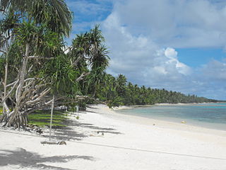
| Tonga | 169 | 36 | The total surface area of the archipelago is about 750 km2 (290 sq mi), scattered over 700,000 km2 (270,000 sq mi) of the southern Pacific Ocean. | List | [57] |
| Tuvalu | 9 | 9 | Six atolls and 3 reef islands. | List | [58] |
| United Kingdom | 6,346 | 129 | Includes all offshore islands marked on Ordnance Survey maps. England, Scotland & Wales: 6289; Northern Ireland: 57. (Not included: Isle of Man: 30[ dubious ]; Bailiwick of Guernsey: 57[ dubious ]; Bailiwick of Jersey: 274[ dubious ]; overseas dependencies.) Inhabited islands. England: 24; Scotland: 93; [59] Wales: 9; [60] Northern Ireland: 2; Britain[ clarification needed ]: 1. | List | [61] |
| United States | 18,617 | 10,000 | List | [62] | |
| Venezuela | 650 | 350 | Most of them are virgin lands[ clarification needed ]and Margarita Island is the largest island of Venezuela. | List |