
Earthquakes are caused by movements within the Earth's crust and uppermost mantle. They range from weak events detectable only by seismometers, to sudden and violent events lasting many minutes which have caused some of the greatest disasters in human history. Below, earthquakes are listed by period, region or country, year, magnitude, cost, fatalities and number of scientific studies.
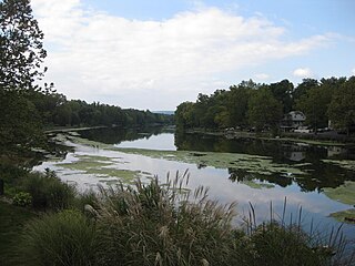
The St. Jones River is a river flowing to Delaware Bay in central Delaware in the United States. It is 12.8 miles (20.6 km) long and drains an area of 36 square miles (93 km2) on the Atlantic Coastal Plain.

Argentine Peak is a high mountain summit in the Front Range of the Rocky Mountains of North America. The 13,743-foot (4,189 m) thirteener is located in Arapaho National Forest, 8.5 miles (13.6 km) southwest by south of Georgetown, Colorado, United States. The summit lies on the Continental Divide between Clear Creek and Summit counties.

Aspen Mountain is a mountain summit in the Elk Mountains range of the Rocky Mountains of North America. The 11,212-foot (3,417 m) peak is located in White River National Forest, 1.4 miles (2.2 km) south-southeast of downtown Aspen in Pitkin County, Colorado, United States. The north face of the mountain is the location of the Aspen Mountain ski area, one of four adjacent ski areas operated collectively as Aspen/Snowmass.

Red Mountain is a set of three peaks in the San Juan Mountains of western Colorado in the United States, about five miles (8.0 km) south of Ouray. The mountains get their name from the reddish iron ore rocks that cover the surface. Several other peaks in the San Juan Mountains likewise have prominent reddish coloration from iron ore and are also called "Red Mountain".

Panamint City is a ghost town in the Panamint Range, near Death Valley, in Inyo County, California, US. It is also known by the official Board of Geographic Names as Panamint. Panamint was a boom town founded after silver and copper were found there in 1872. By 1874, the town had a population of about 2,000. Its main street was one mile (1.6 km) long. Panamint had its own newspaper, the Panamint News. Silver was the principal product mined in the area. The town is located about three miles northwest of Sentinel Peak. According to the National Geographic Names Database, NAD27 latitude and longitude for the locale are 36°07′06″N117°05′43″W, and the feature ID number is 1661185. The elevation of this location is identified as being 6,280 feet AMSL. The similar-sounding Panamint Springs, California, is located about 25.8 miles at 306.4 degrees off true north near Panamint Junction.

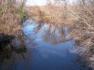
The Coeur d'Alene River flows 37 miles (60 km) from the Silver Valley into Lake Coeur d'Alene in the U.S. state of Idaho. The stream continues out of Lake Coeur d'Alene as the Spokane River.

Mount Wilson is the highest summit of the San Miguel Mountains range of the Rocky Mountains of North America. The prominent 14,252-foot (4,344 m) fourteener is located in the Lizard Head Wilderness of San Juan National Forest, 10.6 miles (17.1 km) north by east of the Town of Rico in Dolores County, Colorado, United States. Mount Wilson should not be confused with the lower Wilson Peak nearby.
Conodoguinet Creek is a 104-mile-long (167 km) tributary of the Susquehanna River in South central Pennsylvania in the United States. The name is Native American, and means "A Long Way with Many Bends".

Shermans Creek is a 53.4-mile-long (85.9 km) tributary of the Susquehanna River in Perry County, Pennsylvania.

Mount Sherman is a high mountain summit in the Mosquito Range of the Rocky Mountains of North America. The 14,043-foot (4,280 m) fourteener is located 6.8 miles (11.0 km) east by south of the City of Leadville, Colorado, United States, on the drainage divide separating Lake County from Park County. The mountain was named in honor of General William Tecumseh Sherman.

Silver Falls State Park is a state park in the U.S. state of Oregon, located near Silverton, about 20 miles (32 km) east-southeast of Salem. It is the largest state park in Oregon with an area of more than 9,000 acres (36 km2), and it includes more than 24 miles (39 km) of walking trails, 14 miles (23 km) of horse trails, and a 4-mile (6.4 km) bike path. Its 8.7-mile (14.0 km) Canyon Trail/Trail of Ten Falls runs along the banks of Silver Creek and by ten waterfalls, from which the park received its name. Four of the ten falls have an amphitheater-like surrounding that allows the trail to pass behind the flow of the falls. The Silver Falls State Park Concession Building Area and the Silver Creek Youth Camp-Silver Falls State Park are separately listed on the U.S. National Register of Historic Places.

Golden and Silver Falls State Natural Area is a state park in Coos County, Oregon, United States, administered by the Oregon Parks and Recreation Department. The nearest settlement is Allegany.

This is a list of the National Register of Historic Places listings in Aiken County, South Carolina.
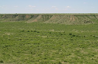
The White River is an intermittent stream in the South Plains of Texas and a tributary of the Brazos River of the United States. It rises 8 miles (13 km) west of Floydada in southwestern Floyd County at the confluence of Callahan and Runningwater Draws. From there, it runs southeast for 62 miles (100 km) to its mouth on the Salt Fork of the Brazos River in northwestern Kent County. Besides these two headwaters, which rise near Hale Center and in Curry County, New Mexico, respectively, other tributaries include Pete, Crawfish, and Davidson Creeks. The White River drains an area of 1,690 sq mi (4,377 km2).
The Owyhee Mountains are a mountain range in Owyhee County, Idaho and Malheur County, Oregon.
Beartooth Glacier is in the U.S. state of Montana. The glacier is situated in a cirque northeast of Beartooth Mountain at an average elevation of 10,500 feet (3,200 m) above sea level.
Hopper Glacier is located in the US state of Montana. The glacier is situated east of Sky Pilot Mountain in the Beartooth Mountains at an elevation of 11,000 feet (3,400 m) above sea level.
The following list creates a summary of the two major producers of different minerals.

Silver Mountain, elevation 10,525 ft (3,208 m), is a mountain in Huerfano County, Colorado. It is part of the southern Sangre de Cristo Range of the Southern Rocky Mountains of North America. Silver Mountain is located northeast of Mount Mestas and north of the Spanish Peaks.