List of crossings of the Schuylkill River

Last updated

This is a list of bridges and other crossings of the Schuylkill River, from the Delaware River upstream to the source. All locations are in Pennsylvania and Historic American Buildings Survey (HABS) and Historic American Engineering Record (HAER) survey numbers are noted where available.

Contents

Crossings

ImagesCrossingCarriesLocationOpened [1] CoordinatesNotes

Philadelphia

Basin Bridge of Philadelphia Naval Shipyard 1995.jpg Girard Point Bridge I-95.svg I-95 Mud Island, Southwest Philadelphia and South Philadelphia 1973 39°53′32″N75°11′50″W / 39.89222°N 75.19722°W / 39.89222; -75.19722 (Girard Point Bridge) Double-deck bridge;
upper deck southbound
Phila Platt Bridge02.png George C. Platt Bridge PA-291.svg PA 291 1949 39°53′53″N75°12′42″W / 39.89806°N 75.21167°W / 39.89806; -75.21167 (George C. Platt Bridge) Through truss bridge
Passyunk Avenue Bridge.jpg Passyunk Avenue Bridge Passyunk Avenue1983 39°55′11″N75°12′07″W / 39.91972°N 75.20194°W / 39.91972; -75.20194 (Passyunk Avenue Bridge) Double-leaf bascule bridge
Phila B&O Railroad Bridge11.png B&O Railroad Bridge CSX Philadelphia Subdivision 1910 39°56′08″N75°12′21″W / 39.93556°N 75.20583°W / 39.93556; -75.20583 (B&O Railroad Bridge) Swing bridge
1999 PW&B No.1 Grays Ferry Avenue Bridge 362216pv.jpg Grays Ferry Avenue Bridge Grays Ferry Avenue1976 39°56′28″N75°12′18″W / 39.94111°N 75.20500°W / 39.94111; -75.20500 (Gray's Ferry Avenue Bridge)
University Avenue Bridge, Philadelphia 01.JPG University Avenue Bridge University Avenue1930 39°56′34″N75°11′49″W / 39.94278°N 75.19694°W / 39.94278; -75.19694 (University Avenue Bridge) Double-leaf bascule bridge
Phila Schuylkill Expressway Bridge03.png Schuylkill Expressway Bridge I-76.svg I-76 1956 39°56′31″N75°11′38″W / 39.94194°N 75.19389°W / 39.94194; -75.19389 (Schuylkill Expressway Bridge)
Phila Arsenal Bridge11.png Schuylkill Arsenal Railroad Bridge CSX Harrisburg Subdivision 1886 39°56′36″N75°11′30″W / 39.94333°N 75.19167°W / 39.94333; -75.19167 (Schuylkill Arsenal Railroad Bridge) Swing bridge (immobilized)
PECO utility tunnelElectric and steam utility lines 39°56′37″N75°11′29″W / 39.94361°N 75.19139°W / 39.94361; -75.19139 (PECO utility tunnel)
Philadelphia South Street Bridge.jpg South Street Bridge South Street2010 39°56′49″N75°11′13″W / 39.94694°N 75.18694°W / 39.94694; -75.18694 (South Street Bridge) Opened November 6, 2010
Philadelphia Walnut Street Bridge.jpg Walnut Street Bridge Walnut Street1991 39°57′06″N75°10′54″W / 39.95167°N 75.18167°W / 39.95167; -75.18167 (Walnut Street Bridge)
Chestnut Street Bridge 2017.jpg Chestnut Street Bridge Chestnut Street1957 39°57′11″N75°10′52″W / 39.95306°N 75.18111°W / 39.95306; -75.18111 (Chestnut Street Bridge)
Market Street Bridge (Philadelphia) - 2017.JPG Market Street Bridge PA-3.svg PA 3 eastbound1932 39°57′16″N75°10′49″W / 39.95444°N 75.18028°W / 39.95444; -75.18028 (Market Street Bridge)
22nd Street trolley station Philadelphia.jpg Market–Frankford Line Tunnel SEPTA Market–Frankford Line 1955 39°57′16″N75°10′49″W / 39.95444°N 75.18028°W / 39.95444; -75.18028 (SEPTA Market–Frankford Line Tunnel) Also carries SEPTA subway–surface trolley lines
Phila JFK Boulevard Bridge01.jpg John F. Kennedy Boulevard Bridge PA-3.svg PA 3 westbound1959 39°57′20″N75°10′48″W / 39.95556°N 75.18000°W / 39.95556; -75.18000 (John F. Kennedy Boulevard Bridge)
HAER-30thStreetStation-09.jpg SEPTA Regional Rail bridge SEPTA Regional Rail 39°57′22″N75°10′47″W / 39.95611°N 75.17972°W / 39.95611; -75.17972 (SEPTA Regional Rail Bridge) All lines
Phila Vine St Expressway12.png Vine Street Expressway Bridge I-676.svgUS 30.svg I-676  / US 30 (Vine Street Expressway)1959 39°57′36″N75°10′48″W / 39.96000°N 75.18000°W / 39.96000; -75.18000 (Vine Street Expressway Bridge)
R.E.Roy02.png Spring Garden Street Bridge Spring Garden Street1965 39°57′51″N75°11′01″W / 39.96417°N 75.18361°W / 39.96417; -75.18361 (Spring Garden Street Bridge) Originally the Colossus Bridge
Phila West River Drive Bridge14.png MLK Drive Bridge Martin Luther King, Jr. (formerly West River) Drive1966 39°57′52″N75°11′02″W / 39.96444°N 75.18389°W / 39.96444; -75.18389 (West River Drive Bridge) Passes underneath Spring Garden Street Bridge at center of both bridges
Fairmount Water Works Dam.jpg Fairmount Water Works Dam 1928 39°58′02″N75°11′11″W / 39.96722°N 75.18639°W / 39.96722; -75.18639 (Fairmount Water Works Dam)
Phila Girard Avenue Bridge301.png Girard Avenue Bridge US 13.svg US 13 ( Girard Avenue )1972 39°58′31″N75°11′36″W / 39.97528°N 75.19333°W / 39.97528; -75.19333 (Girard Avenue Bridge) HABS PA-1657
Pennsylvania Railroad Connecting Bridge (cropped).jpg Pennsylvania Railroad, Connecting Railway Bridge SEPTA Trenton Line
SEPTA Chestnut Hill West Line
Amtrak Northeast Corridor
New Jersey Transit Atlantic City Line
1867 39°58′35″N75°11′38″W / 39.97639°N 75.19389°W / 39.97639; -75.19389 (Pennsylvania Railroad, Connecting Railway Bridge) HAER PA-37, HABS PA-6213
Phila ColumbiaRailroadBridge01.png Columbia Railroad Bridge CSX Trenton Subdivision 1920 39°59′06″N75°12′14″W / 39.98500°N 75.20389°W / 39.98500; -75.20389 (Columbia Railroad Bridge)
Phila Strawberry Mansion Bridge02.png Strawberry Mansion Bridge Strawberry Drive1897 39°59′43″N75°11′38″W / 39.99528°N 75.19389°W / 39.99528; -75.19389 (Strawberry Mansion Bridge) HAER PA-92, HABS PA-1669
Reading Railroad Steel Bridge at West Falls (cropped).jpg Philadelphia and Reading Railroad, Bridge at West Falls CSX Trenton Subdivision 1890 40°00′23″N75°11′33″W / 40.00639°N 75.19250°W / 40.00639; -75.19250 (Philadelphia and Reading Railroad, Bridge at West Falls) Wrought iron plate girder; HAER PA-553
Reading Railroad Bridge (cropped).jpg Philadelphia and Reading Railroad, Schuylkill River Viaduct CSX Trenton Subdivision 1856 40°00′21″N75°11′32″W / 40.00583°N 75.19222°W / 40.00583; -75.19222 (Philadelphia and Reading Railroad, Schuylkill River Viaduct) Stone arch; HAER PA-39
City Avenue Bridges.jpg Twin Bridges US 1.svg US 1 ( Roosevelt Expressway )1960 40°00′24″N75°11′35″W / 40.00667°N 75.19306°W / 40.00667; -75.19306 (Twin Bridges)
Falls Bridge (cropped).jpg Falls Bridge Calumet Street1895 40°00′30″N75°11′51″W / 40.00833°N 75.19750°W / 40.00833; -75.19750 (Falls Bridge) HAER PA-35
Lincoln Drive Bridge 6.jpg City Avenue Bridges City Avenue 1955 40°00′42″N75°12′21″W / 40.01167°N 75.20583°W / 40.01167; -75.20583 (City Avenue Bridges)

Montgomery County–Philadelphia

Pencoyd Bridge.jpg Pencoyd Bridge Rail bridge converted to road bridge Bala Cynwyd and Manayunk 1900 40°01′00″N75°12′48″W / 40.01667°N 75.21333°W / 40.01667; -75.21333 (Pencoyd Bridge) Former PRR industrial spur serving Pencoyd Iron Works and local industries from Schuylkill Branch
Mule Bridge 2.jpg Philadelphia & Reading Railroad Mule Bridge Norfolk Southern Venice Industrial Track Bala Cynwyd and Manayunk 1889 40°01′19″N75°13′10″W / 40.02194°N 75.21944°W / 40.02194; -75.21944 (Rail bridge) Former Reading, HAER PA-552
LOOKING SOUTH, BRIDGE CROSSING SCHUYLKILL RIVER. - Pennsylvania Railroad, Manayunk Bridge, Spanning Schuylkill Expressway (I-76), Schuylkill River and Green Lane, Philadelphia, HAER PA,51-PHILA,723-4.tif Manayunk Bridge (rail bridge converted to trail bridge) Cynwyd Heritage Trail (formerly SEPTA Cynwyd Line to Manayunk) Bala Cynwyd and Manayunk 1918 40°01′31″N75°13′35″W / 40.02528°N 75.22639°W / 40.02528; -75.22639 (Manayunk Bridge) Rail service abandoned 1986 (line truncated at Cynwyd), trail opened 2015, HAER PA-551
Green Lane Bridge.jpg Green Lane Bridge West Manayunk and Manayunk 1928 40°01′34″N75°13′41″W / 40.02611°N 75.22806°W / 40.02611; -75.22806 (Green Lane bridge)
Flat Rock Dam 2020.jpg Flat Rock Dam Belmont Hills and Shawmont 40°02′23″N75°14′49″W / 40.03972°N 75.24694°W / 40.03972; -75.24694 (Flat Rock Dam) Mid-1970s concrete replacement of original crib and timber dam

Montgomery County

Fayette Street Bridge.jpg Fayette Street Bridge (Matsonford Bridge) West Conshohocken and Conshohocken 1987 40°04′14″N75°18′34″W / 40.07056°N 75.30944°W / 40.07056; -75.30944 (Fayette Street Bridge)
Plymouth Dam (removed) West Conshohocken and Connaughtown 40°04′30″N75°18′57″W / 40.07500°N 75.31583°W / 40.07500; -75.31583 (Plymouth Dam) Breached; removed 2009
River Map and Water Trail Guide update
I-476 SB on Pearl Harbor Memorial Bridge.JPG Pearl Harbor Memorial Bridge I-476.svg I-476 West Conshohocken and Connaughtown 40°04′42″N75°19′05″W / 40.07833°N 75.31806°W / 40.07833; -75.31806 (Pearl Harbor Memorial Bridge)
Upper Merion and Plymouth rail bridge Swedeland and Ivy Rock 40°05′26″N75°19′17″W / 40.09056°N 75.32139°W / 40.09056; -75.32139 (Rail bridge) Also used as private truck road
Trenton Cutoff rail bridge Norfolk Southern Railway Trenton Cutoff Swedesburg and Black Horse 1915 40°06′10″N75°19′30″W / 40.10278°N 75.32500°W / 40.10278; -75.32500 (Trenton Cutoff rail bridge) HAER PA-538
Schuylkill River Bridge.jpg Schuylkill River Bridge I-276.svgPennsylvania Turnpike logo.svg I-276  / Penna Turnpike Swedesburg and Black Horse 1954 40°06′11″N75°19′30″W / 40.10306°N 75.32500°W / 40.10306; -75.32500 (Pennsylvania Turnpike)
DeKalb Veterans Memorial BridgeUS 202.svg US 202 (DeKalb Street) northbound Bridgeport and Norristown 1993 40°06′36″N75°20′40″W / 40.11000°N 75.34444°W / 40.11000; -75.34444 (DeKalb bridge)
Bridgeport Bridge SEPTA Norristown High Speed Line (Route 100) Bridgeport and Norristown 1912 40°06′38″N75°20′47″W / 40.11056°N 75.34639°W / 40.11056; -75.34639 (Bridgeport Bridge) Former Philadelphia and Western Railroad, HAER PA-535
Norristown Dam Bridgeport and Norristown 40°06′38″N75°20′49″W / 40.11056°N 75.34694°W / 40.11056; -75.34694 (Norristown Dam)
Rail bridgeNorfolk Southern
Morrisville Connecting Track
Bridgeport and Norristown via Barbadoes Island 40°06′43″N75°21′08″W / 40.11194°N 75.35222°W / 40.11194; -75.35222 (Rail bridge) Crosses under Dannehower Bridge on north side of Barbadoes Island; former Reading passenger main line to Reading and Pottsville
Dannehower BridgeUS 202.svg US 202 southbound Bridgeport and Norristown via Barbadoes Island 40°06′42″N75°21′01″W / 40.11167°N 75.35028°W / 40.11167; -75.35028 (Dannehower Bridge) Twin span
Rail bridgeCSX Stony Creek Branch Barbadoes Island and Norristown 40°06′28″N75°21′03″W / 40.10778°N 75.35083°W / 40.10778; -75.35083 (Rail bridge) Merges into Norfolk Southern Morrisville Connecting Track
Haws Avenue bridge Barbadoes Island and Norristown 40°06′55″N75°21′22″W / 40.11528°N 75.35611°W / 40.11528; -75.35611 (Haws Avenue) Barbadoes Island power plant access
US 422 Schuylkill River Bridge 2.jpg Schuylkill River Crossing Complex US 422.svg US 422 Port Kennedy and Betzwood 2019 40°06′27″N75°25′12″W / 40.10750°N 75.42000°W / 40.10750; -75.42000 (New Betzwood Bridge) Previous bridge replaced with a new, five-span structure, 785 feet (239 m) long with a total width of 146 feet (45 m), to carry six lanes of traffic [2]
Betzwood Bridge.jpg Sullivan's Bridge
([Old] Betzwood Bridge)
Former PA-363.svg PA 363 (South Trooper Road) Port Kennedy and Betzwood 2016 40°06′27″N75°25′14″W / 40.10750°N 75.42056°W / 40.10750; -75.42056 (Old Betzwood Bridge) Demolished in 1995, [3] replacement pedestrian and bicycle bridge began construction May 2014 [4] and opened August 19, 2016 [5]

Chester County–Montgomery County

Pawlings Road bridge Phoenixville and Audubon 1987 40°06′53″N75°28′14″W / 40.11472°N 75.47056°W / 40.11472; -75.47056 (Pawlings Road)
Rail bridge Valley Forge and Oaks 40°07′29″N75°27′41″W / 40.12472°N 75.46139°W / 40.12472; -75.46139 (Rail bridge) Former Reading Perkiomen Branch, now part of Norfolk Southern Devault Secondary, currently inactive as a branch
DamIsland and Oaks 40°07′44″N75°28′17″W / 40.12889°N 75.47139°W / 40.12889; -75.47139 (Dam)
Mont Clare Bridge2.jpg Mont Clare Bridge PA-29.svg PA 29 (Bridge Street) Phoenixville and Mont Clare 1997 40°08′07″N75°30′31″W / 40.13528°N 75.50861°W / 40.13528; -75.50861 (Mont Clare Bridge) Formerly Gordon's, Starr's, or Jacob's ford
Rail bridge Phoenixville and Mont Clare 40°08′15″N75°30′36″W / 40.13750°N 75.51000°W / 40.13750; -75.51000 (Rail bridge) Former PRR Schuylkill Branch, now Norfolk Southern Devault Secondary, currently out of service
Black Rock Dam freshet.jpg Black Rock Dam Phoenixville and Mont Clare 40°08′53″N75°30′22″W / 40.14806°N 75.50611°W / 40.14806; -75.50611 (Black Rock Dam)
Black Rock Bridge.JPG Black Rock Bridge PA-113.svg PA 113 (Black Rock Road) Phoenixville and Mingo 1916 40°09′32″N75°30′43″W / 40.15889°N 75.51194°W / 40.15889; -75.51194 (Black Rock Road)
Rail bridgeBlack Rock Tunnel, Phoenixville and Upper Providence Township 40°08′53″N75°31′09″W / 40.14806°N 75.51917°W / 40.14806; -75.51917 (Rail bridge) Former Reading main line, now Norfolk Southern Harrisburg Line
Rail bridge Cromby and Mingo 40°09′37″N75°31′37″W / 40.16028°N 75.52694°W / 40.16028; -75.52694 (Rail bridge) Former Reading (currently Norfolk Southern) industrial spur serving Cromby Power Plant
Road bridgeEast Bridge Street Spring City and Royersford 1922 40°10′56″N75°32′43″W / 40.18222°N 75.54528°W / 40.18222; -75.54528 (East Bridge Street)
Rail bridge (abandoned) Spring City and Royersford 40°11′05″N75°32′48″W / 40.18472°N 75.54667°W / 40.18472; -75.54667 (Rail bridge) PRR industrial spur connecting Schuylkill Branch with industries in Royersford
Vincent Dam (removed) East Vincent Township and Linfield 40°12′20″N75°33′53″W / 40.20556°N 75.56472°W / 40.20556; -75.56472 (Vincent Dam) Schuylkill Canal Navigation Dam, breached and removed 2009
Rail bridge (removed) Parker Ford and Linfield 40°12′13″N75°34′49″W / 40.20361°N 75.58028°W / 40.20361; -75.58028 (Rail bridge) PRR industrial spur connecting Schuylkill Branch with industries in Linfield
Limerick Road bridge Parker Ford and Linfield 1932 40°12′18″N75°34′51″W / 40.20500°N 75.58083°W / 40.20500; -75.58083 (Limerick Road)
Sanatoga Road Bridge (removed) Fricks Lock and Sanatoga 40°14′07″N75°35′46″W / 40.23528°N 75.59611°W / 40.23528; -75.59611 (Sanatoga Road) Ruin; macadam approaches
Rail bridge (abandoned) Conrail Fricks Lock and Pottstown 40°14′00″N75°36′27″W / 40.23333°N 75.60750°W / 40.23333; -75.60750 (Rail bridge) Former PRR Schuylkill Branch
Road bridgeUS 422.svg US 422 Kenilworth and Pottstown 2016 40°13′54″N75°37′30″W / 40.23167°N 75.62500°W / 40.23167; -75.62500 (US 422)
Madison BridgeKeim Street Kenilworth and Pottstown 1935 40°14′05″N75°38′03″W / 40.23472°N 75.63417°W / 40.23472; -75.63417 (Madison Bridge) Closed October 2010 after a bridge inspection, scheduled for replacement or repair
Hanover Street BridgeHanover Street North Coventry Township and Pottstown 1975 40°14′32″N75°39′04″W / 40.24222°N 75.65111°W / 40.24222; -75.65111 (Hanover Street)
Road bridgePA-100.svg PA 100 (Pottstown Pike) North Coventry Township and Pottstown 40°14′33″N75°39′34″W / 40.24250°N 75.65944°W / 40.24250; -75.65944 (PA 100)
Rail bridge (abandoned) North Coventry Township and Pottstown 40°14′39″N75°39′44″W / 40.24417°N 75.66222°W / 40.24417; -75.66222 (Rail bridge) Former Reading spur, serviced Warwick Iron and Steel Company slag dumping operations
Road bridgeUS 422.svg US 422 North Coventry Township and Stowe 1965 40°14′35″N75°40′29″W / 40.24306°N 75.67472°W / 40.24306; -75.67472 (US 422)

Berks County

Road bridgeRiver Road Unionville (Union Township) and Douglassville 1951 40°14′59″N75°43′30″W / 40.24972°N 75.72500°W / 40.24972; -75.72500 (River Road)
Rail bridge (converted to trail bridge) Schuylkill River Trail Unionville (Union Township) and Douglassville 40°15′22″N75°43′56″W / 40.25611°N 75.73222°W / 40.25611; -75.73222 (Schuylkill River Trail)
Monocacy BridgeMain StreetMonocacy (Union Township) and Monocacy Station1914 40°15′30″N75°46′06″W / 40.25833°N 75.76833°W / 40.25833; -75.76833 (Monocacy Bridge)
Road bridgePA-345.svg PA 345 Birdsboro and Baumstown2014 40°16′06″N75°48′30″W / 40.26833°N 75.80833°W / 40.26833; -75.80833 (PA 345) Former PA-82.svg PA 82
Rail bridgeNorfolk Southern Birdsboro and Baumstown1925 40°16′04″N75°48′38″W / 40.26778°N 75.81056°W / 40.26778; -75.81056 (Rail bridge) Reading Belt Branch of Norfolk Southern Harrisburg Line; also former Reading Wilmington and Northern branch
Road bridgeGibraltar Road Gibraltar and Lorane1974 40°17′20″N75°52′03″W / 40.28889°N 75.86750°W / 40.28889; -75.86750 (Gibraltar Road)
Highway bridgeUS 422.svg US 422 (Benjamin Franklin Highway, West Shore Bypass)Ridgewood and Reiffton 1963 40°18′20″N75°53′42″W / 40.30556°N 75.89500°W / 40.30556; -75.89500 (US 422)
Highway bridgeUS 422.svg US 422 (Benjamin Franklin Highway, West Shore Bypass)Poplar Neck and Ridgewood1963 40°18′31″N75°54′21″W / 40.30861°N 75.90583°W / 40.30861; -75.90583 (US 422)
Rail bridge (converted to trail bridge) Schuylkill River Trail – Thun TrailPoplar Neck and Ridgewood 40°18′29″N75°54′22″W / 40.30806°N 75.90611°W / 40.30806; -75.90611 (Schuylkill River Trail)
Rail bridgeNorfolk SouthernPoplar Neck and Ridgewood 40°18′12″N75°54′21″W / 40.30333°N 75.90583°W / 40.30333; -75.90583 (Rail bridge) Reading Belt branch of Norfolk Southern Harrisburg Line
Road bridgePoplar Neck RoadPoplar Neck and Ridgewood1917 40°18′08″N75°54′20″W / 40.30222°N 75.90556°W / 40.30222; -75.90556 (Poplar Neck Road)
Rail bridgeNorfolk Southern Kenhorst and Poplar Neck 40°18′37″N75°55′12″W / 40.31028°N 75.92000°W / 40.31028; -75.92000 (Rail bridge) Reading Belt branch of Norfolk Southern Harrisburg Line
Rail bridge (converted to trail bridge) Schuylkill River Trail – Thun Trail Kenhorst and Poplar Neck 40°18′41″N75°55′11″W / 40.31139°N 75.91972°W / 40.31139; -75.91972 (Schuylkill River Trail)
Highway bridgeUS 422.svg US 422 (Benjamin Franklin Highway, West Shore Bypass) Kenhorst and Poplar Neck1963 40°18′44″N75°55′11″W / 40.31222°N 75.91972°W / 40.31222; -75.91972 (US 422)
Road bridgeBusiness plate.svg
US 222.svg
US 222 Bus. (Bingaman Street)
Kenhorst and Reading 40°19′32″N75°55′59″W / 40.32556°N 75.93306°W / 40.32556; -75.93306 (Bingaman Street)
Rail bridge (converted to trail bridge) Schuylkill River Trail – Thun Trail West Reading and Reading 40°19′54.0″N75°56′19.2″W / 40.331667°N 75.938667°W / 40.331667; -75.938667 (Schuylkill River Trail)
Road bridgeBusiness plate.svg
US 422.svg
US 422 Bus. (Penn Street)
West Reading and Reading 40°20′7″N75°56′14″W / 40.33528°N 75.93722°W / 40.33528; -75.93722 (Penn Street)
Road bridgeButtonwood StreetWest Reading and Reading 40°20′21″N75°56′35″W / 40.33917°N 75.94306°W / 40.33917; -75.94306 (Buttonwood Street)
Rail bridgeNorfolk SouthernWest Reading and Reading 40°20′27″N75°56′49″W / 40.34083°N 75.94694°W / 40.34083; -75.94694 (Rail bridge) NS Harrisburg Line
Road bridgePA-183.svg PA 183 (Schuylkill Avenue)Reading 40°21′02″N75°56′37″W / 40.35056°N 75.94361°W / 40.35056; -75.94361 (Schuylkill Avenue)
Road bridgeCartech RoadReading 40°21′39″N75°56′17″W / 40.36083°N 75.93806°W / 40.36083; -75.93806 (Cartech Road) {Private}
Shepps Dam railroad bridgeNorfolk SouthernReading 40°21′50″N75°56′27″W / 40.36389°N 75.94083°W / 40.36389; -75.94083 (Shepps Dam railroad bridge) Norfolk Southern Reading Line (Allentown–Reading)
Road bridgePA-12.svg PA 12 ( Warren Street Bypass )Reading 40°21′52″N75°56′28″W / 40.36444°N 75.94111°W / 40.36444; -75.94111 (Warren Street Bypass)
Road bridgeUS 222.svg US 222 Reading1966 40°23′37″N75°58′22″W / 40.39361°N 75.97278°W / 40.39361; -75.97278 (US 222)
Peacock's Lock Viaduct.jpg Peacock's Lock Viaduct Reading Blue Mountain and Northern Railroad 1856 40°24′36″N75°56′51″W / 40.41000°N 75.94750°W / 40.41000; -75.94750 (Peacock's Lock Viaduct) HAER PA-118
Road bridgeCross Keys Road1973 40°24′53″N75°56′23″W / 40.41472°N 75.93972°W / 40.41472; -75.93972 (Cross Keys Road)
Road bridgeWall Street Leesport 2018 40°26′44″N75°58′6″W / 40.44556°N 75.96833°W / 40.44556; -75.96833 (Wall Street)
Road bridgeBellemans Church Road Leesport and Dauberville 1991 40°27′24″N75°58′38″W / 40.45667°N 75.97722°W / 40.45667; -75.97722 (Bellemans Church Road)
Road bridgeMain Street Shoemakersville and Mohrsville 1937 40°28′20″N75°58′20″W / 40.47222°N 75.97222°W / 40.47222; -75.97222 (Main Street)
Road bridgeMiller Street Shoemakersville 2019 40°29′44″N75°58′17″W / 40.49556°N 75.97139°W / 40.49556; -75.97139 (Miller Street)
Berne BridgeFisher Dam Road (TR 952) Berne 2015 40°31′20″N75°59′52″W / 40.52222°N 75.99778°W / 40.52222; -75.99778 (Berne Bridge) 1889 truss bridge; 1896 per this website
Road bridgePA-61.svg PA 61 Hamburg and West Hamburg 40°33′07″N75°59′32″W / 40.55194°N 75.99222°W / 40.55194; -75.99222 (Schuylkill Avenue)
Road bridgeState StreetHamburg and West Hamburg1927 40°33′14″N75°59′25″W / 40.55389°N 75.99028°W / 40.55389; -75.99028 (State Street) Old US 22
Rail bridge (converted to trail bridge) Schuylkill River Trail Hamburg and West Hamburg 40°33′20″N75°59′20″W / 40.55556°N 75.98889°W / 40.55556; -75.98889 (Schuylkill River Trail) Former PRR Schuylkill Branch
Road bridgeI-78.svgUS 22.svg I-78  / US 22 Hamburg and West Hamburg 40°33′37″N75°59′21″W / 40.56028°N 75.98917°W / 40.56028; -75.98917 (Interstate 78)

Schuylkill County

Road bridgePA-61.svg PA 61 Port Clinton, Tilden Township1955 40°34′24.9″N76°1′10″W / 40.573583°N 76.01944°W / 40.573583; -76.01944 (PA) Connects Schuylkill and Berks Counties
Rail bridgeReading and NorthernPort Clinton 40°34′42.7″N76°1′36.6″W / 40.578528°N 76.026833°W / 40.578528; -76.026833 (Rail bridge) Yard access to Reading and Northern headquarters, carries Tamaqua branch
Rail bridgeReading and Northern main lineWest Brunswick Township 40°35′21.8″N76°4′32.5″W / 40.589389°N 76.075694°W / 40.589389; -76.075694 (Rail bridge)
Rail bridge (abandoned)Former Pennsylvania Railroad West Brunswick Township 40°35′19.7″N76°4′32″W / 40.588806°N 76.07556°W / 40.588806; -76.07556 (Rail bridge (abandoned)) Carried Pennsylvania Railroad (Pennsy) across Schuylkill River then Reading main line
Road bridge (abandoned)River Road/East Deer View DriveAuburn1903 40°35′5.9″N76°4′48.9″W / 40.584972°N 76.080250°W / 40.584972; -76.080250 (Road bridge (abandoned)) Closed to vehicles in 2000 due to structural deficiencies, still open to pedestrian traffic
Rail bridgeReading and Northern main lineAuburn 40°35′15.9″N76°4′53.4″W / 40.587750°N 76.081500°W / 40.587750; -76.081500 (Rail bridge)
Road bridgePA-895.svg PA 895 West Brunswick Township1924 40°36′6.7″N76°5′19.2″W / 40.601861°N 76.088667°W / 40.601861; -76.088667 (PA 895)
Rail bridgeFormer Pennsylvania Railroad, now active siding for industryWest Brunswick Township 40°36′32″N76°6′7″W / 40.60889°N 76.10194°W / 40.60889; -76.10194 (Rail bridge) Closed to Pennsy traffic but still carries siding to local factories
Rail bridgeFormer Pennsylvania Railroad, now active siding from Reading and NorthernWest Brunswick Township 40°36′41.4″N76°6′23.6″W / 40.611500°N 76.106556°W / 40.611500; -76.106556 (Rail bridge) Closed to Pennsy traffic but still carries siding to local factories
Rail bridgeReading and Northern main lineWest Brunswick Township 40°36′40.4″N76°6′24″W / 40.611222°N 76.10667°W / 40.611222; -76.10667 (Rail bridge)
Landingville DamWest Brunswick Township 40°36′31.1″N76°6′22.4″W / 40.608639°N 76.106222°W / 40.608639; -76.106222 (Landingville Dam) Desilting dam
Rail bridgeReading and Northern main lineWest Brunswick Township 40°37′13.4″N76°7′15.9″W / 40.620389°N 76.121083°W / 40.620389; -76.121083 (Rail bridge) Stone arch construction
Road bridgeTunnel RoadWest Brunswick Township1925 40°37′19.2″N76°7′8.8″W / 40.622000°N 76.119111°W / 40.622000; -76.119111 (Tunnel Road) Wooden deck, single-lane vehicle bridge
Road bridgeMeadow Drive/Main StreetLandingville1923 40°37′43″N76°7′28.5″W / 40.62861°N 76.124583°W / 40.62861; -76.124583 (Meadow Drive/Main Street)
Rail bridgeReading and Northern main lineNorth Manheim Township 40°37′46″N76°9′14.9″W / 40.62944°N 76.154139°W / 40.62944; -76.154139 (Rail bridge)
Road bridgePA-443.svg PA 443 (Columbia Street)Schuylkill Haven1921 40°37′26.6″N76°10′29″W / 40.624056°N 76.17472°W / 40.624056; -76.17472 (PA 443) Partially renovated in 2007

~

Rail bridgeReading and Northern main lineSchuylkill Haven 40°37′45.8″N76°10′27.1″W / 40.629389°N 76.174194°W / 40.629389; -76.174194 (Rail bridge)
Road bridgeFritz Reed AvenueSchuylkill Haven1929 40°37′59.8″N76°10′26.4″W / 40.633278°N 76.174000°W / 40.633278; -76.174000 (Fritz Reed Avenue) Provides vehicle access to Schuylkill Haven Island Park (Irish Flats)
Rail bridge (abandoned)Abandoned industrial sidingSchuylkill Haven 40°38′1.4″N76°10′48.2″W / 40.633722°N 76.180056°W / 40.633722; -76.180056 (Rail bridge (abandoned))
Dam (removed)Schuylkill Haven 40°38′1.8″N76°10′48.3″W / 40.633833°N 76.180083°W / 40.633833; -76.180083 (Dam (breached)) Sunken wood and concrete dam breached in center
Road bridgePA-183.svg PA 183 (Pottsville Street)Cressona1951 40°38′14.6″N76°10′57.2″W / 40.637389°N 76.182556°W / 40.637389; -76.182556 (PA 183)
Road bridgePA-61.svg PA 61 exit ramp to PA-183.svg PA 183 Cressona1951 40°38′15.8″N76°10′59.4″W / 40.637722°N 76.183167°W / 40.637722; -76.183167 (PA 61 exit ramp)
Road bridgeAccess to Cressona MallCressona 40°38′16.9″N76°11′3.2″W / 40.638028°N 76.184222°W / 40.638028; -76.184222 (Cressona Mall access)
Road bridgeMount Carbon Arch RoadMount Carbon1925 40°40′21.2″N76°11′8.2″W / 40.672556°N 76.185611°W / 40.672556; -76.185611 (Mount Carbon Arch Road)
Rail bridgeReading and Northern main linePottsville 40°40′45.4″N76°11′20.9″W / 40.679278°N 76.189139°W / 40.679278; -76.189139 (Rail bridge)
Rail bridge (abandoned)Former Pennsylvania Railroad Pottsville 40°40′52″N76°11′25.5″W / 40.68111°N 76.190417°W / 40.68111; -76.190417 (Rail bridge (abandoned)) Concrete arch with no track remaining
BridgePA-61.svg PA 61 Pottsville2015 40°40′53.5″N76°11′23.5″W / 40.681528°N 76.189861°W / 40.681528; -76.189861 (PA 61)
BridgeAccess to medical plazaPottsville 40°40′57.1″N76°11′18.5″W / 40.682528°N 76.188472°W / 40.682528; -76.188472 (Medical plaza access)
Road bridge (abandoned)Collin StreetPottsville and Palo Alto 40°41′0.7″N76°11′11″W / 40.683528°N 76.18639°W / 40.683528; -76.18639 (Collin Street) Closed in 2006, still open to pedestrian traffic, slated for replacement

See also

Related Research Articles

<span class="mw-page-title-main">King of Prussia, Pennsylvania</span> Census-designated place in Pennsylvania, United States

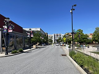
King of Prussia is a census-designated place in Upper Merion Township in Montgomery County, Pennsylvania, United States. As of the 2020 census, its population was 22,028.

<span class="mw-page-title-main">U.S. Route 222</span> Highway in Maryland and Pennsylvania

U.S. Route 222 is a U.S. Highway that is a spur of US 22 in the states of Maryland and Pennsylvania. It runs for 95 miles (153 km) from US 1 in Conowingo, Maryland, north to the junction of Interstate 78 (I-78) and Pennsylvania Route 309 in Dorneyville, Pennsylvania. US 222 is almost entirely in Pennsylvania, and serves as the state's principal artery between the Lancaster and Reading areas in the west and the Lehigh Valley in the east.

<span class="mw-page-title-main">Interstate 76 (Ohio–New Jersey)</span> Interstate from Ohio to New Jersey

Interstate 76 (I-76) is an east–west Interstate Highway in the Eastern United States. The highway runs approximately 435.66 miles (701.13 km) from an interchange with I-71 west of Akron, Ohio, east to I-295 in Bellmawr, New Jersey. This route is not contiguous with I-76 in Colorado and Nebraska.

<span class="mw-page-title-main">Schuylkill Expressway</span> Highway in Pennsylvania

The Schuylkill Expressway, locally known as "the Schuylkill", is a freeway through southern Montgomery County and the city of Philadelphia. It is the easternmost segment of Interstate 76 (I-76) in the U.S. state of Pennsylvania. It extends from the Valley Forge interchange of the Pennsylvania Turnpike in King of Prussia, paralleling its namesake Schuylkill River for most of the route, southeast to the Walt Whitman Bridge over the Delaware River in South Philadelphia. It serves as the primary corridor into Philadelphia from points west. Maintenance and planning for most of the highway are administered through Pennsylvania Department of Transportation (PennDOT) District 6, with the Delaware River Port Authority (DRPA) maintaining the approach to the Walt Whitman Bridge.

<span class="mw-page-title-main">Delaware and Hudson Canal</span> Former canal in New York and Pennsylvania, United States

The Delaware and Hudson Canal was the first venture of the Delaware and Hudson Canal Company, which would later build the Delaware and Hudson Railway. Between 1828 and 1899, the canal's barges carried anthracite coal from the mines of northeastern Pennsylvania to the Hudson River and thence to market in New York City.

<span class="mw-page-title-main">U.S. Route 422</span> Highway in Ohio and Pennsylvania

U.S. Route 422 (US 422) is a 271-mile-long (436 km) spur route of US 22 split into two segments in the U.S. states of Ohio and Pennsylvania. The western segment of US 422 runs from downtown Cleveland, Ohio, east to Ebensburg, Pennsylvania. The eastern segment, located entirely within Pennsylvania, runs from Hershey east to King of Prussia, near Philadelphia. US 422 Business serves as a business route into each of four towns along the way.

<span class="mw-page-title-main">Pennsylvania Route 363</span> A state highway located in Montgomery County, Pennsylvania

Pennsylvania Route 363 (PA 363) is a state highway located in Montgomery County, Pennsylvania that is a spur of PA 63. The route runs 11.96 mi (19.25 km) from an interchange with U.S. Route 422 (US 422) in Audubon northeast to an intersection with PA 63 in Lansdale. The route runs mostly through suburban areas of central Montgomery County, passing some farmland in Worcester Township. PA 363 is designated along Trooper Road, Ridge Pike, Park Avenue, and Valley Forge Road. In the community of Worcester, the route crosses PA 73.

<span class="mw-page-title-main">Pennsylvania Route 65</span> State highway in Pennsylvania, US

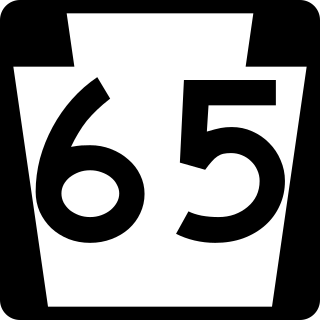
Pennsylvania Route 65 is a major 51-mile-long (82 km) state highway located in western Pennsylvania, United States. The route, traveling north–south from the Interstate 279/U.S. Route 19 Truck concurrency in Pittsburgh north to the PA 108/PA 168 concurrency in New Castle, connects downtown Pittsburgh to the northwestern portion of the Pittsburgh Metropolitan Area. PA 65 is similar in its purpose to PA 18 and PA 51, both of which run parallel to PA 65 at one point or another; however, the three routes pass through different cities for most of their respective alignments.

<span class="mw-page-title-main">Schuylkill River Trail</span> Multi-use trail in Pennsylvania, United States

The Schuylkill River Trail is a multi-use trail along the banks of the Schuylkill River in southeastern Pennsylvania. Partially complete as of 2018, the trail is ultimately planned to run about 140 miles (230 km) from the river's headwaters in Schuylkill County to Fort Mifflin in Philadelphia.

<span class="mw-page-title-main">Pennsylvania Route 23</span> State highway in Pennsylvania, US

Pennsylvania Route 23 is an 81.14-mile-long (130.58 km) state highway in southeastern Pennsylvania. The route begins at PA 441 in Marietta and heads east to U.S. Route 1 at City Avenue on the border of Lower Merion Township and Philadelphia. PA 23 begins at Marietta in Lancaster County and continues east to Lancaster, where it passes through the city on a one-way pair of streets and intersects US 222 and US 30.

<span class="mw-page-title-main">Pennsylvania Route 183</span> State highway in Pennsylvania, US

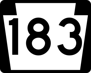
Pennsylvania Route 183 (PA 183) is a 31.7-mile-long (51.0 km) route that runs north to south in southeastern Pennsylvania. The southern terminus is at U.S. Route 422 Business in Reading in Berks County. Its northern terminus is at PA 61 near Schuylkill Haven in Schuylkill County. The road passes through developed areas near Reading before continuing north through rural areas, crossing from Berks County into Schuylkill County at Blue Mountain. PA 183 serves the communities of Bernville, Strausstown, and Cressona.

<span class="mw-page-title-main">Pennsylvania Route 652</span> State highway in Wayne County, Pennsylvania, US

Pennsylvania Route 652 is a 10.559-mile-long (16.993 km) east–west state highway located in the northeast Pennsylvania county of Wayne. The western terminus of the route is at U.S. Route 6 in the Texas Township community of Indian Orchard. The highways heads to the northeast, and reaches the eastern terminus at the New York-Pennsylvania border in Damascus Township, where PA 652 crosses the Narrowsburg–Darbytown Bridge over the Delaware River and into New York, continuing as New York State Route 52 and County Route 24 in Sullivan County.

<span class="mw-page-title-main">Pennsylvania State Route System</span> Highway system of Pennsylvania in the United States

In the U.S. state of Pennsylvania, state highways are generally maintained by the Pennsylvania Department of Transportation (PennDOT). Each is assigned a four-digit State Route (SR) number in the present Location Referencing System. Traffic Routes are signed as Interstate Highways, U.S. Routes and Pennsylvania Routes, and are prefixed with one to three zeroes to give a four-digit number. PA Routes are also called Pennsylvania Traffic Routes, and formerly State Highway Routes.

<span class="mw-page-title-main">Pond Eddy Bridge</span> Petit truss bridge in Pond Eddy, US

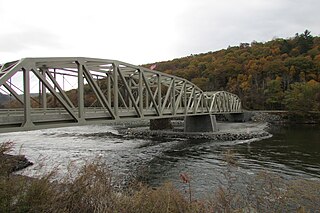
The Pond Eddy Bridge is a petit truss bridge spanning the Delaware River between the hamlet of Pond Eddy in Lumberland, New York and the settlement informally called Pond Eddy in Shohola Township, Pennsylvania. It is accessible from NY 97 in Lumberland on the New York side and two dead-end local roads, Flagstone Road and Rosa Road on the Pennsylvania side. The bridge was built in 1903 by the Oswego Bridge Company to replace an old suspension bridge that had washed away in a flood earlier in the year. It connected the bluestone quarries in Pennsylvania to New York.

<span class="mw-page-title-main">Sonestown Covered Bridge</span> Covered bridge in Davidson Township, Sullivan County, Pennsylvania

The Sonestown Covered Bridge is a covered bridge over Muncy Creek in Davidson Township, Sullivan County, Pennsylvania built around 1850. It is 110 ft (34 m) long and was placed on the National Register of Historic Places (NRHP) in 1980. It is named for the nearby unincorporated village of Sonestown in Davidson Township, and is also known as the Davidson Covered Bridge. It was built to provide access to a grist mill which operated until the early 20th century.

<span class="mw-page-title-main">Forksville Covered Bridge</span> Bridge over Loyalsock Creek, Pennsylvania

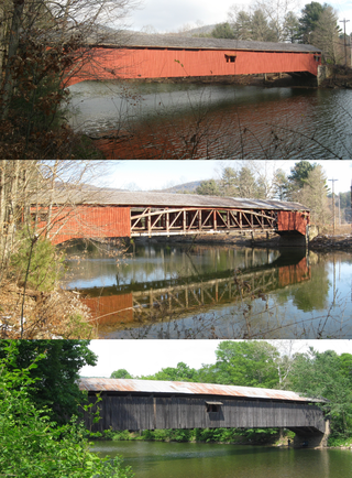
The Forksville Covered Bridge is a Burr arch truss covered bridge over Loyalsock Creek in the borough of Forksville, Sullivan County, in the U.S. state of Pennsylvania. It was built in 1850 and is 152 feet 11 inches (46.61 m) in length. The bridge was placed on the National Register of Historic Places in 1980. The Forksville bridge is named for the borough it is in, which in turn is named for its location at the confluence or "forks" of the Little Loyalsock and Loyalsock Creeks.

<span class="mw-page-title-main">Hillsgrove Covered Bridge</span> Bridge over Loyalsock Creek in Hillsgrove Township, Sullivan County, Pennsylvania

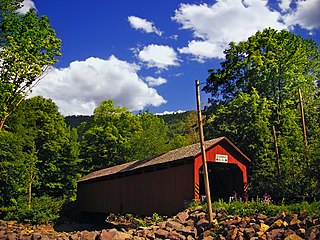
The Hillsgrove Covered Bridge is a Burr arch truss covered bridge over Loyalsock Creek in Hillsgrove Township, Sullivan County, in the U.S. state of Pennsylvania. It was built c. 1850 and is 186 feet (56.7 m) long. In 1973, it became the first covered bridge in the county to be placed on the National Register of Historic Places (NRHP). The bridge is named for the township and nearby unincorporated village of Hillsgrove, and is also known as Rinkers Covered Bridge for an adjoining farm.

<span class="mw-page-title-main">Inclined Plane Bridge</span> Bridge in Pennsylvania, United States

The Inclined Plane Bridge is a 237-foot (72 m), Pennsylvania through truss bridge that spans Stonycreek River in Johnstown, Cambria County, in the U.S. state of Pennsylvania. It connects the city to the lower station of the Johnstown Inclined Plane. The bridge was listed on the National Register of Historic Places in 1988 and was documented by the Historic American Engineering Record (HAER) in 1997.

Germantown Pike is a historic road in Pennsylvania that opened in 1687, running from Philadelphia northwest to Collegeville. The road is particularly notable for the "imposing mansions" that existed in the Germantown neighborhood in Philadelphia. The road was left in ruins after the British destroyed it in the Revolutionary War during the 1777 Battle of Germantown, and was not rebuilt until 1809. Portions of Germantown Pike were signed as U.S. Route 422 (US 422) before the latter was rerouted along a freeway alignment to King of Prussia.

<span class="mw-page-title-main">Sullivan's Bridge</span> Bridge in Betzwood and Port Kennedy, Pennsylvania

Sullivan's Bridge is a trail bridge that connects the Schuylkill River Trail to Valley Forge National Park in the Commonwealth of Pennsylvania, United States.

References

Map all coordinates using: OpenStreetMap
  1. "LTBP InfoBridge". US Department of Transportation, Federal Highway Administration. Retrieved December 17, 2023.
  2. "PENNDOT AWARDS $97.4 MILLION CONTRACT TO REPLACE BRIDGES AND IMPROVE U.S. 422 IN VALLEY FORGE AREA". Pennsylvania Department of Transportation. 26 January 2016. Retrieved 26 May 2016.
  3. "Turn-of-the-century Bridge Reaches Beginning Of Its End The Betzwood Road Bridge In Upper Merion Is Being Demolished So Penndot Can Replace It. - philly-archives".
  4. "Sullivan's Bridge construction begins with groundbreaking ceremony; Route 422 bridge project to begin three years early".
  5. Rotenberg, Carl (2016-08-19). "Sullivan's Bridge opens in Valley Forge National Historical Park". The Times Herald, Norristown, Pennsylvania . Retrieved 2016-07-08.