List of road routes in Victoria

Last updated

Alphanumeric road routes in Victoria Map of VIC Highways.png
Alphanumeric road routes in Victoria

Road routes in Victoria assist drivers navigating roads throughout the state, as roads may change names several times between destinations, or have a second local name in addition to a primary name. There are two main route numbering schemes in use: numeric shields, and alphanumeric routes, with the former being replaced by the latter. The original scheme consists of numbered National Highways, National Routes, Metropolitan and State Routes, each identified with a different shield-shaped route marker. The alphanumeric Statewide Route Numbering Scheme, introduced in the 1990s, has replaced the previous scheme outside Melbourne, and some routes within Melbourne. It consists of alphanumeric routes, which are a one-to-three digit number prefixed with a letter – M, A, B, or C – that denotes the grade and importance of the road. [1]

Contents

History

Route numbers have been allocated to Victoria's roads since 1954, with the introduction of National Routes across all states and territories in Australia, symbolised by a white shield with black writing; National Route 1 ('Highway 1') was one of the best-known numbered national routes, due to its fame for circumnavigating the continent.

To supplement the National Route number system, a new route numbering scheme (now known as the Metropolitan Route Numbering Scheme) allocated blue-and-white shields across Melbourne in 1965, [2] numbered to fit around existing National Routes; Freeway Routes, using green shields to better mark their specialised status, were spun off from this system between 1970 and 1987.

In 1974, the National Highway network was defined, which allowed some existing National Routes to be upgraded to National Highways. These were marked with the same shield design as the National Routes, except for their gold-on-green colouring and the word NATIONAL added across the top.

A shield system covering regional Victoria (the State Route Numbering Scheme) was introduced in 1985, [3] marking out urban arterial routes and secondary rural highways. The Metropolitan Route Numbering Scheme across Melbourne received a major refurbishment in the late 1980s, [4] with the creation of Tourist Routes as a result. [5]

Beginning in late 1996, regional Victoria (and certain core routes through Melbourne) began to replace their system of National Routes, National Highways and State Routes with an alphanumeric route numbering system, called the Statewide Route Numbering Scheme. [6] Many existing numbered routes were allocated a letter (M, A, B or C) in addition to its number, with 'M' routes denoting freeways, 'A' routes denoting routes of national significance, 'B' routes denoting routes of state significance, and 'C' routes acting as local access roads. [7] Instead of shields, route numbers are displayed as yellow text on green rectangular backgrounds, and has now – with the exception of Tourist Routes – become the sole route numbering system in regional Victoria. The Great Ocean Road (signed B100) and Great Alpine Road (signed B500) were the first routes allocated, and with conversion beginning to the M1, in late 1996; [6] signing work had been completed for all 'M' and 'A' class roads and for approximately half of the 'B' class roads throughout Victoria by the end of June 1998. [8] Former National Highways route markers initially retained their shield design (including NATIONAL markings) after conversion, but VicRoads – as of September 2013 – removed them, bringing their design in line with the rest of the state. [9]

Melbourne has been slower to convert between systems, having kept most of its Metropolitan routes, but is currently undergoing a systematic conversion from 2020. Routes listed here may change as a result.

Alphanumeric Routes

M routes

M roads provide a consistent high standard of driving conditions, with divided carriageways, at least four traffic lanes, sealed shoulders and line-marking that is easily visible in all weather conditions. M roads are the primary road links connecting Melbourne and other capital cities and major provincial centres. [7] In practice, this means M roads are usually at least dual-carriageway freeways or high standard rural highways with at least two lanes in each direction. Victorian route allocations use a blue background colour to designate a toll-road (sections attracting a toll are specifically marked).

RouteComponent roadsFromViaToLengthNotes
AUS Alphanumeric Route M1.svgAUS Alphanumeric Route M1 toll.svg
M1
Colac Traralgon 310 km (193 mi)AUS Alphanumeric Route M1.svg Highway 1 route:
– re-aligned along Princes Highway through Waurn Ponds along current alignment when Stage 4B of Geelong Ring Road opened in 2013, renamed Waurn Ponds Drive
– re-aligned along Princes Highway from Corio to Waurn Ponds along current alignment (replaced by AUS Alphanumeric Route A10.svg) when Geelong Ring Road opened in 2009
– continues west as AUS Alphanumeric Route A1.svg along Princes Highway (west) to VIC/SA border
CityLink (Southern link)AUS Alphanumeric Route M1 toll.svg Highway 1 route, toll road
AUS Alphanumeric Route M1.svg Highway 1 route:
– re-aligned along South Gippsland Freeway and Princes Highway from Doveton to Narre Warren along current alignment (replaced by AUS Alphanumeric Route M420.svg/Australian national route ALT1.svg) when Hallam bypass opened in 2003
– re-aligned along Princes Link and Princes Highways from Berwick to Nar Nar Goon along current alignment (replaced by AUS Alphanumeric Route A17.svg/AUS Alphanumeric Route B668.svg/AUS Alphanumeric Route C101.svg) when Pakenham bypass opened in 2007, Princes Link Highway renamed O'Shea Road in 2022
– continues east as AUS Alphanumeric Route A1.svg along Princes Highway (east) to VIC/NSW border
AUS Alphanumeric Route M2.svgAUS Alphanumeric Route M2 toll.svg
M2
Tullamarine Freeway Melbourne Airport Port Melbourne 22 km (14 mi)Allocated AUS Alphanumeric Route M2.svg in 2018, signage progressively under conversion from Australian state route 43.svg to AUS Alphanumeric Route M2.svg
CityLink (Western link)Allocated AUS Alphanumeric Route M2 toll.svg in 2018, toll road, signage progressively under conversion from Australian state route TOLL43.svg to AUS Alphanumeric Route M2 toll.svg
AUS Alphanumeric Route M3.svgAUS Alphanumeric Route M3 toll.svg
M3
Eastern Freeway Clifton Hill Frankston 62 km (39 mi)Allocated AUS Alphanumeric Route M3.svg when EastLink opened in 2008
EastLink Allocated AUS Alphanumeric Route M3 toll.svg when EastLink opened in 2008, toll road
Frankston Freeway Allocated AUS Alphanumeric Route M3.svg when Peninsula Link opened in 2013
AUS Alphanumeric Route M8.svg
M8
Western Freeway Buangor Derrimut 161 km (100 mi)– Eastern end re-aligned along Ballarat Road from Ardeer to current alignment (replaced by Australian state route 8.svg) when Deer Park bypass opened in 2009
– Continues west as AUS Alphanumeric Route A8.svg along Western Highway to VIC/SA border
– Allocated Australian national highway M8.svg in 1997, progressively being replaced by AUS Alphanumeric Route M8.svg from 2013
AUS Alphanumeric Route M11.svg
M11
Mornington Peninsula Freeway Dingley Village Rosebud 60 km (37 mi)– Allocated AUS Alphanumeric Route M11.svg when Peninsula Link opened in 2013
– Northern end extended from Chelsea Heights to Dingley Village when Mordialloc Freeway opened in 2021
AUS Alphanumeric Route M31.svg
M31
Hume Freeway Thomastown VIC/NSW border296 km (184 mi)– Southern end re-aligned along Sydney Road from Fawkner to current alignment (replaced by Australian state route 55.svg) when Craigieburn bypass opened in 2005
– Continues north as AUS Alphanumeric Route M31.svg along Hume Highway into NSW eventually to Sydney
– Concurrency with AUS Alphanumeric Route B400.svg along Hume Freeway from Barnawartha North to Wodonga
– Allocated Australian national highway M31.svg in 1997, progressively being replaced by AUS Alphanumeric Route M31.svg from 2013
AUS Alphanumeric Route M39.svg
M39
Goulburn Valley Freeway Seymour Shepparton 68 km (42 mi)– Continues north as AUS Alphanumeric Route A39.svg along Goulburn Valley Highway to VIC/NSW border
– Allocated Australian national highway M39.svg in 2001, progressively being replaced by AUS Alphanumeric Route M39.svg from 2013
AUS Alphanumeric Route M79.svg
M79
Calder Freeway Ravenswood Niddrie 122 km (76 mi)– Continues north as AUS Alphanumeric Route A79.svg along Calder Highway to VIC/NSW border
– Concurrency with AUS Alphanumeric Route A300.svg along Midland Highway from Ravenswood to Harcourt
AUS Alphanumeric Route M80.svg
M80
Western Ring Road Altona North Greensborough 38 km (24 mi)Allocated Australian national highway M80.svg (from Ardeer to Fawkner) in 1997, extended south to Derrimut when Deer Park bypass opened in 2009, progressively being replaced by AUS Alphanumeric Route M80.svg from 2013
Metropolitan Ring Road Allocated Australian national highway M80.svg (from Fawkner to Thomastown) when Craigieburn bypass opened in 2005, progressively being replaced by AUS Alphanumeric Route M80.svg from 2013
AUS Alphanumeric Route M420.svg
M420
Doveton Bass 80 km (50 mi)– Northern end extended along South Gippsland Freeway from Eumemmerring to Doveton (replacing AUS Alphanumeric Route M1.svg) when Hallam bypass opened in 2003
– Replaced AUS Alphanumeric Route A420.svg from Grantville to Bass when highway upgrades along Bass Highway raised quality of road in 2013
– Continues west as AUS Alphanumeric Route B420.svg along Phillip Island Road to Cowes
AUS Alphanumeric Route M780.svg
M780
Western Port Highway Hampton Park Skye Langwarrin 14 km (9 mi)– Allocated AUS Alphanumeric Route M780.svg in 2000, replaced AUS Alphanumeric Route A780.svg
– Continues south as AUS Alphanumeric Route A780.svg along Western Port Highway to Hastings

A routes

A roads provide a similar high standard of driving conditions usually on a single carriageway, but in practice this means usually a dual-carriageway road within suburban Melbourne. A roads serve the same purpose as M roads, but carry less traffic. [7]

RouteComponent roadsFromViaToLengthNotes
AUS Alphanumeric Route A1.svg
A1
Princes Highway (west)VIC/SA border Colac 301 km (187 mi)AUS Alphanumeric Route A1.svg Highway 1 route:
– continues west as AUS Alphanumeric Route A1.svg along Princes Highway into SA eventually to Mount Gambier
– continues east as AUS Alphanumeric Route M1.svg along Princes Highway through Melbourne to Traralgon
– concurrency with AUS Alphanumeric Route A200.svg along Princes Highway from Heywood to Bolwarra
Princes Highway (east) Traralgon VIC/NSW border350 km (217 mi)AUS Alphanumeric Route A1.svg Highway 1 route:
– continues west as AUS Alphanumeric Route M1.svg along Princes Freeway (east) through Melbourne to Colac
– continues north as AUS Alphanumeric Route A1.svg along Princes Highway into NSW eventually to Sydney
AUS Alphanumeric Route A8.svg
A8
Western Highway VIC/SA border Buangor 257 km (160 mi)– Continues west as AUS Alphanumeric Route A8.svg along Dukes Highway into SA eventually to Tailem Bend
– Continues east as AUS Alphanumeric Route M8.svg along Western Freeway to Melbourne
– Allocated Australian national highway A8.svg in 1997, progressively being replaced by AUS Alphanumeric Route A8.svg from 2013
AUS Alphanumeric Route A10.svg
A10
  • Colac Road
  • High Street
  • Settlement Road
  • Latrobe Terrace
  • Keera Street
  • Melbourne Road
  • Princes Highway
Waurn Ponds Corio 20 km (12 mi)– Allocated AUS Alphanumeric Route A10.svg when Geelong Ring Road opened (replacing AUS Alphanumeric Route M1.svg) in 2009
– Former AUS Alphanumeric Route M1.svg Princes Highway alignment through Geelong
AUS Alphanumeric Route A17.svg
A17
O'Shea Road Berwick Beaconsfield 1.6 km (1 mi)– Allocated in 2022
– Concurrency with AUS Alphanumeric Route B668.svg along O'Shea Road from Berwick to Beaconsfield
AUS Alphanumeric Route A20.svg
A20
Sturt Highway VIC/SA border Mildura VIC/NSW border116 km (72 mi)– Continues west as AUS Alphanumeric Route A20.svg along Sturt Highway into SA eventually to Adelaide
– Continues east as AUS Alphanumeric Route A20.svg along Sturt Highway into NSW eventually to Tarcutta
– Concurrency with AUS Alphanumeric Route A79.svg along Calder Highway through Mildura
– Allocated Australian national highway A20.svg in 1997, progressively being replaced by AUS Alphanumeric Route A20.svg from 2013
AUS Alphanumeric Route A39.svg
A39
Goulburn Valley Highway Shepparton Strathmerton VIC/NSW border86 km (53 mi)– Southern end along Goulburn Valley Freeway originally terminating at Seymour truncated to current alignment (replaced by Australian national highway M39.svg in 2001, progressively being replaced by AUS Alphanumeric Route M39.svg from 2013)
– Continues north as AUS Alphanumeric Route A39.svg along Newell Highway into NSW eventually to Goondiwindi
– Continues south as AUS Alphanumeric Route M39.svg along Goulburn Valley Freeway to Seymour
– Concurrency with AUS Alphanumeric Route B400.svg along Murray Valley Highway from Strathmerton to Yarroweyah
– Allocated Australian national highway A39.svg in 1997, progressively being replaced by AUS Alphanumeric Route A39.svg from 2013
AUS Alphanumeric Route A51.svg
A51
Plenty Road Mernda Bundoora 9.8 km (6 mi)– Allocated in 2021, signage under conversion from Australian state route 27.svg/AUS Alphanumeric Route C727.svg to AUS Alphanumeric Route A51.svg
– Continues south as Australian state route 27.svg along Plenty Road to Preston
– Continues north as AUS Alphanumeric Route C727.svg along Plenty Road eventually to Wallan

A72
Craigieburn Road Craigieburn 5.9 km (4 mi)– Allocated in 2023
– Road is entirely within Craigieburn
AUS Alphanumeric Route A79.svg
A79
Calder Highway VIC/NSW border Ravenswood 438 km (272 mi)– Continues north as AUS Alphanumeric Route B79.svg along Silver City Highway into NSW eventually to Broken Hill
– Continues south as AUS Alphanumeric Route M79.svg along Calder Freeway to Melbourne
– Concurrencies: with AUS Alphanumeric Route A20.svg along Sturt Highway through Mildura, with AUS Alphanumeric Route A300.svg along Midland Highway from Bendigo to Ravenswood
AUS Alphanumeric Route A81.svg
A81
Leakes Road Tarneit Truganina Laverton North 8 km (5 mi)– Allocated in 2020
– Continues east as Australian state route 35.svg along Kororoit Creek Road eventually to Somerton
AUS Alphanumeric Route A91.svg
A91
  • Robinsons Road
  • Palmers Road
Ravenhall Truganina Williams Landing 8.4 km (5 mi)– Allocated in 2020
– Continues south as AUS Alphanumeric Route B91.svg along Palmers/Dunnings Roads to Point Cook
AUS Alphanumeric Route A93.svg
A93
Forsyth Road Truganina Williams Landing Point Cook 4.3 km (3 mi)Allocated in 2020
AUS Alphanumeric Route A200.svg
A200
Henty Highway Portland Horsham 214 km (133 mi)– Continues north as AUS Alphanumeric Route B200.svg along Henty Highway to Lascelles
– Concurrency with AUS Alphanumeric Route A1.svg along Henty Highway from Heywood to Bolwarra
AUS Alphanumeric Route A300.svg
A300
Midland Highway Geelong Benalla 397 km (247 mi)– Continues south as AUS Alphanumeric Route B300.svg along Midland/Maroondah/Melba Highways to Melbourne
– Concurrencies: with AUS Alphanumeric Route A79.svg along Calder Highway from Bendigo to Ravenswood, with AUS Alphanumeric Route M79.svg along Calder Freeway from Ravenswood to Harcourt
AUS Alphanumeric Route A420.svg
A420
Bass Highway Grantville Glen Forbes Bass 13.8 km (9 mi)Decommissioned, replaced by AUS Alphanumeric Route M420.svg when highway upgrades along Bass Highway raised quality of road in 2013
AUS Alphanumeric Route A440.svg
A440
South Gippsland Highway Lang Lang Sale 206 km (128 mi)Replaced AUS Alphanumeric Route B440.svg when highway upgrades along South Gippsland Highway raised quality of road in 2003
AUS Alphanumeric Route A780.svg
A780
Western Port Highway Langwarrin Tyabb Hastings 12.5 km (8 mi)– Northern end along Western Port Highway originally terminating at Hampton Park truncated to current alignment in 2000 (replaced by AUS Alphanumeric Route M780.svg)
– Continues north as AUS Alphanumeric Route M780.svg along Western Port Highway to Hampton Park
AUS Alphanumeric Route A790.svg
A790
Calder Alternate Highway Marong Lockwood Ravenswood 20 km (12 mi)Bendigo bypass route:
– continues north as AUS Alphanumeric Route A79.svg along Calder Highway to Mildura
– continues south as AUS Alphanumeric Route M79.svg along Calder Freeway to Melbourne
  Decommissioned or unsigned route

B routes

B roads are sealed roads wide enough to accommodate two lanes of traffic with good centre line markings, provide adequate shoulders and high quality and visibility signage. B roads are the primary transport links for major regions not connected by either M or A roads, as well as major tourist routes. [7]

RouteComponent roadsFromViaToLengthNotes
AUS Alphanumeric Route B12.svg
B12
VIC/SA borderVIC/NSW border233 km (145 mi)– Continues west as AUS Alphanumeric Route B12.svg along Mallee Highway into SA eventually to Tailem Bend
– Continues east (unmarked) along Yanga Way into NSW to Balranald
AUS Alphanumeric Route B23.svg
B23
Monaro Highway Cann River VIC/NSW border48 km (30 mi)Continues north as AUS Alphanumeric Route B23.svg along Monaro Highway into NSW eventually to Canberra
AUS Alphanumeric Route B37.svg
B37
Eltham Templestowe 3.1 km (2 mi)– Allocated in 2022, signage under conversion from Australian state route 47.svg to AUS Alphanumeric Route B37.svg
– Continues south as Australian state route 47.svg along Williamsons Road eventually to Huntingdale
– Concurrency with Australian state route 42.svg along Williamsons Road through Templestowe
AUS Alphanumeric Route B75.svg
B75
Northern Highway Wallan VIC/NSW border165 km (103 mi)Continues north as AUS Alphanumeric Route B75.svg along Cobb Highway into NSW eventually to Wilcannia
AUS Alphanumeric Route B77.svg
B77
  • Sayers Road
  • Old Geelong Road
Tarneit Williams Landing Laverton North 8.5 km (5 mi)– Allocated in 2020
– Continues north as Australian state route 40.svg along Fitzgerald Road eventually to Keilor
AUS Alphanumeric Route B91.svg
B91
  • Palmers Road
  • Dunnings Road
Williams Landing Point Cook 2.6 km (2 mi)– Allocated in 2020
– Continues north as AUS Alphanumeric Route A91.svg along Palmers/Robinsons Roads to Ravenhall
AUS Alphanumeric Route B94.svg
B94
  • Dohertys Road
  • Grieve Parade
Tarneit Truganina Altona North 12 km (7 mi)– Allocated in 2020, signage under conversion from Australian state route 56.svg to AUS Alphanumeric Route B94.svg
– Continues east as Australian state route 56.svg along Blackshaws Road to Newport
AUS Alphanumeric Route B100.svg
B100
Belmont Allansford 255 km (158 mi)
AUS Alphanumeric Route B110.svg
B110
  • McKillop Street
  • Ormond Road
  • Bellarine Highway
  • Flinders Street
  • Bethune Street
  • King Street
  • Hesse Street
  • Wharf Street
Geelong Queenscliff 31 km (19 mi)Continues east over Port Phillip Bay to Point Nepean Road on Mornington Peninsula
Mornington Portsea 42 km (26 mi)– Re-aligned through Dromana from Mornington Peninsula Freeway to current alignment when Peninsula Link opened in 2013
– Continues west over Port Phillip Bay to Bellarine Highway on Bellarine Peninsula
– Continues north as Australian state route 3.svg along Nepean Highway eventually to Melbourne
AUS Alphanumeric Route B120.svg
B120
Hopkins Highway Warrnambool Ellerslie Mortlake 50 km (31 mi)
AUS Alphanumeric Route B121.svg
B121
Barwon Heads Road Belmont Marshall 4 km (2.5 mi)– Allocated in 2023
– Continues south as AUS Alphanumeric Route C121.svg along Barwon Heads Road eventually to Barwon Heads
AUS Alphanumeric Route B130.svg
B130
Baanip Boulevard Waurn Ponds Grovedale 5 km (3 mi)Allocated in 2015
AUS Alphanumeric Route B140.svg
B140
Hamilton Highway Hamilton Geelong 231 km (144 mi)
AUS Alphanumeric Route B160.svg
B160
Glenelg Highway VIC/SA border Ballarat 289 km (180 mi)Continues west as AUS Alphanumeric Route B160.svg along Glenelg Highway into SA to Mount Gambier
AUS Alphanumeric Route B180.svg
B180
Pyrenees Highway Glenthompson Elphinstone 206 km (128 mi)
AUS Alphanumeric Route B200.svg
B200
Henty Highway Lascelles Warracknabeal Horsham 231 km (144 mi)– Continues south as AUS Alphanumeric Route A200.svg along Henty Highway to Portland
– Concurrency with AUS Alphanumeric Route B240.svg along Wimmera Highway from Horsham to Dooen
AUS Alphanumeric Route B210.svg
B210
Stawell–Warracknabeal Road Warracknabeal Rupanyup Stawell 91 km (57 mi)Allocated in 2000, replaced AUS Alphanumeric Route C235.svg
AUS Alphanumeric Route B220.svg
B220
Sunraysia Highway Ouyen Ballarat 344 km (214 mi)
AUS Alphanumeric Route B240.svg
B240
Wimmera Highway VIC/SA border Marong 325 km (202 mi)– Replaced AUS Alphanumeric Route C240.svg when highway upgrades along Wimmera Highway raised quality of road in 2003
– Continues west as AUS Alphanumeric Route C240.svg along Wimmera Highway into SA to Naracoorte
– Concurrency with AUS Alphanumeric Route B200.svg along Henty Highway from Horsham to Dooen
AUS Alphanumeric Route B260.svg
B260
Loddon Valley Highway Kerang Durham Ox Bendigo 129 km (80 mi)
AUS Alphanumeric Route B280.svg
B280
McIvor Highway Bendigo Axedale Heathcote 45 km (28 mi)
AUS Alphanumeric Route B300.svg
B300
Benalla Lilydale 187 km (116 mi)– Re-aligned through Yarra Glen from Melba Highway to current alignment (replaced by AUS Alphanumeric Route C731.svg) when Yarra Glen bypass opened in 2010
– Continues west as AUS Alphanumeric Route A300.svg along Midland Highway to Geelong
– Continues south into Melbourne as Australian state route 34.svg Maroondah Highway
– Concurrencies: with AUS Alphanumeric Route B340.svg along Goulburn Valley Highway from Cathkin to Yea; with AUS Alphanumeric Route C726.svg along Healesville–Yarra Glen Road through Yarra Glen
AUS Alphanumeric Route B320.svg
B320
Maroondah Highway Maindample Mansfield 12 km (7 mi)Continues east as AUS Alphanumeric Route C320.svg along Mount Buller Road to Mount Buller
AUS Alphanumeric Route B340.svg
B340
Goulburn Valley Highway Seymour Eildon 106 km (66 mi)Concurrency with AUS Alphanumeric Route B300.svg along Goulburn Valley Highway from Yea to Cathkin
AUS Alphanumeric Route B360.svg
B360
Maroondah Highway Alexandra Healesville Coldstream 90 km (56 mi)
AUS Alphanumeric Route B380.svg
B380
Warburton Highway Lilydale Warburton 75 km (47 mi)
AUS Alphanumeric Route B400.svg
B400
VIC/NSW borderVIC/NSW border663 km (412 mi)– Re-aligned through Wodonga from High Street, Osburn/Chapple Streets to Bandiana Link Road (replacing AUS Alphanumeric Route B410.svg) in 2009
– Concurrencies: with AUS Alphanumeric Route M31.svg along Hume Freeway from Barnawartha North to Wodonga, with AUS Alphanumeric Route A39.svg along Goulburn Valley Highway from Strathmerton to Yarroweyah
AUS Alphanumeric Route B401.svg
B401
Bandiana Link Road Wodonga 4.1 km (3 mi)Decommissioned, replaced by AUS Alphanumeric Route B410.svg within months, then AUS Alphanumeric Route B400.svg in 2009
AUS Alphanumeric Route B410.svg
B410
Bandiana Link Road Wodonga 4.1 km (3 mi)Decommissioned, replaced by AUS Alphanumeric Route B400.svg in 2009 (originally allocated as AUS Alphanumeric Route B401.svg in 2007, changed to AUS Alphanumeric Route B410.svg within months)
AUS Alphanumeric Route B420.svg
B420
Bass Newhaven Cowes 23 km (14 mi)– Eastern end re-aligned through Anderson to current alignment (replaced by AUS Alphanumeric Route C439.svg) when Anderson bypass opened in 2013
– Continues east as AUS Alphanumeric Route M420.svg along Bass Highway eventually to Dandenong South
AUS Alphanumeric Route B440.svg
B440
South Gippsland Highway Lang Lang Sale 206 km (128 mi)Decommissioned, replaced by AUS Alphanumeric Route A440.svg when highway upgrades along South Gippsland Highway raised quality of road in 2003
AUS Alphanumeric Route B460.svg
B460
Bass Morwell 113 km (70 mi)Northern end extended along Bass Highway from Anderson to Bass (replacing AUS Alphanumeric Route A420.svg) when Anderson bypass opened in 2013
AUS Alphanumeric Route B500.svg
B500
Great Alpine Road Wangaratta Bairnsdale 304 km (189 mi)

B664
  • Rutherford Road
  • Lathams Road
  • Hall Road
Seaford Cranbourne West 9.2 km (6 mi)Allocated in 2023 [10] [11]
AUS Alphanumeric Route B668.svg
B668
  • Pound Road
  • Narre Warren–Cranbourne Road
  • Greaves Road
  • O'Shea Road
Hampton Park Beaconsfield 10.8 km (7 mi)– Allocated in 2019 [12]
– Eastern end extended from Berwick to Beaconsfield when O'Shea Road extension opened in 2022
– Concurrencies: with AUS Alphanumeric Route C404.svg along Narre Warren-Cranbourne Road through Narre Warren South; with AUS Alphanumeric Route A17.svg along O'Shea Road from Berwick to Beaconsfield
AUS Alphanumeric Route B675.svg
B675
Endeavour Hills Hallam 3 km (2 mi)Allocated in 2020
AUS Alphanumeric Route B716.svg
B716
O'Herns Road Epping 3 km (2 mi)Allocated in 2019, [13] road is entirely within Epping
AUS Alphanumeric Route B980.svg
B980
Centre Dandenong Road Dingley Village 0.7 km (0 mi)Allocated in 2021, road is entirely within Dingley Village
  Decommissioned or unsigned route

C routes

C roads are generally sealed two-lane roads with shoulders and serve as important links between population centres and the primary transport network. [7]

C101 to C198

RouteComponent roadsFromViaToLengthNotes
AUS Alphanumeric Route C101.svg
C101
Princes Highway Narre Warren Nar Nar Goon 23 km (14 mi)AUS Alphanumeric Route M1.svg Loop route
– Former Princes Highway alignment
– Eastern end extended along Princes Highway from Beaconsfield to Nar Nar Goon when Pakenham bypass opened (replacing AUS Alphanumeric Route M1.svg) in 2007
– Continues west as Australian national route ALT1.svg along Princes Highway eventually to Southbank
AUS Alphanumeric Route C102.svg
C102
Princes Way Drouin West Nilma 16 km (10 mi)AUS Alphanumeric Route M1.svg Loop route
– Former Princes Highway alignment
AUS Alphanumeric Route C103.svg
C103
Moe Glengarry 33 km (21 mi)AUS Alphanumeric Route M1.svg Loop route
– Former Princes Highway alignment between Moe and Newborough
AUS Alphanumeric Route C104.svg
C104
Princes Drive Morwell 8 km (5 mi)AUS Alphanumeric Route M1.svg Loop route
– Former Princes Highway alignment
AUS Alphanumeric Route C105.svg
C105
  • Traralgon–Maffra Road
  • Stratford–Maffra Road
Traralgon Stratford 68 km (42 mi)
AUS Alphanumeric Route C106.svg
C106
Bengworden Road Sale Bengworden Bairnsdale 68 km (42 mi)
AUS Alphanumeric Route C107.svg
C107
  • Marlo Road
  • Marlo–Conran Road
Orbost Marlo Cape Conran 32 km (20 mi)
AUS Alphanumeric Route C108.svg
C108
Duncans Road Werribee Werribee South 9 km (6 mi)
AUS Alphanumeric Route C109.svg
C109
Cocoroc Werribee Hoppers Crossing 9 km (6 mi)AUS Alphanumeric Route M1.svg Loop route
– Former Princes Highway alignment through Werribee
AUS Alphanumeric Route C111.svg
C111
  • Fyansford–Gheringhap Road
  • Friend In Hand Road
  • Ceres Road
  • Merrawarp Road
  • Barrabool Road
  • Devon Road
Gheringhap Mt. Moriac 9 km (6 mi)
AUS Alphanumeric Route C112.svg
C112
  • West Fyans Street
  • Fyans Street
  • Carr Street
Newtown Whittington 5 km (3 mi)Geelong suburban road
AUS Alphanumeric Route C114.svg
C114
Forrest Road Lara Corio 4 km (2 mi)Geelong suburban road
AUS Alphanumeric Route C115.svg
C115
  • Shell Parade
  • Seabeach Parade
  • Corio Quay Road
Corio North Shore Geelong North 8.4 km (5 mi)Geelong suburban road
AUS Alphanumeric Route C116.svg
C116
  • Morgan Street
  • The Boulevard
  • North Shore Road
  • Station Street
North Geelong North Shore Corio 5 km (3 mi)Unsigned
AUS Alphanumeric Route C117.svg
C117
Separation Street Bell Post Hill North Geelong 2 km (1 mi)Unsigned
AUS Alphanumeric Route C118.svg
C118
  • Cox Road
  • Anakie Road
  • Vines Road
  • McCurdy Road
Norlane Bell Post Hill Herne Hill 8 km (5 mi)Geelong suburban road
AUS Alphanumeric Route C119.svg
C119
  • Birregurra Road
  • Birregurra–Forrest Road
  • Forrest–Apollo Bay Road
  • Skenes Creek Road
Birregurra Forrest Skenes Creek 63 km (39 mi)
AUS Alphanumeric Route C121.svg
C121
  • Barwon Heads Road
  • Hitchcock Avenue
Marshall Connewarre Barwon Heads 16 km (10 mi)– Northern end truncated to Marshall when Barwon Heads Road Upgrade Stage 1 completed in 2023
– Continues north as AUS Alphanumeric Route B121.svg along Barwon Heads Road eventually to Belmont
AUS Alphanumeric Route C122.svg
C122
Lower Duneed Road Mt. Duneed Connewarre 5 km (3 mi)
AUS Alphanumeric Route C123.svg
C123
  • Ryrie Street
  • Geelong–Portarlington Road
  • Newcombe Street
Geelong Drysdale Portarlington 31 km (19 mi)
AUS Alphanumeric Route C124.svg
C124
  • Breakwater Road
  • Fellmongers Road
  • Boundary Road
Belmont Newcomb 5 km (3 mi)
AUS Alphanumeric Route C125.svg
C125
  • Hood Road
  • The Esplanade
  • Drysdale–St Leonards Road
Drysdale St Leonards Portarlington 23 km (14 mi)
AUS Alphanumeric Route C126.svg
C126
  • Fisher Street
  • Portarlington–Queenscliff Road
Portarlington Point Lonsdale 17 km (11 mi)
AUS Alphanumeric Route C127.svg
C127
Point Lonsdale Road Point Lonsdale 3 km (2 mi)
AUS Alphanumeric Route C129.svg
C129
  • Barwon Heads–Ocean Grove Road
  • Orton Street
  • The Parade
  • Tuckfield Street
  • Grubb Road
  • Drysdale–Ocean Grove Road
Barwon Heads Ocean Grove Drysdale 14 km (9 mi)
AUS Alphanumeric Route C132.svg
C132
  • Bells Boulevard
  • Bells Beach Road
Jan Juc Bells Reach 4 km (2 mi)
AUS Alphanumeric Route C133.svg
C133
  • South Valley Road
  • Pioneer Road
Highton Grovedale 5 km (3 mi)
AUS Alphanumeric Route C134.svg
C134
Anglesea Road Waurn Ponds Mount Duneed Bellbrae 14 km (9 mi)Northern end along Anglesea Road originally terminating through Waurn Ponds truncated to current alignment (replaced by AUS Alphanumeric Route M1.svg) when Stage 4B of Geelong Ring Road opened in 2013
AUS Alphanumeric Route C135.svg
C135
  • Cape Otway Road
  • Hendy Main Road
Mt. Moriac Moriac Bellbrae 20 km (12 mi)
AUS Alphanumeric Route C136.svg
C136
  • Barrabool Road
  • Shannon Avenue
  • Thompson Road
  • Cox Road
Ceres Belmont Corio 18 km (11 mi)
AUS Alphanumeric Route C137.svg
C137
Fyansford–Gheringhap Road Stonehaven Fyansford 4 km (2 mi)
AUS Alphanumeric Route C138.svg
C138
Hepburn Springs Road Daylesford Hepburn Springs 4 km (2 mi)
AUS Alphanumeric Route C141.svg
C141
  • Ballan–Daylesford Road
  • Geelong–Ballan Road
Daylesford Batesford 93 km (58 mi)
AUS Alphanumeric Route C142.svg
C142
Steiglitz Road Steiglitz Geelong 28 km (17 mi)
AUS Alphanumeric Route C143.svg
C143
  • Rokewood–Skipton Road
  • Rokewood–Shelford Road
  • Shelford–Bannockburn Road
Skipton Bannockburn 87 km (54 mi)
AUS Alphanumeric Route C144.svg
C144
Inverleigh–Shelford Road Inverleigh Shelford 10 km (6 mi)
AUS Alphanumeric Route C145.svg
C145
Inverleigh–Winchelsea Road Inverleigh Winchelsea 18 km (11 mi)
AUS Alphanumeric Route C146.svg
C146
Colac–Ballarat Road Magpie Colac East 89 km (55 mi)
AUS Alphanumeric Route C147.svg
C147
Cororooke Road Beeac Colac West 23 km (14 mi)
AUS Alphanumeric Route C148.svg
C148
Mortlake–Ararat Road Maroona Lake Colac Mortlake 74 km (46 mi)
AUS Alphanumeric Route C149.svg
C149
Cobden–Stonyford Road Cobden Stonyford24 km (15 mi)
AUS Alphanumeric Route C151.svg
C151
  • Winchelsea–Deans Marsh Road
  • Deans Marsh–Lorne Road
Winchelsea Deans Marsh Lorne 45 km (28 mi)
AUS Alphanumeric Route C152.svg
C152
  • Warncoort–Birregurra Road
  • Birregurra–Deans Marsh Road
Warncoort Birregurra Deans Marsh 21 km (13 mi)
AUS Alphanumeric Route C154.svg
C154
Colac–Forrest Road Colac Forrest 32 km (20 mi)
AUS Alphanumeric Route C155.svg
C155
Colac–Lavers Hill Road Colac Ferguson Lavers Hill 56 km (35 mi)
AUS Alphanumeric Route C156.svg
C156
  • Terang–Mortlake Road
  • Cobden–Terang Road
  • Lavers Hill–Cobden Road
Mortlake Lavers Hill 106 km (66 mi)
AUS Alphanumeric Route C157.svg
C157
Otway Lighthouse Road Cape Otway 12 km (7 mi)
AUS Alphanumeric Route C158.svg
C158
McKinnons Bridge–Noorat Road Noorat Boorcan6 km (4 mi)
AUS Alphanumeric Route C159.svg
C159
Beech Forest Road Ferguson Haines Junction22 km (14 mi)
AUS Alphanumeric Route C161.svg
C161
  • Carlisle–Colac Road
  • Gellibrand River Road
ElliminytCarlisle RiverChapple Vale51 km (32 mi)
AUS Alphanumeric Route C162.svg
C162
Timboon–Port Campbell Road Timboon Newfield8 km (5 mi)
AUS Alphanumeric Route C163.svg
C163
  • Timboon–Colac Road
  • Timboon–Nullawarre Road
Pirron Yallock Timboon Nullawarre 76 km (47 mi)
AUS Alphanumeric Route C164.svg
C164
  • Foxhow Road
  • Camperdown–Lismore Road
  • Camperdown–Cobden Road
  • Cobden-Terang Road
  • Cobden-Port Campbell Road
Cressy Port Campbell 99 km (62 mi)
AUS Alphanumeric Route C165.svg
C165
Camperdown–Lismore Road Lismore Chocolyn30 km (19 mi)
AUS Alphanumeric Route C166.svg
C166
Princetown Road Simpson Princetown 27 km (17 mi)
AUS Alphanumeric Route C167.svg
C167
Cobden–Warrnambool Road Allansford Cobden 42 km (26 mi)
AUS Alphanumeric Route C168.svg
C168
Ayresford Road Terang Nirranda East25 km (16 mi)
AUS Alphanumeric Route C169.svg
C169
Bridge Road Woodford Bushfield 4 km (2 mi)Unsigned
AUS Alphanumeric Route C171.svg
C171
Lismore–Scarsdale Road Scarsdale Pitfield Lismore 43 km (27 mi)
AUS Alphanumeric Route C172.svg
C172
  • Lexton–Talbot Road
  • Beaufort–Lexton Road
  • Skipton Road
  • Lismore–Skipton Road
Talbot Lismore 109 km (68 mi)
AUS Alphanumeric Route C173.svg
C173
Darlington Road Darlington Gnotuk25 km (16 mi)
AUS Alphanumeric Route C174.svg
C174
Warrnambool–Caramut Road Caramut Woolsthorpe Warrnambool 52 km (32 mi)
AUS Alphanumeric Route C175.svg
C175
Koroit–Woolsthorpe Road Koroit Woolsthorpe 11 km (7 mi)
AUS Alphanumeric Route C176.svg
C176
Woolsthorpe–Heywood Road Heywood
  • Homerton
  • Broadwater
Woolsthorpe 76 km (47 mi)Concurrency with AUS Alphanumeric Route C191.svg along Woolsthorpe–Heywood Road from Heywood to Homerton
AUS Alphanumeric Route C177.svg
C177
Penshurst–Warrnambool Road Southern Cross Illowa7 km (4 mi)
AUS Alphanumeric Route C178.svg
C178
  • Penshurst–Dunkeld Road
  • Penshurst–Warrnambool Road
  • Penshurst–Port Fairy Road
Dunkeld Killarney 81 km (50 mi)
AUS Alphanumeric Route C179.svg
C179
Koroit–Port Fairy Road Koroit Killarney 7 km (4 mi)
AUS Alphanumeric Route C182.svg
C182
Rossbridge–Streatham Road Rossbridge Streatham 30 km (19 mi)
AUS Alphanumeric Route C183.svg
C183
  • Mailors Flat–Koroit Road
  • Penshurst–Warrnambool Road
  • Spencer Road
Woodford Koroit Tarrone29 km (18 mi)
AUS Alphanumeric Route C184.svg
C184
Hamilton–Port Fairy Road Hamilton Macarthur Port Fairy 81 km (50 mi)
AUS Alphanumeric Route C185.svg
C185
Macarthur–Penshurst Road Macarthur Penshurst 36 km (22 mi)
AUS Alphanumeric Route C186.svg
C186
Myamyn–Macarthur RoadMyamyn Macarthur 23 km (14 mi)
AUS Alphanumeric Route C187.svg
C187
Dartmoor–Hamilton Road Dartmoor Digby Hamilton 73 km (45 mi)
AUS Alphanumeric Route C188.svg
C188
  • Natimuk–Hamilton Road
  • Dunkeld–Cavendish Road
Balmoral Cavendish Dunkeld 67 km (42 mi)
AUS Alphanumeric Route C191.svg
C191
  • Woolsthorpe–Heywood Road
  • Tyrendarra–Ettrick Road
Heywood Homerton Tyrendarra 21.4 km (13 mi)Concurrency with AUS Alphanumeric Route C176.svg along Woolsthorpe–Heywood Road from Heywood to Homerton
AUS Alphanumeric Route C192.svg
C192
  • Portland–Nelson Road
  • Glenelg River Road
Portland Nelson Mount Gambier, SA 100 km (62 mi)Continues west as AUS Alphanumeric Route C192.svg along Glenelg River Road into SA to Mount Gambier
AUS Alphanumeric Route C193.svg
C193
Bridgewater Road Portland Cape Bridgewater 17 km (11 mi)
AUS Alphanumeric Route C194.svg
C194
Madeira Packet Road Portland 15 km (9 mi)Portland city circle road
AUS Alphanumeric Route C195.svg
C195
Portland–Casterton Road Heywood Casterton 67 km (42 mi)
AUS Alphanumeric Route C196.svg
C196
Coleraine–Merino Road Coleraine Merino 22 km (14 mi)
AUS Alphanumeric Route C198.svg
C198
  • Casterton–Penola Road
  • Casterton Road
Casterton Lake Mundi Penola, SA 58 km (36 mi)Continues west as AUS Alphanumeric Route C198.svg along Casterton Road into SA to Penola
  Decommissioned or unsigned route

C203 to C298

RouteComponent roadsFromViaToLengthNotes
AUS Alphanumeric Route C203.svg
C203
Coleraine–Balmoral Road Coleraine Balmoral 47 km (29 mi)
AUS Alphanumeric Route C204.svg
C204
Harrow–Balmoral Road Harrow South Balmoral 20 km (12 mi)
AUS Alphanumeric Route C205.svg
C205
Wombelano RoadKanagulkWombelano30 km (19 mi)
AUS Alphanumeric Route C206.svg
C206
  • Coleraine–Edenhope Road
  • Nhill–Harrow Road
Coleraine Nhill 154 km (96 mi)
AUS Alphanumeric Route C207.svg
C207
Casterton–Edenhope Road Casterton Edenhope 75 km (47 mi)
AUS Alphanumeric Route C208.svg
C208
Coleraine–Edenhope Road Harrow Edenhope 34 km (21 mi)
AUS Alphanumeric Route C211.svg
C211
Casterton–Aspley Road Casterton Apsley 86 km (53 mi)
AUS Alphanumeric Route C212.svg
C212
  • Edenhope–Penola Road
  • Edenhope Road
Edenhope Langkoop Wrattonbully, SA 46 km (29 mi)Continues west as AUS Alphanumeric Route C212.svg along Edenhope Road into SA to Wrattonbully
AUS Alphanumeric Route C213.svg
C213
Natimuk–Frances Road Natimuk Frances, SA 92 km (57 mi)Terminates outside Frances, but does not cross VIC/SA border
AUS Alphanumeric Route C214.svg
C214
  • Horsham–Noradjuha Road
  • Natimuk–Hamilton Road
Horsham West Balmoral 69 km (43 mi)
AUS Alphanumeric Route C215.svg
C215
  • Horsham–Lubeck Road
  • Ballyglunin North Road
Horsham DrungBungalally19 km (12 mi)
AUS Alphanumeric Route C216.svg
C216
Grampians Road Dunkeld Halls Gap Stawell 89 km (55 mi)
AUS Alphanumeric Route C217.svg
C217
Victoria Valley Road Dunkeld Yarram Gap34 km (21 mi)
AUS Alphanumeric Route C218.svg
C218
Silverband RoadBellfield Halls Gap 8 km (5 mi)
AUS Alphanumeric Route C219.svg
C219
Natimuk–Hamilton Road Natimuk Noradjuha12 km (7 mi)
AUS Alphanumeric Route C221.svg
C221
  • Pomonal Road
  • Stawell–Avoca Road
Pomonal Stawell Moonambel 88 km (55 mi)
AUS Alphanumeric Route C222.svg
C222
  • Ararat–Halls Gap Road
  • Mount Victory Road
  • Northern Grampians Road
Ararat Bungalally104 km (65 mi)
AUS Alphanumeric Route C223.svg
C223
Nhill–Jeparit Road Nhill Jeparit 41 km (25 mi)
AUS Alphanumeric Route C224.svg
C224
Nhill–Netherby Road Nhill Netherby 25 km (16 mi)
AUS Alphanumeric Route C225.svg
C225
Nhill–Yanac Road Nhill Yanac32 km (20 mi)
AUS Alphanumeric Route C226.svg
C226
Serviceton North–Telopea Downs Road Serviceton Telopea Downs24 km (15 mi)Gravel road
AUS Alphanumeric Route C227.svg
C227
  • Dimboola–Rainbow Rd
  • Hopetoun–Rainbow Rd
Dimboola Hopetoun 117 km (73 mi)
AUS Alphanumeric Route C228.svg
C228
Wartook Road Zumsteins Wartook3.3 km (2 mi)Gravel road
AUS Alphanumeric Route C229.svg
C229
Jeparit–Warracknabeal Road Jeparit Crymelon 25 km (16 mi)
AUS Alphanumeric Route C231.svg
C231
Blue Ribbon RoadWallup Horsham 42 km (26 mi)
AUS Alphanumeric Route C234.svg
C234
Borung Highway (west) Dimboola Warracknabeal Litchfield83 km (52 mi)
AUS Alphanumeric Route C235.svg
C235
Stawell–Warracknabeal Road Warracknabeal Rupanyup Stawell 91 km (57 mi)Decommissioned, replaced by AUS Alphanumeric Route B210.svg in 2000
AUS Alphanumeric Route C236.svg
C236
  • Horsham–Minyip Road
  • Donald–Murtoa Road
Horsham North Minyip Donald 59 km (37 mi)
AUS Alphanumeric Route C237.svg
C237
  • Donald–Murtoa Road
  • Murtoa–Glenorchy Road
Kewell Murtoa Glenorchy 48 km (30 mi)
AUS Alphanumeric Route C238.svg
C238
Donald–Stawell Road Donald Marnoo Stawell 87 km (54 mi)
AUS Alphanumeric Route C239.svg
C239
Borung Highway (east) Charlton Donald 32 km (20 mi)
AUS Alphanumeric Route C240.svg
C240
Wimmera Highway VIC/SA border Marong 325 km (202 mi)Decommissioned, replaced by AUS Alphanumeric Route B240.svg when highway upgrades along Wimmera Highway raised quality of road in 2003
AUS Alphanumeric Route C241.svg
C241
Ararat–St Arnaud Road Dunneworthy Navarre St Arnaud 70 km (43 mi)
AUS Alphanumeric Route C242.svg
C242
Warracknabeal–Birchip Road Warracknabeal Morton Plains 49 km (30 mi)
AUS Alphanumeric Route C243.svg
C243
Birchip–Rainbow Road Ballapur Beulah Rainbow 78 km (48 mi)
AUS Alphanumeric Route C244.svg
C244
Birchip–Sea Lake Road Banyan Birchip 50 km (31 mi)
AUS Alphanumeric Route C245.svg
C245
  • Rainbow Road
  • Warracknabeal–Rainbow Road
Warracknabeal Willenabrina Rainbow 51 km (32 mi)
AUS Alphanumeric Route C246.svg
C246
  • Hopetoun–Sea Lake Road
  • Birchip–Sea Lake Road
  • Sea Lake–Swan Hill Road
Hopetoun Swan Hill 128 km (80 mi)Concurrency with AUS Alphanumeric Route A79.svg along Calder Highway in Sea Lake
AUS Alphanumeric Route C247.svg
C247
Hopetoun–Walpeup Road Hopetoun Patchewollock Walpeup 81 km (50 mi)
AUS Alphanumeric Route C248.svg
C248
Patchewollock–Sea Lake Road Patchewollock Speed Ninda 53 km (33 mi)Gravel road
AUS Alphanumeric Route C251.svg
C251
Robinvale–Sea Lake Road Robinvale Manangatang Sea Lake 109 km (68 mi)
AUS Alphanumeric Route C252.svg
C252
Hattah–Robinvale Road Hattah Bannerton Lake Powell 62 km (39 mi)
AUS Alphanumeric Route C253.svg
C253
Kulkyne Way Red Cliffs Nangiloc Colignan 35 km (22 mi)
AUS Alphanumeric Route C254.svg
C254
Millewa Road Meringur Werrimull Red Cliffs 80 km (50 mi)
AUS Alphanumeric Route C255.svg
C255
Benetook Avenue Mildura 4 km (2 mi)Road is entirely within Mildura
AUS Alphanumeric Route C256.svg
C256
Ranfurly Way Merbein Mildura 13 km (8 mi)
AUS Alphanumeric Route C257.svg
C257
Leitchville–Kerang Road Leitchville 5 km (3 mi)Road is entirely within Leitchville
AUS Alphanumeric Route C259.svg
C259
Airport Road Kerang 1.9 km (1 mi)Unsigned, road is entirely within Kerang
AUS Alphanumeric Route C261.svg
C261
  • Donald–Swan Hill Rd
Donald Swan Hill 130 km (81 mi)Concurrency with AUS Alphanumeric Route A79.svg along Calder Highway in Dumosa
AUS Alphanumeric Route C262.svg
C262
  • Dumosa–Quambatook Rd
  • Kerang–Quambatook Rd
Tittybong Kerang 49 km (30 mi)
AUS Alphanumeric Route C263.svg
C263
  • Kerang–Murrabit Rd
Kerang Murrabit 27 km (17 mi)
AUS Alphanumeric Route C264.svg
C264
  • Kerang–Koondrook Rd
Kerang Koondrook 26 km (16 mi)
AUS Alphanumeric Route C265.svg
C265
  • Cohuna–Koondrook Rd
Cohuna Koondrook 19 km (12 mi)
AUS Alphanumeric Route C266.svg
C266
  • Boort–Charlton Rd
  • Boort–Kerang Rd
Charlton Kerang 96 km (60 mi)
AUS Alphanumeric Route C267.svg
C267
  • Boort–Wycheproof Rd
  • Boort–Pyramid Rd
  • Leitchville–Pyramid Rd
  • Cohuna–Leitchville Rd
Wycheproof Cohuna 126 km (78 mi)
AUS Alphanumeric Route C268.svg
C268
  • Birchip–Wycheproof Rd
Birchip Wycheproof 33 km (21 mi)
AUS Alphanumeric Route C271.svg
C271
  • St Arnaud–Wycheproof Rd
St Arnaud Wycheproof South 57 km (35 mi)
AUS Alphanumeric Route C272.svg
C272
  • Charlton–St Arnaud Rd
Charlton St Arnaud 42 km (26 mi)
AUS Alphanumeric Route C273.svg
C273
  • Boort–Wedderburn Rd
  • Logan–Wedderburn Rd
Boort Logan 67 km (42 mi)Concurrency with AUS Alphanumeric Route A79.svg along Calder Highway in Wedderburn
AUS Alphanumeric Route C274.svg
C274
  • Bridgewater–Serpentine Rd
  • Bridgewater–Dunolly Rd
Serpentine Dunolly 58 km (36 mi)
AUS Alphanumeric Route C275.svg
C275
  • Maryborough–St Arnaud Rd
Maryborough Moyreisk41 km (25 mi)
AUS Alphanumeric Route C276.svg
C276
  • Dunolly–Eddington Rd
Dunolly Eddington 10 km (6 mi)
AUS Alphanumeric Route C277.svg
C277
  • Lockwood Rd
  • Bendigo–Maryborough Rd
  • Maryborough-Dunolly Rd
Bendigo Maryborough 63 km (39 mi)
AUS Alphanumeric Route C278.svg
C278
  • Maryborough–Dunolly Rd
  • Dunolly–Moliagul Rd
Maryborough Moliagul 28 km (17 mi)
AUS Alphanumeric Route C282.svg
C282
  • Castlemaine–Maldon Road
  • Bridgewater–Maldon Road
Castlemaine Maldon Bridgewater On Loddon 63 km (39 mi)
AUS Alphanumeric Route C283.svg
C283
  • Creswick–Newstead Road
  • Maldon–Newstead Road
  • Bendigo–Maldon Road
Creswick Bendigo 80 km (50 mi)
AUS Alphanumeric Route C285.svg
C285
Daylesford–Newstead Road Daylesford North Newstead 18 km (11 mi)
AUS Alphanumeric Route C287.svg
C287
Ballarat–Maryborough Road Ballarat Maryborough 61 km (38 mi)
AUS Alphanumeric Route C288.svg
C288
  • Dunach–Eddington Road
  • McCallums Creek Road
  • Carisbrook–Eddington Road
Dunach Carisbrook Eddington 38 km (24 mi)
AUS Alphanumeric Route C291.svg
C291
  • Bungaree–Wallace Road
  • Bungaree–Creswick Road
  • Melbourne Road
  • Creswick Road
Wallace Clunes 42 km (26 mi)
AUS Alphanumeric Route C292.svg
C292
Ballarat–Daylesford Road Ballarat Newlyn 22 km (14 mi)
AUS Alphanumeric Route C294.svg
C294
  • Barkly Street
  • Main Road
  • Geelong Road
Ballarat East Mount Clear Buninyong 10 km (6 mi)Concurrency with AUS Alphanumeric Route C298.svg along Barkly Street through Ballarat
AUS Alphanumeric Route C295.svg
C295
  • Bridge Street
  • Whitehorse Road
Sebastopol Mount Clear 3 km (2 mi)Ballarat suburban road
AUS Alphanumeric Route C296.svg
C296
Ballarat–Carngham Road Ballarat Bunkers Hill Carngham24 km (15 mi)
AUS Alphanumeric Route C297.svg
C297
  • Eyre Street
  • Grant Street
Ballarat Golden Point 1.8 km (1 mi)Unsigned, Ballarat suburban road
AUS Alphanumeric Route C298.svg
C298
Barkly Street Ballarat East 1.1 km (1 mi)- Unsigned, Ballarat suburban road
- Concurrency with AUS Alphanumeric Route C294.svg along Barkly Street through Ballarat
  Decommissioned or unsigned route

C305 to C392

RouteComponent roadsFromViaToLengthNotes
AUS Alphanumeric Route C305.svg
C305
Drummond Street Ballarat 3 km (2 mi)Ballarat suburban road
AUS Alphanumeric Route C306.svg
C306
Norman Street Wendouree 2.3 km (1 mi)Unsigned, Ballarat suburban road
AUS Alphanumeric Route C307.svg
C307
  • LaTrobe Street
  • Gillies Street
  • Wiltshire Lane
Wendouree Delacombe 8.8 km (5 mi)Ballarat suburban road
AUS Alphanumeric Route C308.svg
C308
Barnard Street Bendigo 0.3 km (0 mi)Unsigned, Bendigo suburban road
AUS Alphanumeric Route C311.svg
C311
Broadford–Kilmore Road Broadford Kilmore 12 km (7 mi)AUS Alphanumeric Route M31.svg Loop route
Former Hume Highway alignment
AUS Alphanumeric Route C312.svg
C312
Clifton Street Euroa 4 km (2 mi)AUS Alphanumeric Route M31.svg Loop route
Road is entirely within Euroa
AUS Alphanumeric Route C313.svg
C313
Sydney Road Benalla 9 km (6 mi)AUS Alphanumeric Route M31.svg Loop route
Road is entirely within Benalla
AUS Alphanumeric Route C314.svg
C314
  • Glenrowan Road
  • Tone Road
  • Bowser Road
Wangaratta 15 km (9 mi)AUS Alphanumeric Route M31.svg Loop route
Road is entirely within Wangaratta
AUS Alphanumeric Route C315.svg
C315
  • Beechworth–Wangaratta Road
  • Beechworth–Wodonga Road
  • Beechworth Road
  • Victoria Cross Parade
Tarrawingee Beechworth Wodonga 63 km (39 mi)
AUS Alphanumeric Route C316.svg
C316
Daylesford–Malmsbury Road Daylesford Denver Malmsbury 26 km (16 mi)
AUS Alphanumeric Route C317.svg
C317
  • Daylesford–Trentham Road
  • Kyneton–Trentham Road
  • Tylden–Woodend Road
Daylesford Woodend 43 km (27 mi)Concurrency with AUS Alphanumeric Route C318.svg along Kyneton–Trentham Road from Trentham to Tylden
AUS Alphanumeric Route C318.svg
C318
  • Kyneton–Trentham Road
  • Greendale–Trentham Road
  • Greendale–Myrniong Road
Kyneton Myrniong 51 km (32 mi)Concurrency with AUS Alphanumeric Route C317.svg along Kyneton–Trentham Road from Tylden to Trentham
AUS Alphanumeric Route C319.svg
C319
Lincoln CausewayVIC/NSW border Wodonga 3 km (2 mi)AUS Alphanumeric Route M31.svg Loop route
Former Hume Highway alignment
AUS Alphanumeric Route C320.svg
C320
Mount Buller Road Mansfield Mount Buller 47 km (29 mi)Continues west as AUS Alphanumeric Route B320.svg along Maroondah Highway to Maindample
AUS Alphanumeric Route C322.svg
C322
Mount Macedon Rd Gisborne Woodend 16 km (10 mi)
AUS Alphanumeric Route C323.svg
C323
  • Inglis St
  • Specimen Hill Rd
Long Gully Golden Square 5 km (3 mi)Bendigo suburban road.
AUS Alphanumeric Route C324.svg
C324
  • Romsey Rd
  • Rochford Rd
  • Lancefield–Kilmore Rd
Woodend Kilmore 44 km (27 mi)
AUS Alphanumeric Route C325.svg
C325
  • Lancefield Rd
  • Melbourne–Lancefield Rd
  • Lancefield–Tooborac Rd
Sunbury Tooborac 65 km (40 mi)
AUS Alphanumeric Route C326.svg
C326
  • Heathcote–Redesdale Rd
  • Heathcote–Kyneton Rd
Heathcote Kyneton 49 km (30 mi)
AUS Alphanumeric Route C327.svg
C327
  • Lyell Rd
  • Strathfieldsaye Rd
Redesdale Bendigo 43 km (27 mi)
AUS Alphanumeric Route C328.svg
C328
  • Cameron Drive
Mount Macedon 4 km (2 mi)Gravel road – Mt Macedon main road.
AUS Alphanumeric Route C329.svg
C329
  • Holmes Rd
Bendigo California Gully 4 km (2 mi)Bendigo suburban road.
AUS Alphanumeric Route C331.svg
C331
  • Myrtle St
Bendigo Quarry Hill 1 km (1 mi)Bendigo suburban road.
AUS Alphanumeric Route C332.svg
C332
  • Wills Street
  • Myers Street
Bendigo 1.5 km (1 mi)Unsigned, Bendigo suburban road
AUS Alphanumeric Route C333.svg
C333
  • Holdsworth Rd
Long Gully White Hills 5 km (3 mi)Bendigo suburban road.
AUS Alphanumeric Route C334.svg
C334
  • Boort–Mitiamo Rd
  • Echuca–Mitiamo Rd
Jarklin Echuca 72 km (45 mi)
AUS Alphanumeric Route C335.svg
C335
  • Barnard St
Bendigo 2 km (1 mi)Bendigo suburban road.
AUS Alphanumeric Route C336.svg
C336
  • Bendigo–Pyramid Rd
Eaglehawk Mitiamo 59 km (37 mi)
AUS Alphanumeric Route C337.svg
C337
  • Elmore–Raywood Rd
Elmore Raywood 39 km (24 mi)
AUS Alphanumeric Route C338.svg
C338
  • Bendigo–Tennyson Rd
HuntlyPine Grove52 km (32 mi)
AUS Alphanumeric Route C339.svg
C339
Mitchell Street Bendigo 1 km (1 mi)Unsigned, Bendigo suburban road
AUS Alphanumeric Route C341.svg
C341
  • Prairie–Rochester Rd
PrairieBallendella41 km (25 mi)
AUS Alphanumeric Route C342.svg
C342
  • Lockington Rd
Lockington Kotta11 km (7 mi)
AUS Alphanumeric Route C343.svg
C343
  • Powells Avenue
  • Strickland Rd
  • Rohs Rd
  • Heinz St
Strathdale White Hills 5 km (3 mi)Bendigo suburban road.
AUS Alphanumeric Route C344.svg
C344
  • Heathcote–Nagambie Rd
Heathcote Nagambie 48 km (30 mi)
AUS Alphanumeric Route C345.svg
C345
  • Bendigo–Murchison Rd
  • Murchison–Violet Town Rd
Goornong Violet Town 108 km (67 mi)
AUS Alphanumeric Route C346.svg
C346
  • Avenel–Nagambie Rd
Avenel Tabilk 13 km (8 mi)
AUS Alphanumeric Route C347.svg
C347
  • Heathcote–Rochester Rd
Ladys Pass Rochester 54 km (34 mi)
AUS Alphanumeric Route C348.svg
C348
  • Curr Rd
  • Girgarre–Rushworth Rd
Girgarre Rushworth 26 km (16 mi)
AUS Alphanumeric Route C349.svg
C349
  • High St
  • Warren St
Echuca 3 km (2 mi)Echuca suburban road.
AUS Alphanumeric Route C351.svg
C351
  • McKenzie Rd
  • Graham Rd
  • Lancaster Rd
  • Lancaster–Mooroopna Rd
Echuca Mooroopna North 57 km (35 mi)
AUS Alphanumeric Route C352.svg
C352
  • Henderson Rd
Tongala 11 km (7 mi)Road is entirely within Tongala.
AUS Alphanumeric Route C353.svg
C353
  • Hattam St
  • Condon St
  • Reservoir Rd
Golden Square Strathdale8 km (5 mi)Bendigo suburban road.
AUS Alphanumeric Route C354.svg
C354
  • Brewer Rd
  • Byrneside–Kyabram Rd
Byrneside Lancaster 15 km (9 mi)
AUS Alphanumeric Route C355.svg
C355
  • Hawdon Rd
  • Echuca Rd
Wyuna Mooroopna 34 km (21 mi)
AUS Alphanumeric Route C356.svg
C356
  • Rushworth–Tatura Rd
Rushworth Tatura 27 km (17 mi)
AUS Alphanumeric Route C357.svg
C357
  • Wahring–Murchison East Rd
  • Murchison–Tatura Rd
  • Tatura–Undera Rd
Wahring Undera 47 km (29 mi)
AUS Alphanumeric Route C358.svg
C358
  • Barmah–Shepparton Rd
Barmah Shepparton North 58 km (36 mi)
AUS Alphanumeric Route C359.svg
C359
  • John Allan Rd
Kyabram Wyuna 12 km (7 mi)
AUS Alphanumeric Route C361.svg
C361
  • Katamatite–Yarrawonga Rd
  • Katamatite–Nathalia Rd
Yarrawonga Nathalia 80 km (50 mi)
AUS Alphanumeric Route C362.svg
C362
  • McEwen Rd
  • Webb Rd
Kyabram Rochester 35 km (22 mi)
AUS Alphanumeric Route C363.svg
C363
  • Katamatite–Shepparton Rd
Katamatite Congupna 42 km (26 mi)
AUS Alphanumeric Route C364.svg
C364
  • New Dookie Rd
  • Dookie–Devenish Rd
Shepparton Devenish 45 km (28 mi)
AUS Alphanumeric Route C365.svg
C365
  • Dookie–Nalinga Rd
  • Dookie–Violet Town Rd
Dookie Violet Town 36 km (22 mi)
AUS Alphanumeric Route C366.svg
C366
  • Central Kialla Rd
  • Euroa–Shepparton Rd
  • Euroa–Mansfield Rd
  • Merton–Euroa Rd
Kialla Merton 71 km (44 mi)
AUS Alphanumeric Route C367.svg
C367
  • Cobram–Koonoomoo Rd
Cobram Koonoomoo 7 km (4 mi)
AUS Alphanumeric Route C368.svg
C368
  • Cobram South Rd
Cobram Muckatah 7 km (4 mi)
AUS Alphanumeric Route C369.svg
C369
  • Toolamba Rd
  • River Rd
Mooroopna Murchison 27 km (17 mi)
AUS Alphanumeric Route C370.svg
C370
  • Broadway St
  • Mookarii St
Cobram VIC/NSW border3 km (2 mi)Road is entirely within Cobram.
AUS Alphanumeric Route C371.svg
C371
Benalla–Tocumwal Road Yarroweyah Katamatite Goorambat 68 km (42 mi)
AUS Alphanumeric Route C372.svg
C372
Tungamah Main Road Youarang Tungamah 21 km (13 mi)
AUS Alphanumeric Route C373.svg
C373
Benalla–Yarrawonga Road Yarrawonga Wilby Benalla 69 km (43 mi)
AUS Alphanumeric Route C374.svg
C374
  • Wangaratta–Yarrawonga Road
  • Edwards Street
  • Evans Street
  • Green Street
  • Rowan Street
  • Reid Street
Esmond Peechelba Wangaratta 36 km (22 mi)
AUS Alphanumeric Route C375.svg
C375
  • All Saints Road
  • Federation Way
VIC/NSW border Wahgunyah Bowser38 km (24 mi)
AUS Alphanumeric Route C376.svg
C376
  • Rutherglen–Wahgunyah Road
  • Rutherglen–Springhurst Road
Wahgunyah Rutherglen Springhurst 21 km (13 mi)
AUS Alphanumeric Route C377.svg
C377
  • Chiltern–Rutherglen Road
  • Beechworth–Chiltern Road
Rutherglen Chiltern Beechworth 41 km (25 mi)
AUS Alphanumeric Route C378.svg
C378
Barnawatha RoadBrowns Plains Barnawartha 6 km (4 mi)
AUS Alphanumeric Route C381.svg
C381
Chiltern–Howlong RoadVIC/NSW borderBrowns Plains Chiltern 22 km (14 mi)
AUS Alphanumeric Route C382.svg
C382
  • Strath Creek Road
  • Broadford–Flowerdale Road
Broadford Strath Creek Flowerdale 30 km (19 mi)
AUS Alphanumeric Route C383.svg
C383
Upper Goulburn Road Tallarook Trawool 13 km (8 mi)
AUS Alphanumeric Route C384.svg
C384
  • Seymour–Tooborac Road
  • Emily Street
Tooborac Puckapunyal Seymour 33 km (21 mi)
AUS Alphanumeric Route C391.svg
C391
  • Grahamvale Road
  • Doyles Road
  • River Road
Congupna Kialla 23 km (14 mi)AUS Alphanumeric Route A39.svg Loop route
Former Shepparton bypass route
AUS Alphanumeric Route C392.svg
C392
  • O'Dwyer Road
  • High Street
  • Grimwade Road
Nagambie Tablik12 km (7 mi)AUS Alphanumeric Route M39.svg Loop route
Former Goulburn Valley Highway alignment
  Decommissioned or unsigned route

C401 to C498

RouteComponent roadsFromViaToLengthNotes
AUS Alphanumeric Route C401.svg
C401
Swansea Road Montrose Lilydale 6 km (4 mi)Continues west into Melbourne as Australian state route 32.svg Canterbury Road
AUS Alphanumeric Route C402.svg
C402
Clegg Road Mount Evelyn Wandin North 4 km (2 mi)
AUS Alphanumeric Route C403.svg
C403
Ridge Road Kalorama Mount Dandenong 4 km (2 mi)
AUS Alphanumeric Route C404.svg
C404
  • Cameron Street
  • Narre Warren–Cranbourne Road
  • Narre Warren North Road
  • Belgrave–Hallam Road
  • Monbulk Road
  • Hereford Road
Cranbourne Lilydale 51 km (32 mi)Concurrency with AUS Alphanumeric Route B668.svg along Narre Warren-Cranbourne Road through Narre Warren South
AUS Alphanumeric Route C405.svg
C405
Monbulk–Seville Road Monbulk Wandin East Seville 12 km (7 mi)
AUS Alphanumeric Route C406.svg
C406
  • Beaconsfield–Emerald Road
  • Emerald–Monbulk Road
  • Olinda–Monbulk Road
Beaconsfield Olinda 36 km (22 mi)
AUS Alphanumeric Route C407.svg
C407
  • Clyde Road
  • Berwick–Cranbourne Road
Berwick Clyde Cranbourne 14 km (9 mi)
AUS Alphanumeric Route C411.svg
C411
  • Pakenham Road
  • Healesville–Koo Wee Rup Road
  • Woori Yallock Road
Pakenham Healesville 53 km (33 mi)
AUS Alphanumeric Route C412.svg
C412
Upper Ferntree Gully Gembrook 28 km (17 mi)Continues west into Melbourne as Australian state route 26.svg Burwood Highway
AUS Alphanumeric Route C413.svg
C413
Wellington Road Rowville Clematis 21 km (13 mi)Continues west into Melbourne as Australian state route 18.svg Wellington Road
AUS Alphanumeric Route C415.svg
C415
Mount Dandenong Tourist Road Upper Ferntree Gully Montrose 22 km (14 mi)Continues west into Melbourne as Australian state route 22.svg Ferntree Gully Road
AUS Alphanumeric Route C417.svg
C417
Cardinia Road Officer 2 km (1 mi)Unsigned, road is entirely within Officer
AUS Alphanumeric Route C418.svg
C418
Loch Valley Road Noojee Loch Valley6 km (4 mi)Gravel road
AUS Alphanumeric Route C419.svg
C419
  • Koo Wee Rup Road
  • Station Street, Koo Wee Rup
  • Sybella Avenue
Koo Wee Rup 5 km (3 mi)Unsigned, replaced AUS Alphanumeric Route C422.svg along Healesville-Koo Wee Rup Road when Koo Wee Rup Bypass opened in 2015
AUS Alphanumeric Route C421.svg
C421
  • Rossiter Road
  • Koo Wee Rup–Longwarry Road
  • Sand Road
Koo Wee Rup Longwarry 37 km (23 mi)Concurrency with AUS Alphanumeric Route C422.svg along Rossiter Road through Koo Wee Rup
AUS Alphanumeric Route C422.svg
C422
  • Racecourse Road
  • Healesville–Koo Wee Rup Road
  • Koo Wee Rup Bypass
  • Rossiter Road
Pakenham Koo Wee Rup 16 km (10 mi)– Southern end re-aligned through Koo Wee Rup to current alignment (replaced by AUS Alphanumeric Route C419.svg) when Koo Wee Rup Bypass opened in 2015
– Concurrency with AUS Alphanumeric Route C421.svg along Rossiter Road through Koo Wee Rup
AUS Alphanumeric Route C423.svg
C423
  • Clyde–Five Ways Road
  • Twyford Road
  • Ballarto Road
Clyde Cardinia Bayles 23 km (14 mi)
AUS Alphanumeric Route C424.svg
C424
  • Gembrook Road
  • Gembrook–Launching Place Road
Pakenham Upper Gembrook Launching Place 34 km (21 mi)
AUS Alphanumeric Route C425.svg
C425
  • Warragul–Korumburra Road
  • Victoria Street
  • Brandy Creek Road
  • Main Neerim Road
  • Yarra Junction–Noojee Road
Korumburra Yarra Junction 114 km (71 mi)
AUS Alphanumeric Route C426.svg
C426
  • Old Sale Road
  • Main Neerim Road
  • Mount Baw Baw Tourist Road
Drouin West Mount Baw Baw 89 km (55 mi)
AUS Alphanumeric Route C427.svg
C427
Main Neerim Road Drouin West Drouin 4 km (2 mi)
AUS Alphanumeric Route C429.svg
C429
McDonalds Track Lang Lang 1.5 km (1 mi)Unsigned, road is entirely within Lang Lang
AUS Alphanumeric Route C431.svg
C431
Westernport Road Drouin South Ripplebrook Lang Lang 30 km (19 mi)
AUS Alphanumeric Route C432.svg
C432
  • Main South Road
  • Drouin–Korumburra Road
Drouin Poowong Ranceby36 km (22 mi)
AUS Alphanumeric Route C433.svg
C433
  • Wellwood Road
  • Longwarry–Drouin Road
  • Drouin Road
  • Nar Nar Goon–Longwarry Road
Drouin Nar Nar Goon 27 km (17 mi)
AUS Alphanumeric Route C434.svg
C434
Lang–Lang–Poowong Road Nyora Poowong 13 km (8 mi)
AUS Alphanumeric Route C435.svg
C435
  • Billson Street
  • Cape Paterson Road
  • Cape Paterson–Inverloch Road
Wonthaggi Cape Paterson Inverloch 22 km (14 mi)
AUS Alphanumeric Route C436.svg
C436
Corinella Road Corinella 7 km (4 mi)Road is entirely within Corinella
AUS Alphanumeric Route C437.svg
C437
  • Korumburra Road
  • Korumburra–Wonthaggi Road
Wonthaggi Kongwak Korumburra 32 km (20 mi)
AUS Alphanumeric Route C438.svg
C438
  • Dalyston–Glen Forbes Road
  • Archies Creek Road
  • West Creek Road
Dalyston West Creek10 km (6 mi)Decommissioned in 2003
AUS Alphanumeric Route C439.svg
C439
Phillip Island Road Anderson 2 km (1 mi)Unsigned, replaced AUS Alphanumeric Route B420.svg along Phillip Island Road when Anderson bypass opened in 2013
AUS Alphanumeric Route C441.svg
C441
  • Bayview Ave
  • Powlett St
  • Inverloch–Kongwak Rd
Inverloch Kongwak 14 km (9 mi)
AUS Alphanumeric Route C442.svg
C442
  • Inverloch–Venus Bay Rd
Inverloch Tarwin Lower 17 km (11 mi)
AUS Alphanumeric Route C443.svg
C443
  • Tarwin Lower Rd
  • Inverloch–Venus Bay Rd
Tarwin Tarwin Lower 23 km (14 mi)
AUS Alphanumeric Route C444.svg
C444
  • Meeniyan–Promontory Rd
  • Wilsons Promontory Rd
Meeniyan Tidal River 72 km (45 mi)
AUS Alphanumeric Route C445.svg
C445
  • Fish Creek–Foster Rd
  • Waratah Rd
Foster Sandy Point 32 km (20 mi)
AUS Alphanumeric Route C446.svg
C446
  • Foster–Promontory Rd
Foster Fish Creek 11 km (7 mi)
AUS Alphanumeric Route C447.svg
C447
  • Barry Rd
Agnes 6 km (4 mi)Road is entirely within Agnes.
AUS Alphanumeric Route C449.svg
C449
  • Won Wron Rd
  • Calrossie–Won Wron Rd
Devon NorthWon Wron10 km (6 mi)Gravel road.
AUS Alphanumeric Route C451.svg
C451
  • Port Welshpool Rd
Welshpool Port Welshpool 5 km (3 mi)
AUS Alphanumeric Route C452.svg
C452
  • Yarram–Port Albert Rd
Alberton Port Albert 10 km (6 mi)
AUS Alphanumeric Route C453.svg
C453
  • Carrajung–Woodside Rd
  • Woodside Beach Rd
Carrajung Woodside Beach 33 km (21 mi)
AUS Alphanumeric Route C454.svg
C454
  • Ogilvy St
  • Nerrena Rd
Leongatha Dumbalk 18 km (11 mi)
AUS Alphanumeric Route C455.svg
C455
  • Meeniyan–Mirboo North Rd
Meeniyan Mirboo North 27 km (17 mi)
AUS Alphanumeric Route C456.svg
C456
  • Monash Way
  • Boolarra–Mirboo North Rd
Morwell Mirboo North 42 km (26 mi)
AUS Alphanumeric Route C457.svg
C457
  • Boolarra South–Mirboo North Rd
Mirboo Mirboo North 14 km (9 mi)
AUS Alphanumeric Route C458.svg
C458
  • Foster Rd
  • Grand Ridge Rd
Boolarra Mirboo16 km (10 mi)Partially unsealed.
AUS Alphanumeric Route C459.svg
C459
  • Cherry Tree Rd
  • McLoughlins Beach Rd
Woodside McLoughlins Beach 10 km (6 mi)
AUS Alphanumeric Route C461.svg
C461
  • Walhalla Rd
Rawson Walhalla 11 km (7 mi)
AUS Alphanumeric Route C462.svg
C462
  • Bloomfield Rd
Crossover Nilma 16 km (10 mi)
AUS Alphanumeric Route C463.svg
C463
  • Seven Mile Rd
  • Willow Grove Rd
Trafalgar Willow Grove 18 km (11 mi)
AUS Alphanumeric Route C464.svg
C464
  • Morwell–Thorpdale Rd
Driffield Thorpdale 13 km (8 mi)
AUS Alphanumeric Route C465.svg
C465
  • Willow Grove Rd
  • Moe–Willow Grove Rd
Icy Creek Tanjil South39 km (24 mi)
AUS Alphanumeric Route C466.svg
C466
  • Haigh St
  • Moore St
  • Moe–Walhalla Rd
  • Moe–Rawson Rd
Moe Rawson 34 km (21 mi)
AUS Alphanumeric Route C467.svg
C467
  • Old Sale Rd
  • Thompsons Rd
  • Sullivans Track
Moe Newborough 5 km (3 mi)
AUS Alphanumeric Route C468.svg
C468
  • Brodribb Rd
Hazelwood North Hazelwood 3 km (2 mi)
AUS Alphanumeric Route C469.svg
C469
  • Mirboo North–Trafalgar Rd
  • Ashby St
Delburn Trafalgar 21 km (13 mi)
AUS Alphanumeric Route C471.svg
C471
  • Haunted Hills Rd
  • De Campo Drive
Hernes Oak Yallourn 4 km (2 mi)
AUS Alphanumeric Route C472.svg
C472
  • Latrobe Rd
Morwell Maryvale8 km (5 mi)
AUS Alphanumeric Route C473.svg
C473
  • Ventnor Rd
Cowes
  • Ventnor
Summerlands 13 km (8 mi)
AUS Alphanumeric Route C474.svg
C474
  • Tanjil East Rd
  • Alexanders Rd
  • Tramway Rd
Yallourn North Hazelwood North 12 km (7 mi)
AUS Alphanumeric Route C475.svg
C475
  • Commercial Rd
  • Morwell–Traralgon Rd
  • Firmins Lane
  • Sanders Rd
  • Mattingley Hill Rd
Morwell Traralgon South 14 km (9 mi)
AUS Alphanumeric Route C476.svg
C476
  • Hazelwood Rd
  • Boldings Rd
  • Tramway Rd
Traralgon Churchill 17 km (11 mi)
AUS Alphanumeric Route C477.svg
C477
  • Grey St
  • Traralgon West Rd
Traralgon Maryvale10 km (6 mi)
AUS Alphanumeric Route C478.svg
C478
  • Back Beach Rd
Sunderland BayVentnor10 km (6 mi)
AUS Alphanumeric Route C481.svg
C481
  • Tyers Road
  • Tyers–Walhalla Road
  • Thomson Valley Road
  • Thomson Dam Access Road
Traralgon Thomson 55 km (34 mi)
AUS Alphanumeric Route C482.svg
C482
Traralgon Gormandale Yarram 60 km (37 mi)
AUS Alphanumeric Route C483.svg
C483
  • Traralgon Creek Road
  • Traralgon–Balook Road
Traralgon South Balook26 km (16 mi)
AUS Alphanumeric Route C484.svg
C484
Willung South Carrajung Yarram 50 km (31 mi)
AUS Alphanumeric Route C485.svg
C485
  • Rosedale–Longford Road
  • Longford–Loch Sport Road
Rosedale Longford Loch Sport 78 km (48 mi)
AUS Alphanumeric Route C486.svg
C486
  • Licola Road
  • Jamieson–Licola Road
Heyfield Jamieson 144 km (89 mi)
AUS Alphanumeric Route C487.svg
C487
Maffra–Rosedale Road Tinamba Kilmany 14 km (9 mi)
AUS Alphanumeric Route C488.svg
C488
Rosedale–Heyfield Road Rosedale Nambrok Heyfield 14 km (9 mi)
AUS Alphanumeric Route C491.svg
C491
Sale–Heyfield RoadFulhamNambrok14 km (9 mi)
AUS Alphanumeric Route C492.svg
C492
Maffra–Sale Road Maffra Bundalaguah Sale 16 km (10 mi)
AUS Alphanumeric Route C493.svg
C493
Maffra–Briagolong Road Maffra Boisdale Briagolong 20 km (12 mi)
AUS Alphanumeric Route C494.svg
C494
Briagolong Road Stratford Briagolong 14 km (9 mi)
AUS Alphanumeric Route C495.svg
C495
Stratford–Bengworden Road Stratford Perry Bridge9 km (6 mi)
AUS Alphanumeric Route C496.svg
C496
Seaspray Road Longford Seaspray 27 km (17 mi)
AUS Alphanumeric Route C497.svg
C497
Garretts Road Longford Dutson7.9 km (5 mi)
AUS Alphanumeric Route C498.svg
C498
  • Raglan Street
  • Aerodrome Road
Sale RAAF Base East Sale 5 km (3 mi)
  Decommissioned or unsigned route

C505 to C655

RouteComponent roadsFromViaToLengthNotes
AUS Alphanumeric Route C505.svg
C505
  • Badger Creek Road
  • Don Road
  • Donna Buang Road
Healesville Warburton 40 km (25 mi)Concurrency with AUS Alphanumeric Route C506.svg along Don Road from Badger Creek to Mount Toolebewong
AUS Alphanumeric Route C506.svg
C506
Don Road Healesville Launching Place 20 km (12 mi)Concurrency with AUS Alphanumeric Route C505.svg along Don Road from Badger Creek to Mount Toolebewong
AUS Alphanumeric Route C507.svg
C507
  • Donna Buang Road
  • Acheron Way
Narbethong Warburton 35 km (22 mi)
AUS Alphanumeric Route C508.svg
C508
Buxton–Marysville Rd Buxton Marysville 11 km (7 mi)
AUS Alphanumeric Route C511.svg
C511
  • Woods Point Road
  • Warburton–Woods Point Road
  • Mansfield–Woods Point Road
Warburton Mansfield 190 km (118 mi)Gravel road between Matlock and Kevington
AUS Alphanumeric Route C512.svg
C512
  • Marysville Road
  • Marysville–Woods Point Road
  • Lake Mountain Road
Narbethong Marysville Lake Mountain Alpine Resort30 km (19 mi)Lake Mountain Road is a gravel road
AUS Alphanumeric Route C513.svg
C513
Marysville–Woods Point Road Cambarville 8 km (5 mi)Road is entirely within locality of Cambarville
AUS Alphanumeric Route C515.svg
C515
Taggerty–Thornton Road Taggerty Thornton13 km (8 mi)
AUS Alphanumeric Route C516.svg
C516
Maroondah Highway Yarck Koriella7 km (4 mi)
AUS Alphanumeric Route C517.svg
C517
  • Benalla–Tatong Road
  • Tatong–Tolmie Road
Benalla Tatong Tolmie 62 km (39 mi)
AUS Alphanumeric Route C518.svg
C518
Midland Highway Barjarg Mansfield 15 km (9 mi)
AUS Alphanumeric Route C519.svg
C519
Mount Stirling RoadMount StirlingMirimbah9.5 km (6 mi)Unsigned
AUS Alphanumeric Route C521.svg
C521
  • Wangaratta–Whitfield Road
  • Mansfield–Whitfield Road
Wangaratta Mansfield 111 km (69 mi)
AUS Alphanumeric Route C522.svg
C522
Snow Road Wangaratta South Oxley Myrtleford 54 km (34 mi)
AUS Alphanumeric Route C523.svg
C523
Greta Road Wangaratta Laceby9 km (6 mi)
AUS Alphanumeric Route C524.svg
C524
Buckland Gap Road Beechworth Bowmans Forest15 km (9 mi)
AUS Alphanumeric Route C525.svg
C525
  • Stanley Road
  • Myrtleford-Stanley Road
Beechworth Stanley 8 km (5 mi)
AUS Alphanumeric Route C526.svg
C526
Buffalo River Rd Myrtleford Buffalo River Dadongadale32 km (20 mi)
AUS Alphanumeric Route C527.svg
C527
  • Myrtleford–Yackandandah Road
  • Yackandandah–Wodonga Road
Myrtleford Yackandandah Baranduda57 km (35 mi)
AUS Alphanumeric Route C528.svg
C528
Dederang RoadBruarong Dederang 14 km (9 mi)
AUS Alphanumeric Route C529.svg
C529
Melbourne Road Wodonga 1 km (1 mi)Unsigned, road is entirely within Wodonga
AUS Alphanumeric Route C531.svg
C531
Bandiana Falls Creek Alpine Resort 110 km (68 mi)Concurrency with AUS Alphanumeric Route C533.svg along Kiewa Valley Highway from Staghorn Flat to Kiewa
AUS Alphanumeric Route C532.svg
C532
Yackandandah RoadWooragee Yackandandah 5 km (3 mi)
AUS Alphanumeric Route C533.svg
C533
Staghorn Flat Tangambalanga 17 km (11 mi)Concurrency with AUS Alphanumeric Route C531.svg along Kiewa Valley Highway from Staghorn Flat to Kiewa
AUS Alphanumeric Route C534.svg
C534
  • Happy Valley Road
  • Running Creek Road
Ovens Running Creek34 km (21 mi)
AUS Alphanumeric Route C535.svg
C535
Mount Buffalo Road Porepunkah Mount Buffalo National Park 37 km (23 mi)
AUS Alphanumeric Route C536.svg
C536
Tawonga Gap Road Bright Tawonga Mount Beauty 25 km (16 mi)
AUS Alphanumeric Route C537.svg
C537
Lockharts Gap Road Tangambalanga Tallandoon24 km (15 mi)
AUS Alphanumeric Route C538.svg
C538
  • Melrose Drive
  • Yarralumla Drive
Wodonga Wodonga South 6 km (4 mi)
AUS Alphanumeric Route C541.svg
C541
Bonegilla Road Ebden Bonegilla VIC/NSW border5.8 km (4 mi)
AUS Alphanumeric Route C542.svg
C542
Murray River Road Bellbridge Granya 32 km (20 mi)
AUS Alphanumeric Route C543.svg
C543
Omeo Highway Tallangatta Omeo 162 km (101 mi)
AUS Alphanumeric Route C544.svg
C544
Dartmouth Road Mitta Mitta Dartmouth 22 km (14 mi)
AUS Alphanumeric Route C545.svg
C545
  • Benambra Road
  • Benambra–Corryong Road
Colac Colac Benambra Omeo 132 km (82 mi)
AUS Alphanumeric Route C546.svg
C546
  • Granya Road
  • Murray River Road
Old Tallangatta Towong 116 km (72 mi)
AUS Alphanumeric Route C547.svg
C547
Shelley Road Walwa Shelley33 km (21 mi)
AUS Alphanumeric Route C548.svg
C548
Cudgewa Valley Road Tintaldra Cudgewa 27 km (17 mi)
AUS Alphanumeric Route C601.svg
C601
Dargo Road Bairnsdale Lindenow Dargo 85 km (53 mi)
AUS Alphanumeric Route C602.svg
C602
Lindenow–Glenaladale Road Lindenow Lindenow South9 km (6 mi)
AUS Alphanumeric Route C603.svg
C603
Bullumwaal Road Bairnsdale Mount TaylorBullumwaal16 km (10 mi)
AUS Alphanumeric Route C604.svg
C604
Paynesville Road Bairnsdale Eagle Point Paynesville 16 km (10 mi)
AUS Alphanumeric Route C605.svg
C605
Swan Reach RoadWiseleigh Swan Reach 13 km (8 mi)
AUS Alphanumeric Route C606.svg
C606
Metung Road Swan Reach Metung 10 km (6 mi)
AUS Alphanumeric Route C607.svg
C607
Timbarra RoadTimbarra Buchan 42 km (26 mi)
AUS Alphanumeric Route C608.svg
C608
  • Snowy River Road
  • Gelantipy Road
  • Bruthen–Buchan Road
VIC/NSW border Buchan Nowa Nowa 124 km (77 mi)
AUS Alphanumeric Route C611.svg
C611
McKillops RoadWulgulmerang East
  • Deddick Valley
  • Tubbut
Bonang80.6 km (50 mi)
AUS Alphanumeric Route C612.svg
C612
Bonang Road VIC/NSW border Goongerah Orbost 113 km (70 mi)
AUS Alphanumeric Route C614.svg
C614
Murrungowar RoadMurrungowar20 km (12 mi)Unsigned, road is entirely within Murrungowar
AUS Alphanumeric Route C615.svg
C615
Sydenham Inlet RoadBellbird Creek Bemm River 21.5 km (13 mi)Decommissioned in 2011 [14]
AUS Alphanumeric Route C616.svg
C616
Combienbar RoadCombienbarClub Terrace32.2 km (20 mi)Gravel road
AUS Alphanumeric Route C617.svg
C617
Genoa–Mallacoota Road Genoa Gipsy Point Mallacoota 22.6 km (14 mi)
AUS Alphanumeric Route C618.svg
C618
Gipsy Point Road Genoa Gipsy Point2.3 km (1 mi)Decommissioned in 2011 [15]
AUS Alphanumeric Route C620.svg
C620
Bruthen–Nowa Nowa Road Bruthen Nowa Nowa 28.8 km (18 mi)
AUS Alphanumeric Route C652.svg
C652
  • Pound Road West
  • Remington Drive
Dandenong South 1.8 km (1 mi)– Allocated in 2023
– Road is entirely within Dandenong South
AUS Alphanumeric Route C655.svg
C655
Jacksons Road Wheelers Hill Noble Park North 1.6 km (1 mi)Allocated in 2020
  Decommissioned or unsigned route

C701 to C794

RouteComponent roadsFromViaToLengthNotes
AUS Alphanumeric Route C701.svg
C701
  • McGrath Road
  • Heaths Road
  • Old Geelong Road
Wyndham Vale Hoppers Crossing 10.6 km (7 mi)Southern end along Forsyth Road originally terminating at Point Cook truncated to current alignment in 2020 (replaced by AUS Alphanumeric Route A93.svg)
AUS Alphanumeric Route C702.svg
C702
  • Derrimut Road
  • Hopkins Road
Werribee Rockbank 16 km (10 mi)
AUS Alphanumeric Route C703.svg
C703
  • Cottrell Street
  • Ballan Road
Werribee Balliang East 24 km (15 mi)
AUS Alphanumeric Route C704.svg
C704
  • Bacchus Marsh Road, Geelong
  • Bacchus Marsh–Geelong Road
  • Geelong–Bacchus Marsh Road
  • Gisborne Road
  • Robertson Street
Corio Gisborne 81 km (50 mi)
AUS Alphanumeric Route C705.svg
C705
  • Melton Road
  • Gisborne–Melton Road
Gisborne Melton 24 km (15 mi)
AUS Alphanumeric Route C706.svg
C706
  • Horne Street
  • Vineyard Road
  • Diggers Rest–Coimadai Road
Sunbury Coimadai 40 km (25 mi)
AUS Alphanumeric Route C707.svg
C707
Gap Road Sunbury 4 km (2 mi)Road is entirely within Sunbury
AUS Alphanumeric Route C708.svg
C708
  • Station Road
  • Saunders Road
  • Kilmore Road (I)
  • Main Road
  • Kilmore Road (II)
Gisborne Monegeeta 17 km (11 mi)
AUS Alphanumeric Route C722.svg
C722
  • Sydney Road
  • Craigieburn Road East
Craigieburn Wollert 9.1 km (6 mi)– Road truncated to current alignment in 2023 after Craigieburn Road Upgrade
– Concurrency with Australian state route 55.svg along Sydney Road through Craigieburn
AUS Alphanumeric Route C723.svg
C723
Donnybrook Road Mickleham Yan Yean 20 km (12 mi)
AUS Alphanumeric Route C724.svg
C724
  • Healesville–Kinglake Road
  • Whittlesea–Kinglake Road
Healesville Kinglake West 44 km (27 mi)
AUS Alphanumeric Route C725.svg
C725
  • Macmeikan Street
  • Beech Street
  • Whittlesea–Yea Road
  • North Street
Whittlesea Yea 56 km (35 mi)
AUS Alphanumeric Route C726.svg
C726
  • Healesville–Yarra Glen Road
  • Melba Highway
  • Bell Street
  • Symonds Street
  • Eltham–Yarra Glen Road
Healesville Kangaroo Ground 30 km (19 mi)Concurrency with AUS Alphanumeric Route B300.svg along Healesville-Yarra Glen Road through Yarra Glen
AUS Alphanumeric Route C727.svg
C727
  • Plenty Road
  • Wallan Road
  • Wallan–Whittlesea Road
  • Epping–Kilmore Road
  • Wallan–Whittlesea Road
  • Watson Street
Mernda Wallan 30 km (19 mi)– Southern end along Plenty Road originally terminating at South Morang truncated to current alignment in 2021 (replaced by AUS Alphanumeric Route A51.svg)
– Continues south as AUS Alphanumeric Route A51.svg along Plenty Road to Bundoora
AUS Alphanumeric Route C728.svg
C728
  • Kangaroo Ground–St Andrews Road
  • Burns Street
Kangaroo Ground St Andrews 11 km (7 mi)
AUS Alphanumeric Route C729.svg
C729
  • High Street
  • Epping Road
  • Merriang Road
  • Epping–Kilmore Road
  • Wandong Road
Epping
Kilmore 41 km (25 mi)Continues south into Melbourne as Australian state route 29.svg Epping Road
AUS Alphanumeric Route C731.svg
C731
Melba Highway Yarra Glen 2 km (1 mi)AUS Alphanumeric Route B300.svg Loop route, allocated when Yarra Glen Bypass opened in 2010
– Road is entirely within Yarra Glen
AUS Alphanumeric Route C739.svg
C739
Mickleham Road Greenvale Yuroke Mickleham 11 km (7 mi)Continues south into Melbourne as Australian state route 39.svg Mickleham Road
AUS Alphanumeric Route C743.svg
C743
  • Sunbury Road (I)
  • Bulla Road
  • Sunbury Road (II)
  • Macedon Street
  • Riddell Road
Tullamarine Airport Riddells Creek 30 km (19 mi)Continues south into Melbourne as AUS Alphanumeric Route M2.svg Tullamarine Freeway
AUS Alphanumeric Route C746.svg
C746
  • Caledonia Street
  • Heidelberg–Kinglake Road
  • Main Hurstbridge Road
Wattle Glen Kinglake 25 km (16 mi)Continues south into Melbourne as Australian state route 46.svg Main Hurstbridge Road
AUS Alphanumeric Route C754.svg
C754
Melton Highway Keilor Melton South 19 km (12 mi)
AUS Alphanumeric Route C776.svg
C776
  • Elizabeth Avenue
  • Eastbourne Road
Capel Sound Rosebud 2 km (1 mi)Unsigned
AUS Alphanumeric Route C777.svg
C777
  • McMahons Road
  • Frankston–Flinders Road
  • Cook Street
  • Boneo Road
Frankston Rosebud 69 km (43 mi)- Northern end extended along Frankston-Flinders and McMahons Roads from Frankston South to Frankston when Peninsula Link opened in 2013
- Continues north into Melbourne as AUS Alphanumeric Route M3.svg Frankston Freeway
AUS Alphanumeric Route C778.svg
C778
Clyde–Five Ways Road Clyde Five Ways 4 km (2 mi)Unsigned
AUS Alphanumeric Route C781.svg
C781
  • Sages Road
  • Baxter–Tooradin Road
Frankston South Tooradin 20 km (12 mi)
AUS Alphanumeric Route C782.svg
C782
  • Main Street, Mornington
  • Tyabb Road
  • Mornington–Tyabb Road
Mornington Moorooduc Tyabb 15 km (9 mi)
AUS Alphanumeric Route C783.svg
C783
  • Esplanade
  • Marine Drive
Mornington Dromana 16 km (10 mi)
AUS Alphanumeric Route C784.svg
C784
Frankston South Balnarring 25 km (16 mi)Northern end extended along Moorooduc Highway from Tuerong to Frankston South when Peninsula Link opened in 2013
AUS Alphanumeric Route C785.svg
C785
Coolart Road Baxter Hastings Balnarring 18 km (11 mi)
AUS Alphanumeric Route C786.svg
C786
Stony Point Road Bittern Crib Point 6 km (4 mi)
AUS Alphanumeric Route C787.svg
C787
  • Nepean Highway
  • White Hill Road
  • Arthurs Seat Road
  • Mornington–Flinders Road
Tuerong Flinders 23 km (14 mi)
AUS Alphanumeric Route C788.svg
C788
  • Dunns Creek Road
  • Bittern–Dromana Road
Dromana Bittern 15 km (9 mi)
AUS Alphanumeric Route C789.svg
C789
  • McCulloch Street
  • Arthurs Seat Road
Dromana Arthurs Seat Red Hill 9 km (6 mi)
AUS Alphanumeric Route C791.svg
C791
  • Station Road
  • Melbourne Road
Gisborne 4 km (2 mi)AUS Alphanumeric Route M79.svg Loop route
Road is entirely within Gisborne
AUS Alphanumeric Route C792.svg
C792
  • Avenue of Honour
  • High Street, Woodend
  • Black Forest Drive
  • Macedon–Woodend Road
Woodend North New Gisborne 18 km (11 mi)AUS Alphanumeric Route M79.svg Loop route
Former Calder Highway alignment
AUS Alphanumeric Route C793.svg
C793
  • Bourke Street, Kyneton
  • High Street, Kyneton
  • Mollison Street, Kyneton
  • Piper Street
  • Burton Avenue
Kyneton 8 km (5 mi)AUS Alphanumeric Route M79.svg Loop route
Road is entirely within Kyneton
AUS Alphanumeric Route C794.svg
C794
Elphinstone Taradale Malmsbury 15.3 km (10 mi)AUS Alphanumeric Route M79.svg Loop route
Former Calder Highway alignment
  Decommissioned or unsigned route

C801 to C996

RouteComponent roadsFromViaToLengthNotes
AUS Alphanumeric Route C801.svg
C801
  • Coburns Road
  • High Street, Melton
Melton Brookfield 5 km (3 mi)AUS Alphanumeric Route M8.svg Loop route
Former Western Highway alignment
AUS Alphanumeric Route C802.svg
C802
  • Bacchus Marsh Road, Bacchus Marsh
  • Main Street
Merrimu Bacchus Marsh 7 km (4 mi)AUS Alphanumeric Route M8.svg Loop route
Former Western Highway alignment
AUS Alphanumeric Route C803.svg
C803
  • Inglis Street
  • Old Melbourne Road
Ballan 5 km (3 mi)AUS Alphanumeric Route M8.svg Loop route
Road is entirely within Ballan
AUS Alphanumeric Route C804.svg
C804
Bungaree–Wallace Road Bungaree Wallace Leigh Creek 8.2 km (5 mi)AUS Alphanumeric Route M8.svg Loop route
Former Western Highway alignment, unsigned, co-signed as AUS Alphanumeric Route C291.svg [16]
AUS Alphanumeric Route C805.svg
C805
  • Ballarat–Burrumbeet Road
  • Victoria Street, Ballarat
  • Mair Street (East)
  • Dawson Street North
  • Sturt Street
  • Remembrance Drive
Warrenheip Burrumbeet 26 km (16 mi)AUS Alphanumeric Route M8.svg Loop route
Former Western Highway alignment
AUS Alphanumeric Route C953.svg
C953
Bolton Street Eltham 1.6 km (1 mi)Allocated in 2022, road is entirely within Eltham [17]
AUS Alphanumeric Route C989.svg
C989
Wells Road Chelsea Heights 1.9 km (1 mi)– Allocated in 2020, road is entirely within Chelsea Heights
– Continues north as Australian state route 23.svg along Wells Road eventually to Doncaster
AUS Alphanumeric Route C996.svg
C996
Thames Promenade Chelsea Heights Chelsea 0.2 km (0 mi)Allocated in 2020
  Decommissioned or unsigned route

See also

Related Research Articles

<span class="mw-page-title-main">Highways in Australia</span>

Highways in Australia are generally high capacity roads managed by state and territory government agencies, though Australia's federal government contributes funding for important links between capital cities and major regional centres. Prior to European settlement, the earliest needs for trade and travel were met by narrow bush tracks, used by tribes of Indigenous Australians. The formal construction of roads began in 1788, after the founding of the colony of New South Wales, and a network of three major roads across the colony emerged by the 1820s. Similar road networks were established in the other colonies of Australia. Road construction programs in the early 19th century were generally underfunded, as they were dependent on government budgets, loans, and tolls; while there was a huge increase in road usage, due to the Australian gold rushes. Local government authorities, often known as Road Boards, were therefore established to be primarily responsible for funding and undertaking road construction and maintenance. The early 1900s saw both the increasingly widespread use of motorised transportation, and the creation of state road authorities in each state, between 1913 and 1926. These authorities managed each state's road network, with the main arterial roads controlled and maintained by the state, and other roads remaining the responsibility of local governments. The federal government became involved in road funding in the 1920s, distributing funding to the states. The depression of the 1930s slowed the funding and development of the major road network until the onset on World War II. Supply roads leading to the north of the country were considered vital, resulting in the construction of Barkly, Stuart, and Eyre Highways.

<span class="mw-page-title-main">Princes Highway</span> Highway in Australia

Princes Highway is a major road in Australia, extending from Sydney via Melbourne to Adelaide through the states of New South Wales, Victoria and South Australia. It has a length of 1,941 kilometres (1,206 mi) or 1,898 kilometres (1,179 mi) via the former alignments of the highway, although these routes are slower and connections to the bypassed sections of the original route are poor in many cases.

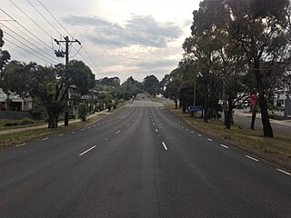
The South Gippsland Highway is a partially divided highway in Victoria, Australia which connects the city of Melbourne with the South Gippsland region of Victoria, ending in the town of Sale. The highway begins at Lonsdale Street, Dandenong. At the Greens Road intersection, it adopts Metropolitan Route 12 until Pound Road, then continues until the South Gippsland Freeway / Western Port Highway interchange where it becomes the M420. The M420 continues through Cranbourne and Koo Wee Rup until the Bass Highway turnoff, at which point the road is then designated A440 onwards to Sale. From the Bass Highway junction, the highway is undivided. The South Gippsland Highway is the gateway from Melbourne to many attractions including Wilsons Promontory and Phillip Island as well as being an important road for farmers in Gippsland.

Melton Highway links Melbourne's outer north-western suburbs of Melton and Taylors Lakes, connecting the Western Freeway and Calder Freeway to provide a more-direct route between Ballarat and Melbourne and Essendon airports; it has a Victorian route designation of C754.

<span class="mw-page-title-main">West Gate Freeway</span> Freeway in Melbourne, Australia

The West Gate Freeway is a major freeway in Melbourne, the busiest urban freeway and the busiest road in Australia, carrying upwards of 200,000 vehicles per day. It links Geelong and Melbourne's western suburbs to central Melbourne and beyond. It is also a link between Melbourne and the west and linking industrial and residential areas west of the Yarra River with the city and port areas. The West Gate Bridge is a part of the freeway.

<span class="mw-page-title-main">Monash Freeway</span> Freeway in Victoria, Australia

The Monash Freeway is a major urban freeway in Victoria, Australia, linking Melbourne's CBD to its south-eastern suburbs and beyond to the Gippsland region. It carries up to 180,000 vehicles per day and is one of Australia's busiest freeways. The entire stretch of the Monash Freeway bears the designation M1.

South Gippsland Freeway is a short freeway linking Dandenong in Melbourne's south–east to other south–eastern destinations, including the Mornington Peninsula and the Gippsland region. The freeway bears the designation M420.

<span class="mw-page-title-main">Calder Highway</span> Highway in Victoria

Calder Highway is a rural highway in Australia, linking Mildura and the Victoria/New South Wales border to Bendigo, in North Central Victoria. South of Bendigo, where the former highway has been upgraded to freeway-standard, Calder Freeway links to Melbourne, subsuming former alignments of Calder Highway; the Victorian Government completed the conversion to freeway standard from Melbourne to Bendigo on 20 April 2009.

<span class="mw-page-title-main">Princes Freeway</span> Freeway in Victoria, Australia

Princes Freeway is a 159-kilometre (99 mi) Australian freeway, divided into two sections, both located in Victoria, Australia. The freeway links Melbourne to Geelong in the west, and to Morwell in the east. It continues beyond these extremities as the Princes Highway towards Adelaide to the west and Sydney to the northeast. The freeway bears the designation M1.

<span class="mw-page-title-main">Mornington Peninsula Freeway</span> Freeway in south-eastern Melbourne, Victoria, Australia

The Mornington Peninsula Freeway is a freeway in Melbourne, Victoria, Australia, that provides a link from south-eastern suburban Melbourne to the Mornington Peninsula. Whilst the entire freeway from Dingley Village to Rosebud is declared by VicRoads as the Mornington Peninsula Freeway, the section between EastLink in Carrum Downs and Moorooduc Highway in Moorooduc is locally and commonly known as Peninsula Link. The entire freeway corridor bears the designation M11.

<span class="mw-page-title-main">Maroondah Highway</span> Highway in Victoria, Australia

Maroondah Highway is a major east–west thoroughfare in the eastern suburbs of Melbourne, and a highway connecting the north-eastern fringes of Melbourne to the lower alpine region of Victoria, Australia.

<span class="mw-page-title-main">Western Highway (Victoria)</span> Highway in Victoria

The Western Highway is the Victorian part of the principal route linking the Australian cities of Melbourne and Adelaide, with a length of approximately 258 kilometres (160 mi) of single carriageway, then 161 kilometres (100 mi) of dual carriageway known as the Western Freeway. It is a part of the National Highway network and designated routes A8 and M8. The western end continues into South Australia as the Dukes Highway, the next section of the Melbourne–Adelaide National Highway. The Western Freeway joins Melbourne's freeway network via the Western Ring Road, in the western suburbs of Melbourne.

<span class="mw-page-title-main">Goulburn Valley Highway</span>

Goulburn Valley Highway is a highway located in Victoria, Australia. The section north of the Hume Freeway is part of the Melbourne to Brisbane National Highway and is the main link between these two cities as well as a major link between Victoria and inland New South Wales. It is also the most direct route between Melbourne and the major regional centre of Shepparton in Victoria.

Moorooduc Highway is a 16 km highway which runs from Frankston to Tuerong and, together with the Mornington Peninsula Freeway, was part of the main route from Melbourne to the Mornington Peninsula until the completion of Peninsula Link in 2013. This name is not widely known to most drivers, as the entire allocation is still best known as by the names of its constituent parts: McMahons Road, Frankston–Flinders Road, and Moorooduc Road.

<span class="mw-page-title-main">Greensborough Highway</span>

Greensborough Highway is a highway in the north-eastern suburbs of Melbourne, Australia, and is an important route for north-east Melbourne. This name is not widely known to most drivers, as the entire allocation is still best known as by the names of its constituent parts: Lower Heidelberg Road, Rosanna Road, Lower Plenty Road, Greensborough Road and Greensborough Bypass. This article will deal with the entire length of the corridor for sake of completion, as well to avoid confusion between declarations.

Western Port Highway is a highway in Victoria, Australia, linking the south-eastern fringe of suburban Melbourne to the western coast of Western Port, after which the highway is named, at the Port of Hastings nearly 30 km to the south. It runs from the end of South Gippsland Freeway at Lynbrook, firstly as a dual carriageway and later as an undivided road, to Frankston-Flinders Road at Hastings.

<span class="mw-page-title-main">State (Bell/Springvale) Highway</span> Highway in Melbourne, Victoria

State (Bell/Springvale) Highway, also known as Bell Street/Springvale Road State Highway, is the longest self-contained urban highway in Melbourne, Australia, linking Tullamarine Freeway and Nepean Highway through Melbourne's north-eastern suburbs. These names are not widely known to most drivers, as the entire allocation is still best known as by the names of its constituent parts : Bell Street, Banksia Street, Manningham Road, Williamsons Road, Doncaster Road, Mitcham Road, Springvale Road and Edithvale Road. This article will deal with the entire length of the corridor for sake of completeness, as well to avoid confusion between declarations.

<span class="mw-page-title-main">M80 Ring Road</span> Freeway in Melbourne, Australia

The M80 Ring Road is a partially complete urban freeway ring road around Melbourne, Australia. This article will deal with the entire length of the corridor for sake of completion, as well to avoid confusion between declarations.

References

  1. VicRoads (2001). "Direction Signs and Route Numbering (non-Freeway)" (PDF). Traffic Engineering Manual, Chapter 2 - Edition 1. Government of Victoria. pp. 21–35. Archived from the original (PDF) on 6 April 2016. Retrieved 10 May 2014.
  2. "Country Roads Board Victoria. Fifty-Second Annual Report: for the year ended 30 June 1965". Country Roads Board of Victoria. Melbourne: Victorian Government Library Service. 2 December 1965. p. 48.
  3. "Road Construction Authority of Victoria. Annual Report for the year ended 30 June 1986". Road Construction Authority of Victoria. Melbourne: Victorian Government Library Service. 24 November 1986. pp. 30, 42.
  4. "Road Construction Authority of Victoria. Annual Report for the year ended 30 June 1987". Road Construction Authority of Victoria. Melbourne: Victorian Government Library Service. 30 September 1987. p. 59.
  5. "Road Construction Authority of Victoria. Annual Report for the year ended 30 June 1989". Road Construction Authority of Victoria. Melbourne: Victorian Government Library Service. 24 September 1989. pp. 20–1.
  6. 1 2 "VicRoads Annual Report 1996-97". VicRoads . Melbourne: Victorian Government Library Service. 27 August 1997. p. 24.
  7. 1 2 3 4 5 VicRoads. "Victoria's route number signs". State Government of Victoria. Archived from the original on 12 May 2014. Retrieved 11 May 2014.
  8. "VicRoads Annual Report 1997-98". VicRoads . Melbourne: Victorian Government Library Service. 31 August 1998. p. 42.
  9. VicRoads (September 2013). "Direction Signs and Route Numbering (non-Freeway)". Traffic Engineering Manual (3 ed.). State Government of Victoria. p. 34. Archived from the original (PDF) on 19 December 2014. The use of National Highway shields for routes M/A8, A20, M31, M/A39 and M80 has been discontinued. They are now signed in the same way as other alphanumeric routes
  10. "Frankston-Dandenong Road, Carrum Downs". Google Maps Street View. September 2023. Retrieved 12 December 2023.
  11. "Cranbourne-Frankston Road, Cranbourne". Google Maps Street View. August 2023. Retrieved 12 December 2023.
  12. "Pound Rd, Hampton Park". Google Maps Street View. October 2019. Retrieved 24 November 2022.
  13. "Findon Rd, Epping". Google Maps Street View. Google. April 2019. Retrieved 10 February 2023.
  14. "Register of Public Roads". VicRoads. 31 January 2015. p. 1065. Retrieved 25 August 2022.
  15. "Register of Public Roads". VicRoads. 31 January 2015. p. 1064. Retrieved 1 December 2023.
  16. "Statewide Route Numbering Scheme".
  17. "Bolton Street, Eltham". Google Maps Street View. December 2022.