Lytle, Texas

Last updated

Lytle, Texas
St. Andrew the Apostle Catholic Church, Lytle, TX IMG 0740.JPG
St. Andrew the Apostle Catholic Church in Lytle (established December 8, 1948)
Motto: 
A city on the grow!
TXMap-doton-Lytle.PNG
Location of Lytle in Texas
Atascosa Lytle.svg
Location of Lytle in Atascosa County
Coordinates: 29°13′59″N98°48′0″W / 29.23306°N 98.80000°W / 29.23306; -98.80000
Country United States
State Texas
Counties Atascosa, Medina, Bexar
Area
[1]
  Total4.81 sq mi (12.45 km2)
  Land4.76 sq mi (12.33 km2)
  Water0.05 sq mi (0.12 km2)
Elevation
[2]
722 ft (220 m)
Population
 (2020)
  Total2,914
  Density610/sq mi (230/km2)
Time zone UTC-6 (Central (CST))
  Summer (DST) UTC-5 (CDT)
ZIP code
78052
Area code 830
FIPS code 48-45288
GNIS feature ID1362011 [2]
Website www.lytletx.org

Lytle is a city in Atascosa, Bexar, and Medina counties in the U.S. state of Texas. The population was 2,914 at the 2020 census. It is part of the San Antonio Metropolitan Statistical Area.

Contents

History

Lytle grew out of 321 acres located around the head of Atascosa Creek, patented to Henry Volkner in 1856. Volkner was the assignee of Mahan Matter, and the patent was signed by Elisha M. Pease, Governor of Texas. In 1870, Volkner sold the 321 acres for $175 to Fitch S. Adams. Lytle's first school was built on Adams' property with a verbal agreement that as long as the school building was there, the land it stood would belong to the school. [3]

In 1881, officials from the International–Great Northern Railroad made an agreement with B. G. Andrews in which he was to give land for a new station ("Andrews Station"). There was some misunderstanding in making the deed, and the dispute ended with Mr. Andrews refusing to submit the property deed. Traildriver and cattleman Captain John Thomas Lytle (1844–1907) then secured land some three miles southwest of Andrews Station, and one morning in 1882 railroad employees loaded Andrews Station on two flat cars, and moved it to the present site near the Lytle-McDaniel Ranch, which became known as Lytle or Lytle Station. [4] [5] When a post office was granted in 1883, the town also consisted of a general store, a bar, and a casketmaker named W. J. Garnand, who also became the first postmaster. [6] An undated newspaper clipping entitled "Pioneer of Lytle" reads, "...W. J. Garnand was the first man to locate in the town of Lytle. That was in 1883. He was the first postmaster there and has been a leading citizen all the time." [7] [ dubious ] [8]

In 1884, Lytle had a population of fifty and the town included a union church, a district school, a hotel, and a physician. By 1892 the population doubled and grew to include four general stores, two livestock breeders, and a Methodist church. [6] Lytle's early settlers were primarily engaged in farming and raising cattle. Over time, Lytle became a major shipping point for cattle, and for years the old stock pens and loading chute were familiar landmarks until they were removed in the late 1960s and early 1970s. Cotton and corn were also two important crops, and cotton gins were located in both Lytle and in now-abandoned Benton City. [4] In the late 1890s, coal mining also contributed to the local economy. By 1896, the population had risen to 150. By 1914 the town had grown to include telephone service, another general store, two lumberyards, and a weekly newspaper called The Herald, and the population had grown to 600. Lytle School had 127 students. [6] During the Great Depression, the school was enlarged as part of a WPA project.

After World War II, the Chamber of Commerce raised enough money together with property owner participation to pave the streets. Later, a pitch by W. C. Loessberg and a group of volunteers led to the town being incorporated on October 27, 1951. On May 28, 1955, a bond election was passed to drill the Edwards well for city water service, and the Lytle Volunteer Fire Department was also founded that year. Another bond election passed to give the city a gas system in 1960, and a sewer system in 1961. More streets were paved in 1971, and a garbage removal and ambulance service were added in 1974. [9] [10] Since that time, the city has continued to grow.

Geography

Lytle is located in the northern corner of Atascosa County. Most of the city lies in Atascosa County; only small portions extend into Bexar and Medina counties. [11]

Interstate 35 passes through the southeastern part of the city, with access from Exit 131. Lytle's Main Street is Texas State Highway 132, following the route of the former U.S. Route 81 southwest to Natalia and Devine, before rejoining I-35. Downtown San Antonio is 25 miles (40 km) northeast via I-35, and Laredo is 133 miles (214 km) to the south.

According to the United States Census Bureau, the city has a total area of 4.5 square miles (12 km2), of which 4.45 square miles (11.5 km2) is land and 0.04 square miles (0.10 km2) is water. [12]

Climate

The area's climate is characterized by hot, humid summers and generally mild to cool winters. According to the Köppen Climate Classification system, Lytle has a humid subtropical climate. [13]

Demographics

Historical population
CensusPop.Note
1960 798
1970 1,29862.7%
1980 1,92047.9%
1990 2,25517.4%
2000 2,3835.7%
2010 2,4924.6%
2020 2,91416.9%
U.S. Decennial Census [14]

2020 census

Lytle racial composition [15]
(NH = Non-Hispanic) [lower-alpha 1]
RaceNumberPercentage
White (NH)82028.14%
Black or African American (NH)210.72%
Native American or Alaska Native (NH)70.24%
Asian (NH)160.55%
Pacific Islander (NH)10.03%
Some Other Race (NH)120.41%
Mixed/Multi-Racial (NH)331.13%
Hispanic or Latino 2,00468.77%
Total2,914

As of the 2020 United States census, there were 2,914 people, 760 households, and 577 families residing in the city.

2000 census

As of the census [18] of 2000, there were 2,383 people, 811 households, and 633 families residing in the city. The population density was 593.4 inhabitants per square mile (229.1/km2). There were 898 housing units at an average density of 223.6 units per square mile (86.3 units/km2). The racial makeup of the city was 73.81% White, 0.46% African American, 0.92% Native American, 0.29% Asian, 0.04% Pacific Islander, 21.57% from other races, and 2.90% from two or more races. Hispanic or Latino of any race were 61.18% of the population. There were 811 households, out of which 39.6% had children under the age of 18 living with them, 60.8% were married couples living together, 13.6% had a female householder with no male householder present, and 21.9% were non-families. 19.9% of all households were made up of individuals, and 9.4% had someone living alone who was 65 years of age or older. The average household size was 2.94 and the average family size was 3.38.

In the city, the population was spread out, with 30.5% under the age of 18, 9.3% from 18 to 24, 26.6% from 25 to 44, 21.4% from 45 to 64, and 12.2% who were 65 years of age or older. The median age was 34 years. For every 100 females, there were 91.6 males. For every 100 females age 18 and over, there were 85.1 males.

The median income for a household in the city was $34,857, and the median income for a family was $40,699. Males had a median income of $27,734 versus $21,129 for females. The per capita income for the city was $14,826. About 15.0% of families and 16.6% of the population were below the poverty line, including 21.8% of those under age 18 and 20.0% of those age 65 or over.

Education

The Lytle Independent School District serves almost all of Lytle and is home to the Lytle High School Pirates. A small sliver of Lytle (the portion in Bexar County) is served by the Southwest Independent School District. Another portion is in the Natalia Independent School District.

English artist Cornelia Parker retrieved charcoal from a Baptist church which had been struck by lightning in Lytle and reassembled the pieces in her 1997 installation, Mass (Colder Darker Matter), which was displayed in the Frith Street Gallery in London, England. [19] [20]

Related Research Articles

<span class="mw-page-title-main">Wilson County, Texas</span> County in Texas, United States

Wilson County is a county located in the U.S. state of Texas. As of the 2020 census, its population was 49,753. Its county seat is Floresville. The county is named after James Charles Wilson. Wilson County is part of the San Antonio–New Braunfels, Texas, metropolitan statistical area.

<span class="mw-page-title-main">Medina County, Texas</span> County in Texas, United States

Medina County is a county located in the U.S. state of Texas. As of the 2020 census, its population was 50,748. Its county seat is Hondo. The county is named for the Medina River. The extreme northern part of the county lies within the Edwards Plateau, which elevates into the Texas Hill Country. The Medina Dam, the fourth largest in the nation when completed in 1913, is listed on the National Register of Historic Places. The irrigation project, creating Medina Lake, was built by 1500 skilled workers who worked in shifts operating 24 hours a day to complete the dam in two years. Medina County is part of the San Antonio, TX Metropolitan Statistical Area.

<span class="mw-page-title-main">McMullen County, Texas</span> County in Texas, United States

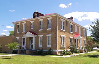
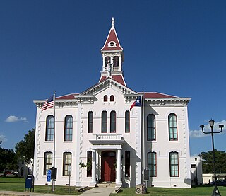
McMullen County is a county located in the U.S. state of Texas. As of the 2020 census, its population was 600, making it the fourth-least populous county in Texas. Its county seat is Tilden. The county was established from parts of Bexar County, Atascosa County, and Live Oak County in 1858 and later organized in 1877. It is named for John McMullen, founder of a colony in Texas. The McMullen County Courthouse was designed by the architect W.C. Stephenson, originally from Buffalo, New York. Stephenson also designed some 50 buildings in Beeville, including the Bee County Courthouse.

<span class="mw-page-title-main">Live Oak County, Texas</span> County in Texas, United States

Live Oak County is a county in the U.S. state of Texas. It was named for its native groves of live oak. George West is its county seat. Its population was 11,335 in the 2020 census.

<span class="mw-page-title-main">La Salle County, Texas</span> County in Texas, United States

La Salle County is a county in Texas. As of the 2020 census, its population was 6,664. Its county seat is Cotulla. The county was created in 1858 and later organized in 1880. It is named for René-Robert Cavelier, Sieur de La Salle, a 17th-century French explorer.

<span class="mw-page-title-main">Karnes County, Texas</span> County in Texas, United States

Karnes County is a county in the U.S. state of Texas. As of the 2020 census, the population was 14,710. Its county seat is Karnes City. The county is named for Henry Karnes, a soldier in the Texas Revolution. The former San Antonio and Aransas Pass Railway passed through Karnes County in its connection linking San Antonio with Corpus Christi.

<span class="mw-page-title-main">Bexar County, Texas</span> County in Texas, United States

Bexar County is a county in the U.S. state of Texas. It is in South Texas and its county seat is San Antonio.

<span class="mw-page-title-main">Atascosa County, Texas</span> County in Texas, United States

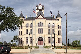
Atascosa County is a county located in the U.S. state of Texas. It is in South Texas and its county seat is Jourdanton.

<span class="mw-page-title-main">Charlotte, Texas</span> City in Texas, United States

Charlotte is a city in Atascosa County, Texas, United States. The population was 1,715 at the 2010 census. It is part of the San Antonio Metropolitan Statistical Area. The town is named for Charlotte Simmons, the daughter of Dr. Charles Simmons, who aided in the development of Atascosa County.

<span class="mw-page-title-main">Christine, Texas</span> Town in Texas, United States

Christine is a town in Atascosa County, Texas, United States. The population was 390 at the 2010 census. It is part of the San Antonio Metropolitan Statistical Area.

<span class="mw-page-title-main">Jourdanton, Texas</span> City in Texas, United States

Jourdanton is a city in and the county seat of Atascosa County, Texas, United States. The population is 4,094. It is part of the San Antonio metropolitan statistical area. The mayor is Robert "Doc" Williams. The city manager is Bobby J. Martinez. The police chief is Eric Kaiser. The fire chief is Jay Fojtik.

<span class="mw-page-title-main">Pleasanton, Texas</span> City in Texas, United States

Pleasanton is a city in Atascosa County, Texas, United States. The population was 8,934 at the 2010 census. Pleasanton's official motto is "The City of Live Oaks and Friendly Folks." It is part of the San Antonio-New Braunfels Metropolitan Statistical Area.

<span class="mw-page-title-main">Poteet, Texas</span> City in Texas, United States

Poteet is a city in Atascosa County, Texas, United States. The population was 2,795 as of the 2020 census. It is part of the San Antonio Metropolitan Statistical Area. It was named for its first postmaster, Francis Marion Poteet. It is best known as the birthplace of country music legend George Strait.

<span class="mw-page-title-main">Converse, Texas</span> City in Texas, United States

Converse is a city in Bexar County, Texas, United States, 15 miles (24 km) northeast of downtown San Antonio. As of the 2020 census, it had a population of 27,466. It is part of the San Antonio Metropolitan Statistical Area.

<span class="mw-page-title-main">Cross Mountain, Texas</span> Census-designated place in Texas, United States

Cross Mountain is a census-designated place (CDP) in Bexar County, Texas, United States. The population was 3,944 at the 2020 census, an increase over the figure of 3,124 tabulated in 2010. It is part of the San Antonio Metropolitan Statistical Area.

<span class="mw-page-title-main">Scenic Oaks, Texas</span> Census-designated place in Texas, United States

Scenic Oaks is a census-designated place (CDP) in Bexar County, Texas, United States. It is part of the San Antonio Metropolitan Statistical Area. The population was 10,458 at the 2020 census, up from 4,957 at the 2010 census.

<span class="mw-page-title-main">Somerset, Texas</span> City in Texas, United States

Somerset is a city located in Bexar County, Texas, United States. It is located less than 20 miles south of Downtown San Antonio and is part of the San Antonio–New Braunfels metropolitan area. The population was 1,756 at the 2020 census.

<span class="mw-page-title-main">Windcrest, Texas</span> City in Texas, United States

Windcrest is a city in Bexar County, Texas, United States. Its population was 5,865 at the 2020 census. It is part of the San Antonio metropolitan area.

<span class="mw-page-title-main">Fair Oaks Ranch, Texas</span> City in Texas, United States

Fair Oaks Ranch is a city in Bexar, Comal, and Kendall counties in the U.S. state of Texas. The population was 9,833 at the 2020 census, and an estimated 10,505 in 2021. It is part of the San Antonio-New Braunfels Metropolitan Statistical Area. The city was named after Ralph Fair Sr, an oilman who had a large cattle ranch on the now residential town. The Fair family decided to sell a portion of the ranch to build what is now Fair Oaks Ranch in 1975.

<span class="mw-page-title-main">Selma, Texas</span> City in Texas, United States

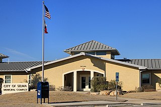
Selma is a city in Bexar, Comal, and Guadalupe counties in the U.S. state of Texas. It is part of the San Antonio metropolitan statistical area. Its population was 10,952 at the 2020 census, up from 5,540 at the 2010 census. Selma was settled by German and Polish immigrants in the mid 1800s.

References

  1. "2019 U.S. Gazetteer Files". United States Census Bureau. Retrieved August 7, 2020.
  2. 1 2 U.S. Geological Survey Geographic Names Information System: Lytle, Texas
  3. Official Bicentennial City Map and Historical Guide: Lytle Texas, published by the Lytle Chamber of Commerce, compliments of Columbus Insurance Agency, 1976, inside page
  4. 1 2 Official Bicentennial City Map and Historical Guide: Lytle Texas, published by the Lytle Chamber of Commerce, compliments of Columbus Insurance Agency, 1976, inside page.
  5. Juan T. Lytle; Texas Handbook online; accessed August 2020
  6. 1 2 3 "Texas Historical Association (THSA)". The Handbook of Texas Online. Retrieved January 5, 2021.
  7. Undated newspaper clipping. "Pioneer of Lytle"; includes a photo of Garnand; [Dubious]
  8. Ancestrylibrary.com, Appointments of U.S. Postmasters, 1832-1971, database. See Atascosa County, Lytle, William J. Garnand, appointed 10 September 1883; retrieved 8 May 2020.
  9. "City of Lytle, Texas - Official Website" . Retrieved December 15, 2013.
  10. "City of Lytle, Texas - Official Website" . Retrieved January 5, 2021.
  11. "Geographic Identifiers: 2010 Demographic Profile Data (G001): Lytle city, Texas". U.S. Census Bureau, American Factfinder. Archived from the original on February 12, 2020. Retrieved August 23, 2013.
  12. "US Gazetteer Files 2016-Places-Texas". US Census. Retrieved January 11, 2017.
  13. Climate Summary for Lytle, Texas
  14. "Census of Population and Housing". Census.gov. Retrieved June 4, 2015.
  15. "Census Bureau profile: Lytle, Texas". data.census.gov. Retrieved May 20, 2022.
  16. https://www.census.gov/ [ not specific enough to verify ]
  17. "About the Hispanic Population and its Origin". www.census.gov. Retrieved May 18, 2022.
  18. "U.S. Census website". United States Census Bureau . Retrieved January 31, 2008.
  19. "Tate Gallery, London: Turner Prize Artists 1984-2005" . Retrieved August 23, 2003.
  20. Baker, Kenneth. "Sculptor Cornelia Parker's Multidimensional Charcoal 'Drawings' Leave Us to Ponder Burned Churches from Which Her Pieces are Made". Sfgate. Retrieved January 14, 2014.
  1. Note: the US Census treats Hispanic/Latino as an ethnic category. This table excludes Latinos from the racial categories and assigns them to a separate category. Hispanics/Latinos can be of any race. [16] [17]