Maple Falls, Washington

Last updated

Maple Falls, Washington
CDP
Whatcom County Washington Incorporated and Unincorporated areas Maple Falls Highlighted.svg
Location of Maple Falls, Washington
Coordinates: 48°55′35″N122°4′43″W / 48.92639°N 122.07861°W / 48.92639; -122.07861 [1]
CountryUnited States
State Washington
County Whatcom
Area
  Total3.0 sq mi (7.8 km2)
  Land3.0 sq mi (7.8 km2)
  Water0.0 sq mi (0.0 km2)
Elevation
646 ft (197 m)
Population
 (2020)
  Total291
  Density97/sq mi (37/km2)
Time zone UTC-8 (Pacific (PST))
  Summer (DST) UTC-7 (PDT)
ZIP code
98266
Area code 360
FIPS code 53-43010 [2]
GNIS feature ID1522693 [3]

Maple Falls is a census-designated place (CDP) in Whatcom County, Washington, United States. The population was 291 at the 2020 census. [4]

Contents

Geography

Maple Falls is located on the Mount Baker Highway, east of Bellingham, three miles east of a junction at Kendall, with State Route 547, which connects over a low pass on the northeast flank of Sumas Mountain to Sumas and the border crossing with Abbotsford, British Columbia.

According to the United States Census Bureau, the CDP has a total area of 3.0 square miles (7.8 km2), all of it land.

Climate

The climate in this area has mild differences between highs and lows, and there is adequate rainfall year-round. According to the Köppen Climate Classification system, Maple Falls has a marine west coast climate, abbreviated "Cfb" on climate maps. [5]

History

Among the first settlers of Maple Falls was Herbert Everant Leavitt, a native of Melbourne, Quebec, Canada. [6] After leaving Canada, Leavitt spent time in Truckee, California, where he worked as a carpenter before setting out for Columbia Township in Washington state. In 1888 Leavitt took up a homestead in Whatcom County where present-day Maple Falls is located. Leavitt packed his supplies in from Bellingham, Washington some 30 miles to his new farm. In subsequent years, besides farming, Leavitt operated a blacksmith shop at Maple Falls, was the proprietor of a Bellingham restaurant, and ran two hotels, in addition to serving as county constable for some 24 years. [7]

Demographics

As of 2010 census, there were 324 people residing in Maple Falls. [2]

As of the census of 2000, there were 277 people, 109 households, and 70 families residing in the CDP. The population density was 91.7 people per square mile (35.4 people/km2). There were 128 housing units at an average density of 42.4 per square mile (16.4/km2). The racial makeup of the CDP was 90.61% White, 2.53% Native American, and 6.86% from two or more races. Hispanic or Latino of any race were 0.36% of the population.

There were 109 households, out of which 30.3% had children under the age of 18 living with them, 53.2% were married couples living together, 6.4% had a female householder with no husband present, and 34.9% were non-families. 22.9% of all households were made up of individuals, and 3.7% had someone living alone who was 65 years of age or older. The average household size was 2.54 and the average family size was 3.04.

In the CDP, the age distribution of the population shows 27.4% under the age of 18, 3.6% from 18 to 24, 32.5% from 25 to 44, 25.6% from 45 to 64, and 10.8% who were 65 years of age or older. The median age was 36 years. For every 100 females, there were 125.2 males. For every 100 females age 18 and over, there were 128.4 males.

The median income for a household in the CDP was $41,250, and the median income for a family was $56,477. Males had a median income of $40,250 versus $17,125 for females. The per capita income for the CDP was $24,216. None of the families and 3.5% of the population were living below the poverty line.

See also

Related Research Articles

<span class="mw-page-title-main">Whatcom County, Washington</span> County in Washington, United States

Whatcom County is a county located in the northwestern corner of the U.S. state of Washington, bordered by the Lower Mainland of British Columbia to the north, Okanogan County to the east, Skagit County to the south, San Juan County across Rosario Strait to the southwest, and the Strait of Georgia to the west. Its county seat and largest population center is the coastal city of Bellingham, comprising the Bellingham, WA Metropolitan Statistical Area, and as of the 2020 census, the county's population was 226,847.

<span class="mw-page-title-main">Simms, Montana</span> CDP in Montana, United States

Simms is a census-designated place (CDP) in Cascade County, Montana, United States. The population was 354 at the 2010 census. It is part of the Great Falls, Montana Metropolitan Statistical Area.

<span class="mw-page-title-main">Leavittsburg, Ohio</span> Census-designated place in Ohio, United States

Leavittsburg is a census-designated place in Trumbull County, Ohio, United States. The population was 1,571 at the 2020 census. Located directly west of Warren, Ohio, it is part of the Youngstown–Warren metropolitan area.

<span class="mw-page-title-main">Hobart, Washington</span> Census-designated place in Washington, United States

Hobart is an unincorporated community and census-designated place (CDP) in King County, Washington, United States. The population was 6,767 at the 2020 census.

<span class="mw-page-title-main">Maple Heights-Lake Desire, Washington</span> Census-designated place in Washington, United States

Maple Heights-Lake Desire is a census-designated place (CDP) in King County, Washington, United States. At the 2020 census, the population was 3,873.

<span class="mw-page-title-main">Gold Bar, Washington</span> City in Washington, United States

Gold Bar is a city in Snohomish County, Washington, United States. It is located on the Skykomish River between Sultan and Index, connected by U.S. Route 2. The population was 2,403 at the 2020 census.

<span class="mw-page-title-main">Acme, Washington</span> Census-designated place in Washington, United States

Acme is a rural unincorporated community, and census-designated place in Whatcom County, Washington, United States. There is a general store, post office, gas station, diner, elementary school and two churches located there. Acme is also included in, and the source-name for, a larger census-designated place (CDP). The Census Bureau no longer tracks the population for the village itself, but for the entire CDP the population was 229 at the 2020 census, down from 246 at the 2010 census.

<span class="mw-page-title-main">Birch Bay, Washington</span> CDP in Washington, United States

Birch Bay is a protected bay of the east shore of the Salish Sea, between Semiahmoo Bay and Lummi Bay; approximately 100 miles (160 km) north of Seattle and 35 miles (56 km) south of Vancouver, BC, Canada.

<span class="mw-page-title-main">Deming, Washington</span> CDP in Washington, United States

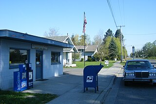
Deming is a census-designated place (CDP) in Whatcom County, Washington, United States, along the Nooksack River. It is named for its first postmaster, George Deming. The community population was 339 at the 2020 census.

<span class="mw-page-title-main">Everson, Washington</span> City in Washington, United States

Everson is a city in Whatcom County, Washington, United States. The population was 2,888 at the time of the 2020 census. It is the fifth Largest city within the Bellingham Metropolitan Area.

<span class="mw-page-title-main">Ferndale, Washington</span> City in Washington, United States

Ferndale is a city in Whatcom County, Washington, United States, with a population of 15,840 according to the 2022 census. It is the third largest city in Whatcom County and is situated near the Lummi Nation within the Bellingham Metropolitan Area.

<span class="mw-page-title-main">Geneva, Washington</span> CDP in Washington, United States

Geneva is an unincorporated area and census-designated place (CDP) in Whatcom County, Washington, United States. The population was 2,652 at the 2020 census.

<span class="mw-page-title-main">Glacier, Washington</span> CDP in Washington, United States

Glacier is a census-designated place in the North Fork Nooksack River Valley, at an elevation of 906 ft., just 10 miles northwest of the Mount Baker Summit towering nearly 10,000 ft above it, in Whatcom County, Washington, United States. The population was 300 at the 2020 census.

<span class="mw-page-title-main">Kendall, Washington</span> CDP in Washington, United States

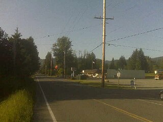
Kendall is a census-designated place (CDP) in Whatcom County, Washington, United States. The population was 191 at the 2010 census.

<span class="mw-page-title-main">Lynden, Washington</span> City in Washington, United States

Lynden is a city in Whatcom County, Washington, United States. It is located 15 miles north of Bellingham, the county seat and principal city of the Bellingham Metropolitan Area. It is the second largest city in Whatcom County. The city is approximately 5 miles (8.0 km) south of the Canada–US Border.

<span class="mw-page-title-main">Marietta-Alderwood, Washington</span> Place in Washington, United States

Marietta-Alderwood is a census-designated place (CDP) in Whatcom County, Washington, United States. The population was 3,906 at the 2010 census. Parts of Marietta-Alderwood were annexed into Bellingham in 2019, while the rest remains an unincorporated area.

<span class="mw-page-title-main">Nooksack, Washington</span> City in Washington, United States

Nooksack is a city in Whatcom County, Washington, 8 km (5.0 mi) south of the border with Canada. The population was 1,471 at the 2020 census. Despite the name, it is actually located right next to the upper stream of the Sumas River, and is 2 km (1.2 mi) northeast of the nearest bank of the Nooksack River.

<span class="mw-page-title-main">Peaceful Valley, Washington</span> CDP in Washington, United States

Peaceful Valley is a census-designated place (CDP) in Whatcom County, Washington, United States, near Kendall. The population was 3,015 at the 2020 census.

<span class="mw-page-title-main">Sudden Valley, Washington</span> Census-designated place in Washington, United States

Sudden Valley is a census-designated place (CDP) just outside of Bellingham in Whatcom County, Washington. The population was 6,354 at the 2020 census, down from 6,441 at the 2010 census.

<span class="mw-page-title-main">Sumas, Washington</span> City in Washington, United States

Sumas is a city in Whatcom County, Washington, United States. It had a population of 1,583 as of the 2020 census. Sumas is located adjacent to the Canada–U.S. border and borders the city of Abbotsford, British Columbia. The Sumas–Huntingdon port of entry at the north end of State Route 9 operates 24 hours a day. Sumas shares Nooksack Valley School District with the cities of Nooksack and Everson. It is the northernmost settlement on Washington State Route 9.

References

  1. "US Gazetteer files: 2010, 2000, and 1990". United States Census Bureau. February 12, 2011. Retrieved April 23, 2011.
  2. 1 2 "U.S. Census website". United States Census Bureau . Retrieved January 31, 2008.
  3. "US Board on Geographic Names". United States Geological Survey. October 25, 2007. Retrieved January 31, 2008.
  4. "Census Bureau profile: Maple Falls, Washington". United States Census Bureau. May 2023. Retrieved May 9, 2024.
  5. Climate Summary for Maple Falls, Washington
  6. Leavitt was a descendant of Moses Leavitt of Exeter, New Hampshire, whose descendant Dudley Leavitt subsequently removed from New Hampton, New Hampshire to Quebec.
  7. History of Whatcom County, Vol. II, Lottie Roeder Roth, 1926, pp. 659660, genealogytrails.com